The Many Lessons Learnt by JIRPers

Kellie Schaefer

Michigan Technological University

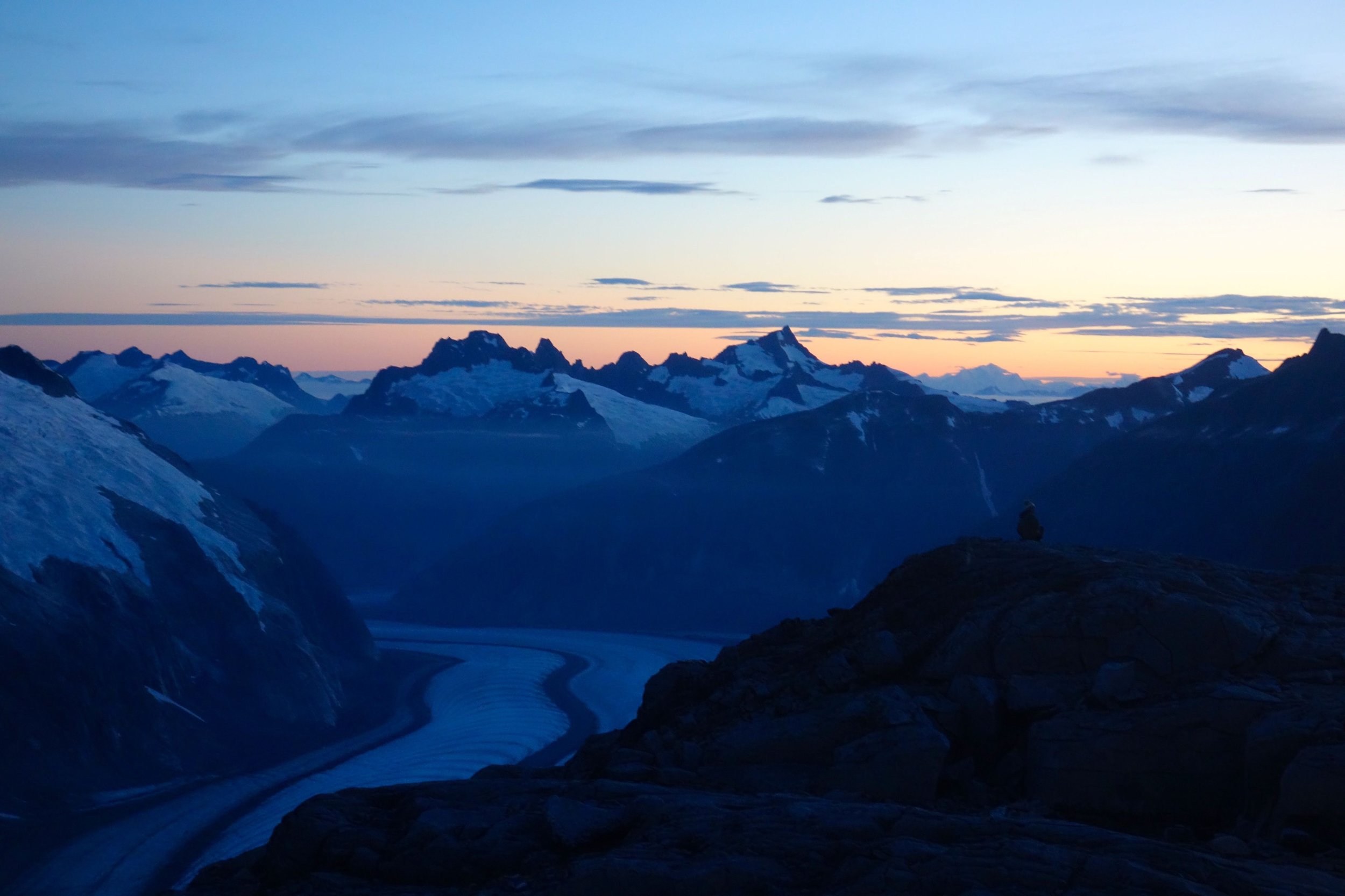
It is fair to say that the majority of students participating in JIRP this year have never been on a glacier before. I thought it was insane that a large group of 20-somethings was going to be transported via skiing throughout different locations on a large ice sheet in Alaska. Through trial and error that broadened their range of knowledge (and perhaps developed some “character”), the students began to learn a few lessons on their JIRP journey.  

Crampon training on the Mendenhall Glacier. Photo by Kellie Schaefer.

Crampon training on the Mendenhall Glacier. Photo by Kellie Schaefer.

They first began their quest through the famed “vertical swamp”. While most of the trek consisted of slogging through dense blueberry bushes and boggy muskeg, there were a few short moments of excitement. While crossing a large stream, Chris managed to drop his bright green roll of duct tape into the rushing water. The duct tape was eventually fished out of the stream with a ski pole, much to the excitement of the trail party. Two lessons were learned during this episode:

1) Don’t “Christmas Tree” your pack

2) Duct tape is a crucial piece of gear that must be saved at all costs

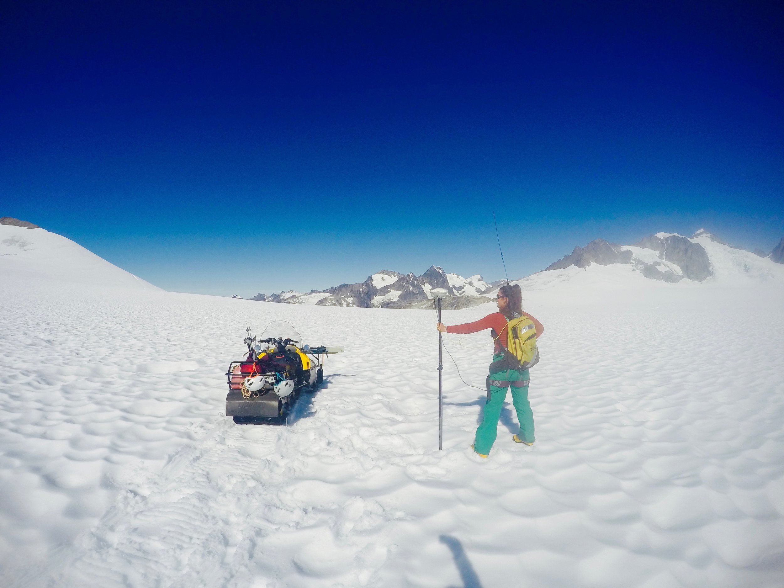
About halfway up the vertical swamp, Victor hiked past a stump, and promptly began to hoot and holler, yelling “Stinging!!! Stingers!!! Aaahhhhh!!” Having no idea what was meant my “stingers”, I continued to slosh through the muskeg, only to hear a buzzing sound. I glanced up to see a swarm of angry bees. I quickly changed my course and escaped with no bee stings, while Victor managed to receive three. About three weeks later, I was collecting Isotope samples along Profile A. Unfortunately, I was paying more attention to the GPS path than the terrain. Before I knew it, I had toppled face first into a rather large sun cup. Maybe I was not being as observant on the icefield as I had been with the bees. In short:

3) Be aware of your surroundings at all times

4) You don’t always have to follow the exact GPS path

The weather had treated us JIRPers unusually well during the voyage up to Camp 17, with the exception of one night that consisted of 60 mph winds and everyone in the camp running outside to lean into the wind. Clear skies and impromptu outdoor nights of sleep continued throughout the week at Camp 10. The staffers continuously reminded us of how spoiled we were in terms of weather. When the clouds rolled in and the rain began to patter on the corrugated roofs of the various camp buildings, the students began to panic. Clothes that had been laying out on the granite rocks for days had suddenly become sodden. Boots left out to dry were now soaked again. People scrambled for their rain gear, which is pretty unserviceable on the icefield (unless you utilize the rubber rain jackets in the cook shack). When mass balance or GPS teams returned from their daily excursions in the rain, their faces were freshly sunburned and contoured with even more tan lines. The recent precipitation has taught us many things:

5)    Rain is wet

6)    The driest sock is sacred

7)    You can get sunburned all of the time, even when you’re in a cloud 

Shawnee and Alex being the "victims" during crevasse rescue training. Photo by Kellie Schaefer.

Shawnee and Alex being the "victims" during crevasse rescue training. Photo by Kellie Schaefer.

Due to the change in weather, most of the student’s free time is now spent in the kitchen area. If they are feeling particularly observant, they may find entertainment in witnessing the exploits of the creatures known as “the cooks”. The cooks are extremely vigilant of “vultures”, swooping in on anyone who takes one too many slices of fried spam. Only the bold will enter their domain to seek a certain spice, or if they are feeling particularly cocky, exit/enter the cook shack through the cook’s door. The cooks can become frazzled after a long day of catering to hungry FGERs, and can sometimes do silly things. Take Joel for example, who turned on the stove, struck the match (after a brief period of time), and lit the stove. Joel did not realize that propane gas is quite flammable, and proceeded to scorch all of the hair off of his hand in the flame that ensued. Kate-CO forgot to drain the water after cooking the mac n cheese noodles, and ended up making a mac n cheese soup.  Eric somehow got bit by a carrot. The cooks frequently make too much oatmeal in the morning, and creative new recipes are born from the leftovers. A few very important life lessons can be obtained from the experience of being a cook:

8)    Light the match before turning on the burner

9)    You love oatmeal and oatmeal loves you

10)    SPAM® is a beautiful thing 

Cheers from 'Taku B'!!!

Cheers from 'Taku B'!!!

Our Beautiful Machine

Annie Zaccarin

UC San Diego

I love embarking on expeditions: being able to discover new places, explore the wilderness, and learn more about the world around us. Yet, expeditions are a lot of work and for an expedition to be successful, a certain degree of planning and teamwork is required. As Howard Tomb says in his essay Expedition Behavior, the Finer Points, “Think of your team - the beautiful machine - first. You are merely a cog in that machine”.  Inadequate planning and cooperation often leads to chaos and poor execution of an expedition. JIRP runs for 8 weeks, with an average of 50 people, or cogs, in camp consisting of 32 students, 10 staff, and 6-8 rotating faculty and professors.  The larger the expedition, the more planning and gear required. Each individual requires personal gear (sleeping bag, clothes, skis, etc.), fuel, food, and bunk space. As the quantity of individuals increases, not only does the quantity of supplies increase, but so does the amount of people needed to support and help make the expedition run. It becomes imperative that expedition logistics and teamwork be running smoothly to prevent falling into disarray. Here’s a look into how our little community resists falling into such chaos through logistics, flexibility in the face of weather, and teamwork.

JIRP’s organization, leadership, and staff played a vital role in helping the JIRP machine run smoothly as we traversed across the Juneau Icefield. There were four main pieces that make up the bulk of the logistics concerns: food, fuel, machinery, and movements. Food and fuel were perhaps the easiest to understand. Food was of utmost importance in keeping us all fed, healthy, focused and enthusiastic. We used fuel to cook food, run the generator for lectures, and power the snowmobiles. Snowmobiles (known locally as “snow machines”), some of our most important machines, went out in the field almost every day to help the GPS Survey group complete transects of the glacier. They were also used for hauling supplies (tents, food, scientific equipment) out to temporary base camps for overnight scientific excursions. In addition to the smaller snowmobiles, a trusty old Thiokol (snow cat) towed out-of-commission snowmobiles and heavy sled loads up the steep slope back to camp. The fourth part of logistics, movements, might be the hardest component to understand for those readers who have not been up on the icefield. During our expedition, we slowly traversed 90 miles from established base camp to base camp across the Juneau Icefield from Juneau, Alaska to Atlin, British Columbia. Overall, this required movement of people, equipment, food, and fuel. When it came to organizing the traverse, the field staff had to consider: forming trail parties to go to the next camp, time needed for research, available camp space, and significant time just for opening and closing camps. Luckily, much of life on the icefield was intertwined with helicopter support. They brought us food, fuel, and mail and took away our waste metal and outgoing mail. In addition, new faculty arrived, and exiting faculty left on the helicopters. Helicopters also helped transport gear and scientific equipment from camp to camp when snowmobile transportation was limited due to crevasses and topography. 

Coastal Helicopter bringing us new supplies and personnel at Camp 17. Photo by Annie Zaccarin.

Coastal Helicopter bringing us new supplies and personnel at Camp 17. Photo by Annie Zaccarin.


However, a tricky part of running logistics and making all the pieces fit together was flexibility in the face of weather. So much of what we did relied on either going out in the field to conduct research or having helicopter flights arrive on time. When bad weather drifted in and camp was surrounded by a white out, research was delayed without new faculty arriving, fresh food could not be flown in, and weather-dependent field work had to be put off. While this may seem frustrating to those of you reading back home, we JIRPers are resilient folks who always found ways of making the most of any weather that came our way. The role of overseeing all of these components fell on our field staff and Juneau staff. It could very easily be argued that while everyone on the icefield were the engine and the heart and soul of the program, the expertly-run logistics, by the Juneau and field staff, was the motherboard that kept the expedition going. 

While staff kept the big picture and organization in perspective, all expedition members were key cogs in making the expedition machine run smoothly through teamwork and cooperation. Imagine having all 50 expedition members cook their own meals or clean the outhouses; not very practical. Within the camp, the camp manager assigned cook teams every day, and everyone pitched in on other camp chores and maintenance tasks every morning. Typical chores ranged from maintaining our makeshift snow-fridge, to refilling fuel barrels, or to touching up paint around camp. Although some of the chores were intimidating at first, such as figuring portion sizes for over 50 people, eventually we grew in learning not only how to complete each chore, but also each one’s importance in maintaining camp life. An important lesson I learned during cook crew was how to make and keep gallons of coffee ready for the never-ending cups needing refilling throughout the day. While these small tasks definitely helped keep camp from falling into chaos and disorder, less obvious forms of teamwork and community were similarly instrumental in helping our community come together.

We saw teamwork in the staff member that helped you tape up your blisters, in the faculty who worked in challenging conditions to impart their knowledge, in the friend that slowed down to ski with you, in the rope team that arrested your fall, and in the community that became a family. None of us would have been as successful up there on the icefield without that community around us. Every day, as I looked around, I saw our friendships deepen, our team grow stronger, and our community turn into its own 50-person family isolated up on our little nunatak. Our community came together as seen through the cooks that got excited to serve new culinary creations, everyone’s genuine interest in each other’s research projects, and our willingness to share dry clothing. It’s amazing how these all helped contribute to the positive, pleasant, and productive environment whatever the circumstances we were facing on the icefield. In the end, whether we were student, field staff, faculty, or Juneau staff, we all had a role to play in helping make the JIRP machine run smoothly and continue to be the remarkable program that it is. I am ever thankful for getting to be part of the amazing community that is JIRP, and all of the new found friends (students, staff, and faculty) that were instrumental in making the community and experience incredible.

Thank you to Newt for providing me with some of the insight needed for this blog post.

Coming together over dinner at Camp 10 to enjoy the view and each other's company. Photo by Annie Zaccarin.

Coming together over dinner at Camp 10 to enjoy the view and each other's company. Photo by Annie Zaccarin.

Earth's Heat Budget: How Lakes and Glaciers Are Connected

Kellie Schaefer,

Michigan Technological University

When I initially signed up for JIRP, I had no idea how I would be able to find a connection between my field of study and glaciers. The only correlation between the two that I could think of was the fact that about 2 billion people worldwide rely on annual snow pack and glaciers for drinking water (Griggs, 2015). On that note, it is relevant to mention the fact that approximately 90% of the city of Anchorage, AK relies on the Eklutna Glacier for drinking water, and about 15% of its electricity comes from a hydropower plant that utilizes meltwater from the glacier (Sinnott, 2013). While this idea was fascinating to me, I wanted to find other connections between Environmental Engineering and glaciers.

Now that I am back in school, I am finding that what I learned on the icefield can be found everywhere in the classes that I am currently taking. My Senior Design project involves calculating a mass balance model to find various concentrations of copper in a mining basin. Soil Science has showed me just how important glaciers are when forming landscapes and depositing till in certain areas (not to mention the fact that we get to dig pits, although digging a dirt pit is a much slower process than digging a snow pit). In Geohydrology, we discussed how the global groundwater flux, or movement of groundwater over a specific area, is almost equivalent to global glacial meltwater flux. Surface Water Engineering brought up the fact that inland freshwater lakes are being affected by a change in Earth’s climate due to an imbalance in our heat budget.

Meltwater from the Thomas and Lemon Creek glaciers pours into small lakes (green with glacier silt), and continue on to Lemon Creek and the Pacific Ocean. Photo by M. Beedle.

Meltwater from the Thomas and Lemon Creek glaciers pours into small lakes (green with glacier silt), and continue on to Lemon Creek and the Pacific Ocean. Photo by M. Beedle.

This “heat budget” concept really struck a chord with me. The sun emits shortwave radiation, which enters our atmosphere. This shortwave radiation can be reflected back into space (clouds), absorbed by Earth’s surface, or absorbed by chemical compounds in the atmosphere and re-emitted as longwave radiation back to Earth’s surface. Typically, the Earth would have a balanced heat budget, with incoming radiation equivalent to outgoing radiation. The atmospheric chemistry of the Earth has been anthropogenically altered, and now the heat budget of the Earth is imbalanced. Greenhouse gases absorb reflected shortwave radiation from the Earth’s surface, and re-emit it as longwave radiation. 

What does this imbalance in Earth’s heat budget mean? In terms of surface water, lakes are absorbing more shortwave radiation and increasing in temperature. This is especially true for Lake Superior, which has had an increase in mean lake temperature by 2.5°C since 1976. Additionally, winter ice cover has been reduced by 23% - 12% over the last 100 years (Austin and Colman, 2007). This decrease in the ice cover results in a lower albedo for the lake. More shortwave radiation is absorbed during the winter months, increasing the temperature of the lake. This positive feedback has gradually resulted in reduced ice cover and increased lake temperatures. Freshwater fish require specific temperatures in order to survive, and this increase in lake temperature results in a reduction in the ideal environment for some fish species. Similarly, glaciers provide specific temperatures required for salmon spawning. Streams fed by glacier meltwater become cooler, allowing salmon to spawn in streams that would otherwise be too warm. The decreasing mass in glaciers can sometimes lead to a reduction in the glaciers surface area. This results in a lower albedo for that particular area, since the glacier is no longer reflecting the incoming solar radiation. 

On a global scale, the reduction in glacier surface cover and the shortened ice cover period of inland lakes is resulting in an overall lower albedo. The Earth’s heat budget continues to become more and more imbalanced, with more heat being retained in Earth’s atmosphere than is being emitted back into space. Positive feedback cases such as a reduction in ice cover, both with glaciers and lakes, is resulting in more retained heat. We cannot afford to allow Earth to reach a point where it is impossible to return to a balanced heat budget.

References

Austin, J. A., and S. M. Colman (2007), Lake Superior summer water temperatures are increasing more rapidly than regional air temperatures: A positive ice-albedo feedback, Geophys. Res. Lett., 34, L06604, doi:10.1029/2006GL029021.

Griggs, M. B.. (2015), Two Billion People Rely On Snow For Drinking Water, And Supplies Are Melting." Popular Science. Environmental Research Letters, 12 Nov. 2015. Web. 27 Sept. 2016.

Sinnott, Rick (2013), As Eklutna Glacier Shrinks, Anchorage's Water and Power Will Become More Expensive. Alaska Dispatch News. N.p., 15 Dec. 2013. Web. 27 Sept. 2016.

Unexpected Biogeochemistry Results, and How They Were Surprisingly Helpful

Molly Peek

Smith College

Sometimes, in field science, things do not go as planned, and you just have to make the best of it. While this is true for all of life at JIRP, this year’s biogeochemistry group received special lessons in planning and adaptation.

This was the first year of the biogeochemistry student research project (BGC for short); we needed to start with an exploratory study. With no prior fieldwork done in the area, we relied on related research to begin our study characterizing the chemistry of supraglacial streams in the ablation zone of the Llewellyn Glacier. Supraglacial streams are melt water streams that run along the top of exposed ice in glacier melt zones. Nutrients from nearby nunataks are blown onto the ice, where supraglacial streams transport them across the glacier, and eventually off the end of the glacier into the downstream fluvial system. We decided to focus our project on alkalinity, which is dissolved inorganic carbon, or bicarbonate, in the water. Bicarbonate can be weathered off rocks through water, and thus is a good starting point in characterizing the chemical makeup of water.

Team BGC crosses from the nunataks to the blue ice of the ablation zone for a day of fieldwork. Photo credit: Auri Clark

Team BGC crosses from the nunataks to the blue ice of the ablation zone for a day of fieldwork. Photo credit: Auri Clark

Team BGC headed down to the blue ice of the Llewellyn Glacier and Camp 26 to investigate alkalinity in the supraglacial streams carving the ice, armed with our relevant literature and our alkalinity titrator (a devise used to measure the concentration of bicarbonate in our water samples). After a long traverse over thin snow and a tricky crevasse field, we arrived to Camp 26 on the Llewellyn ready to take alkalinity measurements on 30 melt water streams. Using clean water sampling strategies, we donned plastic gloves and filled plenty of bottles to bring back to camp for titration, as well as recording measurements and observations on the character of the stream.

Chris Miele measures the dimensions of a supraglacial stream on the Llewellyn Glacier. Photo credit: Annie Zaccarin

Chris Miele measures the dimensions of a supraglacial stream on the Llewellyn Glacier. Photo credit: Annie Zaccarin

Back at camp with fresh samples, we excitedly began titration to test for bicarbonate. To titrate, we added a dark green indicator base to the water sample, followed by drops of acid that react to the base, turning the water bright pink. The number of drops of acid required to turn the water a vibrant pink indicates the alkalinity of the water—the more drops we needed to add, the more alkalinity in the water.

Based on previous research on similar glaciers and the nature of the Llewellyn’s geology, our group expected to find significant amounts of alkalinity in supraglacial streams, especially in those streams with visible debris along their beds.

So, where was all this alkalinity? Adding acid to our samples, we consistently found it only in low levels, with the water turning boldly pink after fewer than 10 drops of the acid, indicating our samples would have bigger error bars.

Did we do something wrong? Checking over our work, we realized that, no, we had done the process correctly; we just had results that were completely unexpected. What now?

We had committed a fatal flaw in science: becoming married to a hypothesis! What can I say, we were excited. Our first response was to laugh for a little while in some frustration, and then we decided to take this as a lesson, but make it a fun one in the end.

A supraglacial stream running over the blue the ice, which our testing showed carries surprisingly low levels of alkalinity. Photo credit: Auri Clark

A supraglacial stream running over the blue the ice, which our testing showed carries surprisingly low levels of alkalinity. Photo credit: Auri Clark

If we didn’t find alkalinity where we predicted, we wondered if we would find it anywhere else. As a group, we decided to use our extra bottles to collect samples from other places around Camp 26 and on our hike off the icefield. We collected water from basal streams found in ice caves and coming out near the terminus of Llewellyn Glacier, and at the Llewellyn Inlet on Atlin Lake.

A meltwater stream running over rock debris near the terminus of the Llewellyn Glacier. Although sampling this stream wasn’t part of our initial fieldwork plan, it proved to have high levels of alkalinity. Photo credit: Auri Clark

A meltwater stream running over rock debris near the terminus of the Llewellyn Glacier. Although sampling this stream wasn’t part of our initial fieldwork plan, it proved to have high levels of alkalinity. Photo credit: Auri Clark

Finally in Atlin, we broke open the alkalinity titrator kit for one final hurrah to test these “fun” (or, more professionally, “exploratory”) samples. Observing the water as we collected samples, most of these sites were more turbid, or cloudy with dissolved particles, than the supraglacial streams had been: a good sign for finding alkalinity derived from bedrock weathering. We added our indicator dye, and apprehensively began to add drops of acid. We started slowly, but became more excited as they passed the statistically significant threshold – we had found alkalinity!

Testing these samples was exciting purely because we found the results we had set our hearts on earlier. Even though we know this is a dangerous trap in which to fall in science, as this experiment proved, it was satisfying to find the sought-after alkalinity. Beyond that, though, these samples allowed us to ask more questions about our study, which we consider a successful outcome in an exploratory study.

Why was there far more alkalinity found in basal streams than in supraglacial streams? Where did the alkalinity in the basal streams come from? How do we characterize the supraglacial streams, knowing they have little bicarbonate? How does this differ from basal streams?

All in all, this year’s biogeochemistry project was a lesson in flexibility. When the route through the crevasse field doesn’t work, try again. When your hypothesis gets a little fuzzy, ask why. A ‘null result’ is still a result, and it allows us to build off the unexpected and ask new questions.


Communication and Toads

Riley Wall

Occidental College ’17

Blogging seems quite simple.  To blog one simply needs to communicate in an informal manner with one’s audience, but to be perfectly honest with you, blogging intimidates me.

When I write a blog I have a voice.  Not to say that I don’t usually have a voice; I mean writing a blog is like putting a megaphone in front of my mouth. My words can reach an audience far larger when written than when spoken.  I am intimidated. I am intimidated not because I find the process too difficult, but because I realize that if others are taking the time to read my words to better understand JIRP, that I have a responsibility to make those words representative of the experience and its impacts.  JIRP however, for me, has been so deeply impactful that I struggle with the question of how I could best attempt to communicate the myriad of ways that I have been changed by my experiences on the icefield and the myriad of landscapes that have contributed to those changes.  

I am reminded of a quote from one of my favorite authors, Yann Martell, “words are cold, muddy toads trying to understand sprites dancing in a field–but they’re all we have, ” and I know that I cannot communicate through my cold, muddy personal observations and senses what is most vital and important about JIRP.

I can describe the visual beauty of the enormous Gilkey Trench.  I can illustrate how it plunges 2,000 vertical feet down below JIRP’s Camp 18, how the curved ogives and enormous medial moraines create an unexpected symmetry in the ice until the canyon bends and carries them out of sight, how the glacier resembles a calm laminar flowing river several kilometers wide, and how the ice seems to light on fire as orange, pink, and purple clouds reflect down upon it at sunset.  I can effectively communicate what I see on the icefield, but I wonder if I can describe how the trench makes me small and insignificant before its grandeur, or how it can instill so much joy in me when I revel in its beauty one moment and so much sadness the next when I spot the engraved lines recording hundreds of feet of rapid glacial melting in the canyon walls, signaling that this mighty force before me is dying, and still I know that I cannot communicate how what I saw on the icefield changed me.  

The Gilkey Trench as seen from Camp 18. Photo by Riley Wall.

The Gilkey Trench as seen from Camp 18. Photo by Riley Wall.

I can describe the sounds that ice blocks larger than houses make when they tumble down the Vaughan Lewis Ice Fall.  I can convey how the noise that crumbling seracs make resembles the roar of distant thunder, how the crashes are often powerful enough to wake sleeping JIRPers, how the rumble that interjects forcefully into everyday life at random intervals never loses its novelty or ceases to cause excitement, and how one can’t help but hold his or her breath until each individual ice fall event terminates with an eerie thud.  I can effectively communicate what I hear on the icefield, but I wonder if I can communicate how these sounds indicate that despite the fact that the icefield seems static day to day, it is in a constant state of dynamic transformation, very much alive and susceptible to human actions, and still I know that I cannot communicate how what I heard on the icefield changed me.

The Vaughan Lewis Icefall. Photo by Allen Pope.

The Vaughan Lewis Icefall. Photo by Allen Pope.

I can describe the unexpected scents of the forget-me-not, heather, and fireweed blooms. I can express how tiny blue forget-me-nots conceal their fragrance during the day but unleash a powerful sweet aroma when the sun drops beneath the horizon, how the white, pink, and mountain heather release an earthy, herb-like smell that is reminiscent of the holiday season, and how expansive fields of deep purple fireweed draw passersby and bees alike with their citrus-honey like scent.  I can communicate what I smell on the icefield, but I wonder if I can communicate how these smells are more prevalent now than ever, how many of these plants are markers of change in the form of primary succession, how the hillsides now full of bright colors and smells used to be permanently white and scentless, how even though I enjoy the unexpected blooms, I can’t help but to feel a tinge of bitterness when encountering their aromas, and still I know that I cannot communicate how what I smelled on the icefield changed me.

Dwarf fireweed above Llewellyn Glacier. Photo by Riley Wall.

Dwarf fireweed above Llewellyn Glacier. Photo by Riley Wall.

I can describe the sensations caused by the ice of the Orphan Ice Caves.  I can explain how hands effortlessly slide across the walls as if they were greased with oil, how the ice’s surface is flawlessly smooth yet mere millimeters deeper within, billions of trapped bubbles resembling the cosmos crack and rearrange under the minimal pressure and heat of a fingertip, how the ridges of the inverted sun cups on the ceiling are as sharp as knife blades, and how the cave, warmed by the sun above, continually drips 0° C water, soaking clothing and causing moments of shock every time a drop touches exposed skin.  I can effectively communicate the feeling of what I touch on the icefield, but I wonder if I can communicate how lucky I feel to have walked through such an ephemeral feature of the landscape that morphs, stabilizes and destabilizes annually, ever-shrinking since changes in ice flow dynamics and rising temperatures permanently detached the caves from the larger glacier, bestowing on it the name Orphan, and still I know that I cannot communicate how what I felt on the icefield changed me.

Exploring the Orphan Ice Cave. Photo by Auri Clark.

Exploring the Orphan Ice Cave. Photo by Auri Clark.

I can describe even the flavor of the snow I ski across.  I can articulate how the finer snow is best for quenching one’s thirst because it melts most easily into refreshing water, how larger grained snow that has experienced melt and refreeze numerous times is best to provide a crunch in one’s PB&J sandwiches, and how concentrated Tang and Gatorade powder make the best snow-cone flavoring when carried out onto the icefield. I can even communicate what I taste on the icefield, but I wonder if I can communicate how I am constantly daydreaming about when the snow level was, on average, 8 meters (26 feet) above where I extract my cold treats now less than two decades ago, how I am terrified by the knowledge that many scientists estimate that the massive, seemingly unconquerable icefield I have been snacking on is already conquered and likely to completely disappear before 2200 (Ziemen et al., 2016), and still I know that I cannot communicate how even what I tasted on the icefield changed me.

Icefield trails. Photo by Riley Wall.

Icefield trails. Photo by Riley Wall.

The true value of JIRP comes from the realizations, revelations, and ideas that it inspires in its participants.  No amount of communication can describe the intangible elements of personal change that manifest from the first-hand icefield immersion of JIRP.  

Thus I am left with the conclusion that while one can gain an understanding of what JIRP and the icefield look like, sound like, smell like, feel like, and even taste like, the most important aspects, the impactful aspects, remain, for me, inexplicable…

Blogging perhaps intimidates me, therefore, not because I am incapable of communicating with readers, but because I am incapable of communicating what I feel needs to be communicated.  So my only remaining recourse is a plea to those truly interested in JIRP, glaciers, climate change, and the greater natural world: to embark on your own adventures, for you learn from your own personal experiences best, to foster any feelings of inspired motivation you find on those adventures, and to be a champion of the change you want to see. It is much easier to show people how you’ve changed than it is to describe it, trust me.   


Jet Pack Science

Brittany Ooman

University of Alaska Southeast

The JIRP 2016 GPS Survey trusts its precious traditions of gathering data to six capable students from around the world. Can we accomplish the task? Of course we can!  I am here to tell you a bit about what we, the GPS student survey crew, were doing this summer on the Juneau Icefield.

The primary purpose of the GPS survey project is to collect data about the glaciers to determine the surface velocities and surface elevations of the ice on the Juneau Icefield. JIRP has maintained digital GPS measurements of the Juneau Icefield for the past 17 years. The Juneau Icefield alone spans some 3,176 km2, and over the course of the summer the GPS survey team collected the data profiles on many of the biggest glaciers, traveling upwards to 60+ km in a day to collect it. Surface elevation and velocity data are measured using GPS each year at exactly the same location. This consistency enables us to monitor spatial and temporal changes in the morphology of the landscape of the Juneau Icefield.

We use snowmobiles as transportation from one profile point to the next. Photo by Brittany Ooman.

We use snowmobiles as transportation from one profile point to the next. Photo by Brittany Ooman.

The survey team collects as much data as possible, aiming to cover as much of the icefield as possible, in order to understand the ice surface elevation changes that are happening on both short- and long- term bases. When collected, these data are then available to assist with other research efforts taking place on the Juneau Icefield, such as the geophysical and mass balance student projects. GPS data can also provide background information for the isotope, biogeochemistry, and botany student research teams, as well as add to the ongoing monitoring of the Juneau Icefield.

 It is truly an empowering feeling to wear the GPS rover; it feels as if I were wearing a jet pack! The rover is a backpack with a mounted antenna. The antenna can stretch upwards two meters, and connects to a monitor system atop a two-meter pole, which in turn connects to a portable handheld controller via Bluetooth.

The author with her GPS jet pack! The GPS Rover (looks like a yellow backpack) and the antenna we use to find and re-survey the profile points. With the press of a few buttons it stores the latitude, longitude, and elevation of that particular point…

The author with her GPS jet pack! The GPS Rover (looks like a yellow backpack) and the antenna we use to find and re-survey the profile points. With the press of a few buttons it stores the latitude, longitude, and elevation of that particular point. Photo credit Brittany Ooman.

Using the rover we take measurements along both the longitudinal profiles, or center lines, of the glaciers, and the transverse profiles, the horizontal profiles across the glaciers. At each point we collect data about the latitude, longitude, and elevation. We primarily use the longitudinal profiles to monitor annual elevation changes along the glacier. To do this we snowmobile as close as possible to the point, then walk to within 0.5 m of the exact point, manually record the distance from the snow surface to the antenna using a measuring stick, and click measure on the rover. The rover, using GPS, measures the latitude, longitude, and elevation at that particular location. Then we pack up and head to the next profile point.

On the transverse profiles we primarily record data to determine the velocity of ice flow. To do this, we first use the GPS to measure the coordinates of points in a transect perpendicular to glacier flow, and mark the points with bamboo wands. Several days later, after the ice has had to time to flow a measurable distance, we record the new locations of the bamboo wands. Later, we will compile the data and use a simple equation to determine the ice flow rate based on the distance the wands moved during our sample time.

A map of the center of the Juneau Icefield with GPS survey profiles. The longitudinal profiles are represented with the dots running down the center lines of the glaciers. The transverse profiles are the block line sections running perpendicular to …

A map of the center of the Juneau Icefield with GPS survey profiles. The longitudinal profiles are represented with the dots running down the center lines of the glaciers. The transverse profiles are the block line sections running perpendicular to the longitudinal profiles. By collecting different data along both types of transects, we can paint a picture of elevation change over the entire area.

Using all these tools, benchmarks, base stations, and the GPS rover, we spend our days taking measurements in various areas of the icefield. Sometimes we spend most of our days measuring and sometimes we spend most of our days traveling to get to a small set of measurements. Surveying data is a critical field of study on the Juneau Icefield. The data we collect shows the surface elevation and ice flow velocity for this year. By monitoring the glacier annually, we can see changes in the characteristics and behavior of the glaciers of the icefield through time.  

Links:

CrevasseZone.org: A site by long-time JIRPer Scott McGee dedicated to GPS Surveying of the Juneau Icefield.

Crevasse Orientation with Respect to Flow Velocity

Donald Jarrin

Colorado Mesa University

Here on the Juneau Icefield we have many hazards we must overcome on a day-to-day basis. These hazards range from hypothermia to snow blindness, but some of the biggest hazards we encounter are crevasses. These features are found across the glacier, and in this blog I will describe how ice flow velocity dictates crevasse orientation.

For the sketches here I will use the following color scheme: blue for the glacier, brown for the valley walls, yellow for glacier flow direction, green for lateral extension, red for zones of friction, and black for crevasses. It’s important to understand that there are arrows showing flow direction and speed, but there is an overall flow velocity throughout the glacier. The middle of the glacier flows more quickly than the sides of the glacier. There is friction from the valley walls which is causing the crescent shape in the flow velocity.  In all of figures (see Figure 1 below) we look down on the glacier from a bird’s-eye view.

Figure 1

Figure 1

Tension

In general, when two things are pulled apart this causes extensional stress (tension). On glaciers extensional stress occurs when faster moving ice is followed by slower moving ice, as seen in Figure 2 below. Because the stress acting upon the ice is extensional and oriented down glacier, the crevasse forms perpendicular to the flow direction.

Figure 2

Figure 2

Compression

Figure 3

Figure 3

The opposite of extensional stress is compressional stress. Glaciers experience compressional stress when ice with a faster velocity is uphill of ice with a slower velocity. The compressional stress creates a lateral extensional stress as the ice spreads to accommodate the change in volume. As the ice flows outward laterally, crevasses form parallel to flow. This results in crevasses in the exact opposite orientation to the previous extension method. This process is shown in Figure 3 above.

Shear

Figure 4

Figure 4

Shear stress is a little different from the two previous forms of stress. This is because shear stress is a product of both the ice flow and friction against the valley walls. As the ice grinds against the valley wall, the rest of the glacier moves at a more constant rate. This yields a crevasse orientation 45 degrees up glacier from the valley wall. Figure 4 above shows the flow direction of the ice at the shear zone, and a single resulting crevasse. Figure 5 below shows what the crevasses would look like as the glacier moves down valley and encounters friction on both sides of the glacier.  

Figure 5

Figure 5

Terminus Crevasses

Figure 6

Figure 6

The last type of crevasses are terminus crevasses. Once the glacier has made its journey down the valley is has the potential to form one last set of crevasses. If the glacier terminates in a broad flat area it can form a fan-shape toe (terminus). If this happens, the glacier begins to widen, thin, and create new crevasses that are sub-parallel to the original direction of flow- down the glacier. Figure 6 above shows that when the toe begins to expand the flow outward, lateral extension pulls the ice apart(shown in green). This is similar to the compression figure above but in this figure the ice is flowing down and outward to the lowest possible elevation.
    
Though crevasses are a major hazard to anyone who traverses any icefield, as well as being sobering reminders that glaciers are always in flux, they are also valuable teaching tools for looking at ice velocity and overall glacier movement.


What Doesn't Kill You Makes You Stronger

Deirdre Collins

Georgetown University
 

Our first major traverse—the 10 mile hike to Camp 17, which sits on the edge of the Juneau Icefield and marks the beginning of our expedition—persistently sat in the back of my mind during my first week of JIRP. Having learned the stories and backgrounds of my peers upon my arrival in Juneau, I was initially intimidated by their physical strength, adventurous spirits and wilderness backgrounds. I was filled with nervous excitement as I listened to the staff tell stories of the swamps, elevation gains and challenging terrain we would encounter on our hike. Despite their descriptions of the trials we would face on our upcoming endeavor, the staff reminded me, as I reminded myself, that we were all capable of completing the hike to Camp 17, to begin our journey on the Juneau Icefield. Seeing that my fellow JIRPers exuded confidence in their attitudes towards the hike and were supportive of those who didn’t helped me feel secure as I anticipated the big day ahead.

On the morning of June 30th, I quickly shoved the remainder of my belongings into my pack, and questioned how on earth I would ever manage to lift all of its 40 pounds onto my back. I joined my trail party outside our University of Alaska Southeast dorm to drive to the trailhead. When we arrived, I jumped, twisted and jumped again several times to strap my pack to my body. Our Juneau-based staff said their goodbyes, snapped a “before” photo of us before we wouldn’t take a real shower for around 50 days, and we set out on the trail. The path underlay monstrous trees that I only imagined existed in movies like Lord of the Rings, and inclined gradually from the very start. Remembering that this was considered the “flat” part of the hike, a trace of panic emerged within me as I imagined what was referred to as the “vertical swamp” ahead. When Ibai, our Safety Manager and the head of my trail party, announced that we had reached the vertical swamp, I cranked my neck backwards to process the steep incline above me, which appeared impossible to maneuver. Holding onto any bit of hope I had that I would make it, I began to lift myself up the hillside, clambering under fallen trees, shoving my hands and feet into holds made by tree roots and leaning forward to ensure my pack didn’t take me down with it. Despite my best efforts, any slight movement of my pack caused me to tumble sideways, backwards, or even face first on many occasions. In that moment, I understood why we had practiced some of our climbing skills when we visited the Rock Dump, the local climbing wall, in Juneau.

JIRP students stand above the Ptarmigan Valley at Camp 17. Climbing up the Ptarmigan Valley represented the last leg of the traverse to Camp 17. Photo by Paul Neiman

JIRP students stand above the Ptarmigan Valley at Camp 17. Climbing up the Ptarmigan Valley represented the last leg of the traverse to Camp 17. Photo by Paul Neiman

We hiked through the wet understory of the Tongass National Forest, and the humidity quickly overcame me. With not much hiking experience throughout my life, I hadn’t properly nourished myself for the hike and I soon grew incredibly exhausted. I drank five liters of water, which I seemed to sweat out immediately, and as we climbed higher and higher in elevation, I had trouble regulating my breath. I was sure that this was the hardest thing I had ever done and was genuinely unsure as to whether I would make it to Camp 17 that night. Physical exertion soon turned to emotional panic and as I trailed behind my group, there were moments I wondered if I was in over my head choosing to do JIRP. I had always considered myself strong, but in these moments of difficulty, I lost confidence in my strength and in my ability to recover. As I trailed behind my group, I had a realization; I was with a staff member who had done this before, who had surely seen students struggle, and with friends who would help me if I vocalized how I was feeling. Once I told my trail party that I needed a break, that I didn’t feel well, everything changed. We stopped at a beautiful lake and took a 30 minute break. I made myself eat, drink Gatorade, change into a dry shirt and let Ibai take some of the weight from my pack. I suddenly felt better and was amazed at how quickly I was able to bounce back after having reached such a low point only a half an hour before. I replenished my electrolytes and started to retain more water. Thirty minutes, self-care and support from my group was all I needed to move forward and succeed. I walked up the last part of the hike— up the Ptarmigan valley to Camp 17—for hours feeling strong and revitalized. I was amazed how much my body could endure and that I already had so much to learn from an experience that had seemed so hopeless and negative just hours before. I will always have my trail party, those strong and understanding JIRPers, to thank for supporting me. I realized that I was no longer intimidated, but grateful for their wilderness backgrounds, strength and collective knowledge since they had so many lessons to teach me, even in my weakest moments.

After a week of safety training at Camp 17, full of lessons on glacier travel, ski practice and mini traverses, we have now completed the two-day, 23 mile traverse across the Juneau Icefield to Camp 10. Despite my difficult experience hiking to Camp 17, the weeks leading up to this traverse and the lessons I learned from my first hike, including to take care of myself, to seek help and to persevere, prepared me for this longer and arguably more difficult traverse. Having spent a week with other JIRPers at Camp 17 for safety training, I realized that I wasn’t the only person who struggled at times. As I grew closer to my new friends, we were able to look at the difficulties we encountered and laugh; Laugh at our many face plants on the Lemon Creek Glacier as we learned how to cross country ski, at our memories of the vertical swamp on the hike to Camp 17 and at the challenges that JIRP throws at us every day. We viewed these as learning experiences that would make us stronger for future traverses and became support systems for one another. With these lessons in mind, I crossed the first leg of the Juneau Icefield just a week ago to Camp 10 with a smile on my face despite many skiing falls and exhausting, steep elevation gains. I went from struggling as I walked up the vertical swamp to enjoying myself as I ascended a steep hill on skis just two weeks later. I arrived after two days to our new camp still smiling and had regained confidence in my physical and mental strength. My experience on the first traverse was so difficult, I was unsure if I could learn from it. In the end, that same experience proved to help me immensely on our second major traverse. I now know that I was right all along; I am strong and I can carry on in the face of challenge. Even more than that, it only takes me a few hops to get my backpack on now.

The Matthes-Llewellyn Divide

Kate Bartell

Wittenberg University

Science itself is an interesting focus. It is not just a thing, or an idea, or even a sole research topic. You cannot box it into a category with one title or one author. It is not defined to a single glacier system or a solitary winding stream. It can be studied in any part of the world, with any questions in mind. The science that I am working on now happens to be on the Juneau Icefield in Alaska. My science involves snow-machines, base-stations, and of course: Global-Positioning-System (GPS).

A beautiful sunset at Camp 8. Photo by Kate Bartell.

A beautiful sunset at Camp 8. Photo by Kate Bartell.

I am spending the majority of my summer traversing and researching the Juneau Icefield. As part of the GPS team here at the Juneau Icefield Research Program (JIRP), it is our job to help collect elevation, longitude, and latitude data points as we traverse along the icefield. This variety of information will be used to calculate velocity in the numerous areas of the Icefield and relate it with past GPS data and JIRP’s other research area’s data, for instance, Mass Balance.

One specific area of science and research that the GPS group is focusing in on is the Matthes-Llewellyn Divide. The Matthes-Llewellyn Divide is a glacier divide that connects and separates Matthes Glacier from Llewellyn Glacier. As part of our project, we are constructing a grid of GPS points that we will lay out onto the divide with bamboo wands. When we lay the wands out, we will survey their exact longitude and latitude coordinates. As the ice flows, the set points will flow along with the two different glaciers, moving in opposite directions. We then will return back to the bamboo wands and re-measure the new locations of the wands. The distance and direction the wands have travelled will allow us to calculate the ice flow velocities and where, exactly, the two glaciers separate. We are constructing this grid by looking at the divide data from 2013 and beyond, and interpreting where the Divide may have migrated in the intervening years.  By determining where exactly the flow divide is, how it has changed, and how it compares to previous years, we gain critical information about where one glacier ends and the other begins.

The research that the GPS team is working on over the course of summer 2016, and has worked on in many previous summers, provides important information about the condition of the Icefield. For example, that the Divide is shifting over time; this change can alter how much precipitation is being distributed to the Matthes and Llewellyn Glaciers. So, by using our GPS data along with data from other research teams, we can track long-term changes in the mass balance of the two glaciers. This, in turn, gives us a deeper understanding of the health of the whole glacial system.

One of JIRP’s trusty snow-machines that are used to collect points across the Juneau Icefield. Photo by Kristen Lyda Rees.

One of JIRP’s trusty snow-machines that are used to collect points across the Juneau Icefield. Photo by Kristen Lyda Rees.

Cross-Back-Tele-Country-Mark-Hiking

Sämi Hepner

University of Zurich

Before I learned to walk I learned to ski. Later, when I was 7 years young, I began to snowboard. During the last 15 years, I have become both a fanatic skier and snowboarder. I count my days on the snow. In a winter season, which for me, in Switzerland, begins in late October and ends at the end of May, I normally count about 50 snow days. My record was 60 days on the slope back when I was in high school.

Apart from downhill skiing and snowboarding I tried cross-country skiing a few times. It was fun, but did not compare with downhill skiing. Once I tried telemarking. The feeling was something between skiing and snowboarding: not as smooth and flowing as snowboarding, and not as fast and speedy as skiing. I was not convinced.

When I heard about JIRP I was excited about the idea of skiing in the summer. I have traveled to South America twice during my summertime, where I skied in their winter. But to ski in the actual summer was something new.

Reading the complicated description of the required ski gear for JIRP I couldn’t imagine what type of ski we would be using. I went to different ski and outdoor stores in Switzerland and showed the whole description to the salespeople. No one could help me find this weird ski creation. Finally, I purchased a pair on the website of an American outdoor store and sent them directly to Alaska. Even once they arrived in Alaska, we had to change the bindings to meet the JIRP requirements.

Once at JIRP, I tried the skis for the first time. It turned out that the ski is more or less a cross-country ski: it is long, lightweight and has no sidecut. Additionally, it has some features for backcountry use: the edges are metal for stability, and the bases have fish scales to allow uphill travel. The binding, which is an old school three-pin-style nordic binding, works like a telemark binding in that the toe is fixed while the heel is free. The boot itself is a telemarking boot and surprisingly compatible to the binding.

This style of skiing is more difficult than I expected. The thin ski requires a lot of balance, made even more difficult when you are wearing a heavy backpack. The snow is certainly not flat and there are a lot of bumps in the snow surface, called sun cups, which make the way challenging. Traversing the glacier often requires a rope to connect members of the trail party. Keeping the rope appropriately taut requires matching skiing speeds between the members of the team. Skiing on a rope team also requires constant attention to avoid both cutting the rope with the steel ski edges and creating tangles and snarls of rope around the harness, legs, and skis.

Typical rope team of four people with skis. From left to right:  Annika, Annie (Lynx), and Louise. Photo by Sämi Hepner

Typical rope team of four people with skis. From left to right:  Annika, Annie (Lynx), and Louise. Photo by Sämi Hepner

At our first camp we often went to the Ptarmigan Glacier to downhill ski in our meager spare time. Because of the slopes lack of constant exposure to the sun, the sun cups were not as bad. Without backpack and rope we succeeded and failed in some inspiring telemark turns. Without T-bars or gondolas, we had to earn every run and appreciated each one even more. The runs were something rare, special and valuable.

Riding the sunset. Photo by Sämi Hepner.

Riding the sunset. Photo by Sämi Hepner.

Continuing the traverse towards Atlin, we are confronted more and more with huge flat areas of the icefield without any ascents or descents. Crossing these plains, our transportation reminds me more of hiking than of skiing. These long walks in the middle of a wild landscape and in a certain amount of isolation leave time to think and philosophize.

One thought I’ve had is the following: It is insane, how big the energy footprint of conventional downhill skiing is. The production of artificial snow, as a result of decreasing natural snowfall, requires huge amounts of water and energy. The attempt to get more tourists and visitors uphill with continuously bigger and fancier gondolas leads to a kind of urbanization of the mountain. In the end it is another modification and conquest of a natural space by humans. Skiing, then, is no longer associated with a peaceful immersion in nature, but just another consumer’s entertainment. Maybe we should start to rethink skiing and go back to skiing’s roots; where sweaty ascents through beautiful landscapes are more valued than perfectly shaped but crowded slopes or après-ski parties that surround the whole mountain with loud and annoying sounds. Instead, maybe we can share the fascination of skiing with the next generation, or at least the fascination of Cross-Back-Tele-Country-Mark-Hiking.