An Interview by Jai Chowdhry Beeman
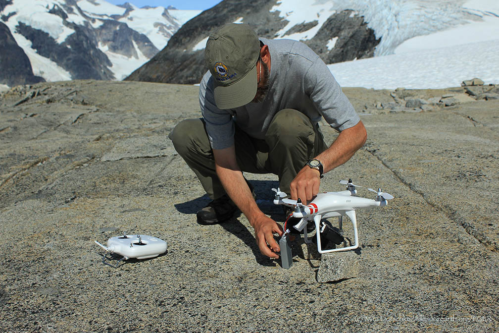
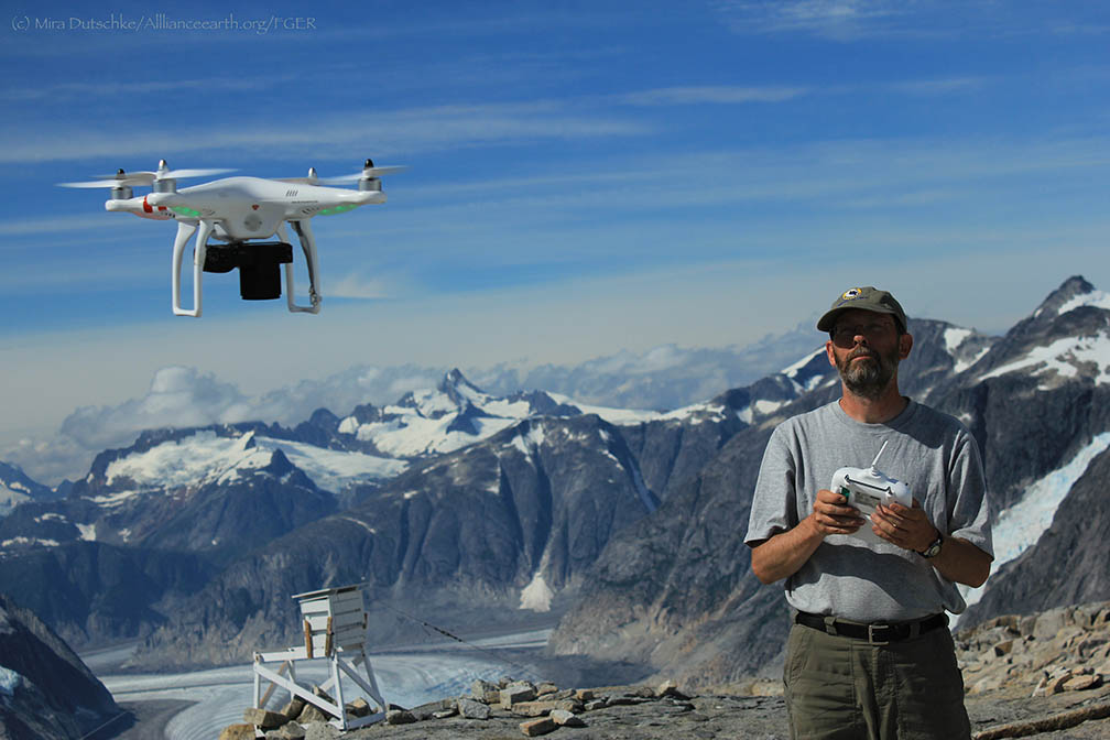
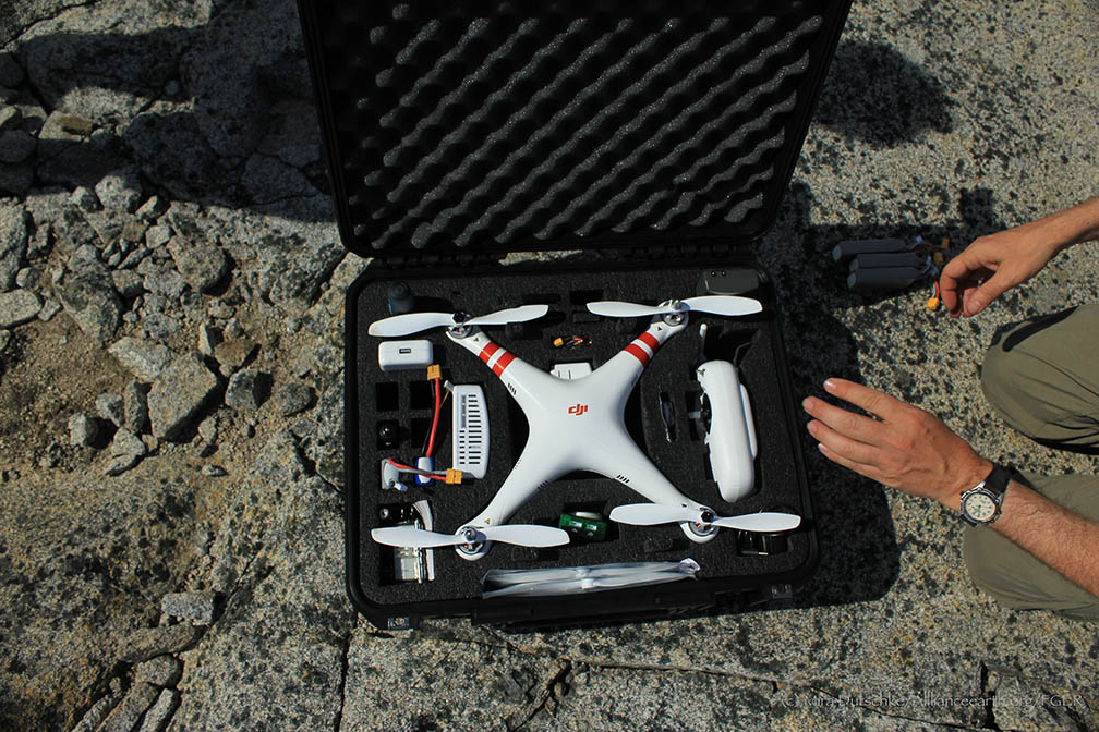
Paul Illsley is a cartographer at the Centre of Geographic Sciences in Nova Scotia, Canada. He joins the JIRP 2013 program as a visiting faculty member for several weeks. In addition to delivering captivating lectures on aerial surveying, he has been using a quadcopter to take aerial surveys for student projects.Paul Illsley at the controls of his quadcopter at Camp 18. Photo by Mira Dutschke.
High-resolution aerial photography is essential to the geosciences. In particular, aerial photography allows for the creation of much higher-resolution surface images of glaciers than are available from satellites. I spoke with Paul Illsley on the Juneau Icefield above the Gilkey Trench about aerial surveying.
PI: My background is in research photography—close-up work in the natural sciences. I also have a passion for flying. I realized that I could combine these two by taking aerial photographs. I moved to the Centre of Geographic Sciences (COGS) to study cartography , where I studied aerial imaging. After graduation I conducted numerous mapping projects, after which I moved back to COGS.
JCB: When did you begin working with the Juneau Icefield Research Program?
PI: I first came to JIRP in 2003. Maynard Miller, the former director of the Program, needed a faculty member to help students with mapping the Icefield. He had contacted my college, and I agreed to come. I’ve been coming back in the summers since then.
At JIRP, I have been able to learn from the work of my colleagues who serve as the other instructors from the program – and also from spending time with students and working on imagery for student projects.
I also work with satellite imagery to study changes in the positions of the termini of six glaciers on the Icefield. We have tracked the Llewellyn, Taku, Mendenhall, Hole-In-Wall, Norris and Herbert glaciers using images taken between 1985 and 2011. As is well known, the Taku Glacier and Hole in the Wall have continued to advance throughout this period, while the others are all clearly retreating.
JCB: What are some of the challenges of your work on the icefield?
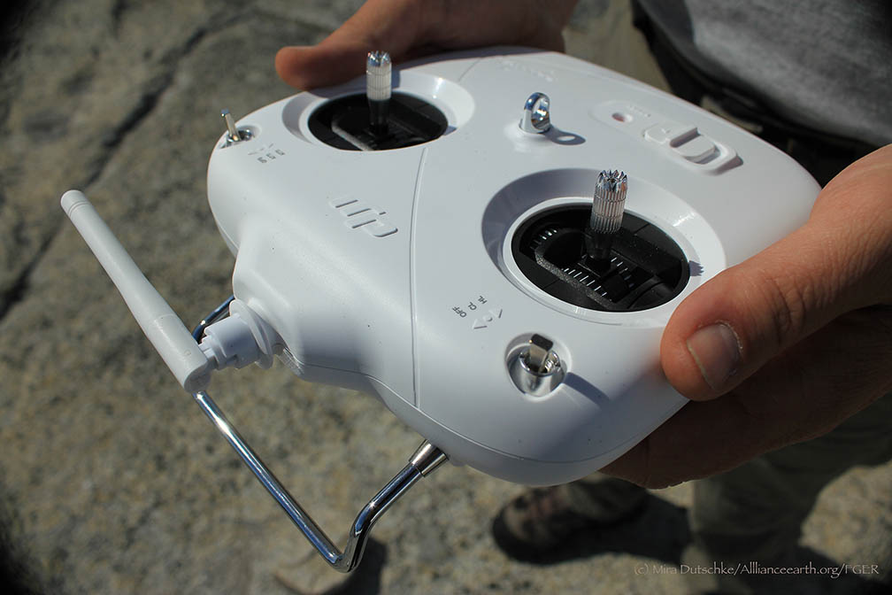
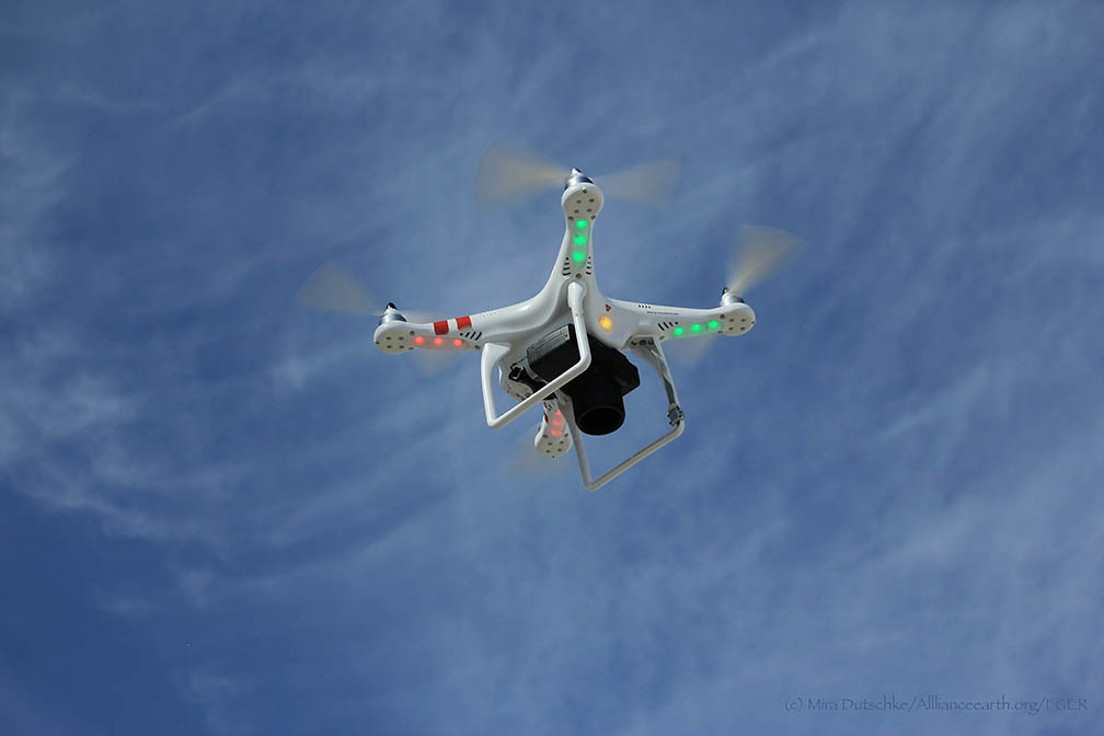
PI: The remoteness. It is challenging and expensive to fly aircraft over the icefield. Every year, I have experimented with bringing different technology to the program to take photographs. For the first few years, I photographed with kites, and this year I began using a remote-control quad copter, which allows me to control the flight path much more easily.
Remoteness, though, comes with beauty. In 2004, for the first time, I rappelled into a crevasse close to Camp 10 on the TakuGlacier. The ice in the crevasse was deep, blue and spectacular.
JCB: Tell me about the importance of combining aerial photographic surveys and satellite imagery.
PI: Aerial photographic surveys come into play when higher-resolution images are needed. At present, the best-resolution satellite imagery is about half a meter. With aerial photographs, we can produce resolution up to 10 centimeters, allowing for much finer detail and a more accurate picture of landscape change.
Aerial surveys can also be performed on a low budget, especially using smaller-scale technology—the quad copter I am using on this trip, for example, cost around US $1200, and still provides excellent high-resolution imagery of the areas we are surveying.
JCB: What are some projects you have worked on off the icefield?
PI: During the year, I serve as a resource for students working on cartographic projects at the COGS. I’ve recently done a few other mapping projects—one in the Caribbean, on the Dutch Island of Saba, where I created a new map of the island’s hiking trails using GPS. Another project I recently worked on was a map of Sable Island National Park off the coast of Nova Scotia.
I approach each project differently, depending on the resources available and the landscape at hand. I recently worked on a project sponsored by NASA and National Geographic on the glaciers that supplied water to communities in the Peruvian Cordillera Blanca. A consortium of scientists from various disciplines—chemists, glaciologists, hydrologists and cartographers—investigated the sustainability of the community’s water resources, which rely mainly on glacial water. The water chemists, for example, took samples to investigate whether water sources would still be potable without the addition of glacial water.
I performed a photogrammetric study of the glaciers using both the visual and infrared spectra. The photographs we usually take are in the visible spectrum—that is, they record the reflections of visible light off the surfaces we see in the photograph. But by modifying the filters inside a camera, we can allow it to record the reflections of infrared waves—which creates images that are much more sensitive to the moisture content of the surface. On glaciers, this gives us a much clearer picture of the boundaries between snow, firn and ice surfaces, which can appear similar in visual spectrum photography, but are distinct in infrared images.
I photographed the same locations on the glaciers in the area from five different camera positions. Using these photos and airborne LiDAR, which provides high vertical resolution, we were able to create 3-dimensional models of the glacial surfaces. We compared this model to another we made using photographs taken in the same locations by a Peruvian Aerial Survey in the 1950’s, to get a rough idea of the rate of retreat of these glaciers. At the rate we estimated, the glacial water source in the area will only last about 30 more years.
The Peru project presented much different challenges than working on the Juneau Icefield. At JIRP, technology and replacement parts can be sent to camps on a 20-minute helicopter ride from Juneau. The nearest town to the research site was a day-long bus ride away from Lima, and the research site in the mountains was another day-long hike away from the community. The research site was at 15,000 feet above sea level, and extra equipment could only be packed in by mule. Instruments had to be lightweight and very carefully packed, and sometimes replacement parts could not be found in Peru. The altitude was also a challenge—work goes slowly and becomes taxing much more quickly at such high elevations.
JCB: What kinds of work are you engaged in at JIRP this year?
PI: I am helping JIRP students with projects that use Geographic Information Systems (GIS) and satellite imagery, and supplying aerial imagery for geographic mapping projects at two camps. Christiane McCabe, for example, is using satellite imagery and digital elevation models to map changes in the equilibrium line altitude (ELA) of the glaciers on the Icefield over time. The equilibrium line marks the boundary between the accumulation zone of a glacier, where snow and firn dominate, and ablation (melt) zone, where ice dominates. Infrared images easily pick up on the different water content in snow, firn and ice, and I’m assisting Christiane in integrating these images with digital elevation models to find the ELA locations for multiple years.
JCB: Why cartography?
PI: I definitely have a passion for the outdoors—I really enjoy hiking and kayaking. I’m not as good of a skier—Nova Scotia is pretty flat.
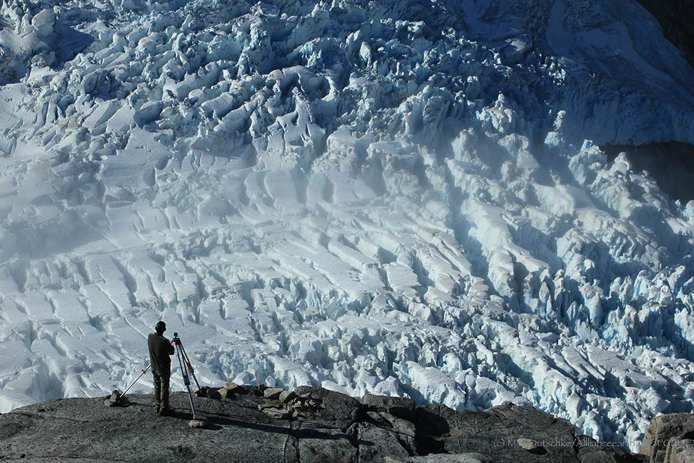
An aerial photographer looks at patterns in the landscape. I was captivated by patterns of color and physical surface features— for example, I surveyed the ogives on the Gilkey Glacier, in 2003, which are repeating arcs of ice that go downglacier, and are so out of character with the evenness you see on other parts of the Icefield. In the og ives, you can see wave-flow, whereas above the icefall that produces them the pattern is continuous flow.
I am taking a time lapse series of the Vaughan Lewis Icefall—a tributary of the Gilkey Glacier—over seven days while I’m here. I take a photograph every five minutes, and will compile them into a movie of the downward motion of the icefall. I’ve been lucky enough to have seven days of perfect weather (Interviewer’s note: as I type this interview, it has finally started to rain.) And people who have never experienced seeing an icefall move will be able to see the patterns of the crevasses and seracs—towers of ice—flowing and crashing down the slope.
I am also captivated by the patterns formed by farmlands—the way humans use the colors of vegetation—and by the intricacies of hard-rock coastlines and beaches. But glaciers are something different entirely—large and expansive, exactly like rivers of ice.
Those who want to pursue cartography as a career path should have an interest in accuracy and precision, a desire to create information that others can understand, using color, symbols and careful thought.
Cartographers work with the psychology of maps—we use color and pattern theories to develop representations of landscapes with the user in mind. For the general public, we can use certain thicknesses of lines, text and colors…but in other contexts, we have to completely redesign maps. Some of our students have created maps for the sight-impaired, the elderly, and the blind. For the last project, they used a textured cloth to create a detailed map of a college campus. I have also been working on time-light maps, as well as maps using multiple datasets and new technologies like Google Earth. These kinds of projects are challenging and unique.
JCB: What is the future of cartography?
PI: One interesting new direction in the mapping world is public sourcing. Individuals can upload GPS data to online databases, and the entire globe is populated with people who can contribute data to make enormous datasets at an incredibly quick rate. Google Earth, for example, is an important source for advancing public interest in cartography. But cartographers have to keep in mind data integrity—where surveys by trained cartographers follow high standards of accuracy, public-sourced survey data may not maintain these high standards. Public sourcing is at a starting point—and has a lot of potential—but is still not ready to be used as a source of authoritative maps.
JCB: Any closing comments?
PI: You never know what might happen when working on a mapping project. Sable Island, where I worked several years ago, is home to a protected herd of nearly 300 wild horses. When I arrived, I was setting up aerial photo targets on the island. The horses, of course, were curious about the new targets, and cautiously came up right beside us to see what we were doing.
I was on my hands and knees placing a target, and when I leaned back to get up, I was inches away from a huge pair of curious, gentle, brown eyes watching my actions. I remember fondly these kinds of moments.
I have been really fortunate to belong to the JIRP community—to be able to learn and help others learn in a landscape so spectacular and so wild that it never leaves you. Sometimes, in the middle of winter, the view at Camp 18 comes back to me—the incredible sight of the Vaughn Lewis Icefall and the Gilkey Trench far below.

