By Alex Cox, Princeton University
“What would you do for a Klondike bar?”
Everywhere you look on the walls of JIRP Camps, you can piece together a history of the expedition and its participants through scribbles and graffiti. In the outhouse at Camp 17, an anonymous JIRPer asked the above question - "What would you do for a Klondike bar?"
“Jump in Lake Linda,” someone wrote in reply.
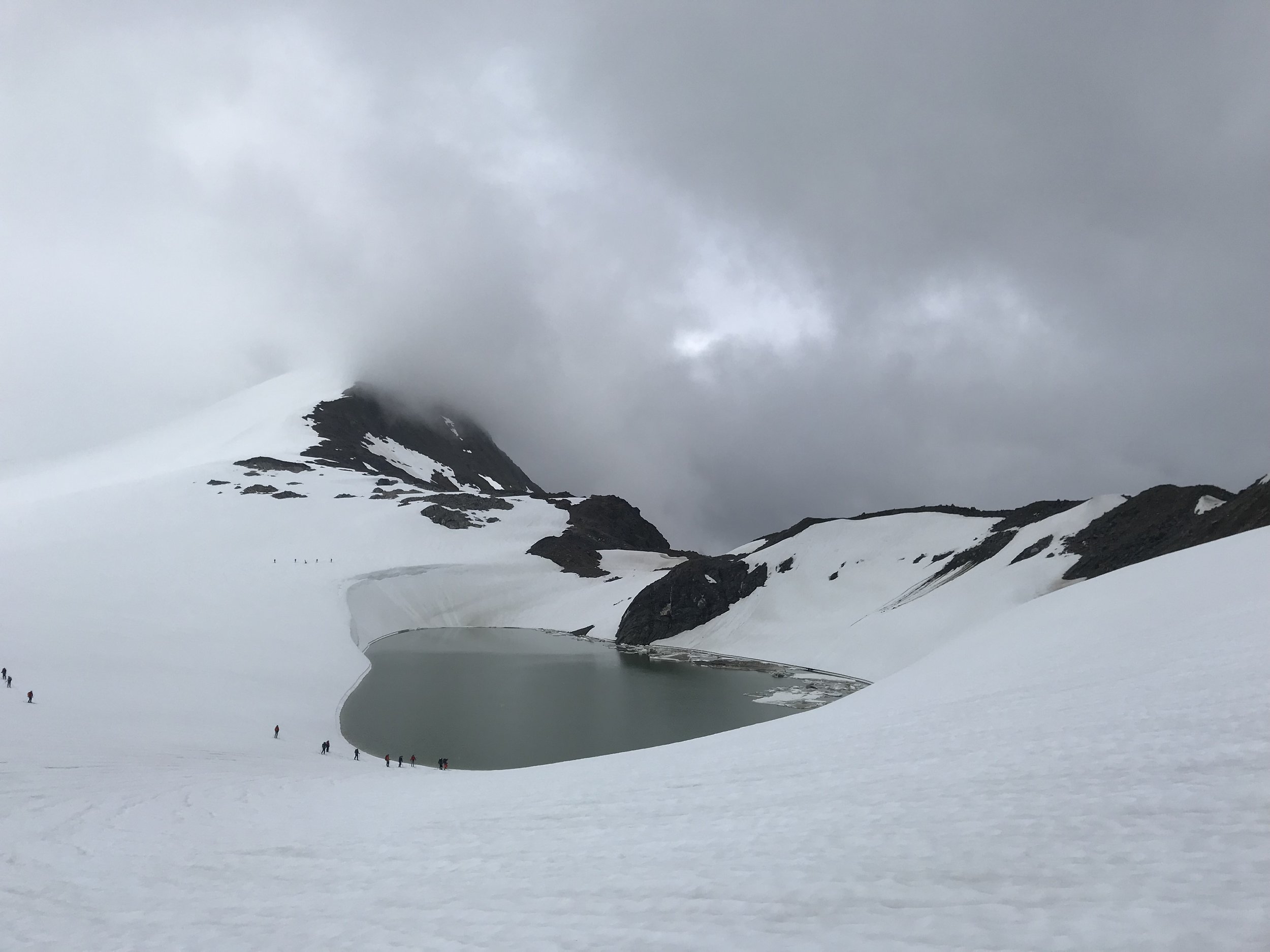
Lake Linda is an ice-dammed lake at the southern end of Lemon Creek Glacier, which itself flows from south to north. It is visible from Camp 17 and from the outhouse window. It seems counter-intuitive to have a liquid lake this far from the terminus of the glacier, but it is all due to the slope of the ice.
A profile view of Lemon Creek Glacier, showing the high point roughly 1 km from the lake, and the direction of water flow in the glacier.
The highest point on the Lemon Creek Glacier is not at its top. Instead, the glacier rises from its southern end before gently falling to the terminus. On a glacier, water flows in the direction of the ice surface, regardless of the glacier's underlying rocks or where the water is located within the glacier.
The water that accumulates between the start of the Lemon Creek and the ice's highest point, about 1 km further down the glacier, therefore, pools into Lake Linda. This means that water is actually forced uphill at the base of the Lemon Creek into the lake, because the ice surface flows to Lake Linda even though the underlying topography does not.
When JIRPers arrive at C17 in mid-June and after a period of rain, the lake is usually full, at about 200m in diameter.
The conversation in the outhouse continued. In response to "Jump in Lake Linda," someone else had written: "But it's gone."
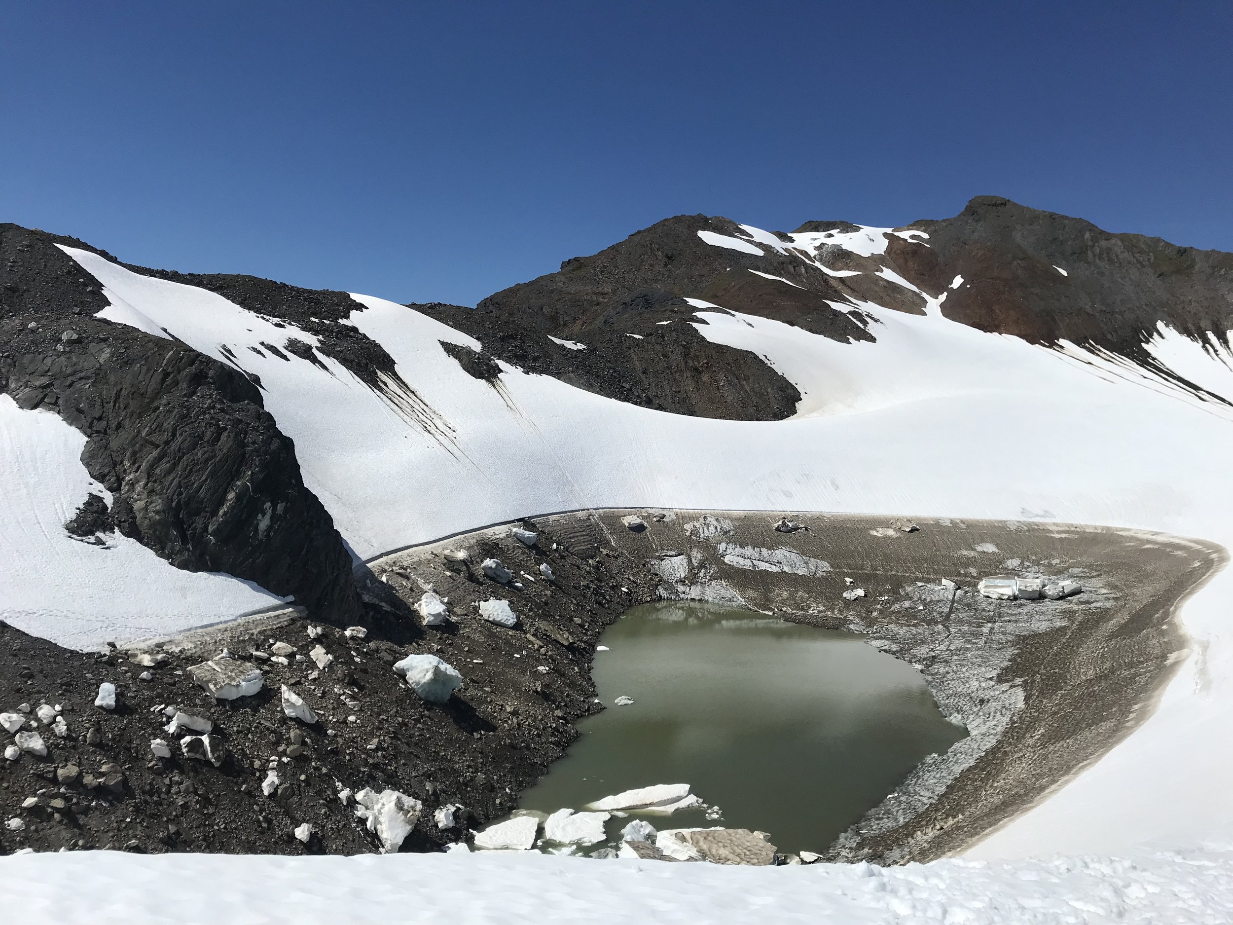
It's true - Lake Linda empties every summer, and if JIRPers are lucky, they witness this phenomenon. This year, we observed the lake drop dramatically over five days. We know for certain that the lake doesn’t solely disappear by evaporation, which means it must have a drainage. But where is the drainage? And where does the water go once it drains?
Glacial lakes like Linda offer scientists the opportunity to learn more about how water flows through a glacier. This year, Dr. Kiya Riverman, returning faculty and member of JIRP's academic council, and Dr. Colin Meyer, both from the University of Oregon, joined us at C17. One of their first tasks at camp was to place a pressure sensor at the lake's bottom. Previous studies on similar lakes show a variety of ways that they can drain, and Linda is a mystery they would like to solve.
Here today; gone tomorrow-Lake Linda on 06/28 (left) and 07/03 (right) credit: Gryphen Goss)
Pressure sensors can be as cheap as twenty dollars, and provide an accurate measurement of depth. This cheap tool gives us insight into the nature of lake drainage. Rivermen and Meyer's theory is that some kind of siphon is created when a channel in the glacier opens up. Much like a fuel siphon, this means that as long as the outlet of the channel is at a lower elevation than the start, then water will flow out the drainage, regardless of if it must go uphill.
The data they retrieved seems to back up this initial hypothesis and goes some way to explaining the mystery of this lake. The rate of drainage increased over the four days that the sensor was in place, which suggests that the area of the channel that drains the lake also increases over time.
"Don't worry, it'll be back," is the last addition to the outhouse wall conversation. As predictably as it drains, Lake Linda will fill again for another cohort of JIRP students to observe and inquire about.
But what we have shown in just a few days with a cheap sensor, is that a testable hypothesis can go a long way in answering a scientific question.
I’ll have my Klondike bar now.
Outhouse ponderings- graffiti on the wall of the ‘double-wide’ outhouse, Camp 17.


