The JIRP 2017 Staff!

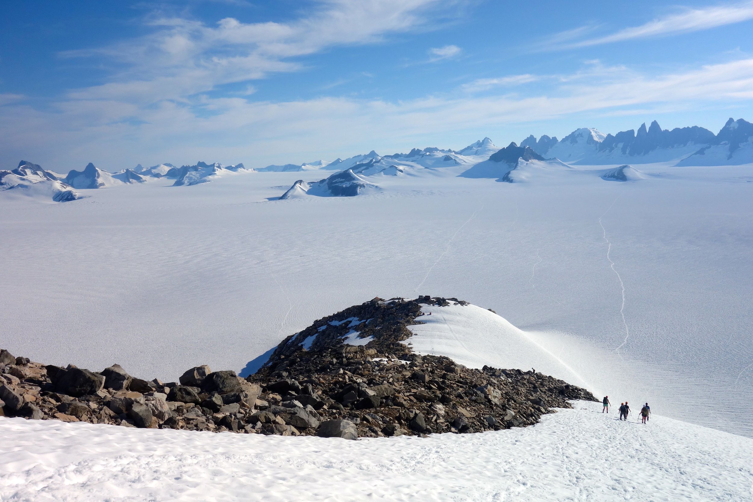
The individuals that comprise JIRP's field staff are in many ways the heart and soul of each summer. This talented crew is the team that is present throughout the eight-week season, lead safety and logistical training for the students and faculty, lead trail parties and research teams as they traverse the Juneau Icefield, and perhaps most importantly they model what it means to be a JIRPer. In short, they enable everything that happens on the Icefield, and do so in a manner that fosters the incredible community of JIRP. We are fortunate to have such a phenomenal staff team for JIRP 2017!

Newt Krumdieck (Operations Manager):


First a JIRP student in 2008, I immediately felt a deep and unquestioning connection to the people and places that JIRP brought together. Since then I have been returning as a member of the field staff most years since 2010, playing roles ranging from safety staff to carpenter to operations manager. I graduated from Colby College with a degree in Geology, and worked for several years in the sciences, doing research and field work for the NY state geological survey, and then teaching earth science to middle schoolers. Currently I work as a carpenter/woodworker, and spend as much time as I can in the outdoors hiking, biking, skiing, motorcycling, and travelling. JIRP to me is about the ultimate combination of learning, the environment, and most importantly the community. Getting a chance to share these aspects with folks each summer is a privilege I do not take lightly, and continue to enjoy immensely.

Ibai Rico (Safety Manager):

I have been the safety lead and mountain guide at JIRP since 2015. I've been a climber and skier from a young age and now have several new ice climbing routes in Patagonia and the Himalayas. When I am not at JIRP I work as a mountain guide in the Pyrenees, Alps, Norway and the Greater Caucasus. I also deliver snow/avalanche, expedition logistics and risk management courses. I combine my mountain guide activity with carrying out glaciology research in the glaciers of the Pyrenees and Tierra del Fuego (Glacier Change, Glacial Geomorphology, Permafrost and Geo-Hazards).  My last expedition to the Chilean Patagonia was focused on exploring the Cloue Icefield; understanding glacier change and ascending the unclimbed summits in an expedition sponsored by the National Geographic Society.

Guiding JIRP has been one of the most fulfilling experiences; the combination of Nature, Books and Action makes it a completely unique and unforgettable experience for every person in the program.

Incognita Patagonia Project

Basque Mountain Guides

Annie Boucher (Assistant Operations Manager):

My name is Annie Boucher, and I first came to JIRP as a student in 2012. I grew up in Brooklyn, NY, got my B.A. in Geology at Carleton College in 2011, and I'm finishing up my M.Sc. at the University of Maine modeling Alaskan tectonics and glacial erosion. This will be my sixth season on the icefield; in the past I've worked as field staff, taught science communication, and collected field data for my master's research. This season I'll be assisting with logistics and operations management, helping the new staff jump into the swing of things, and filling a couple part-time roles on the faculty. I've been leading trips and working in outdoor education for fourteen years, and I keep coming back to it for the same reasons I return to JIRP: few things in this world give me as much joy as working with a group of motivated and passionate people bent on exploring the big wide world.

Sarah Gotwals (Juneau Logistics Manager):

I am very excited to be returning to Jueanu for summer 2017 for the second time. I was a JIRP student in 2015, and spent last summer working as a logistics coordinator at the Colorado Outward Bound School. Originally from Massachusetts, I graduated from Macalester College in St. Paul, Minnesota this past May (2016). I am interested in everything that "makes science happen" and can't wait to be on the ground with Mary ensuring a safe, productive, and (most importantly) fun summer.

Lara Hughes-Allen (Senior Staff):

In the summer of 2015, I participated in JIRP as a student and returned in the summer of 2016 as field safety staff and helped lead the GPS survey effort. In the winter, I coach the Alpine race team at Northstar California Ski Resort in Lake Tahoe, CA. I enjoy backcountry skiing, hiking, and backpacking with my dog Boomer.

I graduated from the University of Southern California in 2016 with a Master’s degree in Geographic Information Science.  My thesis focused on using remote sensing analysis to quantify changes in the Taku Glacier, specifically equilibrium line altitude, accumulation area ratio, and total glacier surface area from 1973-2015. The goal of this research was to look at how in situ monitoring might be underestimating total glacier loss resulting from anthropogenic climate change. I graduated from Pitzer College in 2011 with a double major in Environmental Biology and Geology.  

Annika Ord (Senior Staff):

I grew up floating between Juneau and my family's remote cabin on the Chilkat peninsula. Exploring and learning from wild places and the people who make their homes there is what I love most. JIRP is a beautiful blend of this -- full of deep belly laughter, immense snowscapes, and inspired learning.

I am super stoked to return for my third season as staff and am particularly excited to  continue helping the botany and mass balance research groups and to lead field sketching expeditions!

When not romping around the icefield with JIRP, you can find me commercial fishing with my dad, sketching a tree, snorkeling in kelp, or trekking around the mountains of Southeast Alaska. To check out (or submit to!) the environmental feminist Selkie Zine I co-created, visit: cargocollective.com/selkiezine

Allie Strel (Senior Staff):

My name is Allie Strel and I hail from Edmonton, Alberta, Canada.  These days I am living in Munich, Germany where I am completing my master’s degree in Cartography with a side interest in cryospheric sciences.  My student experience at JIRP in 2015 had me certain that I wanted to come back to the icefield and I am excited to be joining the team again this year for my second season as safety staff.  I can’t wait to see some familiar JIRP faces and to meet all of this year’s new students.  When I’m not at JIRP (and not being a thesis-hermit) you might find me telemarking somewhere in the Alps, flying my kite on a mountain peak, cooking up a mad curry, or inflicting my terrible German on the locals.

Danielle Beaty (Field Staff):

I grew up in the rainy city where hipsters roam (Portland, OR), then made my way to the University of Colorado Boulder where I received degrees in geography and ecology/evolutionary biology. After doing JIRP as a student in 2014, I returned to school to complete an honors thesis on mass balance of glaciers on the Juneau Icefield. I also decided I had had enough of Colorado lift lines and ski traffic so I moved to Juneau, Alaska where I became a glacier/kayak guide. I am thrilled to return to the icefield as staff this summer, and I am excited to have the opportunity to make as great an experience as I had on JIRP for the students this year. I most look forward to seeing all the creative ways students make the otherwise abysmal pilot bread an enjoyable snack with various toppings, and am equally excited for pit talks in the bottom of several meter deep mass balance pits. When I am not JIRPing you’ll most likely find me backcountry skiing the AK pow, ski patrolling, climbing, or wishing there was some way I could own my spirit animal - an orca whale - as a pet.

Evan Koncewicz (Field Staff):

Hello! My name is Evan and I am originally from Upstate New York, right down the street from Newt. I was a JIRP student last year in 2016 and loved it so much I came back as staff! JIRP is a truly unique experience, and personally reminded me of the power of place-based education. I graduated from St Lawrence University in 2015 receiving a BS in Geology. Since graduating I have taught environmental education and skiing in Jackson WY, done JIRP, traveled to Peru, and substitute taught. I enjoy being outside, skiing, exploring the Tetons, following current events, learning, and telling lame jokes. I am super excited to meet you all and share an amazing summer on the ice!  

Mo Michels (Field Staff):

My name is Mo. I’m 22 years young. Last year I participated in JIRP as a student and am beyond thrilled to have the opportunity to come back as part of the 2017 staff team. I grew up in the small town of Talkeetna, AK (a town that truly believed in the maxim, it takes a village to raise a child) where I first learned the value of community. What has drawn me back to JIRP is a similar sense of community – it takes every JIRPer for a mass balance survey – if you don’t know what I mean by this yet you will at the end of the summer.

Over the past five years Juneau, AK has become home. Working winters as a downhill and cross-country ski instructor and getting a bachelors degree in geography and environmental resources. In past summers, I have zipline guided, worked extensively in tourism, and counted salmon for the Alaska Department of Fish and Game. I enjoy long treks through the woods, up mountains, and on the water. I am inspired by the look in peoples eyes when they achieve that ‘ah-ha’ moment after they were willing to struggle, to practice, to recognize their strengths and weaknesses, to adapt, and to grow, all just to learn something new.

I look forward to meeting, working and growing with all of you who will create the JIRP community this coming field season!

Mike Staron (Field Staff):

My name is Mike Staron currently from Bend, Oregon. I was a student on JIRP in 2014 and fell in love with the icefield. While not JIRPing I enjoy traveling around the world with other JIRPers in beautiful places in South America. Since participating in JIRP the first time I have developed an obsession with skiing so I converted a van and have been living in it on and off for the past year or so, skiing and climbing around the country (#notanothervan). I’m spending the spring before JIRP attempting to climb/ski all the Cascade volcanoes. I have a B.S. in geology from Keene State College in New Hampshire. For the past two years I have been working on Mount St. Helens as a guide/educator leading people on backpacking trips and to the top of the mountain while teaching them the local geology/ecology. I would not be where I am today if it wasn’t for JIRP. I can’t wait to help make this the best JIRP season yet!


A Basic Introduction to the Juneau Icefield Research Program

Annie Boucher

JIRP Senior Staff and Faculty Member

Welcome to the Juneau Icefield Research Program blog! We’re gearing up for the new season: students will soon be connecting with staff mentors to navigate expedition preparation, staff are making plans for staff training week in June, and faculty are sketching out plans for student research projects.

At this time of year, when our new students are preparing for the field season, we know there are a lot of people getting to know JIRP (pronounced “jerp”) for the first time. In the coming weeks, we will use this blog to give you a taste of who will be involved in the expedition this summer, what all goes into expedition prep, and some background on a few of the returning JIRPers who make everything happen. Over the course of the field season - June through August - we will use the blog to post daily updates from the field about what we’re up to. Students will post photos, essays, drawings, and video clips covering both the science research and the day-to-day mechanics of moving more than 50 people across the Icefield.

We have a lot to look forward to! To start, though, here’s a quick and dirty overview of what’s about to happen.

What is JIRP?
JIRP is an expedition-based field science education program. Over two months, we traverse the Juneau Icefield in southeast Alaska and northwest British Columbia, moving between permanent camps while we teach a variety of field research and glacier science topics. Because we are living right on the glacier, JIRP students are immersed in their studies. They don’t just learn about glacier ice flow from a textbook, they go out onto the glacier and explore the real-life markers of flow dynamics from the ice surface, from inside crevasses, from under the ice in sub-glacial caves, and from the bird’s eye view atop nearby mountains. JIRP students spend every waking minute soaking up their surroundings; this leads to a deeper understanding of the environment than any student could get inside the classroom.

Faculty member Billy Armstrong (right, red jacket) holds an evening lecture on ice flow dynamics above the Gilkey Glacier.

Faculty member Billy Armstrong (right, red jacket) holds an evening lecture on ice flow dynamics above the Gilkey Glacier.

Who makes up the JIRP team?
There are three groups of people at JIRP: students, staff, and faculty. At any given time, there are 50-60 people participating in the expedition. Our students are mostly undergraduates, although we often have high schoolers, graduate students, and in-between-schools students as well. Our students come from schools across the U.S. and around the world. Everything that happens at JIRP revolves around student education. This summer we expect to have 32 students, all of whom will be part of the program for the whole field season.

Students Matty Miller (blue jacket) and Tai Rovzar (green jacket) repel into a crevasse and observe their surroundings.

Students Matty Miller (blue jacket) and Tai Rovzar (green jacket) repel into a crevasse and observe their surroundings.

Our staff facilitate field safety and expedition logistics. The Icefield-based field staff spend the first two weeks of the program teaching the students and new faculty required glacier safety skills. For the rest of the season they manage our camps and accompany every group that goes out onto the ice to oversee technical mountaineering challenges and take care of any first aid needs. The Juneau-based staff organize personnel, equipment, and groceries for our helicopters, as well as maintaining daily radio communication with the expedition. This summer JIRP has 12 staff members on the Icefield and two in Juneau, all of whom will work for the whole season.

Field staffer Kirsten Arnell (center, blue jacket) discusses setting routes for rope team travel on the Norris Icefall. The field staff works closely with the students every step of the traverse, teaching them the skills to travel safely through the…

Field staffer Kirsten Arnell (center, blue jacket) discusses setting routes for rope team travel on the Norris Icefall. The field staff works closely with the students every step of the traverse, teaching them the skills to travel safely through the terrain. Photo credit: Ibai Rico.

Our faculty are researchers, professors, graduate students, journalists, medical doctors, and other professionals. While their backgrounds vary, they share a deep commitment to education and expertise in a field relevant to the Juneau Icefield. They are on the program primarily to teach and while they’re with the expedition all their work includes JIRP students. Faculty rotate throughout the summer; most weeks there are between 5 and 10 faculty members on the icefield.

Student Joel Gonzales-Santiago and faculty member Lindsey Nicholson download meteorological data from a weather station. Photo credit: Allen Pope.

When does JIRP happen?
JIRP is a summer program. Our team is in the field from mid-June through mid-August. The program has been running on this schedule every year since 1949. For more on the history of JIRP, check out our history page and stayed tuned for some JIRP legends to be posted to the blog this spring and throughout the summer.

On clear nights toward the end of the summer JIRPers often sleep outside. Everyone falls asleep around 11:00 pm when it’s getting dark, but it’s not uncommon to wake up three hours later to shouts of “Lights! Northern lights!” Photo credit: Brad Mar…

On clear nights toward the end of the summer JIRPers often sleep outside. Everyone falls asleep around 11:00 pm when it’s getting dark, but it’s not uncommon to wake up three hours later to shouts of “Lights! Northern lights!” Photo credit: Brad Markle.

Where are we working?
The Juneau Icefield is one of the largest icefields in North America at 3,700 square kilometers, covering an area a bit larger than the state of Rhode Island. An icefield is a collection of several contiguous glaciers that flow more or less outward from an area of high snow accumulation. The ice surface of an icefield is low enough that the glaciers flow around, not over, the highest mountains (distinguishing it from an ice cap). The Juneau Icefield straddles the border between southeast Alaska and northwest British Columbia. The western side of the Juneau Icefield abuts the city of Juneau, AK - our students begin their traverse hiking just beyond the Home Depot parking lot. In contrast to many icefields of a similar size, proximity to Juneau makes the logistics of JIRP relatively easy.

The hike down to camp for dinner. At the top of the rocky hilltop in the fore ground you can pick out the buildings of our largest camp. Beyond camp, Taku Glacier flows from right to left in front of the distant Taku Towers. Photo credit: Kenzie McA…

The hike down to camp for dinner. At the top of the rocky hilltop in the fore ground you can pick out the buildings of our largest camp. Beyond camp, Taku Glacier flows from right to left in front of the distant Taku Towers. Photo credit: Kenzie McAdams.

JIRP maintains several permanent camps across the Icefield; we are based out of these for most of the summer. Our large camps include bunk room housing for all 50-60 members of the expedition, cooking facilities, outhouses, generators, and lecture space. All permanent structures are built on the bare rocky hilltops above the flowing glaciers. The buildings are modest and space is sometimes tight, but it makes all the difference for us to be able to get out of the weather at the end of the day.

Our last large camp, near the divide between the U.S. and Canadian side of the icefield. Photo credit: Kenzie McAdams.

Our last large camp, near the divide between the U.S. and Canadian side of the icefield. Photo credit: Kenzie McAdams.

Why study the Juneau Icefield?
People study the Juneau Icefield for a host of reasons. Geologists seek information about the complicated tectonic and geologic history of Alaska. Biologists examine the flora and fauna of the rocky mountain islands isolated by the flowing ice. Physicists use seismic data to look into the ice itself to understand how the glaciers flow.

Students DJ Jarrin and Riley Wall set up the delicate gravimeter. The gravimeter measures tiny anomalies in the local gravity, which the students use to deduce information about the bedrock buried beneath almost a mile (1500 m) of ice. Photo credit:…

Students DJ Jarrin and Riley Wall set up the delicate gravimeter. The gravimeter measures tiny anomalies in the local gravity, which the students use to deduce information about the bedrock buried beneath almost a mile (1500 m) of ice. Photo credit: DJ Jarrin.

Glaciers are also a “hot topic” right now because of climate change. Glaciers form and flow in areas where annual snow accumulation is high enough that substantial snowpack survives the summer. Because they rely on the snowpack, glaciers are sensitive to two central pieces of climate: temperature and precipitation. Measuring and observing different aspects of glaciers can tell us about past and present trends in temperature and precipitation. Climate research is a central component of the JIRP curriculum, but it is far from the only topic we cover.

Students Kate Bollen, Kristen Lyda Rees, and Louise Borthwick measure the density of the snow accumulated over the past year. Even at the end of the summer the last year’s snow accumulation is often 4-6 m/13-20 ft. deep high on the icefield. Measure…

Students Kate Bollen, Kristen Lyda Rees, and Louise Borthwick measure the density of the snow accumulated over the past year. Even at the end of the summer the last year’s snow accumulation is often 4-6 m/13-20 ft. deep high on the icefield. Measurements of the each year’s snowfall are compared with a continuous dataset that stretches back to the 1940s. Photo credit: Victor Cabrera.

That’s all we’ve got for now. Blog posts will be published periodically this spring and almost daily during the summer on every aspect of working and living on the Juneau Icefield. In the meantime, we hope this gives new students, their friends and family a basic idea of what to expect in the coming months.


Field Sketching

Part 1:

Little Details

Kellie Schaefer, Michigan Technological University

One of the best ways to document a specific person, place, or thing is to compose a field sketch. Field sketches are extremely useful on the icefield for a number of reasons. They help to create a record for future analysis. For example, a field sketch of a specific icefall or cirque glacier can be compared with another field sketch or photograph from a different time to see how much change has occurred. In addition to providing an image, field sketches include a set of notes describing who did the sketch, where they were, what the weather conditions were, when they composed the sketch, and why they decided to sketch a particular subject. Unlike a photograph, these specific details can be included for future reference. Field sketches also help the composer to record their memories of the subject that they are sketching. Much more time, effort, and observation are put into a field sketch than into a photograph. Little details must be taken into account. The scale of the sketch must be proportionate to the actual object. This forces the composer of the sketch to deeply analyze the “big picture”.

This aspect of analyzing the “big picture” is why I enjoyed field sketching on the icefield so much. Most of the time, I would ski or hike past the most amazing sights I’ve ever seen, and I didn’t take the time to really look at these sights. I would snap a photograph, pause a moment to take in the scenery, and continue on with what I was doing. When I decided to sketch something, it really made me analyze what exactly I was drawing. Where did this rock slope meet the glacier? How was this peak situated with respect to its surroundings? How many cracks were there on the right face of a particular Taku Tower? Little details that I would most likely have overlooked were suddenly seen. I can still go back to my memories of the places I sketched and remember them as if I’d only seen them yesterday. I can still see the bush planes that flew past us on Vesper Peak as a group of students sat on top, quietly contemplating the layout of Camp 17. I can still feel the intense sun that beat down on Camp 10 as I sketched the Taku Towers. Sketching put me into a near meditative state. I would become so fixated on what I was sketching that I couldn’t think about anything else.

While field sketching provides us with a way to compile scientific observations, it also enables us to get a good look at our surroundings and observe the little details that would normally be overlooked. Some people may be thinking that they need to be an artist in order to make a good field sketch. Being an artist is not necessary, because the purpose of a field sketch is not to create a masterpiece, but to record with pencil and paper your experiences and how you are interpreting them.


Part 2:

Sketching a JIRP Field Season

Annika Ord, JIRP Senior Staff Member

June 30, 2016
Watching the waters rise during the now annual jökulhlaup, a glacial outburst flood, at Mendenhall Glacier visitor center. JIRP students take field notes in our first field sketching outing of the season.

July 9, 2016 Observing the route to C-10 with anticipation. Like 2015, the snow cover was particularly low, and we'd have to transition multiple times between snow and ice before reaching the Norris Cache and a well deserved nights sleep in the village of tents.

July 16, 2016
We stumbled upon this gem of a lake while exploring Ivy Ridge for vascular plants with the botany project group, otherwise known as Portable Plant. Sapphire blue and filled with icebergs, it lay like a gem between the talus slope and a blue ice face of the glacier.

August, 2016
Waiting at the inlet for Archie, soaking up the last moments before Atlin and the return of showers, dogs, and four-wheeled mobiles.


Part 3:

Field Sketching and JIRP

Matt Beedle, Director of Academic and Research

At the outset of the eight weeks of JIRP, many participants begrudge the leaving behind of screens and digital connectivity. Strangely, this forced "isolation" feels foreign. But upon emerging in Atlin, it may well be one of the things that we JIRP participants miss most.

Dr. Maynard Miller (JIRP co-founder and long-time director) is famed for saying, and guiding JIRP based on this maxim:

We bring students into Nature, and that makes all the difference.

JIRP, however, does a bit more than "bring students into Nature" - it fully immerses students in the wilderness of the northern Coast Mountains. This immersion, I feel, is crucial to the power of JIRP, and the power of wilderness experience in general. Even while immersed in such an experience, however, it's easy to gloss over your surroundings. To take a picture and make a promise to revisit the landscape at a later date (a promise unlikely to come true). In many years with JIRP, and on my travels with family and friends, my only regret is that I didn't slow down even more. Field sketching affords this slowing down, an opportunity to study, admire and learn from the landscape, and also to cache the memory in our internal hard drives for later recollection. Quoting Locke (1989) in their seminal review of "Learning in the Field", Mogk and Goodwin (2012) write:

Having to physically move from place to place in the environment requires students to slow down their engagement with the subject of interest, take time to talk with mentors and peers about observations as they emerge, and have time to reflect on their work to gain deeper understanding.

This slowing down, taking time, and having time is central to the JIRP experience. JIRP has benefited greatly from having artists play an integral role, artists such as Dee Molenaar, Maria Coryell-Martin, Annika Ord, Kellie Shaefer and more. We are excited that field sketching has grown in prominence in recent years under the guidance of Annika, and to announce that the role of art and science communication is set to expand for JIRP 2017 (more on this soon). In the mean time, know that JIRP and its participants aren't the only beneficiaries. Sitting down, breathing, looking, seeing, sketching are available to all. Grab a pen and paper. Slow down. Breathe. Sketch.

Left to Right: The toes and sketches of JIRPers after a pause for observation and reflection at Mendenhall Glacier (Photo: M. Beedle). Annika Ord sketches Camp 18 and Vaughan Lewis Glacier (Photo: A. Pope). The sketches completed by JIRPers during the 2016 "JIRP Olympics" at Camp 17 (Photo: M. Beedle).

References:

Mogk, D. W. and Goodwin, C. 2012. Learning in the field: Synthesis of research on thinking and learning in the geosciences, in Kastens, K. A., and Manduca, C.A., eds., Earth and Mind II: A Synthesis of Research on Thinking and Learning in the Geosciences: Geological Society of America Special Paper 486, p. 131-163, doi:10.1130/2012.2486(24).

The Juneau Icefield: Sub-Surface Exploration

Kit Cunningham, Montana State University
Annie Zaccarin, University of California, San Diego

As the sun warmed the rocks and the clouds drifted away from Camp 18, the biogeochemistry research group skied up and away from camp. The weather was pleasant. A glacial breeze cooled us as we gleefully kicked and glided our way across the icefield towards the Matthes-Llewellyn divide. The divide is a topographic high between the two glaciers, from which point the ice flows downhill and away in both directions. Our research group aimed to gather snow samples from the past years’ snowpack on the Llewellyn Glacier to analyze in a lab.

We arrived at our location, roughly halfway between the two sides of the Llewellyn Glacier, on a relatively flat area downhill of the divide. Enthusiastic to start working, we kicked off our skis and set up our work area amid the ever glorious snow and mountain peaks surrounding us. The first step was to dig a trench roughly 1.5 m by 3 m, and 1 m deep. We used the excavated snow to build a shade wall on the south side of the work area, protecting sensitive samples from the sun. This trench and wall created our main workstation, a sort of subterranean workbench where we could comfortably stand and use the top of the snowpack as a waist-high counter top. After this our team prepared to gather snow samples by pulling up snow cores from the depths of the snow beneath our feet, just to the side of the trench. We all picked a job to start at on our snow core assembly line and enthusiastically got ready for a day of collecting samples.

The snow core assembly starts with gathering the snow core itself. This consisted of 3 main parts: the snow corer, the flights, and the handle. The snow corer is a tube about 1.5 m long, with plastic threads down the outside connecting to sharp teeth, and metal latches in the inside, also known as ‘dogs’ (Fig. 1). The snow corer acts like a hollow screw, with the plastic threads on the side helping to guide it straight downward as the sharp teeth cut into the snow. The metal latches are at the inside bottom of the tube, which prevent the snow core from sliding out when the snow core is brought to the surface.
 

Figure 1. Image of the bottom of a snow corer. Photo Credit: Kovacs Enterprise; Ice Drilling and Core Equipment

Figure 1. Image of the bottom of a snow corer. Photo Credit: Kovacs Enterprise; Ice Drilling and Core Equipment

A flight, the second section of the set up, is a meter-long attachment to the handle. It is meant to increase the depth of the coring hole. Basically, once the snow corer is deeper than its own height (1.5 m), we need additional attachments in able to retrieve it. A flight is one meter long, so if the snow core hole is 10 m deep, we need to attach 10 flights to the handle to drill and recover the core. The last piece of the snow corer set up is the handle. This is where all the power comes from, with our own arm strength. We operate the drill by turning the T-shaped handle, slowly spinning the whole apparatus and drilling the corer deep into the snow.

Caption: Kit Cunningham and Chris Miele adding flights to the drill (partly lowered in the hole). Photo credit: Sarah Fortner

Caption: Kit Cunningham and Chris Miele adding flights to the drill (partly lowered in the hole). Photo credit: Sarah Fortner

Once the snow corer is set up, we began the core extraction. I started out at the beginning of the assembly line, pulling the snow core out of the hole; which in my opinion is the most fun job. Using the snow core assembly, I pulled out our first segment of snow and slid it out of the snow corer and onto our workbench. Since extra snow shavings, or filings, from the threads of the snow corer can gather on top of the snow core sample itself, we measured both the depth of the hole and the length of the snow core and compared the measurements. If the snow core sample was longer than the depth of the hole, we removed the excess snow (filings from the side and top of the hole). As the snow core assembly went deeper, more filings got into the core, and this discrepancy increased. After we matched our snow core sample to the depth of the hole, the next two people in the assembly line, the snow core sawer, cut the snow core into 10 cm segments. We treated each of these 10 cm segments as individual samples. We measured the top and bottom diameters and the mass of each segment using a field scale, so that we could calculate the density of the sample later. The next person in the assembly line, the master note keeper, carefully recorded all these measurements. The master note keeper also kept track of any ice lenses, layers of ice within the snow core, in each sample. The master note keeper handed off the baggie holding the snow core segment to yet another member of the assembly line, the snow core pulverizer. The snow core pulverizer had perhaps the most entertaining job, breaking the snow core up into tiny little pieces. Accomplished via fist pounding and sometimes the use of a hammer, the goal is to break up and mix all of the snow core segment particles together, to make them as uniform in size as possible. Because we did not have enough sample bottles, or helicopter space, to carry out the entire snow core, we filled two sample bottles with the pulverized snow from each 10 cm segment. Pulverizing the segment helps ensure that the snow core pieces bottled are representative of the entire 10cm segment and not just the top or bottom part. Last, but not least of our tasks, the bottle labeler was responsible for marking all the sample bottles with the core segment label, so that back at the lab everyone knows which bottle goes with which part of the snow core.

Caption: Field staffer Matt Pickart and faculty member Natalie Kehrwald measure the snow core section, camouflaged on the snow workbench. Biogeochemistry students Molly Peek, Annie Holt, and faculty member Sarah Fortner bottle and label samples in t…

Caption: Field staffer Matt Pickart and faculty member Natalie Kehrwald measure the snow core section, camouflaged on the snow workbench. Biogeochemistry students Molly Peek, Annie Holt, and faculty member Sarah Fortner bottle and label samples in the background.
Photo credit: Annie Zaccarin.

These snow cores will travel, from our backpacks, hundreds of miles via helicopter, car, and airplane to get to a laboratory to be tested for inclusions. These inclusions will function as proxies for different characteristics and changes occurring on the Icefield. The inclusions we will be testing for are isotopes, major ion content, snow density, levoglucosan (which is a chemical produced through burning plant biomass), and dust particles. Through these five things, we will be able to understand changing precipitation and wind patterns, temperature fluxes, types of rock surrounding the glaciers, and the quantity of forest fires in the area and if they are affecting the Icefield melt. Independently, each test is a little clue about the Icefield health and together it can make a more encompassing picture.

The Juneau Icefield is the fifth largest Icefield in the western hemisphere and determining whether changes are occurring, such as increased precipitation or ash deposits, are important factors in hypothesizing its present and future melt patterns. Since these cores can go back approximately 3-5 years depending on depth, we can compare this year’s annual melt, precipitation, and wind data to previous year’s data as a way to put current changes into perspective. Through these little microscopic changes in the snow, we can gain huge amounts of information on the Icefield's present and future health. And this whole process starts with a group of excited students enjoying the day and stuffing snow inside small bottles.

This brings us back to our makeshift conveyor belt of snow chunks, and what marked the end of the day’s sample collection. Our snow core reached an impressive 9.2 meters depth, which contains snow dating back 3-4 years. We packed the hundreds of sample bottles away into our bags, ready to be carry them back to camp. After taking off a layer and grabbing a quick snack, we all put on our skis and started the long trek back to camp for supper. We gazed at the tall, mountainous beauty of the Storm Range, hypothesized about what might be cooking for supper, and reflected on how lucky we are to learn science in a place as wonderful as the Juneau Icefield.

To learn more about the potential links between snow cores and forest fires, take a listen to this podcast by Elizabeth Jenkins about our group’s snow coring on the icefield.

The JIRP 2017 Biogeochemistry team at Camp 18. From left to right: Kiana Ziola, Dr. Sarah Fortner, Auri Clark, Molly Peek, Annie Zaccarin, Kit Cunningham, Annie Holt, Chris Miele and Dr. Natalie Kehrwald.

The JIRP 2017 Biogeochemistry team at Camp 18. From left to right: Kiana Ziola, Dr. Sarah Fortner, Auri Clark, Molly Peek, Annie Zaccarin, Kit Cunningham, Annie Holt, Chris Miele and Dr. Natalie Kehrwald.


Meet Chuck - Our Field Spectroradiometer

Meet Chuck – Our Field Spectroradiometer

Shawnee Reynoso

Sonoma State University

Reflectance. To most of us, it is just light bouncing back from a surface. Most of us refer to it when talking about a mirror or road signs. To a JIRPer, it is the reason behind our most frequent and prominent sunburns. As a glaciologist, reflectance is the key to understanding the relationship between incoming solar radiation, glaciers, and melt. When dust or ash or algae is deposited on a glacier’s surface, it gets darker and melts more. It is important for us glaciologists to measure and understand these processes. But how?

To measure the glacier surface reflectance, JIRP faculty member Allen Pope introduced us to the field spectroradiometer. We named it Chuck. Why you may ask? Because it stuck. That’s pretty much the only requirement to name things here at JIRP.

Chuck the field spectroradiometer is a lightweight box you can easily carry into the field. So what does a spectroradiometer do? It measures the amount of visible and near-infrared light being reflected off a surface. Along with the spectroradiometer comes a Spectralon panel. Spectralon is a ceramic white palette which is very bright in almost all wavelengths, making it close to 100% reflective. This Spectralon is used as a reference for how much light is present where you are currently taking surface reflectance measurements.

Deirdre Collins, Brittany Ooman, and Kate Bartell discuss reflectance data in the field. Photo by Shawnee Reynoso.

Deirdre Collins, Brittany Ooman, and Kate Bartell discuss reflectance data in the field. Photo by Shawnee Reynoso.

To use Chuck the spectroradiometer, you hold it as far away from you as possible and point it at your intended surface. First, you take a snap of your Spectralon to get a reference reflectance. This device is highly sensitive meaning that the color clothing you are wearing or your shadow can significantly influence its results. Next, you take a measurement of your surface and then you can see a graph on the computer screen showing your results. This graph shows highs and lows throughout visible and near-infrared light indicating which colors are being reflected and which are being absorbed.

Excited at how easy it was to use Chuck, we ran around camp and found various surfaces to measure and then compare. We pointed Chuck at brightly colored clothing, green moss, white snow, dark pools of water, and more! In measuring the reflectance of a reddish-tan granite, the graph peaked near the red point of visible light. This is the result we would have expected considering the tint of the rock. White snow matched up with our expectation of a bright and even reflectance spectrum throughout the visible light (because white is made up of all colors of light) but darker in the near infra-red (which is typical), and so our results made logical sense, which is always encouraging.

Deirdre Collins uses Chuck the Field Spectroradiometer to investigate the reflectance of various surfaces near Camp 18. Photo by Shawnee Reynoso.

Deirdre Collins uses Chuck the Field Spectroradiometer to investigate the reflectance of various surfaces near Camp 18. Photo by Shawnee Reynoso.

This exercise allowed us first hand experience with one of the research tools used by scientists. Allen’s research then uses this type of field data to help better interpret satellite imagery, for example. We were able to explore potential for what we could learn being able to get this data from specific locations in the field. Automatically retrieving the data also allowed us to consider and discuss the data while we were still collecting it in the field. (On another day, we used the data to calculate how much darker algae on the snow made the surface.) Aside from data collecting this was a fun activity that allowed me to understand reflectance in a clearer way then I had previously.


JIRP 2016 - Success at AGU

Matt Beedle

JIRP Director of Academics and Research

As we work through the application materials for JIRP's prospective 2017 cohort (amazing applicants, by the way!), I'm reminiscing on this process from a year ago and the phenomenal JIRP class of 2016. JIRP, of course, is a research program, an educational expedition. The more years I'm involved in JIRP, however, the more I realize that it is the community of JIRP that is transformative. In the words of Dr. Maynard Miller, reflecting on why he was so drawn to the program he helped shape and led for decades:

I can’t get away, because you’re all so wonderful!

After completing the summer field season, the 2016 cohort went their separate ways, but continued their summer research, building towards the American Geophysical Union's Fall Meeting in early December where they presented their work. Half of our 2016 cohort of 32 made the trek to San Francisco to present, expand their scientific understanding and connections, and enjoy a number of gatherings with JIRP alumni and faculty. Engaging once again with this talented group of young scientists, introducing them to the larger JIRP family of alumni and faculty, and helping them make connections on their career paths was a real highlight of AGU 2016. The JIRP team is proud of your work and we are excited to build upon these efforts with JIRP's 2017 students!

Please see the images and text below for a team-by-team synopsis of student research presented at the 2016 AGU Fall Meeting:

BIOGEOCHEMISTRY: Team members Annie Holt, Annie Zaccarin, Auri Clark and Molly Peek (left to right in image below), present their group's work.

Abstract: Previous work has characterized chemical weathering in polar, polythermal, and alpine settings. However, chemical weathering and the role of supraglacial streams within the carbon cycle on the Juneau Icefield glacial system is not well documented. This study examines the concentration and spatial variability of alkalinity and major ions present in the ablation zone of the Llewellyn glacier, which is on the northeast side of the Icefield in Canada.

In particular, we explore how differences in chemistry are associated with source area reflectivity. By conducting measurements to characterize melt chemistry and alkalinity, we present results of a spatial variation survey of the Llewellyn Glacier ablation zone and relate the findings to surface albedo. We sample 30 locations in August 2016 during the late ablation season using a Hach digital titrator, ion chromatograph and an albedometer to measure alkalinity, major ion concentrations and albedo respectively. We characterize the relation between alkalinity concentrations and dust patterns and compare our data to other glacial systems. This study contributes to the larger understanding of chemical weathering in glacial environments.


BOTANY/ECOLOGY: Deirdre Collins presents her team's work.

Abstract: Alpine environments are particularly vulnerable to climate change, and alpine plant populations of the Juneau Icefield are currently experiencing increased environmental stress. In this study, vascular plants on selected nunataks of the Juneau Icefield of the Coast Range Mountains are investigated. Sixty meter transects spanning an elevation range are collected along prominently vegetated portions of each study site. The population of vascular plants found is considered in relation to the nunatak soil microbiota, elevation, latitude, nunatak emergence and geology. Results indicate previously unknown variations in nunatak soil microbiota and provide baseline data that may be used for future studies.


GEOPHYSICS: Tae Hamm, Dr. Kiya Riverman and DJ Jarrin present the geophysics team's 2016 research.

Abstract: High resolution measurements of spatial ice thickness variability on the Juneau Icefield are critical to an understanding of current glacial dynamics in the Coast Mountains of Southeast Alaska. In particular, such data are lacking on the Taku Glacier, a tidewater glacier in the Juneau region whose unique advance has slowed in recent years.

Significantly, such information is necessary to develop an accurate description of ice dynamics as well as sub-surface hydrology and bedrock erosion. Utilizing relative gravimetry, we sought to modify existing parameterized models of ice thickness with field measurements taken along the centerline of the Taku. Here we present a three-dimensional representation of ice thickness for the Taku, based on in situ observations from July 2016. As the glacier approaches a potential period of rapid terminal retreat, this data gives refined physical information prior to this potential juncture in the tidewater cycle-an observation that may yield insight into marine ice sheet instabilities more broadly.


GPS SURVEY: Brittany Ooman (with the assistance of DJ Jarrin) presents the survey team's work from 2016.

Abstract: Glaciers are retreating at unprecedented rates worldwide, but the Taku Glacier in Southeast Alaska underwent a recent advance. As part of the Juneau Icefield Research Program, glacier surface elevation and short-term velocity are measured annually during the summer season along longitudinal and transverse profiles using a real time kinematic global positioning system (GPS).

We compared our survey results from 2016 to those of recent decades to determine changes in surface elevation and velocity over time. The observed changes are discussed in relation to the available bed topography data. In addition, we generated a detailed surface model and measured the pattern of local surface flow to constrain the location of the Matthes-Llewellyn divide, and determine if it is migrating through time. The results will help us understand the evolving dynamics of Taku glacier.


ISOTOPE GEOCHEMISTRY: Cezy Semnacher and Mo Michels present the 2016 efforts of the JIRP isotope team.

Abstract: The glaciers and climate of Southeast Alaska are currently changing, and the water isotopic record stored within these glaciers can act as an informant of this variability. Toward this end, it is necessary to understand the modern relationship between environmental factors and the patterns of water isotope variability. In this study, we present a spatio-temporal survey of water isotopes in precipitation on the Juneau Icefield of Southeast Alaska, carried out through the Juneau Icefield Research Program during the summer of 2016.

Samples were collected from 75 kilometers of surface transects, seven pits, and three cores of the annual snow pack, including repeat measurements to test for isotopic alteration from rainfall events. Measurements span three glaciers, a range of elevations, and multiple climate zones. Results, including those from annually repeated surface transects, were compared to data collected in the summers of 2012 and 2015.

Data from 2015 show an icefield-wide trend between δ18O values and elevation. However, a locally reversed trend was identified across the Taku Glacier. The data collected from this study will help to explain this unexpected result. Comparisons are made to other environmental factors including annual average temperature, distance from the coast, and the influence of different weather patterns.

Understanding the spatial and temporal patterns of isotopes across the Juneau Icefield will allow for a deeper understanding of the local relationship between these tracers and climate. This understanding is critical to interpreting water isotopes as a proxy for climate changes in the past.


MASS BALANCE: Dr. Shad O'Neel, Kate Bollen, Olivia Truax, Evan Koncewicz, Tai Rovzar and Alex Burkhart present the mass balance team's 2016 research.

Abstract: The Juneau Icefield Research Program has collected mass balance data over the last 70 years on the Taku and Lemon Creek glaciers. We analyze data from 2004-2016 to investigate the interannual variability in the accumulation gradients of these two glaciers from ground penetrating radar (GPR), probing, and snow pits. Understanding interannual variability of accumulation gradients on the Juneau Icefield will help us to interpret its long-term mass balance record.

The Lemon Creek Glacier is a small valley glacier on the southwest edge of the Icefield. GPR data was collected over the glacier surface in March 2015 and 2016. In July of 2014 and 2016, the accumulation area was probed for snow depth, and two snow pits were dug for snow depth and density. The accumulation gradients resulting from each method are compared between years to assess the interannnual variability of the accumulation gradient and the resulting glacier wide mass balance.

The Taku Glacier is the largest outlet glacier on the Juneau Icefield. We use three snow pits dug each year along the longitudinal profile of the glacier between ~1000m and ~1115m, the region that typically reflects the ELA. In 2004, 2005, 2010, 2011, and 2016, snow probing was continued in the central region of the Taku and the resulting gradients are compared to each other and to the gradients derived from the snow pits. We assess the resulting impact on glacier wide mass balance furthering our understanding of the state of these two well-monitored glaciers on the Juneau Icefield.


PLANNING FOR 2017: We are excited to build upon these research efforts and also expand in new and exciting research directions. Stay tuned for more information on our 2017 season in the coming weeks!

A portion of the JIRP crew at the 2016 AGU Fall Meeting gathers for dinner after a day of science in San Francisco.Back row: Annie Zaccarin, Annie Holt, Olivia Truax, Evan Koncewicz, Kate Bollen, Molly Peek, Deirdre Collins, Matt Beedle, ????, Brad …

A portion of the JIRP crew at the 2016 AGU Fall Meeting gathers for dinner after a day of science in San Francisco.

Back row: Annie Zaccarin, Annie Holt, Olivia Truax, Evan Koncewicz, Kate Bollen, Molly Peek, Deirdre Collins, Matt Beedle, ????, Brad Markle, Tai Rovzar. Front row: DJ Jarrin, Cezy Semnacher, Chris McNeil