Riley Wall
Occidental College ’17
Blogging seems quite simple. To blog one simply needs to communicate in an informal manner with one’s audience, but to be perfectly honest with you, blogging intimidates me.
When I write a blog I have a voice. Not to say that I don’t usually have a voice; I mean writing a blog is like putting a megaphone in front of my mouth. My words can reach an audience far larger when written than when spoken. I am intimidated. I am intimidated not because I find the process too difficult, but because I realize that if others are taking the time to read my words to better understand JIRP, that I have a responsibility to make those words representative of the experience and its impacts. JIRP however, for me, has been so deeply impactful that I struggle with the question of how I could best attempt to communicate the myriad of ways that I have been changed by my experiences on the icefield and the myriad of landscapes that have contributed to those changes.
I am reminded of a quote from one of my favorite authors, Yann Martell, “words are cold, muddy toads trying to understand sprites dancing in a field–but they’re all we have, ” and I know that I cannot communicate through my cold, muddy personal observations and senses what is most vital and important about JIRP.
I can describe the visual beauty of the enormous Gilkey Trench. I can illustrate how it plunges 2,000 vertical feet down below JIRP’s Camp 18, how the curved ogives and enormous medial moraines create an unexpected symmetry in the ice until the canyon bends and carries them out of sight, how the glacier resembles a calm laminar flowing river several kilometers wide, and how the ice seems to light on fire as orange, pink, and purple clouds reflect down upon it at sunset. I can effectively communicate what I see on the icefield, but I wonder if I can describe how the trench makes me small and insignificant before its grandeur, or how it can instill so much joy in me when I revel in its beauty one moment and so much sadness the next when I spot the engraved lines recording hundreds of feet of rapid glacial melting in the canyon walls, signaling that this mighty force before me is dying, and still I know that I cannot communicate how what I saw on the icefield changed me.
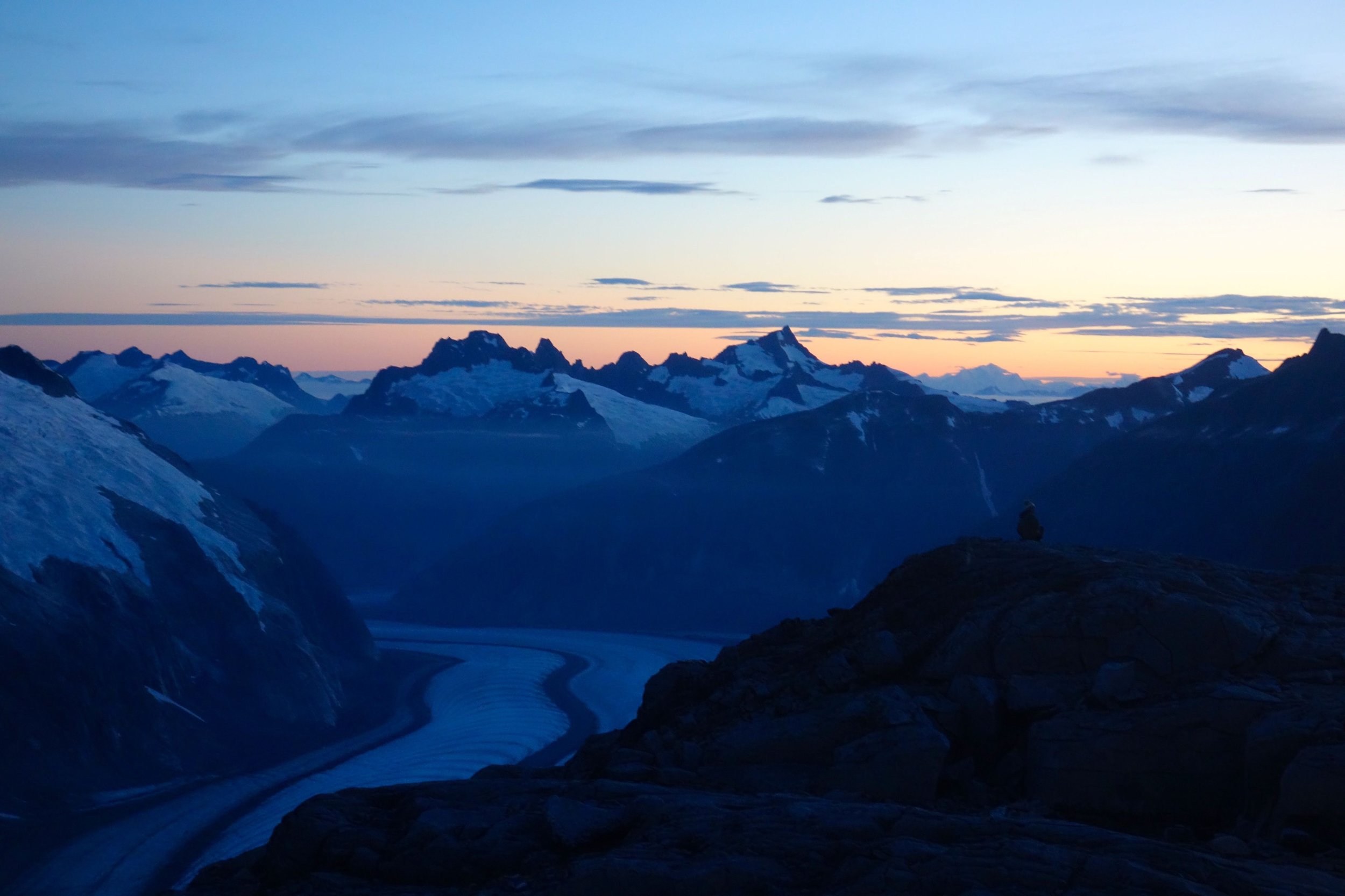
The Gilkey Trench as seen from Camp 18. Photo by Riley Wall.
I can describe the sounds that ice blocks larger than houses make when they tumble down the Vaughan Lewis Ice Fall. I can convey how the noise that crumbling seracs make resembles the roar of distant thunder, how the crashes are often powerful enough to wake sleeping JIRPers, how the rumble that interjects forcefully into everyday life at random intervals never loses its novelty or ceases to cause excitement, and how one can’t help but hold his or her breath until each individual ice fall event terminates with an eerie thud. I can effectively communicate what I hear on the icefield, but I wonder if I can communicate how these sounds indicate that despite the fact that the icefield seems static day to day, it is in a constant state of dynamic transformation, very much alive and susceptible to human actions, and still I know that I cannot communicate how what I heard on the icefield changed me.

The Vaughan Lewis Icefall. Photo by Allen Pope.
I can describe the unexpected scents of the forget-me-not, heather, and fireweed blooms. I can express how tiny blue forget-me-nots conceal their fragrance during the day but unleash a powerful sweet aroma when the sun drops beneath the horizon, how the white, pink, and mountain heather release an earthy, herb-like smell that is reminiscent of the holiday season, and how expansive fields of deep purple fireweed draw passersby and bees alike with their citrus-honey like scent. I can communicate what I smell on the icefield, but I wonder if I can communicate how these smells are more prevalent now than ever, how many of these plants are markers of change in the form of primary succession, how the hillsides now full of bright colors and smells used to be permanently white and scentless, how even though I enjoy the unexpected blooms, I can’t help but to feel a tinge of bitterness when encountering their aromas, and still I know that I cannot communicate how what I smelled on the icefield changed me.

Dwarf fireweed above Llewellyn Glacier. Photo by Riley Wall.
I can describe the sensations caused by the ice of the Orphan Ice Caves. I can explain how hands effortlessly slide across the walls as if they were greased with oil, how the ice’s surface is flawlessly smooth yet mere millimeters deeper within, billions of trapped bubbles resembling the cosmos crack and rearrange under the minimal pressure and heat of a fingertip, how the ridges of the inverted sun cups on the ceiling are as sharp as knife blades, and how the cave, warmed by the sun above, continually drips 0° C water, soaking clothing and causing moments of shock every time a drop touches exposed skin. I can effectively communicate the feeling of what I touch on the icefield, but I wonder if I can communicate how lucky I feel to have walked through such an ephemeral feature of the landscape that morphs, stabilizes and destabilizes annually, ever-shrinking since changes in ice flow dynamics and rising temperatures permanently detached the caves from the larger glacier, bestowing on it the name Orphan, and still I know that I cannot communicate how what I felt on the icefield changed me.
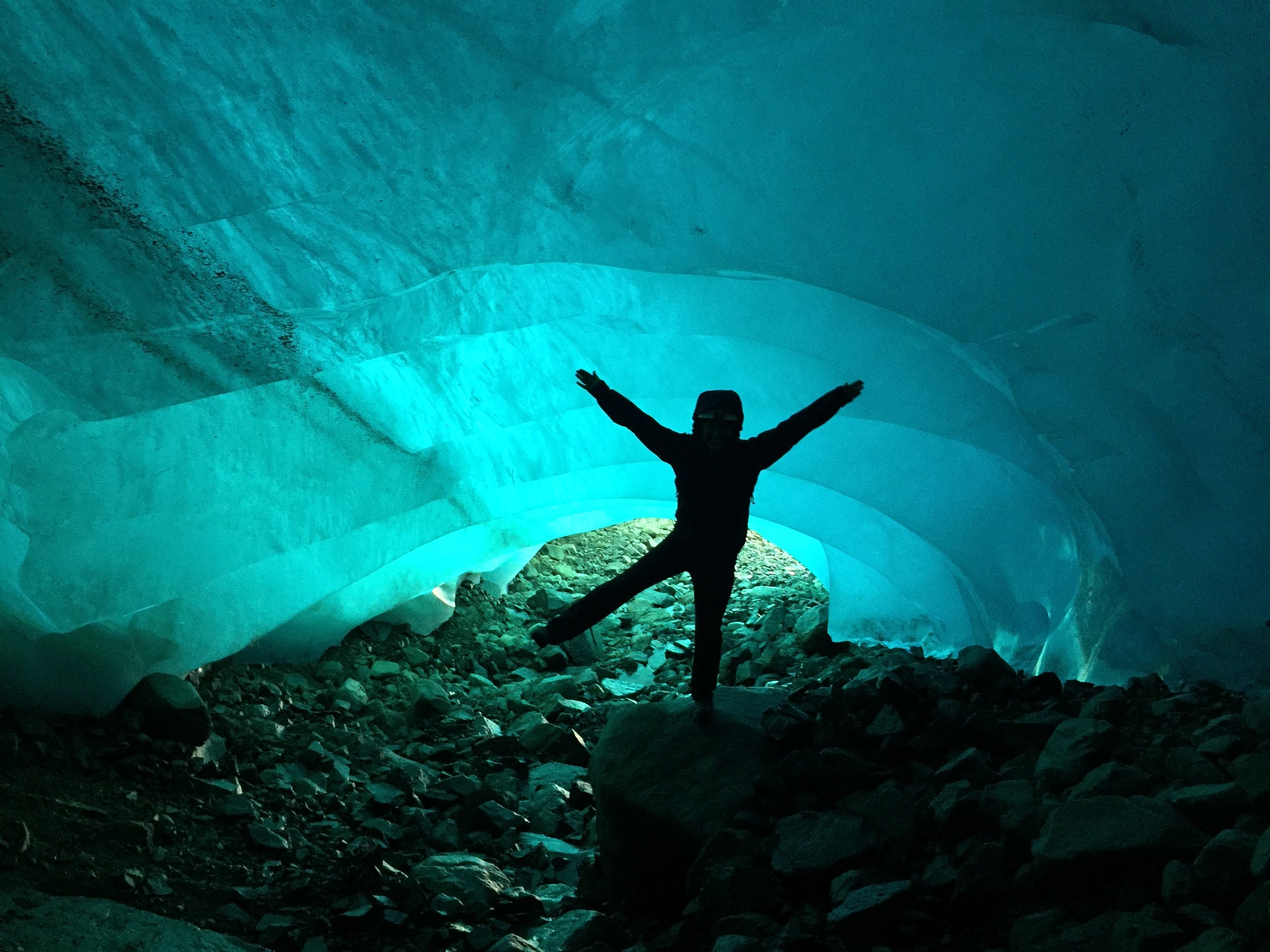
Exploring the Orphan Ice Cave. Photo by Auri Clark.
I can describe even the flavor of the snow I ski across. I can articulate how the finer snow is best for quenching one’s thirst because it melts most easily into refreshing water, how larger grained snow that has experienced melt and refreeze numerous times is best to provide a crunch in one’s PB&J sandwiches, and how concentrated Tang and Gatorade powder make the best snow-cone flavoring when carried out onto the icefield. I can even communicate what I taste on the icefield, but I wonder if I can communicate how I am constantly daydreaming about when the snow level was, on average, 8 meters (26 feet) above where I extract my cold treats now less than two decades ago, how I am terrified by the knowledge that many scientists estimate that the massive, seemingly unconquerable icefield I have been snacking on is already conquered and likely to completely disappear before 2200 (Ziemen et al., 2016), and still I know that I cannot communicate how even what I tasted on the icefield changed me.

Icefield trails. Photo by Riley Wall.
The true value of JIRP comes from the realizations, revelations, and ideas that it inspires in its participants. No amount of communication can describe the intangible elements of personal change that manifest from the first-hand icefield immersion of JIRP.
Thus I am left with the conclusion that while one can gain an understanding of what JIRP and the icefield look like, sound like, smell like, feel like, and even taste like, the most important aspects, the impactful aspects, remain, for me, inexplicable…
Blogging perhaps intimidates me, therefore, not because I am incapable of communicating with readers, but because I am incapable of communicating what I feel needs to be communicated. So my only remaining recourse is a plea to those truly interested in JIRP, glaciers, climate change, and the greater natural world: to embark on your own adventures, for you learn from your own personal experiences best, to foster any feelings of inspired motivation you find on those adventures, and to be a champion of the change you want to see. It is much easier to show people how you’ve changed than it is to describe it, trust me.