The Pirates of Glacier Mass Balance

By Jon Doty

Mass balance is in many ways piratical by nature. There is a reason why a JIRPer often stumbles across pirate flags with the words "Mass Balance 2012" scrawled onto the walls of camp. We have our map, shovels to dig for treasure, and X marks the spot. However, our modern day plundering involves a somewhat different set of tools, and an altogether different goal. In lieu of a pirate ship, we ride our skis into the horizon, following a GPS in search of science. 

The mass-balance crew on the morning before skiing to the Demorest Glacier pit. Photo by Mary Gianotti.

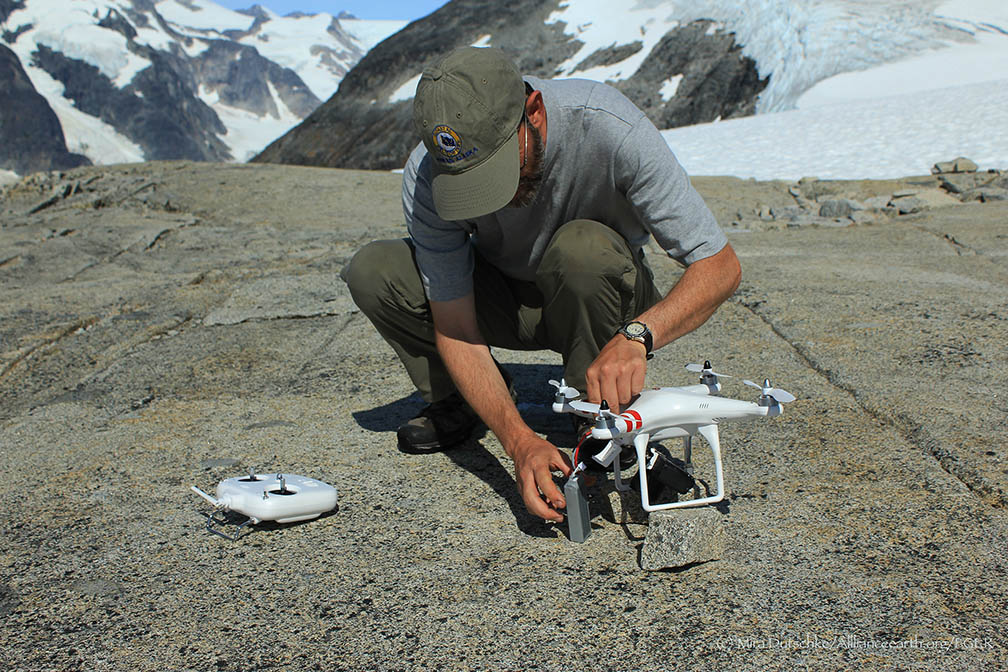
Although I have lost touch with the outside world, I am told that the day we left C-10 was July the 26th, bound for C-9, tasked with digging mass-balance pits on the Matthes and Demorest glaciers. For all you glacial neophytes out there mass balance is the bread and butter of JIRP science. By digging a pit into the winter snowfall and comparing to the summer ablation (mass lost through melt, sublimation, calving, etc.) we can determine whether the glacier has gained or lost mass over the year, and learn about the variability of the glacier on an annual basis. JIRP holds one of the longest records of glacial mass balance data - having measured Taku Glacier mass balance every year since 1946.  Storglacieren in Sweden is the only glacier with a similarly long data set.

Our itinerary was a nine-mile ski to C-9, pausing to dig a pit just short of camp on the Matthes Glacier. We would spend the night in camp, and then ski down onto the upper Demorest Glacier to dig another test pit before returning to C-9 for the night. On our final day we were bound for C-18 and the wonders of the Vaughn Lewis Icefall and Gilkey Trench.

We waved our final goodbyes to C-10, made a final pit-stop into Dreamland, and then took off down the ski hill onto the vast expanses of the Taku. We skied up-glacier on snowmobile tracks laid down by Scott McGee and the survey team, taking a few short snack breaks along the way, eventually hanging a right up the Matthes Glacier towards C-9. The turn onto the Matthes meant that we were officially on ground that none of us – save for our friendly field staff members Annie Boucher and Matt Pickart – had ever tread upon before - uncharted territory. As we set a course for discovery, I couldn’t help but smile. The interface between the Taku and the Matthes is quite noticeable; as the Matthes spills out into the Taku the flow rates vary greatly, producing a crevasse ridden terrain. These are mostly ankle-biters and nothing to really worry about, mostly affecting scientific curiosity instead of trepidation or thoughts of roping up.

Mary Giannotti and Jon Doty relaxing while Matt Pickart and Chrissy McCabe dig. Photo by Annie Cantrell.

After about four or five hours of skiing through marginal weather, we reached the pit location, and began digging. We dig our mass balance pits in four steps, each reaching progressively deeper down through the snowpack.  The north facing wall is a clean wall, where we make measurements of density, and is never stepped upon as it would affect the snow density below.

At first everyone is at work shoveling out the initial meter of depth, but once the first step becomes defined, only one person can safely fit on each step. At that point, those inside of the pit begin to shovel from their step onto step one, from where it is a shorter shovel throw to remove the snow from the pit. Those who are not within the mass-balance pit take a break and refuel for their next shift inside, or tend the rim of the pit to prevent snow buildup. This year our pits have averaged 3.5 to 4 meters deep, which takes about 4 hours to dig – in the past, however, pits have ranged up to 8 meters in depth, requiring feats of strength that even the Dread Pirate Roberts would shy away from.

The treasure at the bottom of the pit? The annual layer. This line marks the boundary between this year and last year’s snowfall. It can be represented by a variety of features within the snowpack: an undulating ice layer - evidence of suncups from the previous year; a dirty layer – dust and debris upon the snowpack deposited throughout the summer and buried during the accumulation season; or depth hoar – large unconsolidated sugary snow crystals which sits upon the far more dense firn (year-old snow). Once we have found the annual layer we begin to take our data from the pit. We prep the wall of step four (the deepest) into a clean vertical face, and sample the snow at 10 cm (~4”) intervals using a coring device of known volume. Measuring the mass of these snow samples (and the thickness of all ice lenses that cut across our sampling section) gives us a density profile of the snowpack. With this knowledge, we can determine the water equivalent of the accumulated snow at this location on the glacier.  By digging pits at varying elevations and distances along the central profile of the glacier, we can estimate the total accumulation received by the glacier for the past year.

Our pit on the Matthes ended up being 4 meters deep. The depth of our pits creates an interesting logistical problem: how to sample snow cores and ice lenses at fifteen plus feet off the ground. We JIRPers take this as an opportunity to cross the disciplines of science and mountaineering, and so we build a snow anchor and collect data on rappel. In this metaphorical crow’s nest (I know, this likeness is a bit of a stretch) we have a bird’s eye view of the pit we have dug, and can sample the layers safely and precisely.

View of Camp 9, with Matthes Glacier in the background.  Photo by Annie Cantrell

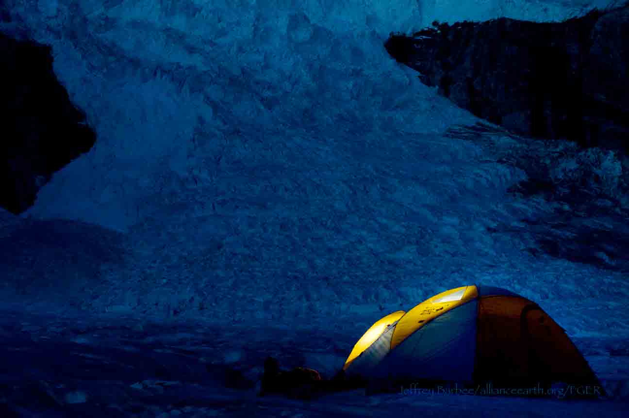
Hungry from a full day’s work, we chugged on up the hill to C-9 through a whiteout, gaining the first views of our home for the next few days only once we were within thirty feet. We all piled inside, leaving our backpacks covered up outside on the nunatak as there was no room indoors for anything more than people. C-9 consists of a single two story building with exactly enough space for about two fewer people than we had in our crew. We managed to squeeze in, and bided our time reading graffiti on the wall and cracking jokes while we waited for the pasta water to boil. After dinner there was only one option: bed.

Interior of Camp 9 with Matt Pickart.  Photo by Annie Cantrell.

Dawn broke with a cloudless sky, and an absolutely beautiful view. After finishing off leftovers from last night we were treated to fresh oatmeal! Our ski down to the pit on the Demorest Glacier was an absolute treat – views of Devil's Paw, the Dipyramid, the Citadel, hanging glaciers, bergshrunds, and so much more. The first half of the ski was a long downhill, and so I sat back and paid zero attention to the track ahead of me as I soaked in the alpine panorama. Once we hit the Demorest Glacier we skied a few more miles of flats to reach the test pit. The sun was hot and bright, and so we blasted some music and got to work. The day was pleasant and the pit went quickly, and as manpower became less necessary within the pit we dug couches into the snow, and laid our socks on our ski poles to dry. Our pit ended up 4.5 meters deep, and so we cored it, and set sail back to C-9, treated to an absolutely incredible sunset just as we topped the camp ridge. Our rations for the night consisted of spaghetti with a mixture of tomato sauce, leftover broccoli cheddar soup, and roast beef for toppings. As we tucked in to bed, strong winds buffeted our home, but thoughts of the coming day’s traverse to C-18 and adding new points to my life’s map lulled me to sleep.

Matt Pickart, Lindsey Nicholson and Jon Doty watching the sunset with Devil’s Paw in the background. Photo by Salvador G. Candella.

The Secret Natives of the Juneau Icefield

By Ben Slavin

Many students and faculty take part in JIRP each summer with the central goal of using the Juneau Icefield as a living and breathing classroom of Earth system science. As a high school JIRPer in 2011, I imagined that I too would take part in the numerous exciting glaciological projects that have been ongoing since 1946. But as I began exploring the mountaintop landscapes, known as “nunataks”, of JIRP’s field camps, I realized that there was a whole other world waiting to be delved into. With the help of dedicated JIRP faculty member and geobotanist, Polly Bass, I gained my first experience in the field of glacial entomology by conducting a general survey of glacier flea (H. nivicola) population characteristics on the Taku Glacier in front of Camp 10.

After completing my project and closing the proverbial book on JIRP 2011, I returned to my senior year of high school assuming that I would only ever return to the Icefield in my countless wonderful memories. A year later, I watched my sister Lindsey complete the program as a high school student and, like so many of the individuals that make JIRP the juggernaut of a program it continues to be, I found myself longing to return to the High Ice. “But how?” I wondered. As I was sitting  in a biology class at the University of Miami (FL), where I am pursuing a degree in Neuroscience with the ultimate dream of becoming a medical physician, I remembered the fascinating glacier insects that I had studied two years prior through the lenses of a high school student. Now that I had a college level understanding of the field of biology, I was very hopeful that I might be able to apply this knowledge to the Icefield. After corresponding with Polly, JIRP Director Jeff Kavanaugh, as well as Dr. Sean Schoville at the University of Wisconsin Madison, I was thrilled to be informed that I would have the opportunity to return to JIRP to study insects once again.

Ben Slavin night-collecting N. lituyae.  Photo by Jeffrey Kavanaugh.

Instead of glacier fleas, the research project I am taking part in this summer focuses on a species of beetle known as Nebria lituyae. This species is very near and dear to the Kavanaugh family given that Jeff’s father, Dr. Dave Kavanaugh, discovered and named the species and Jeff himself has been collecting it for his father from a young age. The central goal of the project is to determine the amount of microevolution, also known as evolutionary diversification within a species, that is occurring between populations of Nebria lituyae on various nunataks located all over the Icefield. When my friends and family, many of whom are Florida natives, who are much more familiar with sandy beaches than they are with snow and mountains, asked how we were expecting to go about determining microevolution amongst beetles, I cited Darwin’s classic expedition to the Galapagos Islands.
Darwin observed with finches in the Galapagos that being reproductively isolated from their mainland conspecifics caused the island finches to have different physical appearances from finches on the nearby South American continent. Darwin wrote that he believed that the Galapagos finches’ separate gene pool favored individuals who were best suited to surviving the Galapagos’ unique environment over many generations, thus explaining the difference in physical appearance. Essentially, it helps to think of each mountaintop nunatak as its own island, surrounded by a sea of snow and ice instead of water, the target of our collection trips to each of these “Icefield Islands” is not finches but N. lituyae beetles, with the hypothesis that there has been a level of microevolution that has occurred amongst the isolated populations.

In order to be able to study and compare N. lituyae beetle populations, Jeff, Polly, and I (as well as Staff Member Scott McGee, faculty member Gabrielle Gascon, fellow student Pat Englehardt, and Field Safety manager Adam Toolanen), have ventured out on numerous collection trips to strategically-spaced nunataks in which we gather the beetles and humanely preserve them in alcohol-filled collection vials. The biggest challenge of these daytime collection trips thus far has been finding the beetles, which are most active at night when they venture onto the snow bank to feed on other insects that may have died during the day.  Given the beetles’ penchant for darkness, daytime collection trips mean that we must turn over (and then carefully replace so as not to disturb the ecosystem) many rocks at each nunatak site we visit. Further adding to the challenge is that we must find a minimum of ten beetles at each nunatak in order to be able to compare them to other nunataks. Some days, we are unable to meet the minimum requirement of ten beetles collected and must don our headlamps for a collecting session after nightfall, when the N. lituyae are much easier to spot. Though the “ten beetle rule”, can lead to some longer days in the field, I personally have been relishing the opportunities to explore cool spots, like the base of "Taku B" behind Camp 10, after dark. 

Ben Slavin collecting at Shoehorn Mountain, across the main branch of Taku Glacier from Camp 10.  Photo by Jeffrey Kavanaugh. 

The reasoning behind a minimum of ten beetles from each nunatak is that we must allow for a certain degree of variability amongst individual beetles that come from the same nunatak. For example, my sisters, Lindsey and Blaire, came from the same parents and grew up in the same environmental conditions I did, but our DNA sequences are not the same as is evidenced by our many physiological differences, such as height. 

After explaining the mechanism behind microevolution as well as the collection protocol, my Floridian friends and family are usually eager to learn exactly how we intend to go about determining if microevolution is indeed occurring amongst the N. lituyae populations of the Juneau Icefield. Once we have collected all of our samples for the field season, the beetles will be sent to the lab of Dr. Sean Schoville at the University of Wisconsin Madison. In his lab, Sean will use a specialized technique to surgically remove a part of each of the beetles we collect. Sean will then be able to extract a specific DNA sequence from each beetle which will be compared to the other beetles found on the same nunatak, as well as different nunataks.

We hypothesize that given the beetle populations’ isolation from each other,  these DNA sequences will be somewhat different from one another. We are also taking global positioning system (GPS) readings at each of the nunataks where we collect so that we will be able to see if differences in DNA sequence between N. lituyae populations correspond with the distances between the nunataks from which they are collected. Of course, there is also a chance that the DNA sequences of all of the N. lituyae populations will be the same. This would also provide an interesting result as it would suggest that the N. lituyae populations are able to move from nunatak to nunatak in spite of the extremely harsh conditions of the Juneau Icefield.

Regardless of the findings of this riveting project, I have been having the time of my life rediscovering what made the Juneau Icefield Research Program something special for my father, Andrew Slavin (JIRP ’73), who raised me with whimsical stories of this magical place in Alaska. Aside from the amazing landscapes and mostly beautiful weather, I’d have to say that my favorite thing about this program continues to be the people. When I first joined the group, I was equally excited to be reunited with old friends as well as make many new ones, and I most certainly have. I have definitely appreciated how enthusiastic everyone has been about my project - I don’t think a single insect, let alone beetle, has walked through camp without someone letting me know of its whereabouts.  The group of students, staff, and faculty who choose to truly take the time to enjoy each others’ presence while doing great research on the Icefield is truly what has made JIRP one of the most special times of my life now not once, but twice!

Notes from the Ferry

By Molly Blakowski

I see Cantrell sort of beat me to the obligatory, sappy goodbye post, but, as Uwe would say… this is my one.
 

The kind of scene that brought me back to Southeast Alaska for seconds. Photo: M. Blakowski

A hundred miles up the coast from Juneau, Alaska, a mainline vessel for the Alaska Marine Highway System carries us down the Inside Passage, a thousand mile stretch of ocean protected by a chain of archipelagos west of the continent’s edge. For me, it is the final day of the JIRP season; tomorrow, I will be leaving for Anchorage to prepare my poster for the annual geochemistry conference in Florence, Italy. Funny to think this day has finally come.

The adjacent terrain is town-less and teeming with life; the fecund estuaries of the great grizzly bear and wolf. At the stern, I sip lukewarm tea from a styrofoam cup and watch the sea as it breaks against beaches littered with blue-ish white and pale-gray stones, delicately laced together by soft, green mosses. Tiny pools of rainwater accumulate amongst the till, beyond which grow virgin, old-growth spruce that cling to scalloped granite walls, and white-capped mountains draped with stringy curtains of clouds that seem to peel apart like pages in a pop-up book. It’s windy now, and the late afternoon sun is low in the sky, glowing the same dirty yellow as an old seaman’s slicker. The ship rolls atop the gentle waves, and as my friends sprawl out on their loungechairs back up on the deck, glacier goggles sliding down their sunburnt cheeks, I remind myself of a quote written in one of the outhouses back on the icefield:

“I feel more like I do now than when I came in!” – The prototype “Fugger”

[NOTE:  'Fugger' is a term (used endearingly) for a JIRPer, stemming from the name of the non-profit parent organization of JIRP - Foundation for Glacier and Environmental Research (FGER)]

Just think. Combined, we have traversed thousands of miles of beautiful, untouched snow, walked from ice to gravelly streambeds that billions of people will never, ever see; we’ve thrown rocks at other rocks that nobody else will ever know exist. Our burns, callouses, and minefields of blisters are signs that time does not pass gently by in climates harsh as these, a sentiment to which the jagged landscape before us can attest, and yet, what a splendor it has been to wake up at dawn and see the moon low in the sky, glowing pink, the Taku Towers to our backs. To feel so free and easy and full of light.

Does it happen in other people's lives, I wonder, that a single event influences all subsequent time? Because after this second summer in Alaska, I know that things have changed for me—and although I am unable to pinpoint some exact moment when the transition took place, I couldn’t be more serious when I say I am leaving the icefield a different person than when I arrived. My life has been forever changed; I can tell from this familiar feeling as I gaze out across the water, a feeling that I hope I will never forget. Of course, I can try to explain, but those of you who are with me right now, and will be reading this as it is posted, I know you will understand. And likewise, those of you who have seen it before, I have no doubt that you too will recollect the very sensation overcoming me right now as I watch the distant lights of Juneau slowly rolling in, how it all looks so new, so different from anything I have seen before.

I believe that for each of us, the pattern of our lives have and will continue to form around memories like these—whether they be of the early-morning smell of Spam grease and Kirkland-brand coffee, the sound of crampons crunching into crisp, blue ice, or the comfortable stillness of a sun setting over the Gilkey Trench. I don't know how many places, or times, or chances like this one person is allowed to have in one lifetime. I don't know if I’ll ever see some of these people, or some of these places ever again. Nevertheless, they will remain dear in my heart as we all part ways and return to school and jobs worldwide.

Like the hundreds or thousands before me, I have fallen in love with this icefield, this program, these people. How could I not? Here, I have found the scholars who have rejuvenated my curiosity and encouraged me to continue pursuing a career in the earth sciences. The strong women who have inspired me to seek leadership roles in expeditionary settings. The friends who have taught me to consider each day a blessing, who have lent me a hand and brushed snow off my pack after a tumble down the ski hill, who have schemed and laughed with me in front of gas stoves spattered with Spam grease and oozing pancake batter, who have smoothed over my anxieties with cups of tea and quiet conversation, who have read to me aloud under setting suns and waxing moons, who have guided me across scree slopes, vertical swamps and crevasse fields with ease, who have lain awake with me until two hunting for shooting stars and talking just to talk, even when they had to get up early for cook duty the next morning.

Now, I sip from my cup and lock my elbows against the railing, craning my neck for a better view. Juneau is coming, closer and closer; I swear it looks so bizarre glowing there in the dark, like a little figurine town, or like it all could be made of crepe paper, carefully folded and taped in place. Surrounded by little candles, just flickering there, waiting for us. Knowing where we’ve been. Occasionally during my time on the Icefield I have woken up in the middle of the night in a little panic, wondering where I am, and the idea of packing up my bags, leaving my JIRP family and flying to Anchorage tomorrow makes me feel eerily similar. Well, here goes.

To the friends I have made this summer, and to those of you who I’ve yet to meet, I thank you for giving me the time to explain that this place and the memories we have of it will cling hardily to these talus slopes for years and years to come, certainly for the rest of my life—and I hope for yours as well. To the FGERs I’ll never forget, may the roots we have firmed here withstand the tests of weather and time, and may this forever be our refuge, through and through. I can feel it in the light sea breeze, could hear it earlier in the promising calls of sea birds, and again now in the laughter of all you freaks and geeks as you gather and wait for the ship to port. I can see it in this skyline of crepe paper castles and candles.

Because while it’s true that for this summer, the icefield is behind us, in a few moments, we will be leaving this ship feeling more like we do now than when we came in.

A bittersweet view from “The Hilton” at Camp 10. Photo: B. Stamper

The Hidden Messages of JIRP

By Annie Cantrell

When I headed to Juneau I did not know where I would be living.  I assumed  it would not  be in tents for most of the time. I had everything on the packing list and I knew I was physically and emotionally capable. All that had propelled me into JIRP was curiosity. I was curious about myself and who I would be when surrounded by white. Another thing I did not know, was how many years of great people before me have been curious about themselves in the same way. The legacy of JIRP was completely unknown to me.

Back in January my dad told me about how a close family friend of ours had done this thing on the Juneau Icefield where he stayed on the ice for two months and helped students with research. I decided I wanted to go almost immediately after our phone conversation. I was accepted, but our friend died a bit after, so I hardly heard about it from him.

Upon entering the world of JIRP on the van from the airport I got my first glimpse into the legacy when I was told that the founder and long-term director of JIRP lives in my hometown (Moscow, Idaho). I knew nothing about Maynard M. Miller at the time, just as I knew nothing about the spirit of what I was getting myself into. A couple of days later, while we were in lecture in Juneau, Dr. Alf Pinchak comes in looking like someone out of another era, and he listened to the lecture with us. Simply seeing him filled me with this strange sense of awe. I was thrilled to learn that he would be coming with us to the Icefield.

I started to get little hints of what I was a part of.  These camps we were living in were built in the 40’s, largely through military funding and have been in use since then.  The first part I saw of Camp 17 were stone structures that had been built for a  temporary shelter while these men built the formal camp.  In the C17 cook shack, the first JIRP building I entered, the walls were  covered in Sharpie writing going back to the 70’s.

I did not quite know how to take it all in. Every building is covered in writing. Some of it is really funny.  Reading the walls is a common past time. Sometimes I search for names I recognize. To know you are staying in a place where past JIRPers have also been tired, had cabin fever, waited anxiously for mail, and made games out of nothing, brings that place to life.

Right before I left Camp 17,  I signed by my bed, 15 years before someone from the town where I go to school also slept. I commented enthusiastically in Sharpie on the coincidence and dated it. There was also writing above the staircase where I slept, to be careful not to slip as the author had done (and I almost did many times during my stay). 

At Camp 10, signatures in the girl’s cabin ranged all the way back to the 60’s. These past inhabitants wrote some funny stuff. They also wrote some dumb stuff. We wrote some responses to these things. There was writing about being tired and sore after the very same traverse we had just completed. The very same older man I talked about seeing in Juneau at the lecture signed my bed in 1963. As did one of this year's safety staff members, in 2011.

All these things on top of one another slowly made me feel like maybe I was also a part of the legacy. I will not forget when I came to Camp 9, a tiny shack, where a small group of JIRPers stayed for two nights to dig Mass Balance pits, and I saw the name of the man from my hometown who told me to come here. He scrawled it inconspicuously on the ladder. I had found him. I signed beside it and felt I belonged.

Miller, who seems like a legend of a man to me, has been written about everywhere. In the cook shack the words “Miller Rocks” are scrawled messily up high on the wall. There is a tiny loft in the girls’ cabin where the words “FIRE ESCAPE/M3 (meaning Maynard M. Miller) AVOIDANCE DEVICE” are written. Apparently he did not like going in there since he would hit his head on the ceiling. I hear he would often say “Mighty fine, Mighty fine.” These words are written all over the buildings.

I stayed at Camp 18, the favorite camp of my family's friend. With the Gilkey Trench below and the sound of chunks breaking off the icefall, the Icefield really feels alive. I feel so close to the past when I read and connect to the wonderful and ridiculous things written. I was feeling bittersweet, with the beauty of this camp and the ending of JIRP, when I saw this quote written on the wall of the Camp 18 cookshack:   

“Such a long long time to be gone, and a short time to be there.” 

Aurora Hunters

By Sarah Bouckoms

For the first seven nights at Camp 18 I did not sleep under a roof. We were blessed with fabulous weather that left most of us retreating inside a building only for an hour or two during our daily lectures.  As the sun set, we all wandered around the rocks, looking for the best sleeping site we could find. Armed with bed rolls or sleeping pads, we knew we could tolerate a few bumps and rolls of rocks but the flatter the spot, the better. This of course could all be compromised for the view or proximity to the icefalls. Yes, we were lulled to sleep by the sounds of the calving Vaughan Lewis Icefall under the clear night skies of Alaska. It sounds so wild and remote that sometimes I feel as if I am dreaming before I have even fallen asleep. 

Armed with a book for a pillow the Vaughan-Lewis Icefall can lull anyone to sleep. Photo by Sarah Bouckoms.

We do our best to avoid sleeping and spend time finding constellations and hunting for aurora. I am familiar with the constellations of the Northern Hemisphere so it is a joy to see some old friends that have gone missing with the extended daylight hours this close to the Arctic Circle. An even greater joy comes when I am able to point out the constellations to the students. I have to explain the first fundamental rule to be an astronomer -  having an overactive imagination. That, yes, this square over here is completely different from that square over there. Clearly one is Hercules, the brave warrior, the other is Pegasus, proudly soaring through the sky. The Summer Triangle also greets us shinning forth from the stars Vega, Altair and Deneb. Not to be forgotten is the slightly dimmer star Polaris which is near the North Celestial Pole, the special point that marks the axis around which the stars appear to rotate.  It can easily be found by extending the distance between the last two stars in the Big Dipper. Surely every good Alaskan must know this group of stars since it is represented on the state flag. But did you know that it is not actually a constellation? Yes it is true. As Pluto is not a planet, nor is the Big Dipper a constellation. Have no fear though, for the group of stars that we know well as the Big Dipper resides in another constellation, Ursa Major. The Latin name translates to Big Bear.  Another key ingredient to being a good astronomer is imagination. For the handle of the Big Dipper is actually the elongated tail of a bear and the four stars of the cup are the rear end and back of the bear. Further stars contribute to the face along with stars in groups of three to make up the paws. It is much easier to see the constellations when there is less light pollution, such as we are lucky to avoid on the Juneau Icefield. It seems a shame that the light from the stars should travel light years through outer space only to be dimmed out by the man-made light in the lower parts of the atmosphere just before it reaches our eyes. Thus is life in a world where we are no longer ruled by the solar cycle but a 9 – 5 workday. If you can manage to escape out to the country or turn the lights off in your house, you will be amazed at the glory of the stars and the white band that is the Milky Way.

A group sleeping outside wakes to morning views of the Gilkey Trench. Photo by Sarah Bouckoms.

While stars are pretty, that is not what we outside slumberers dream to see. What we really want to see are the solar particles colliding above Earth’s atmosphere attracted by the magnetic field. This fantastic display of collisions is responsible for the light that we call the Aurora Borealis in the Northern Hemisphere and the Aurora Australis in the Southern Hemisphere.  The different colors are dependent on the type of particles interacting and the altitude. The sun emits electrons which interact with either Nitrogen or Oxygen. The collisions (and hence the aurora) are most prominent closer to the poles as this is where the magnetic fields converge, creating the greatest pull for the electrically charged particles emitted from the Sun.

So if you are a good aurora hunter, what do you have to look for? The probability of the collisions happening in the winter is no greater than in the summer. The largest difference is that during the winter you have 12 + hours of darkness, which gives you a greater chance of observing the light show. We are only just creeping into true darkness as we enter August, so the Sun, which is ironically the source of the particles, is also producing light which is brighter than the light of the aurora.  The Sun has decided to help us out though! The Sun is climbing out of its 11 year cycle from a solar minimum – or minimum amount of solar activity. As the Sun becomes more active, it will send more particles into the Solar System, increasing the chance of an interaction in Earth’s atmosphere. So if the stars alight for us and we get a clear night, with high solar activity, we may be lucky enough to see this dazzling display of lights. Keep your fingers crossed readers and you two will get to vicariously live through the wonder of the aurora in another blog post full of aurora pictures or videos.

While I have watched with enthusiasm as the faces of my students light up when I show them YouTube videos of aurora, I hope that I may be lucky enough to record my own video or describe the lights personally back in the classroom. I love teaching physics, as I find that knowing the science behind the phenomena of the natural world only makes it more beautiful.

Taken straight from the sleeping bag. The beautiful sunrise over Atlin Lake welcomes us to the day when we return to civilization. Photo by Sarah Bouckoms.

While the Sun wakes me up earlier than I would like at times, watching it lighting up the glaciers as they drip off the jagged mountain peeks from the comfort of my toasty sleeping bag, I have a quiet moment in the morning to myself thinking I must have done something right to wake up to this view. Then the hustle and bustle of the day on the Juneau Icefield begins and we wait for nightfall when the aurora hunters emerge again.

Blisters and Band-Aids on the Juneau Icefield

By Sarah Bouckoms
   
With the change over of faculty we are excited to welcome long time FGER, Jack Ellis. He is an ER doctor in Burlington, VT with wilderness medicine experience.  We are glad to have him on board to expand upon the first aid we learned earlier in the summer.  The past few nights’ lectures have been filled with fun hands-on scenarios.

First we discussed the best practices for splinting ankles, knees, elbows and shoulders.  With the loose rocks found around camp, it is a real possibility to roll an ankle so we have to take care while walking. The triangle bandages and Sam Splints were very handy but we also learned how to be resourceful with bandanas, pieces of wood or rolled up jackets.

Kamil Chadirji-Martinez being lifted on  a backboard with the help of 6 fellow JIRPers, including Jai Beeman on the left with Jack Ellis and  William Jenkins to the right. Photo by Sarah Bouckoms.

We then moved on to heavier topics dealing with broken legs and spinal injuries. In most cases on the Juneau Icefield, if the weather is good, one can be in the hospital in less than an hour. However, we were rehearsing the possible scenario that help was not accessible, and a patient had to be evacuated by foot. After splinting the patient, we needed to package the patient up. This was easily done with a backboard. We tested our skills by inclining our nervous ‘patient’ Kamil Chadirji-Martinez at all angles of inclination. To his relief he did not slide around on the backboard.

Kamil Chadirji-Martinez is well secured. Don’t worry Mom, this is only practice! Photo by Sarah Bouckoms.

In the field, it is not common practice to carry around a backboard strapped to your pack. But you often have materials in which to make a very suitable carrying rig known as a litter.  Using a combination of skis, poles, tarps and ropes, we made hypothermic body wraps or carriages to transport victims out of the wilderness. Communication is key when lifting and traveling with a patient, but thanks to our good leadership skills and teamwork, the system worked well. 

Christiane McCabe is wrapped up like a tortilla by Jack Ellis. Photo by Sarah Bouckoms.

Despite all the stress that we felt playing out scenarios involving an ‘injured’ JIRPer, the most likely first aid we will have to practice will be easily managed by the supplies in our personal first aid kits. An extensive first aid kit is part of our 10 Essentials and is brought with us whenever we leave camp. Blisters, sunburn, hypothermia and dehydration are the most likely medical issues we will have to treat on JIRP. Also lucky for us, many of the JIRPers this year already have their Wilderness First Responders or Wilderness First Aid Certifications.  Ironically, the more training you have in first aid, the more aware you are of the dangers and less likely you will have to use it. No matter the level of training you have, it is important to remember the first rule of first aid – always making sure that the scene is safe before you rush into help the victim. Here on JIRP, we look after each other, and ourselves, as we function as a group all affected by each member's well being. 

Interview with Polly Bass

By Mary Gianotti

Polly Bass is a Faculty Member for the JIRP 2013 season. She came here first as a student herself in 1992 and has returned many times since then. She is a valuable member to the summer program with her knowledge in geobotany. Her enthusiasm is contagious and her dedication to the program a benchmark for all.

Dr. Polly Bass talking with JIRP students, Patrick Englehardt, William Jenkins and Mary Gianotti, about the geobotany of the "Taku B" nunatak on the Taku Glacier in Southeast Alaska. Photo by Mira Dutschke

Mary Gianotti: What is your current field of study or interest?
Polly Bass: I am a physical geographer specializing in alpine and high latitude vegetation, Quaternary environments and glacial geomorphology. I study the biogeography of periglacial areas and the vegetation of nunataks, in particular vascular plants and their distribution.

MG: What was your educational path to becoming a scientist?
PB: I was inspired first by my 7th grade science teacher, Mr. Anderson. He and his family were incredibly enthusiastic and lived their work. 

In my high school library I came across a booklet on National Science Foundation sponsored summer programs. That is how I found out about the Juneau Icefield Research Program. I wrote Dr. Miller and he replied with a detailed letter. My work in various jobs including a paper route and work at the Pastry Palace on the weekends allowed me to purchase my first plane ticket to Alaska.

Once I got up to the Icefield, I was taken by not only the passion everyone had for their work, but also by how Dr. Miller and the academic and safety staff really cared about the students and wanted them to succeed. They made sure we had a sense of responsibility and accountability to others and ourselves. Dr. Miller emphasized, s=xy^2. Your success in life (s) is equal to your God given ability (x) multiplied by your motivation (y) squared. In other words, your work ethic is much more important than your natural talent. The program also taught me about expedition mentality. If you hurt your toe, it is not just your toe, it is the expedition’s toe. It is important to take care of yourself and recognize you are one of several integral pieces of a well oiled machine. All are important and without one of the parts, the rest will not function as efficiently.

I attended the University of the South in Sewanee, Tennessee for my undergraduate degree and initially majored in geology.   An interest in the plant life encountered on geology field investigations led me to add a biology major. I knew I wanted to return to the Icefield. I earned my EMT certification and took NOLS and Outward Bond courses in winter camping and ski mountaineering and extra technical mountaineering in order to increase my value to JIRP. In 1994, I came back to the Icefield and worked on a senior thesis project while serving as a junior staff member. This research project was on the investigation of the presence of Blockschollen flow at the terminus of the Taku Glacier.

Following undergraduate work, I worked with the USFWS in Homer, Alaska, at the Alaska Maritime Wildlife Refuge prior to completing a masters degree with a thesis on the distribution of gymnamoebae in subtypes of the Orangeburg Sandy Loam. My concentration was in geology and botany. My advisor, Dr. Paul Bischoff was very inspiring. During this time I completed my teaching certification and student taught as a high school science teacher.  I then continued to pursue research and entered a doctoral program in physical geography, concentrating in alpine environments and high latitude environments. I went down to Ecuador initially considering research on tropical glacier environments.  Shortly thereafter I returned to the Juneau Icefield and felt like I had come home.  My interest in vegetation and its distribution led to the observation of a lack of knowledge on the plants of the icefield region. I decided to focus on the theory of island biogeography and its application to the nunataks.

Dr. Polly Bass talking with JIRP students, Mira Dutschke, William Jenkins amongst others, about glandular tipped hairs of Phyllodoce aleuctica, ssp. glanduliflora (Yellow Mountain Heather) on the "Taku B" nunatak above Camp 10. Photo by Sarah Bouckoms

MG: What have been the worst places your work has taken you?

PB: It is a matter of perspective. Southeast Alaska receives significant rain and wind.  This can wear on a person. Even the most difficult conditions make us  better and allow us to appreciate the sunny days. The challenges are just as important as the Bluebird Days. Supporting scientific field work requires significant energy and resources. We cannot afford to waste a day in a tent or shelter because it is raining sideways. Every day in this environment is a gift…another day in paradise.

MG: What about the best places your work has taken you?

PB: Getting to work in places where it is quite likely that no one has set foot prior, is a primeval thrill.  You are one with nature. You can really see nature at work without the clutter of contemporary times. The basic processes of landscape and ecosystem evolution are in clear view.

MG: From talking with you earlier I know that you have taught in Sitka, Alaska and been a Southeast Alaskan resident for seven years. What do you love most about Southeast Alaska?

PB: It is green and lush. Even in the winter it is green. You notice that when you go to other places.  People in Southeast Alaska love to complain about the wind and rain. However, it is all of the rain that makes the landscape lush and vibrant.

MG: How many times have you been up to the Juneau Icefield?
PB: Fifteen times.

MG: Clearly this is an important place to you. What do you love most about the Juneau Icefield?

PB: I like the feeling of being close to the Earth.  Without the complications of the modern world, one can focus on the basics.  When you remove these distractions you have a better chance of understanding what nature has to share. It allows for a new perspective on the world and life.

MG: What advice would you give to young scientists?

PB: Don’t box yourself in. Be open minded. Design your own skill set based on personal strengths. Change is the only constant in life. Having a background that is diverse and interdisciplinary will give you the ability to have unconventional insight in the areas where disciplines overlap. This is frequently where breakthroughs occur.  Do not be afraid to take the difficult route.  It will pay off in the long run. Don’t protect yourself by taking easy courses to protect your GPA. Let go of the ‘success ethos’ and other societal baggage and do what you are interested in and passionate about, even if it is not what you are best at, right now. Most importantly, be thankful for the people who care enough to tell you things that you may not want to hear  but need to hear; who point out your true potential, which you may not be living up to;  and who teach you how you can be a better scientist and person.

MG: Thank you Polly. It was nice talking with you.

Dr. Polly Bass talking with JIRP students about the cushion plants and lichens on the "Taku B" nunatak along the Taku Glacier in Southeast Alaska. Photo by Sarah Bouckoms.

Geomorphology of The Cleaver

By Patrick Englehardt and Leah Nelson

Camp 18 is located on a body of exposed rock called the Cleaver, and it is bordered by the Vaughan Lewis and the Little Vaughan Lewis icefalls. Although it currently stands proud of these icefalls, it is clear from geomorphological evidence that the Cleaver was once overridden by glacier ice. The scarred rock left behind following glacial erosion can indicate the direction of ice flow and can give clues to help understand subglacial conditions and forces.

Geomorphological features found on the Cleaver include chatter marks, striations  and roche moutonnee (all of which are defined below). Leah Nelson’s project is the creation of a geomorphological walking tour on the Camp 18 nunatak that identifies these features for future generations of JIRP students. The following photos and definitions are part of this project.

Chattermarks: Chattermarks are a series of small and closely spaced crescent-shaped features made by vibratory chipping of the bedrock surface by rock fragments carried in ice at the base of the glacier.  Their shape indicates movement; they are generally convex in the direction of ice motion.  The bedrock of the Cleaver is littered with chattermarks, showing the movement of the overriding ice.  

Chattermarks in the bedrock of the Cleaver.  Photo by Leah Nelson

Striations: Striations are multiple scratches, often parallel, inscribed on the bedrock surface.  These are caused by the sediment load in the base of the glacier that scraped along the bedrock.  In some places on the Cleaver, you can see striations that pass through both the bedrock and inclusions that are of a different rock type.  This instance of differential weathering shows the contrasting resistances between the two types of rock due to their composition.

Striations through a xenolith. Photo by Leah Nelson.

Roche Moutonnee: A roche mountonnee is an elongated bedrock knob whose long axis is oriented in the direction of ice movement. The upstream side is gently inclined, smoothly rounded and striated; while the downstream side is rough and steep, often with portions of rock removed or plucked away during formation. The term comes from the French and means “sheep-backed rock”.

Author Leah Nelson gives scale to a roche mountonnee on the Cleaver. Photo by Patrick Englehardt.

Author Patrick Englehardt stands on another roche mountonnee with the impressive Gilkey Trench in the background. Photo by Leah Nelson.

Patterns of the Planet: A Conversation with Paul Illsley

An Interview by Jai Chowdhry Beeman

Paul Illsley is a cartographer at the Centre of Geographic Sciences in Nova Scotia, Canada. He joins  the JIRP 2013 program as a visiting faculty member for several weeks. In addition to delivering captivating  lectures on aerial surveying, he has been using a quadcopter to take aerial surveys for student projects.

Paul Illsley at the controls of his quadcopter at Camp 18.  Photo by Mira Dutschke. 

High-resolution aerial photography is essential to the geosciences. In particular, aerial photography allows for the creation of much higher-resolution surface images of glaciers than are available from satellites. I spoke with Paul Illsley on the Juneau Icefield above the Gilkey Trench about aerial surveying.

JCB: What sparked your interest in aerial photography?

PI: My background is in research photography—close-up work in the natural sciences. I also have a passion for flying. I realized that I could combine these two by taking aerial photographs. I moved to the Centre of Geographic Sciences (COGS) to study cartography , where I studied aerial imaging. After graduation I conducted numerous mapping projects, after which I moved back to COGS.

JCB: When did you begin working with the Juneau Icefield Research Program?

PI: I first came to JIRP in 2003. Maynard Miller, the former director of the Program, needed a faculty member to help students with mapping the Icefield. He had contacted my college, and I agreed to come. I’ve been coming back in the summers since then.

At JIRP, I have been able to learn from the work of my colleagues who serve as the other instructors from the program – and also from spending time with students and working on imagery for student projects.

I also work with satellite imagery to study changes in the positions of the termini of six glaciers on the Icefield. We have tracked the Llewellyn, Taku, Mendenhall, Hole-In-Wall, Norris and Herbert glaciers using images taken between 1985 and 2011. As is well known, the Taku Glacier and Hole in the Wall have continued to advance throughout this period, while the others are all clearly retreating.

JCB: What are some of the challenges of your work on the icefield?

PI: The remoteness. It is challenging and expensive to fly aircraft over the icefield. Every year, I have experimented with bringing different technology to the program to take photographs. For the first few years, I photographed with kites, and this year I began using a remote-control quad copter, which allows me to control the flight path much more easily.

Remoteness, though, comes with beauty. In 2004, for the first time, I rappelled into a crevasse close to Camp 10 on the TakuGlacier. The ice in the crevasse was deep, blue and spectacular.

JCB: Tell me about the importance of combining aerial photographic surveys and satellite imagery.

PI: Aerial photographic surveys come into play when higher-resolution images are needed. At present, the best-resolution satellite imagery is about half a meter. With aerial photographs, we can produce resolution up to 10 centimeters, allowing for much finer detail and a more accurate picture of landscape change.

Aerial surveys can also be performed on a low budget, especially using smaller-scale technology—the quad copter I am using on this trip, for example, cost around US $1200, and still provides excellent high-resolution imagery of the areas we are surveying.

JCB: What are some projects you have worked on off the icefield?

PI: During the year, I serve as a resource for students working on cartographic projects at the COGS. I’ve recently done a few other mapping projects—one in the Caribbean, on the Dutch Island of Saba, where I created a new map of the island’s hiking trails using GPS. Another project I recently worked on was a map of Sable Island National Park off the coast of Nova Scotia.

I approach each project differently, depending on the resources available and the landscape at hand. I recently worked on a project sponsored by NASA and National Geographic on the glaciers that supplied water to communities in the Peruvian Cordillera Blanca. A consortium of scientists from various disciplines—chemists, glaciologists, hydrologists and cartographers—investigated the sustainability of the community’s water resources, which rely mainly on glacial water. The water chemists, for example, took samples to investigate whether water sources would still be potable without the addition of glacial water.

I performed a photogrammetric study of the glaciers using both the visual and infrared spectra. The photographs we usually take are in the visible spectrum—that is, they record the reflections of visible light off the surfaces we see in the photograph. But by modifying the filters inside a camera, we can allow it to record the reflections of infrared waves—which creates images that are much more sensitive to the moisture content of the surface. On glaciers, this gives us a much clearer picture of the boundaries between snow, firn and ice surfaces, which can appear similar in visual spectrum photography, but are distinct in infrared images.
I photographed the same locations on the glaciers in the area from five different camera positions. Using these photos and airborne LiDAR, which provides high vertical resolution, we were able to create 3-dimensional models of the glacial surfaces. We compared this model to another we made using photographs taken in the same locations by a Peruvian Aerial Survey in the 1950’s, to get a rough idea of the rate of retreat of these glaciers. At the rate we estimated, the glacial water source in the area will only last about 30 more years.

The Peru project presented much different challenges than working on the Juneau Icefield. At JIRP, technology and replacement parts can be sent to camps on a 20-minute helicopter ride from Juneau. The nearest town to the research site was a day-long bus ride away from Lima, and the research site in the mountains was another day-long hike away from the community. The research site was at 15,000 feet above sea level, and extra equipment could only be packed in by mule. Instruments had to be lightweight and very carefully packed, and sometimes replacement parts could not be found in Peru. The altitude was also a challenge—work goes slowly and becomes taxing much more quickly at such high elevations.

JCB: What kinds of work are you engaged in at JIRP this year?

PI: I am helping JIRP  students with projects that use Geographic Information Systems (GIS) and satellite imagery, and supplying aerial imagery for geographic mapping projects at two camps. Christiane McCabe, for example, is using satellite imagery and digital elevation models to map changes in the equilibrium line altitude (ELA) of the glaciers on the Icefield over time. The equilibrium line marks the boundary between the accumulation zone of a glacier, where snow and firn dominate, and ablation (melt) zone, where ice dominates. Infrared images easily pick up on the different water content in snow, firn and ice, and I’m assisting Christiane in integrating these images with digital elevation models to find the ELA locations for multiple years.

JCB: Why cartography?

PI: I definitely have a passion for the outdoors—I really enjoy hiking and kayaking. I’m not as good of a skier—Nova Scotia is pretty flat.

An aerial photographer looks at patterns in the landscape. I was captivated by patterns of color and physical surface features— for example, I surveyed the ogives on the Gilkey Glacier,  in 2003, which are repeating arcs of ice that go downglacier, and are so out of character with the evenness you see on other parts of the Icefield. In the og  ives, you can see wave-flow, whereas above the icefall that produces them the pattern is continuous flow.

I am taking a time lapse series of the Vaughan Lewis Icefall—a tributary of the Gilkey Glacier—over seven days while I’m here. I take a photograph every five minutes, and will compile them into a movie of the downward motion of the icefall. I’ve been lucky enough to have seven days of perfect weather (Interviewer’s note: as I type this interview, it has finally started to rain.) And people who have never experienced seeing an icefall move will be able to see the patterns of the crevasses and seracs—towers of ice—flowing and crashing down the slope.

I am also captivated by the patterns formed by farmlands—the way humans use the colors of vegetation—and by the intricacies of hard-rock coastlines and beaches. But glaciers are something different entirely—large and expansive, exactly like rivers of ice.
Those who want to pursue cartography as a career path should have an interest in accuracy and precision, a desire to create information that others can understand, using color, symbols and careful thought.

Cartographers work with the psychology of maps—we use color and pattern theories to develop representations of landscapes with the user in mind. For the general public, we can use certain thicknesses of lines, text and colors…but in other contexts, we have to completely redesign maps. Some of our students have created maps for the sight-impaired, the elderly, and the blind. For the last project, they used a textured cloth to create a detailed map of a college campus. I have also been working on time-light maps, as well as maps using multiple datasets and new technologies like Google Earth. These kinds of projects are challenging and unique.

JCB: What is the future of cartography?

PI: One interesting new direction in the mapping world is public sourcing. Individuals can upload GPS data to online databases, and the entire globe is populated with people who can contribute data to make enormous datasets at an incredibly quick rate. Google Earth, for example, is an important source for advancing public interest in cartography. But cartographers have to keep in mind data integrity—where surveys by trained cartographers follow high standards of accuracy, public-sourced survey data may not maintain these high standards. Public sourcing is at a starting point—and has a lot of potential—but is still not ready to be used as a source of authoritative maps.

JCB: Any closing comments?

PI:  You never know what might happen when working on a mapping project. Sable Island, where I worked several years ago, is home to a protected herd of nearly 300 wild horses. When I arrived, I was setting up aerial photo targets on the island. The horses, of course, were curious about the new targets, and cautiously came up right beside us to see what we were doing.

I was on my hands and knees placing a target, and when I leaned back to get up, I was inches away from a huge pair of curious, gentle, brown eyes watching my actions. I remember fondly these kinds of moments.

I have been really fortunate to belong to the JIRP community—to be able to learn and help others learn in a landscape so spectacular and so wild that it never leaves you. Sometimes, in the middle of winter, the view at Camp 18 comes back to me—the incredible sight of the Vaughn Lewis Icefall and the Gilkey Trench far below. 

Gilkey Trench Fieldwork Adventure

By The Gilkey Trench Crew (Jamie Bradshaw, William Jenkins, Jon Doty, and Justyna Dudek)

While many students already started the fieldwork for their projects at Camp 10 and even Camp 18, five students have been anxiously awaiting to begin their fieldwork in the Gilkey Trench. The Gilkey Trench is the magnificent view that you see from Camp 18 where the Gilkey, Vaughan-Lewis, the Unnamed and many other glaciers connect and flow down through the steep, glacially carved, 2,000 foot deep valley. The Trench is filled with beautiful curving medial moraines and jaw dropping ogives created by ice falls. Getting to such a beautiful place is not easy and well worth a full day’s effort.

Descending "The Cleaver" - approaching the start of the series of fixed ropes - with the Gilkey Trench in the background.  Photo by Adam Toolanen

On Wednesday, July 31st, these students and four safety staff members departed Camp 18 for our camp on the bare glacier ice in the sunshine. The trick to getting to the glacier is descending what is affectionately called “The Cleaver.” The Cleaver is the 2,000 feet of bedrock that sits between Camp 18 and the glaciers below.  The descent was led by senior staffer Scott McGee, who has done the route many, many times. The first half of the route was going down steep snow slopes until we got to a vegetated area called “The Heather Camp.” This is where the fixed ropes began.

Waiting in a safe location - protected from rockfall from above - for their turn to descend the next section of fixed ropes.  Photo by Adam Toolanen. 

Here, the students and staff put on helmets and harnesses and tied into the fixed ropes with a knot called a prussik. This rope system served as a back up in case there was a slip on the steep, unstable terrain.  Fixed ropes were used for the last half of the descent because the route became steeper and more exposed. Because the glacier is melting, new bedrock and rock debris is left behind. This makes finding new routes difficult and challenging in the unstable footing. After 11 very long hours, the students and staff safely and happily arrived at our camp in the Gilkey Trench during a magnificent sunset.

Scott McGee scouts the lowest section of the descent made of freshly exposed bedrock, and precariously deposited boulders left by the rapidly thinning Gilkey Glacier.  Photo by Jeffrey Barbee. 

The next two days were spent collecting data from the field. A brief explanation of the students’ projects in the Gilkey Trench are below:

Jamie Bradshaw - Surface Ablation of the Gilkey Glacier

For my project, I looked at the ablation, or melt rates, of the Gilkey Glacier. In May 2013, wires were steam drilled into the ice for Dr. Anthony Arendt at the University of Alaska Fairbanks (also a visiting JIRP Faculty member earlier in the summer). My task was to find these wires and measure how much wire was exposed. Luckily the sites came with known GPS coordinates and had a wire tetrahedron with bright orange flagging attached to it, so it was fairly easy to find in the rolling, mildly crevassed terrain of the Gilkey Glacier. By knowing the length of the wire exposed at the time of installation (which I will find out upon returning to civilization) and measuring the length of wire exposed in August, the ablation can be determined. This becomes important because once the area of the glacier is known, the total amount of melt water runoff from the glacier to the ocean can be calculated.

Jamie Bradshaw photo documents one of the ablation-measurement sites on Gilkely Glacier.  As the glacier surface melts, more wire (at Jamie's feet) is exposed.  Photo by Jeffrey Kavanaugh. 

William Jenkins - Ogive Survey

My research in the Gilkey Trench was focused on the ogives, also called Forbes Bands, which form at the base of the Vaughan Lewis Icefall, adjacent to Camp 18. These interesting features in the ice are annual formations that only appear beneath fast flowing icefalls. It is commonly accepted that their light and dark banding represents the variations between summer and winter ice that has made its way through the icefall in one year. Summer ice, which is subjected to wind blown particulates and increased melt, constitutes the dark bands of the ogives and forms the trough of their frozen wave-like appearance. The white winter ice is composed of that year’s snowfall, and forms the crests of the wave bulges. 

William Jenkins surveys one of the Gilkey Glacier ogives with GPS.  "The Cleaver" is the ridge of rock in the background, with the Vaughan Lewis Icefall on the right.  Photo by Jamie Bradshaw. 

The purpose of my study was to determine how fast this area of the Gilkey Glacier was thinning in comparison to previous years. In order to determine this rate, I conducted a longitudinal GPS survey, with the help of Scott McGee, that had previously been carried out from the years 2001-2007. As a result of the glacier’s rapid thinning rate, I’ll be able to calculate its subsidence by the changes in the elevation of the survey over time. I will also compare the data I observe with the Vaughan Lewis mass-balance data that JIRP has collected over the years. This comparison will allow me to correlate the changes in annual precipitation with the transformations in the ogives wavelength and amplitude over time. The relationship between mass balance and ogive structure will shed light on the future transformations of the ogives and Vaughan-Lewis Glacier as a whole.    

Panorama of one of the ogives near the base of the Vaughan Lewis Icefall (in the background).  Photo by William Jenkins. 

Justyna Dudek - Photogrammetry

The main objective of my project was to create an up to date digital terrain model (DTM) of the Vaughan Lewis Icefall flowing down from Camp 18 into the Gilkey Trench. A digital terrain model describes the 3-dimentional position of surface points and objects, and can be used to retrieve information about geometrical properties of glaciers. In order to create the model, I decided to explore the procedures and tools available within the field of digital photogrammetry, a practical method which allows carrying out non-contact measurements of inaccessible terrain (very useful for areas such as icefalls, which for the sake of avalanches and falling seracs, might be too dangerous for exploration or measurements on their actual surface). The baseline dataset for creating the DTM of Vaughan Lewis Icefall  were recorded on the first, sunny and cloudless day of our stay in the Trench. With the guidance from Paul Illsley (present via radio from Camp 18) and help from my colleagues Jeff Barbee and Jon Doty (present on the Gilkey Trench), I set up the three profiles along which we collected the data in the form of terrestrial photogrammetric stereo pairs and ground control points (GCP). The database created by our team will be subsequently processed in order create a DTM which can constitute a reliable, starting point for further research in this area in the future.


Paul Illsley overlooks the Vaughan Lewis Icefall from a terrestrial photogrammetry station near Camp 18.  Photo by Mira Dutschke. 

Jon Doty - Nunatak Biology

My path into the trench followed a slightly different approach than the other students who reached the Gilkey Trench via the Cleaver descent.  Ben Partan – Senior Staff member in charge of camp maintenance – and I were brought down to the Gilkey via helicopter from Camp 18 to Camp 19, with a load of material to fix up the camp, which sees infrequent use. After two days repairing the roof, and siding, as well as swamping the camp interior, we descended into the trench. During our descent we made four stops at progressively lower elevations, conducting a botanical survey. At each site I recorded all plant species present, the compass orientation of the plot, elevation, and tried to keep an eye out for faunal interaction, and any other interesting features of the site. 

Ben Partan repairs the C 19 roof.  The upper Gilkey Glacier is in the background.  Photo by Jon Doty. 

As we dropped down closer to the surface of Gilkey Glacier - biodiversity plummeted. My final site featured only a single species of plant, as opposed to nearly twenty at the highest point of my survey. This loss of biodiversity can be tied to the recession of the Gilkey exposing new substrates, and the time required for mosses and lichens to reach the area and for soil to develop. Using a rough dating technique called lichenometry, we can gain insight as to the amount of time each site has been exposed by the recession of the glacier. The lichen species Rhizocarpon geographicum grows about 1 cm for every 100 years and is very common. Its absence at the lowest two sites is therefore noticeable, and signals that these sites were only recently revealed.

My survey is paired with another conducted by Molly Blakowski on the southerly oriented C 18 nunatak. These two slopes face each other with the Gilkey separating them. We plan on comparing the results of our surveys to determine what affects the differences of aspect have on the vegetation.   It was an absolute pleasure to join back up with the group and explore the Trench, and true fun to climb up the Cleaver and reunite with the rest of the JIRPers at C 18. 

The 2013 Gilkey Trench Crew (left to right): Jeff Kavanaugh, Jeff Barbee, Justyna Dudek, Jamie Bradshaw, Adam Toolanen, Adam Taylor, Jon Doty and William Jenkins. Photo by Jeffrey Kavanaugh

In closing, on August 3rd, the Gilkey Trench Crew packed up camp and headed towards the Cleaver to ascend back to life at Camp 18. Again, we tied into fixed ropes, had a remarkably beautiful day and had a safe climb up the Cleaver. The Gilkey Trench Fieldwork Adventure had been a success and possibly, the icing on the cake for all crew members.

Additional photos from the Gilkey Trench Fieldwork Adventure.  Click on any of the images below to open a slideshow with all photos and captions: