Geomorphology of The Cleaver

By Patrick Englehardt and Leah Nelson

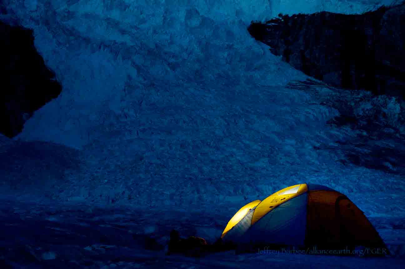
Camp 18 is located on a body of exposed rock called the Cleaver, and it is bordered by the Vaughan Lewis and the Little Vaughan Lewis icefalls. Although it currently stands proud of these icefalls, it is clear from geomorphological evidence that the Cleaver was once overridden by glacier ice. The scarred rock left behind following glacial erosion can indicate the direction of ice flow and can give clues to help understand subglacial conditions and forces.

Geomorphological features found on the Cleaver include chatter marks, striations  and roche moutonnee (all of which are defined below). Leah Nelson’s project is the creation of a geomorphological walking tour on the Camp 18 nunatak that identifies these features for future generations of JIRP students. The following photos and definitions are part of this project.

Chattermarks: Chattermarks are a series of small and closely spaced crescent-shaped features made by vibratory chipping of the bedrock surface by rock fragments carried in ice at the base of the glacier.  Their shape indicates movement; they are generally convex in the direction of ice motion.  The bedrock of the Cleaver is littered with chattermarks, showing the movement of the overriding ice.  

Chattermarks in the bedrock of the Cleaver.  Photo by Leah Nelson

Striations: Striations are multiple scratches, often parallel, inscribed on the bedrock surface.  These are caused by the sediment load in the base of the glacier that scraped along the bedrock.  In some places on the Cleaver, you can see striations that pass through both the bedrock and inclusions that are of a different rock type.  This instance of differential weathering shows the contrasting resistances between the two types of rock due to their composition.

Striations through a xenolith. Photo by Leah Nelson.

Roche Moutonnee: A roche mountonnee is an elongated bedrock knob whose long axis is oriented in the direction of ice movement. The upstream side is gently inclined, smoothly rounded and striated; while the downstream side is rough and steep, often with portions of rock removed or plucked away during formation. The term comes from the French and means “sheep-backed rock”.

Author Leah Nelson gives scale to a roche mountonnee on the Cleaver. Photo by Patrick Englehardt.

Author Patrick Englehardt stands on another roche mountonnee with the impressive Gilkey Trench in the background. Photo by Leah Nelson.

Patterns of the Planet: A Conversation with Paul Illsley

An Interview by Jai Chowdhry Beeman

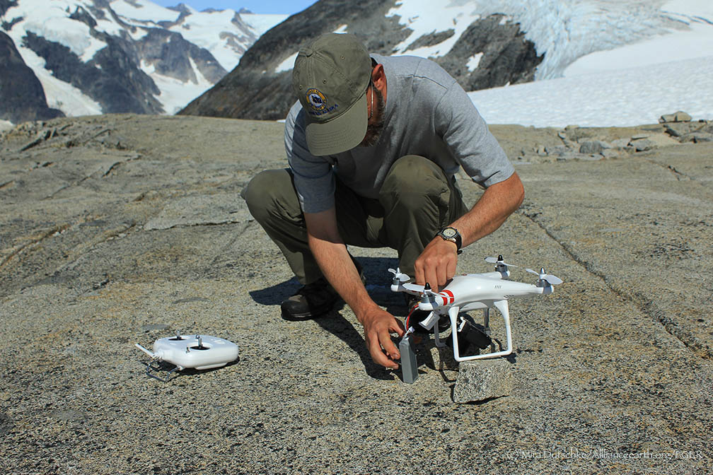
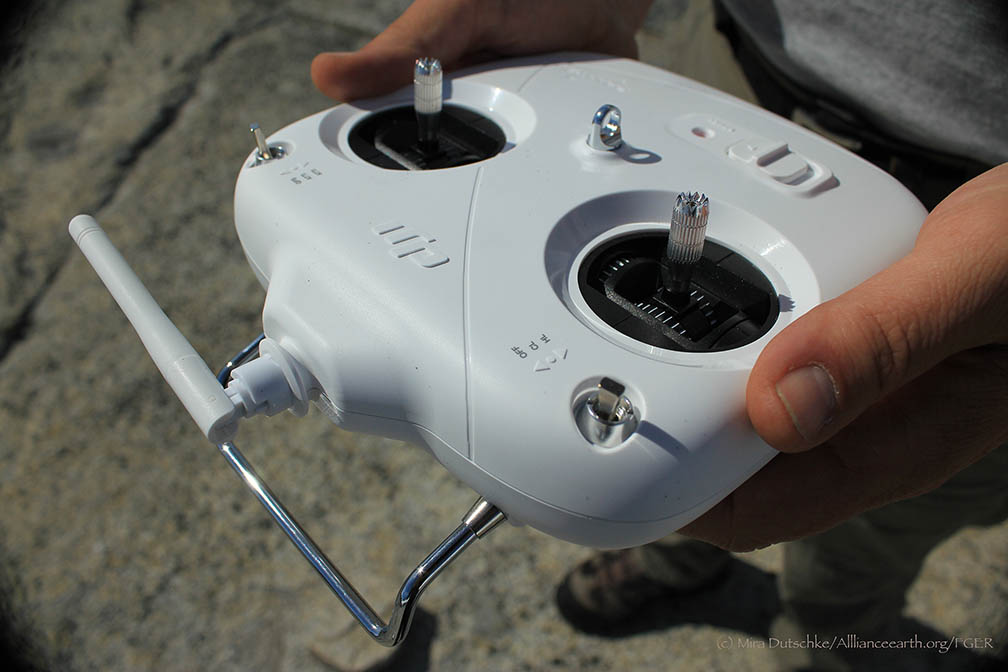
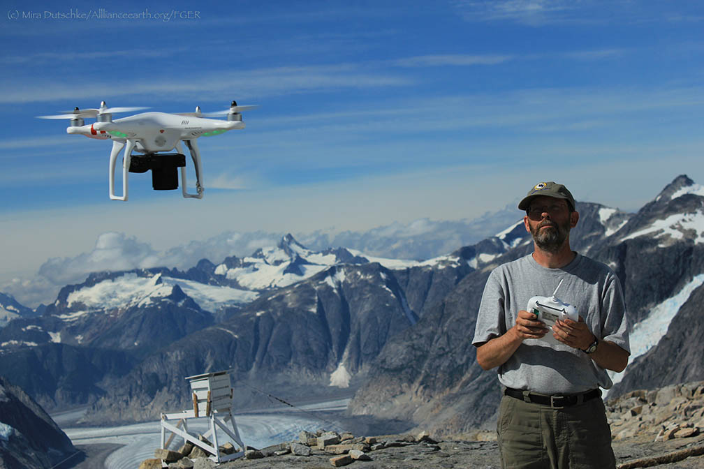
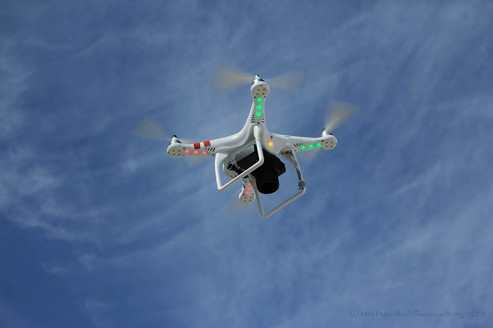
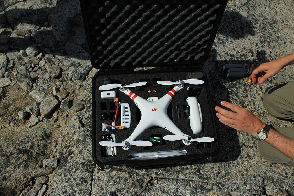
Paul Illsley is a cartographer at the Centre of Geographic Sciences in Nova Scotia, Canada. He joins  the JIRP 2013 program as a visiting faculty member for several weeks. In addition to delivering captivating  lectures on aerial surveying, he has been using a quadcopter to take aerial surveys for student projects.

Paul Illsley at the controls of his quadcopter at Camp 18.  Photo by Mira Dutschke. 

High-resolution aerial photography is essential to the geosciences. In particular, aerial photography allows for the creation of much higher-resolution surface images of glaciers than are available from satellites. I spoke with Paul Illsley on the Juneau Icefield above the Gilkey Trench about aerial surveying.

JCB: What sparked your interest in aerial photography?

PI: My background is in research photography—close-up work in the natural sciences. I also have a passion for flying. I realized that I could combine these two by taking aerial photographs. I moved to the Centre of Geographic Sciences (COGS) to study cartography , where I studied aerial imaging. After graduation I conducted numerous mapping projects, after which I moved back to COGS.

JCB: When did you begin working with the Juneau Icefield Research Program?

PI: I first came to JIRP in 2003. Maynard Miller, the former director of the Program, needed a faculty member to help students with mapping the Icefield. He had contacted my college, and I agreed to come. I’ve been coming back in the summers since then.

At JIRP, I have been able to learn from the work of my colleagues who serve as the other instructors from the program – and also from spending time with students and working on imagery for student projects.

I also work with satellite imagery to study changes in the positions of the termini of six glaciers on the Icefield. We have tracked the Llewellyn, Taku, Mendenhall, Hole-In-Wall, Norris and Herbert glaciers using images taken between 1985 and 2011. As is well known, the Taku Glacier and Hole in the Wall have continued to advance throughout this period, while the others are all clearly retreating.

JCB: What are some of the challenges of your work on the icefield?

PI: The remoteness. It is challenging and expensive to fly aircraft over the icefield. Every year, I have experimented with bringing different technology to the program to take photographs. For the first few years, I photographed with kites, and this year I began using a remote-control quad copter, which allows me to control the flight path much more easily.

Remoteness, though, comes with beauty. In 2004, for the first time, I rappelled into a crevasse close to Camp 10 on the TakuGlacier. The ice in the crevasse was deep, blue and spectacular.

JCB: Tell me about the importance of combining aerial photographic surveys and satellite imagery.

PI: Aerial photographic surveys come into play when higher-resolution images are needed. At present, the best-resolution satellite imagery is about half a meter. With aerial photographs, we can produce resolution up to 10 centimeters, allowing for much finer detail and a more accurate picture of landscape change.

Aerial surveys can also be performed on a low budget, especially using smaller-scale technology—the quad copter I am using on this trip, for example, cost around US $1200, and still provides excellent high-resolution imagery of the areas we are surveying.

JCB: What are some projects you have worked on off the icefield?

PI: During the year, I serve as a resource for students working on cartographic projects at the COGS. I’ve recently done a few other mapping projects—one in the Caribbean, on the Dutch Island of Saba, where I created a new map of the island’s hiking trails using GPS. Another project I recently worked on was a map of Sable Island National Park off the coast of Nova Scotia.

I approach each project differently, depending on the resources available and the landscape at hand. I recently worked on a project sponsored by NASA and National Geographic on the glaciers that supplied water to communities in the Peruvian Cordillera Blanca. A consortium of scientists from various disciplines—chemists, glaciologists, hydrologists and cartographers—investigated the sustainability of the community’s water resources, which rely mainly on glacial water. The water chemists, for example, took samples to investigate whether water sources would still be potable without the addition of glacial water.

I performed a photogrammetric study of the glaciers using both the visual and infrared spectra. The photographs we usually take are in the visible spectrum—that is, they record the reflections of visible light off the surfaces we see in the photograph. But by modifying the filters inside a camera, we can allow it to record the reflections of infrared waves—which creates images that are much more sensitive to the moisture content of the surface. On glaciers, this gives us a much clearer picture of the boundaries between snow, firn and ice surfaces, which can appear similar in visual spectrum photography, but are distinct in infrared images.
I photographed the same locations on the glaciers in the area from five different camera positions. Using these photos and airborne LiDAR, which provides high vertical resolution, we were able to create 3-dimensional models of the glacial surfaces. We compared this model to another we made using photographs taken in the same locations by a Peruvian Aerial Survey in the 1950’s, to get a rough idea of the rate of retreat of these glaciers. At the rate we estimated, the glacial water source in the area will only last about 30 more years.

The Peru project presented much different challenges than working on the Juneau Icefield. At JIRP, technology and replacement parts can be sent to camps on a 20-minute helicopter ride from Juneau. The nearest town to the research site was a day-long bus ride away from Lima, and the research site in the mountains was another day-long hike away from the community. The research site was at 15,000 feet above sea level, and extra equipment could only be packed in by mule. Instruments had to be lightweight and very carefully packed, and sometimes replacement parts could not be found in Peru. The altitude was also a challenge—work goes slowly and becomes taxing much more quickly at such high elevations.

JCB: What kinds of work are you engaged in at JIRP this year?

PI: I am helping JIRP  students with projects that use Geographic Information Systems (GIS) and satellite imagery, and supplying aerial imagery for geographic mapping projects at two camps. Christiane McCabe, for example, is using satellite imagery and digital elevation models to map changes in the equilibrium line altitude (ELA) of the glaciers on the Icefield over time. The equilibrium line marks the boundary between the accumulation zone of a glacier, where snow and firn dominate, and ablation (melt) zone, where ice dominates. Infrared images easily pick up on the different water content in snow, firn and ice, and I’m assisting Christiane in integrating these images with digital elevation models to find the ELA locations for multiple years.

JCB: Why cartography?

PI: I definitely have a passion for the outdoors—I really enjoy hiking and kayaking. I’m not as good of a skier—Nova Scotia is pretty flat.

An aerial photographer looks at patterns in the landscape. I was captivated by patterns of color and physical surface features— for example, I surveyed the ogives on the Gilkey Glacier,  in 2003, which are repeating arcs of ice that go downglacier, and are so out of character with the evenness you see on other parts of the Icefield. In the og  ives, you can see wave-flow, whereas above the icefall that produces them the pattern is continuous flow.

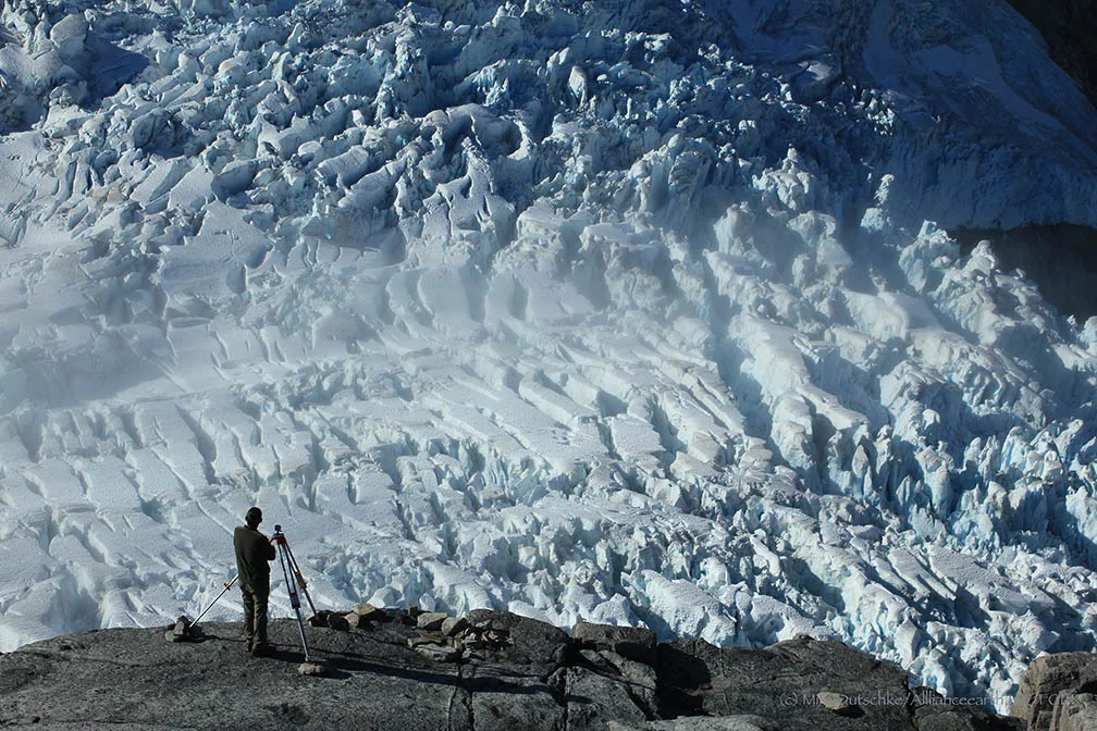
I am taking a time lapse series of the Vaughan Lewis Icefall—a tributary of the Gilkey Glacier—over seven days while I’m here. I take a photograph every five minutes, and will compile them into a movie of the downward motion of the icefall. I’ve been lucky enough to have seven days of perfect weather (Interviewer’s note: as I type this interview, it has finally started to rain.) And people who have never experienced seeing an icefall move will be able to see the patterns of the crevasses and seracs—towers of ice—flowing and crashing down the slope.

I am also captivated by the patterns formed by farmlands—the way humans use the colors of vegetation—and by the intricacies of hard-rock coastlines and beaches. But glaciers are something different entirely—large and expansive, exactly like rivers of ice.
Those who want to pursue cartography as a career path should have an interest in accuracy and precision, a desire to create information that others can understand, using color, symbols and careful thought.

Cartographers work with the psychology of maps—we use color and pattern theories to develop representations of landscapes with the user in mind. For the general public, we can use certain thicknesses of lines, text and colors…but in other contexts, we have to completely redesign maps. Some of our students have created maps for the sight-impaired, the elderly, and the blind. For the last project, they used a textured cloth to create a detailed map of a college campus. I have also been working on time-light maps, as well as maps using multiple datasets and new technologies like Google Earth. These kinds of projects are challenging and unique.

JCB: What is the future of cartography?

PI: One interesting new direction in the mapping world is public sourcing. Individuals can upload GPS data to online databases, and the entire globe is populated with people who can contribute data to make enormous datasets at an incredibly quick rate. Google Earth, for example, is an important source for advancing public interest in cartography. But cartographers have to keep in mind data integrity—where surveys by trained cartographers follow high standards of accuracy, public-sourced survey data may not maintain these high standards. Public sourcing is at a starting point—and has a lot of potential—but is still not ready to be used as a source of authoritative maps.

JCB: Any closing comments?

PI:  You never know what might happen when working on a mapping project. Sable Island, where I worked several years ago, is home to a protected herd of nearly 300 wild horses. When I arrived, I was setting up aerial photo targets on the island. The horses, of course, were curious about the new targets, and cautiously came up right beside us to see what we were doing.

I was on my hands and knees placing a target, and when I leaned back to get up, I was inches away from a huge pair of curious, gentle, brown eyes watching my actions. I remember fondly these kinds of moments.

I have been really fortunate to belong to the JIRP community—to be able to learn and help others learn in a landscape so spectacular and so wild that it never leaves you. Sometimes, in the middle of winter, the view at Camp 18 comes back to me—the incredible sight of the Vaughn Lewis Icefall and the Gilkey Trench far below. 

Gilkey Trench Fieldwork Adventure

By The Gilkey Trench Crew (Jamie Bradshaw, William Jenkins, Jon Doty, and Justyna Dudek)

While many students already started the fieldwork for their projects at Camp 10 and even Camp 18, five students have been anxiously awaiting to begin their fieldwork in the Gilkey Trench. The Gilkey Trench is the magnificent view that you see from Camp 18 where the Gilkey, Vaughan-Lewis, the Unnamed and many other glaciers connect and flow down through the steep, glacially carved, 2,000 foot deep valley. The Trench is filled with beautiful curving medial moraines and jaw dropping ogives created by ice falls. Getting to such a beautiful place is not easy and well worth a full day’s effort.

Descending "The Cleaver" - approaching the start of the series of fixed ropes - with the Gilkey Trench in the background.  Photo by Adam Toolanen

On Wednesday, July 31st, these students and four safety staff members departed Camp 18 for our camp on the bare glacier ice in the sunshine. The trick to getting to the glacier is descending what is affectionately called “The Cleaver.” The Cleaver is the 2,000 feet of bedrock that sits between Camp 18 and the glaciers below.  The descent was led by senior staffer Scott McGee, who has done the route many, many times. The first half of the route was going down steep snow slopes until we got to a vegetated area called “The Heather Camp.” This is where the fixed ropes began.

Waiting in a safe location - protected from rockfall from above - for their turn to descend the next section of fixed ropes.  Photo by Adam Toolanen. 

Here, the students and staff put on helmets and harnesses and tied into the fixed ropes with a knot called a prussik. This rope system served as a back up in case there was a slip on the steep, unstable terrain.  Fixed ropes were used for the last half of the descent because the route became steeper and more exposed. Because the glacier is melting, new bedrock and rock debris is left behind. This makes finding new routes difficult and challenging in the unstable footing. After 11 very long hours, the students and staff safely and happily arrived at our camp in the Gilkey Trench during a magnificent sunset.

Scott McGee scouts the lowest section of the descent made of freshly exposed bedrock, and precariously deposited boulders left by the rapidly thinning Gilkey Glacier.  Photo by Jeffrey Barbee. 

The next two days were spent collecting data from the field. A brief explanation of the students’ projects in the Gilkey Trench are below:

Jamie Bradshaw - Surface Ablation of the Gilkey Glacier

For my project, I looked at the ablation, or melt rates, of the Gilkey Glacier. In May 2013, wires were steam drilled into the ice for Dr. Anthony Arendt at the University of Alaska Fairbanks (also a visiting JIRP Faculty member earlier in the summer). My task was to find these wires and measure how much wire was exposed. Luckily the sites came with known GPS coordinates and had a wire tetrahedron with bright orange flagging attached to it, so it was fairly easy to find in the rolling, mildly crevassed terrain of the Gilkey Glacier. By knowing the length of the wire exposed at the time of installation (which I will find out upon returning to civilization) and measuring the length of wire exposed in August, the ablation can be determined. This becomes important because once the area of the glacier is known, the total amount of melt water runoff from the glacier to the ocean can be calculated.

Jamie Bradshaw photo documents one of the ablation-measurement sites on Gilkely Glacier.  As the glacier surface melts, more wire (at Jamie's feet) is exposed.  Photo by Jeffrey Kavanaugh. 

William Jenkins - Ogive Survey

My research in the Gilkey Trench was focused on the ogives, also called Forbes Bands, which form at the base of the Vaughan Lewis Icefall, adjacent to Camp 18. These interesting features in the ice are annual formations that only appear beneath fast flowing icefalls. It is commonly accepted that their light and dark banding represents the variations between summer and winter ice that has made its way through the icefall in one year. Summer ice, which is subjected to wind blown particulates and increased melt, constitutes the dark bands of the ogives and forms the trough of their frozen wave-like appearance. The white winter ice is composed of that year’s snowfall, and forms the crests of the wave bulges. 

William Jenkins surveys one of the Gilkey Glacier ogives with GPS.  "The Cleaver" is the ridge of rock in the background, with the Vaughan Lewis Icefall on the right.  Photo by Jamie Bradshaw. 

The purpose of my study was to determine how fast this area of the Gilkey Glacier was thinning in comparison to previous years. In order to determine this rate, I conducted a longitudinal GPS survey, with the help of Scott McGee, that had previously been carried out from the years 2001-2007. As a result of the glacier’s rapid thinning rate, I’ll be able to calculate its subsidence by the changes in the elevation of the survey over time. I will also compare the data I observe with the Vaughan Lewis mass-balance data that JIRP has collected over the years. This comparison will allow me to correlate the changes in annual precipitation with the transformations in the ogives wavelength and amplitude over time. The relationship between mass balance and ogive structure will shed light on the future transformations of the ogives and Vaughan-Lewis Glacier as a whole.    

Panorama of one of the ogives near the base of the Vaughan Lewis Icefall (in the background).  Photo by William Jenkins. 

Justyna Dudek - Photogrammetry

The main objective of my project was to create an up to date digital terrain model (DTM) of the Vaughan Lewis Icefall flowing down from Camp 18 into the Gilkey Trench. A digital terrain model describes the 3-dimentional position of surface points and objects, and can be used to retrieve information about geometrical properties of glaciers. In order to create the model, I decided to explore the procedures and tools available within the field of digital photogrammetry, a practical method which allows carrying out non-contact measurements of inaccessible terrain (very useful for areas such as icefalls, which for the sake of avalanches and falling seracs, might be too dangerous for exploration or measurements on their actual surface). The baseline dataset for creating the DTM of Vaughan Lewis Icefall  were recorded on the first, sunny and cloudless day of our stay in the Trench. With the guidance from Paul Illsley (present via radio from Camp 18) and help from my colleagues Jeff Barbee and Jon Doty (present on the Gilkey Trench), I set up the three profiles along which we collected the data in the form of terrestrial photogrammetric stereo pairs and ground control points (GCP). The database created by our team will be subsequently processed in order create a DTM which can constitute a reliable, starting point for further research in this area in the future.


Paul Illsley overlooks the Vaughan Lewis Icefall from a terrestrial photogrammetry station near Camp 18.  Photo by Mira Dutschke. 

Jon Doty - Nunatak Biology

My path into the trench followed a slightly different approach than the other students who reached the Gilkey Trench via the Cleaver descent.  Ben Partan – Senior Staff member in charge of camp maintenance – and I were brought down to the Gilkey via helicopter from Camp 18 to Camp 19, with a load of material to fix up the camp, which sees infrequent use. After two days repairing the roof, and siding, as well as swamping the camp interior, we descended into the trench. During our descent we made four stops at progressively lower elevations, conducting a botanical survey. At each site I recorded all plant species present, the compass orientation of the plot, elevation, and tried to keep an eye out for faunal interaction, and any other interesting features of the site. 

Ben Partan repairs the C 19 roof.  The upper Gilkey Glacier is in the background.  Photo by Jon Doty. 

As we dropped down closer to the surface of Gilkey Glacier - biodiversity plummeted. My final site featured only a single species of plant, as opposed to nearly twenty at the highest point of my survey. This loss of biodiversity can be tied to the recession of the Gilkey exposing new substrates, and the time required for mosses and lichens to reach the area and for soil to develop. Using a rough dating technique called lichenometry, we can gain insight as to the amount of time each site has been exposed by the recession of the glacier. The lichen species Rhizocarpon geographicum grows about 1 cm for every 100 years and is very common. Its absence at the lowest two sites is therefore noticeable, and signals that these sites were only recently revealed.

My survey is paired with another conducted by Molly Blakowski on the southerly oriented C 18 nunatak. These two slopes face each other with the Gilkey separating them. We plan on comparing the results of our surveys to determine what affects the differences of aspect have on the vegetation.   It was an absolute pleasure to join back up with the group and explore the Trench, and true fun to climb up the Cleaver and reunite with the rest of the JIRPers at C 18. 

The 2013 Gilkey Trench Crew (left to right): Jeff Kavanaugh, Jeff Barbee, Justyna Dudek, Jamie Bradshaw, Adam Toolanen, Adam Taylor, Jon Doty and William Jenkins. Photo by Jeffrey Kavanaugh

In closing, on August 3rd, the Gilkey Trench Crew packed up camp and headed towards the Cleaver to ascend back to life at Camp 18. Again, we tied into fixed ropes, had a remarkably beautiful day and had a safe climb up the Cleaver. The Gilkey Trench Fieldwork Adventure had been a success and possibly, the icing on the cake for all crew members.

Additional photos from the Gilkey Trench Fieldwork Adventure.  Click on any of the images below to open a slideshow with all photos and captions:     

The Traverse to Camp 18

By Adam Toolanen

The summer’s third big traverse is the ski from Camp 10 to Camp 18. As a former JIRPer returning as staff member, I have knowledge of the magnificence of Camp 18, which is what kept me going during the 18 mile ski from Camp 10, whereas the students only had my description of the splendor of Camp 18 to ponder as we skied. The excitement of seeing the vast icy expanse on a gorgeous summer day made the journey as rewarding as the destination.

Uwe Hofmann skiing down the hill at Camp 10 for an early morning departure. Photo by Sarah Bouckoms

In the days leading up to the traverse, it was unfortunate that we could not see the Taku Towers - the iconic landmarks of Camp 10. Luckily, the weather cleared on the day that our group left for Camp 18. The first few hundred feet of the 18 mile day consisted of a steep downhill pitch covered in suncups, which always takes awhile to navigate.  Just as we thought we would have a smooth start to the day a ski binding broke on that first, steep slope. Not wanting to have everyone wait at the bottom of the hill, I sent the group on their way and headed back to Camp 10 with Will Jenkins and his broken binding. Luckily, the binding was fixed quickly and we skied back down the hill. I remember being a student on JIRP and never wanting to be behind the group. No different than I, Will cruised ahead of me and soon we caught up with the others.

The trail party takes a snack break, changes some layers and rests for a minute before hitting the trail again. Photo by Sarah Bouckoms

As we traveled up the Taku Glacier towards the Matthes Glacier, we took many breaks to adjust our gear. It is not always obvious how to dress for travel on the glacier. The effect of the sun heating your body is amplified by the solar radiation that reflects off the glacier. Naturally, skiing with a big backpack keeps you toasty as well. On the other hand, there is the massive body of snow under your feet and the cold katabatic winds that cool you off as you ski. Katabatic winds are created by cold air flowing from high to low elevations on the glacier, and can really chill you on a hot summer’s day. Depending on the combination and prevalence of these factors, people have to change clothes constantly. The other challenges are hotspots and blisters. As potentially day-ruining afflictions, these need to be addressed immediately. During the breaks to bandage foot sores and adjust outfits, we also snack to keep our energy levels up and joke together as we rest our feet for a little while.

Author Adam Toolanen on a sunny day on the Icefield. Photo by Jeff Kavanaugh

When I was a student I skied the traverse in a whiteout, so I couldn’t see anything other than the ski tracks from the person in front of me. The staff member leading my group told us about the views of Devil's Paw and the Storm Range, but we could only imagine them. Coming up the trail to Camp 18 this year we were all captivated by the stunning ridgelines and mountain glaciers set against the backdrop of the blue, blue sky and did not have to rely on our imaginations.

The group slowly rising over the final crest of the Matthes Glacier headed towards Camp 18. Photo by Sarah Bouckoms.

As with many things in Alaska, the size and scale of icefield features is deceiving. Setting small personal goals is both rewarding and challenging on such a long ski trip. Promising yourself that you will eat that chocolate bar once you crest the next hill can mean waiting an hour instead of the 20 minutes you were planning on. However, when you finally stand on that hill enjoying your chocolate bar and take in the views offered by the massive slope you just conquered, you can be all the more content with reaching your goal. Some of the students started inquiring about the location of Camp 18 and although I can point out the peaks surrounding the camp, it really takes the whole day for the scale of the journey to really dawn on them.

A group of four carries on in good spirits on Matthes Glacier. Mt. Moore - with Camp 8 on the ridge of rock pointing down towards the first skier - is in the background.  Photo by Sarah Bouckoms

As the group crested the last hill of the Matthes Glacier, we could finally see down into the basin alongside the daunting ridge of the Storm Range. Huge black rock faces towered above us as we pushed through the remaining two miles to camp. The sun was setting behind this ridge and the soft snow froze over, creating a fast and slick surface for our skis. As we neared our destination, the Camp 18 buildings glimmered in the last sunlight, perched high on the nunatak. The final push to Camp 18 offered a view of the mighty Vaughan Lewis Icefall. The top of the icefall billows down a ridge where it breaks up into large crevasses. These crevasses stretch, become bigger, deform and transform into even larger crevasses. When these start to collapse due to the steep slope they are passing over, the icefall really shows that it is in slow, albeit chaotic motion. As my group crested the hill and we started the final downhill glide into Camp 18, the grandiose Gilkey Trench opened up before us. Only as we skied the final quarter-mile to camp did we really see the backdrop which is the surroundings of Camp 18. After 11 hours skiing uphill on the glaciers leading to Camp 18, the group made it just in time for a sunset over the Gilkey Trench. Being back at this magnificent Camp after a long day of skiing is just the reward I was hoping for.

The scale of the Icefield is shown with two skiers dwarfed by their surroundings as they ski up Matthes Glacier. Photo by Sarah Bouckoms

The real treat for me as a staff member was to be able to lead first-time JIRPers on this trip, to one of the most beautiful spots I have ever been to. The students were excited and positive all day, but what they saw upon arrival exceeded all of their expectations. Even I who knew what was in store was in wonder at the realization that this place is still here, that it is real, not just some past dream. I felt like the mediator or the guide who took the students to this place and when we arrived I could just sit back and smile as I watched them explore their new home, giddy with excitement.

After a long day of skiing from Camp 10 to Camp 18, the sun sets on the glaciers and peaks of the Gilkey Trench.  Photo by Sarah Bouckoms.

Maintaining a Balance

Written by Sarah Bouckoms, with contributions from Lindsey Nicholson and Gabrielle Gascon

For the past two years, JIRP has had more female students than male students. In addition, this year’s field staff and faculty include many powerhouse females. The notion that science is a male-dominated field may still be true in some areas, but not at JIRP.  JIRP’s focus is on science and outdoor learning, regardless of gender, race, religion, or sexual orientation/identification. In this blog, JIRP participants Lindsey Nicholson, Gabrielle Gascon and Sarah Bouckoms write on their experiences as women who have worked to attain advanced science degrees.

Lindsey Nicholson is a post doctoral researcher at the University of Innsbruck joining JIRP for four weeks as a visiting faculty member. Lindsey writes:

I'm happy to say that I have not felt discriminated against because of my gender in any way in my career so far. In fact, it seems more common at present to see job advertisements which state that preference will be given to suitably qualified women in order to achieve gender equality in the composition of faculty and staff. Similarly, my current research grant is specifically targeted to women in science, which gave me a better chance of winning the funding.  Clearly, although I would prefer to see a simple meritocracy determine the allocation of funding and appointments, I am not above taking advantage of these “positive” gender discrimination tactics that are currently in place. My perception is that current academic faculty in Earth sciences is still strongly dominated by men, but that the cohort of upcoming young scientists is increasingly equally made up of men and women, and in the future I expect that gender will not play any role in appointing scientists or allocating funding money.

That said, I am pleased to see so many young women participating in JIRP, particularly because the combination of group expedition and scientific endeavor encourages all participants to see themselves as equal parts of a whole. Each member has something different to bring to the group and all contribute to the group well-being and scientific success.

JIRP is a particularly powerful program as the expedition focus means that people have to take both individual and collective responsibility for their safety and that of the group. I am concerned that it is not uncommon to observe in science (and in wider society) that women do not take up leadership positions as readily as men, and while I do not wish to take away from instances of great leadership from men in science and society, I think this imbalance is a pity and a potential loss to the community. So, seeing both young men and women filling leadership roles at JIRP, and both male and female students working and cooperating on an equal footing in all the activities of JIRP is a great pleasure.

I hope that I can serve as a scientific role model here at JIRP and play a part in stimulating the participants to be interested in science and the environment, and believe that they can have important roles to play within these spheres of our society.

Gabrielle Gascon also joins us as a visiting faculty member for four weeks from Camp 10 to Camp 18. Gabrielle writes:

I am also happy to say that I have not felt discriminated by my gender so far. I’ve had equal opportunity to undertake field work in the Canadian Arctic, and have not felt disadvantaged when applying for scholarships. I think women should not believe that they are disadvantaged compared to men. Ambition, personality and hard work can take anybody far.

Although most faculties in Earth sciences are still male dominated, Undergraduate classes are becoming increasingly male/female balanced. During my Undergraduate studies in Atmospheric Sciences at McGill University, the program had an equal number of male and female students, and the 4th year Undergraduate course in atmospheric modeling I taught at the University of Alberta for the last two years was female dominated. Over the next few years, I believe that this wave of increasing female students will help balance faculty gender ratios.

Summer programs like JIRP provide equal opportunities to men and women, and teaches them to work together as a team. Everyone shares daily tasks,  goes out to dig (deep!) mass balance pits or cook for 40 people. Most importantly though, everyone feels equal, and I believe that this reflects of the  characteristics of the new generation of scientists to come.

Sarah Bouckoms is a JIRP field safety staff member this summer and a high school physics teacher during the school year. Sarah writes:

My mother pursued a career in a heavily male dominated field to become the first female dentist in Waterbury, Connecticut. Just as she followed after her father, I took example from my mother when choosing a profession. While I did not pursue dentistry, rather Physics, I followed her lead to enter a field usually left for the Y chromosomes.  

During my Undergraduate and Masters Degree in Physics, I would find myself tallying the head count of male vs. female. In a lecture of 30 or more students, only two or three would be female. At first this ratio made me nervous, but soon it became the normal and I thought nothing of it. From the study groups that formed, not only did I take away some great science lessons, but also both male and female friends.  I have had some great professors of both sexes but happened to have most of my supervisors as females.

Next year I am looking forward to teaching high school physics at an all-girls school.  I think it will be a great experience to see how the dynamics of a single sex classroom work. I hope that I can be an inspiration to my students motivating them to pursue a field in science. A generation later, Dentistry is now a field with an equal sex ratio, if not more women than men. I feel that transition is starting to take place across the sciences with the Juneau Icefield Research Program setting a great example.

While there is gender equality on the Icefield, this principle does not try to make everyone the same. In fact, each sex is allowed to express themselves however they feel. No one is made to feel uncomfortable by the way they dress, wear their hair or what they choose to shave. Both men and women have shown their excellent skills in the kitchen and in cleaning the lovely outhouses. The dress up parties for dinner are a special celebration enjoyed by all. So it is not at all that women are on the Icefield trying to fit into the mold of a man’s job, but that women are on the icefield doing a job. From pearl earrings to hairy armpits, there is a range of ways that the women on JIRP choose to express their feminine side and all levels are accepted.

In closing, the most important message to take away is that no matter what degree or profession is chosen, the anticipated challenges can be overcome. Anticipated gender inequality in the sciences is not an obstacle that should stand in anybody’s way of pursuing their dream career or following their passion for research in remote and harsh environments. Mental attitude has such a big part in overcoming any challenge regardless of gender. The determination and passion, not the roles traditionally assigned to the sexes, will have the biggest impact on the success of any career choice. Both Lindsey and Gabrielle have expressed their positive experiences as women in the sciences. They are great role models for all the students of JIRP and serve as an inspiration to any women wanting to pursue a career in science.

The JIRP Spirit

By Muriel Will

[NOTE:  Muriel wrote this post at Camp 10 on July 25th (JIRPmas), but helicopter logistics have caused a delay in posting.  Our apologies for the delayed JIRPmas wishes!] 

T’was the day of JIRPmas, and all through the camp every JIRPer was stirring, why even the mouse. The snow pits were all dug by the students with care, while hopes of helicopters danced through our heads.  

Alexei Doncov, and Leah Nelson enjoying the afternoon sun on the Camp 10 deck with our JIRPmas ski tree. Photo by Muriel Will.

Greetings and salutations from Camp 10. Today (July 25th) is an honorary JIRP holiday, “JIRPmas”. We have all been busy on our breaks between lectures and field activities, making gifts to later exchange with our JIRP secret Santas.

Although relaxing days such as this are a great respite after long days of digging and skiing, the true spirit of our team (and the extravagance of the landscape where we find ourselves) is most memorable when down on the glacier. Of the 3 mass balance camping trips going out from Camp 10, I was able to attend the second.  For this trip, eleven students and four staff went up the Northwest Branch of the Taku Glacier with the intention of digging four mass balance pits. The first day (June 22nd) started off with some laughs and regretted goodbyes, as five of our visiting staff (including Alf and Stanley Pinchak, Jason Amundson, Bill Isherwood, and Jay Fleisher) departed our nunatak hideaway to return to their everyday lives.

After a three hour ski to our camp site, we split our strengths between: digging our first pit, setting up tents, and making our kitchen. A 4 inch ice layer approximately a foot down in the snow pack, provided a perfect floor for our kitchen, though a bit of an obstacle for our digging crew . On the second day we split up into two groups, with each of us debating which view we wanted to see most. The day could not be more ideal, with beach-worthy weather, we spent the day in shorts digging and chatting as we dug our pit of nearly 5 meters deep. However, that was before we realized we had dug almost half a meter beyond last year’s ablation layer (the previous summer’s buried surface). After a long day’s work we began our 2 hour ski back toward our temporary home, and at 21:30 we found ourselves in a sunset landscape that can only be described as unbelievable. Skiing over snow turned pink by the setting sun, towards a rainbow stretching clear across the sky, the beauty could only be made more remarkable by the fire in the clouds at our backs. Tired and wet from the rain now misting as we skied, we were greeted after a nearly 12 hour day, by the hoots and howls of the second digging team.  Our evening finished with a dinner of hot lentil stew, which the second team had prepared, but had refrained from eating until our much later return. The final pit of the trip was completed quickly, (July 24th) with all hands on deck, and although sad to leave our snowy getaway, a good dinner and dry feet were a welcome homecoming.


July 23, a fiery sunset that can never be truly captured by a picture, nor described in words. Photo by Muriel Will.

And so from Camp 10, merry JIRPmas to all.  May we all find the strength in our limbs, a fire in our hearts, and may we never take for granted the people and places we encounter along the way.

Dear John . . .

By Lindsay Starr

While being out here on the icefield is truly beautiful and breathtaking, connecting with the outside world is hard. At camp 17 we had very limited cellular reception and no internet. Most of us had even packed away our cell phones so the limited reception at camp 17 did not even matter. What does matter is sheets of paper, colored pens and creatively decorated envelopes.  

A variety of letters and postcards ready to be sent to loved ones.  Photo by Lindsay Starr

With being far away from our loved ones, writing to them is as close as we can get. On any clear day we hope to hear the radio alert us that there is a helicopter on its way up with supplies and mail. We have gone up to ten days alone except for the company of those in camp without a helicopter that carries the mail. When a helicopter arrives it is like a new party guest has arrived and brought the best present – MAIL!

Alexei Doncov, Christiane McCabe, Sarah Cooley, Mary Gianotti, Jamie Bradshaw, Patrick Englehardt, Leah Nelson, and Stephanie Streich.  Photo by Lindsay Starr.

I’ve received cards from my parents along with photos from their 4th of July party. My sister sent me a gold body chain along with stickers. Others have received chocolate bars (melted), newspapers, and drawings. Receiving mail is like getting a puppy while getting accepted to your top college and receiving an A in your hardest class all at once.

Writing letters is so different than writing thank you notes and journal or diary entries. Without the almost instant satisfaction of text messages or email you have to fit everything in this one letter without instant response.

Lindsay Starr writing a letter with the Taku Towers in the background. Photo by Leah Nelson.

So if you are reading this blog and have received a letter feel loved and special. If you have not received a letter do not give up hope as it could be in the mail right now! For those of you who have sent us mail:  Thank you for sending someone in the middle of the Juneau Icefield a letter and making them the happiest person in the United States and Canada!

The Blister

By Justyna Dudek

At Camp 10 there were many different ways to spend free time: enjoy the great views from the deck, read, work on science project proposals, cook and eat food… or you could take a field trip exploring what we usually spent considerable effort avoiding: the inside of a giant crevasse! (Note 1: Dear parents reading this blog, please do not worry; this was a completely controlled undertaking, supervised by our outstanding and experienced safety staff. Note 2: Kids, don’t try this at home.) Finally we got to use the great outdoor skills we learned in the safety course of Camp 17 by rappelling into a crevasse associated with a feature called “The Blister”.
 

The Blister as seen from the side of 'Taku B'.  The Blister is in 'North Basin' just north of Camp 10.  Water accumulates here during each melt season.  Photo by Justyna Dudek

Why would someone want to lower themselves into a giant, water-filled ice crack? For one, it is a great way to see the annual accumulation of snowfall.   Annual layers of accumulation are exposed in the crevasse, without having to dig a giant snow pit. Secondly (and most of all), it is really great fun.

[NOTE:  Click on any of the images below to open a slideshow with all photos and captions.]    

Sweet Tooth

By Sarah Bouckoms

Just because we live on a remote icefield in Alaska is no excuse to not be civilized and have dessert. In fact the peer pressure to come up with the next greatest dessert is a competition no one minds. We started with brownies and escalated  to a super secret ice cream concoction. While it had a different texture the taste was remarkably delicious. Then we started with the pie baking competition. It was a joint effort to make a delicious Pumpkin Pie fit for any Thanksgiving table. There was also a peach pie, but well, not even I took the time to snap a photo before devouring the treat. Have no fear, the sweet tooth of the JIRP students and staff is in no danger of going without.

[NOTE:  Click on any of the images below to open a slideshow with all photos and captions.]   

Back with JIRP

By P. Jay Fleisher, Director Emeritus

JIRP ’68, ’69, ’79, ’86. ’87, ’93, '10, ’11, ’13

It is a pleasure and privilege to be back with JIRP (Juneau Icefield Research Program) after a one-year hiatus.  My initial JIRP experience decades ago was followed when I returned several times in subsequent years as a visiting faculty.  The Program, initiated and directed by Dr. Maynard M. Miller, evolved into a superb training ground for students heading to careers in Glaciology, Glacial Geology, Climate Science, and Arctic Sciences.  It is gratifying to see that the same high level of spirit and enthusiasm continues today in the current staff and students.


Dr. P. Jay Fleisher leads a geology field trip near Camp 10.  Photo by Mira Dutschke

Situated on the “high ice” central to the icefield, Camp-10 is currently the hub of research involving field measurements on multiple glaciers related to icefield mass balance and a variety of precision GPS projects that monitor glacier movement and elevation.  The scientific staff is eager to involve an enthusiastic group of 23 students (13 women and 10 men) who rotate in and out of projects, while attending to the logistical tasks of running the field camp.  An interesting variety of independent student projects is currently beginning formulated.  Soon the entire operation will shift to Camp-18 situated at the head of the Gilkey Trench, which in my humble opinion is the most photogenic place in all of Alaska.  The students will make the journey (about 15 miles) on skis, as they did two weeks ago when traversing from C-17 (20 miles) situated on the southern edge of the icefield and perched above Juneau.  Unfortunately, I am scheduled to depart prior to the C-18 move and will have to bid farewell to this dynamic group of students and staff.  But before I go I will offer the JIRP 2013 students a few farewell comments, comments that I hope will inspire them in their future efforts and perhaps inspire you as well.

My advice is to seek a mentor, one who will provide guidance when defining career goals.  For me their were three; my father who taught me, “if its worth doing, its worth doing right”, my wrestling coach who offered, “as you approach an initial goal, set another”, and finally a college professor who said to me years into my teaching career, “don’t tell me what you plan to do, tell me what’ve done”.  

I will advise the students “to follow their bliss, never stop questioning, and to find something to love”. 

Within this isolated icefield community, where the benefits of common values resonate most meaningfully, I hope the JIRPers will find inspiration and motivation in my comments.

So, until my return, hopefully next summer, I will add my name to the wooden rafters that record the annual roster of participants that goes back decades.