Trip to the Northwest Branch of Taku Glacier

By Eric Keenan, U. Washington, and Christoph Suhr, Whitman College

One method that scientists use to evaluate the health of glaciers is by digging holes into the glacier surface. On the Juneau Icefield Research Program, students and scientists use this method - known as mass balance - to determine the total amount of water in the form of ice and snow that has accumulated at pre-determined points on the Juneau Icefield in the past year. These measures have been collected since 1948, forming the second longest lasting mass balance record in the world. Recently, fifteen students, faculty, and staff embarked on a three day expedition to the Northwest Branch of Taku Glacier to carry on a part of this long-term survey.

Part of the mass balance group skiing to their pit located behind Emperor Peak. Photo credit: Julian Cross.

Part of the mass balance group skiing to their pit located behind Emperor Peak. Photo credit: Julian Cross.

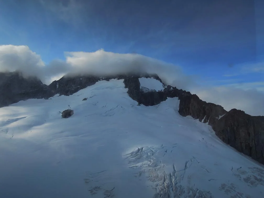
To reach the pits on the NW Branch of Taku Glacier, our group skied approximately thirteen kilometers from Camp 10, and established an overnight basecamp complete with dug-out tent platforms, latrines, sheltered gear trenches, and a cook tent. The second day of the expedition consisted of digging the mass balance pits higher up the NW Branch of Taku Glacier, too far afield to access in a day trip from any permanent JIRP camp. On the third and final day of the expedition we awoke to sunny skies, packed up our camp, and enjoyed the beautiful weather for our ski back to Camp 10.

To conduct the mass balance research, on each day of the expedition the fifteen participants would split into three groups, and head from basecamp to different locations to dig their mass balance pits. To document the health of the glacier, the students and scientists dug tirelessly down to the previous summer’s surface, sometimes having to dig over four meters into the glacier! By reaching the previous summer’s surface, the students could sample the snow that fell in the past year, weigh it, and from those data calculate the total mass of ice and snow that was added to that part of Taku Glacier by snowfall. With this information, total mass of snow and ice added in the winter can be compared with the mass of ice lost to summer melt. This comparison can be thought of as ‘balancing the glaciers checkbook,’ and can be used to evaluate the glacier’s health.

Basecamp for the NW Branch trip, consisting of four sleeping tents, and gear, cook, and dining tents. Photo credit: Julian Cross.

Basecamp for the NW Branch trip, consisting of four sleeping tents, and gear, cook, and dining tents. Photo credit: Julian Cross.

Taku Glacier: Anomaly of the Juneau Icefield

Kate Bollen

On a map of the Juneau Icefield, Taku Glacier is a distinguished ribbon that winds out of the southeast corner of the icefield as an outlet glacier. It’s remarkably large, even by Alaskan standards. It encompasses 671 square kilometers (Pelto et al, 2013) and measures about 5 kilometers across where it passes in front of Camp 10. It’s fed by four tributary glaciers that line its upper margins, and its outline is similar to the shape of Thailand. Taku Glacier is quite special, not only because it sets a stunning scene for JIRPers to admire from the porch of the Camp 10 cook shack, but also because it’s one of only a hand-full of glaciers in Alaska (and around the world, for that matter), that has been advancing (Pelto et al, 2013).

Shawnee Reynoso and Louise Borthwick sleeping out on the porch of the Camp 10 cook shack overlooking Taku Glacier. Photo: Kate Bollen

Shawnee Reynoso and Louise Borthwick sleeping out on the porch of the Camp 10 cook shack overlooking Taku Glacier. Photo: Kate Bollen

Until recently, Taku Glacier has been growing in mass. Indeed, the Taku looks unlike its neighbors as it descends toward the floodplain of the Taku River. The ice juts out over the small trees that live in its path, as the adjacent Norris Glacier looks as if it’s withering away, cracked and shrunken. Since most Alaskan glaciers are surrounded by forests that are actively creeping out onto the new ground exposed by glacial retreat, the sight of the Taku mowing over trees and shrubs as it slides down its broad valley is quite victorious to the glacier enthusiast.

Positions of the end of Taku Glacier from 1948 to 2014. Adapted from a figure by Chris McNeil.

Positions of the end of Taku Glacier from 1948 to 2014. Adapted from a figure by Chris McNeil.

Boundaries of Taku Glacier on the Juneau Icefield. Adapted from a figure by Chris McNeil.

Boundaries of Taku Glacier on the Juneau Icefield. Adapted from a figure by Chris McNeil.

Students Molly Peek and Shawnee Reynoso and faculty member Chris McNeil ski through thinly exposed crevasses on Taku Glacier below Camp 10 on a sunny day. Photo: Kate Bollen

Students Molly Peek and Shawnee Reynoso and faculty member Chris McNeil ski through thinly exposed crevasses on Taku Glacier below Camp 10 on a sunny day. Photo: Kate Bollen

There are two main causes behind the anomalous case of the Taku. First, the glacier has a unique hypsometry, which refers to the distribution of the glacier’s surface area with respect to elevation. Most of the Taku lies above 1200 meters above sea level, so it has a huge accumulation zone (the area where annual snowfall doesn’t completely melt by the end of the melt season) compared to the total surface area of the glacier. As a result, the majority of Taku Glacier can gain mass from falling snow each year. Second, Taku Glacier is a tidewater glacier. This may strike an observer as peculiar since the Taku currently flows into a river rather than the ocean, but this classification stands based on the Taku’s behavior and bed topography.

Olivia Truax collects snow depth data on the Northwest branch of Taku Glacier. Photo: Kate Bollen

Olivia Truax collects snow depth data on the Northwest branch of Taku Glacier. Photo: Kate Bollen

To understand the dynamics of Taku Glacier, we have to know the story of the tidewater glacier cycle. Here is a summary derived from a lecture delivered to JIRP students by Martin Truffer earlier this summer at Camp 17. As the end of a tidewater glacier, known as the terminus, rests in a fjord, the elevation of the glacier’s bed is below sea level. As a result, the melt water beneath the terminus of the glacier becomes pressurized so that it can still flow into the ocean despite the weight of the seawater column. The terminus is quickly eroded as big chunks of ice peel away during calving events and as warm sea water circulates against the terminus. Consequently, the glacier is driven into a rapid retreat, and it recoils up its valley until it reaches a resting point above sea level. There, the glacier is able to stabilize and to eventually begin an advance by pushing its dirty, icy terminus forward on a terminal moraine (a pile of sediment collected by the glacier at its terminus as it grinds forward). By advancing a homemade mound of sediment ahead of itself, the glacier can rest above the deep water of the fjord and the subglacial hydraulics are less pressurized, so the glacier is protected from the intense melting and erosion that previously drove it back. As it continues to bulge onward, the glacier eventually reaches a state where its surface balance nears zero, which means that its accumulation and ablation (melting) are equal. At this point, the glacier can reenter a rapid retreat as the tidewater glacier cycle continues.

A steamship floats in front of the Taku terminus during an earlier advancement of the glacier.

A steamship floats in front of the Taku terminus during an earlier advancement of the glacier.

As for the Taku, its bed doesn’t rise above sea level until an estimated 20 kilometers up-valley of its terminus (oral comm. Beem 2016). Additionally, the Taku has been in the advancement stage of the tidewater glacier cycle since 1850, but its advance has halted in the last two years (oral comm. Truffer, 2016). It’s too early to determine if the Taku has reached the end of its advance or to say that a rapid retreat is imminent. However, the reactions of the Taku and other glaciers to climate will have wide-spread impacts and can tell us quite a bit about the changing climate. Mountain glaciers account for less than 1% of global glacial ice volume, but their rapid rate of mass loss is responsible for one-third of the current observed sea level rise (Larsen et al., 2015). Additionally, glaciers play a big role in downstream ecosystems as they deliver nutrients and sediment as well as well as manipulate water flow, turbidity, and temperature (O’Neel et al., 2015). Consequently, these glaciers can almost directly impact where and how people near and far are living. The Taku and other glaciers captivate us as scientists and inspire us as humans to understand the complex systems in which we live.

References

Beem, Lucas. Oral communication 2016.

Larsen, C. F., E. Burgess, A. A. Arendt, S. O’Neel, A. J. Johnson, and C. Kienholz (2015), Surface melt dominates Alaska glacier mass balance, Geophys. Res. Lett., 42, 5902–5908, doi:10.1002/2015GL064349.

O’Neel, S. et al. 2015. Icefield-to-Ocean Linkages across the Northern Pacific Coastal Temperate Rainforest Ecosystem, BioScience, 65, 5, 499-512.

Pelto, M., J. Kavanaugh, and C. McNeil , Juneau Icefield Mass Balance Program 1946-2011, Earth Syst. Sci. Data, 5, 319-330, doi:10.5194/essd-5-319-2013.

Truffer, Martin. Oral communication 2016.


From the Archives: JIRP 1953 Forecasts Mild Winter in 2053

Recent communication between George Argus (JIRP '52) and JIRP surveyor Scott McGee (JIRP '88) has brought to light a short piece on JIRP in Popular Science - "Scientists Probe Glaciers for Tomorrow's Weather" - from November 1953. Most enlightening, perhaps, are the aspects of JIRP that have not changed in the 60+ years since this article was published.

pop-sci-1953-title.png

As we prepare for JIRP 2016, it is these commonalities that are striking. Dr. Calvin Heusser was one of the on-ice leaders in the early 1950s, and his quotes on botany, ecology, glacier surface color and the riddle of the advancing Taku Glaicer resonate and continue as areas of study today. And with humanity continuing to grapple with the challenges of climate change, it's with more than a bit of awe to read about some of the early understanding and indeed forecasts of a warming Earth. 

Look forward to announcements of JIRP 2016 details in the coming weeks, including core research areas, participating faculty and the fantastic group of students we look forward to welcoming to the JIRP family in 2016.

As you wait, enjoy this short article and delight in what has made JIRP a phenomenal experience, and vital scientific endeavor for 70 years. In the words of Dr. Heusser:

"It makes you feel all's right with the world, and is a big reason you go up there aside from the scientific purposes."

Access the November 1953 Popular Science article here.

Juneau Ice Field - 1965: The Science Experience to Last a Lifetime

By Thomas A. Herbert, Ph.D., P.G.

The Story:

This is a field science story of learning to work with a small team of individuals on projects that have merit and impact. This story is told looking back through the telescope after 49 years of other professional experiences with the intent of stressing the value of that first summer in 1965.

Background:

I am a geologist and was destined to be a geologist. My father, grandfather, and great grandfather were mining engineers so my post natal education began with discussions on rocks, oil fields, ores, and coal mines from my first recollections. I was born and grew up in Rock Island, Illinois, living on the Rock River so in retrospect I could have picked a geology career track in any subcategory from petrology to geomorphology.

I was fortunate to be offered a full scholarship for track at Michigan State University (MSU) in 1962 and went off to throw the discus and shot. We won several Big Ten championships when I was an undergraduate. The coaches all wanted me to take the jock courses to keep my grades up to give me time to train. My first quarter in 1962 had me in a really dumb jock course so I started to look for courses that would be interesting. I landed in Physical Geology 201 in the winter quarter of 1963 and did well. Spring quarter of 1964 had me in Geomorphology 303 with Dr. Maynard M. Miller. I was hooked on the science and on Dr. Miller’s engaging academic style and stories of doing science on Mount Everest. I declared a major in geology and began assembling knowledge in an organized fashion.

In March 1964 the Good Friday Earthquake hit Alaska and Dr. Miller packed his several Nikon F cameras, his red Eddie Bauer parka, Lowa boots and headed to the action for an expedition to evaluate damage and changes to the coastal glaciers. By fall quarter he was back in East Lansing with many slide trays depicting coastal glaciers laden with land slide debris and discussing incipient kinematic waves. I was enrolled in his Glacial Geology 412 class and it was all action science with new information from Alaska.

My big day was when Dr. Miller asked if I wanted to go for the 1965 field season on the Juneau Ice Field as a National Science Foundation undergraduate research participant. There was no question that I wanted to go and my father jumped in with his checkbook to cover all the purchases from Eddie Bauer and REI. An interesting side note is that my REI number in 1965 was only five digits long meaning I was buying gear from the beginning of that greatly successful recreational equipment company.

Field camp is required for geology students between junior and senior year in most programs. I petitioned the MSU Geology Department to accept the Summer JIRP work for my field camp requirement and was approved with the caveat that I would need to write several papers as directed independent study (DIS) for the 12 credits I would take. I was encouraged by the department chairman to engage in as many diverse tasks as possible to give me a broad field experience (Duh, how could that not happen on the Ice Field?). In retrospect it was sort of like a “self-directed” field camp. Dad got me up to Alaska early in June by plane and I stayed late that summer since MSU didn’t start fall quarter until the third week of September. Several of the MSU JIRP team drove the Alaska Highway in the 1963 VW bus that was early JIRP transportation. I got to Juneau early, stayed late, and was able to do some extra tasks.

Before the science adventure started the MSU Track Team won the Big Ten championship on May 26 and I did well in the discus setting the MSU record. I learned later from Barry Prather that Dr. Miller really wanted me for my lifting and toting abilities to schlep equipment. Barry had worked in a toting role for Dr. Miller on both the Everest (1963) and Mount Kennedy (1965) Expeditions and I think the muscular athlete roll worked well for Dr. Miller’s plans. Barry was a Dartmouth footballer who later was my office mate in grad school at MSU. I was awed by his record of climbing to 28,000’+ on Everest staging gear for the ascent team.

The Gear:

I admit to being a gear nut. My family and colleagues know that I stand ready to give a full discourse on the merits of field equipment. This character flaw has its root in the preparation for JIRP in 1965. There have been many improvements in clothing, foot gear, packs and rainwear. But the most important and symbolic gear item is the hat (Figure 1).

Figure 1: Gurka hat in place ready for the adventure to start

Figure 1: Gurka hat in place ready for the adventure to start

Hat selection – I picked a Gurka bush hat with wide brim to keep off the sun at altitude and the occasional rain. In my professional geology career the bush hat has been retired to the field gear box and replaced by several Tilley hats. My pick for the Alaska summer season would be a narrow brim Tilley.

Camera – I went off with a 35 mm Minolta rangefinder and about 30 rolls of film and mailers to send the exposed rolls off for processing. I bought additional rolls and shot about 1600 slides of which about 600 have been scanned at this writing. As a side note more than 500 nearly identical photos of the Taku Towers have been tossed.

At Dr. Miller’s suggestion and later in 1966, I purchased a Nikon F and a couple lenses. That camera is still in the case along with a Nikon F3, 8008, underwater Nikon and presently about five Nikon digital cameras. My pick for a summer field season would be a small pocket digital with 20 megapixels and a cheaper backup camera with batteries. Small is good for field cameras and backups are handy. Digital video is a good backup too. Also, you can record field observations on the audio track of the video… just in case you forget your field notebook. As Dr. Miller told me early on, a durable and high end camera is your best choice for field work. I definitely concur. All these cameras have been used for my work recording tens of thousands of frames. What we do as geologists is observe and record and explain what we have seen to others.

Foot gear – I had two pairs of Danner leather boots that I coated in layers of Snow Seal. Bad choice on boots, because after I stepped off the Hiller 12E at Camp 10 on June 21 into deep, wet snow I had wet feet for the rest of the summer. See Figure 1 for un-soaked boots.  I screwed up on socks too with cotton. Every night was a process of socks drying in the foot of the Bauer bag. Every boot company now has sealed and water proof boots and wicking socks of wonderful fibers so that won’t be a problem for future JIPRers.

Pack – I got the biggest oversized Kelty frame, frame extension and bag that was made then. I had six extra side pockets and two big back pockets sewn on. That pack worked for soft good and loose gear and the frame took a Blazo box of two 5 gallon gas tins for many trips up to Camp 10. We lugged full-sized wet cell car batteries around on the frame for the photogrammetry work too. Other than having battery acid eat up my pants, I never had a problem with the pack frame or bag. There are many designs today and most will work but big volume is better. After I finished my Ph.D. in 1973 at MSU I gave Dr. Miller the Kelty for his gear and I know he used it for years.

Parka – I had the Everest down Eddie Bauer Karakorum in red, the standard field jacket of the day. That type of down jacket is great if you are standing around watching drilling rigs in the winter at -5 which I did later in northern Michigan. For the Icefield, however, layers of Polartec or equivalent would be better since the temperature range is wide and in the summer 35 degrees is about as low as it went. You can regulate heat/cold better with Polartec type materials and it performs when wet. Dr. Miller was the recipient of the parka and in size XL he had plenty of room for layers.

Sleeping gear – I had the extra-long extra-large Karakorum bag that worked great particularly at Camp 8. I had a closed cell foam, three quarter length pad and a rubber sheet. We were sleeping on snow for the 10 days at the Ice Fall and the pad worked great until I rolled off. Dr. Miller also got the mummy bag when I moved to Florida in 1973. Joan chided me on that gifting because the bag had never been cleaned from 1965-1973 so it still had some Icefield grunge on it.

Ice axe – Bought from REI and gifted to Bill Isherwood for his trip to the South Pole in 1966. I have a picture of the ice axe (living vicariously through an ice axe!!!!) at the pole.

Crampons – 12 point deluxe models from REI and also went to the South Pole with Isherwood.

Binoculars – I bought a 7x35 pair just in case I might need them. They were bulky and took up pack space but they were invaluable in the surveying work picking up control stations and flagging across the ice. Dr. Adam Chrzanowski took over the binoculars for his survey spotting. They now reside in my gear bag for the shooting range.

Dr. Adam Chrzanowski at Mendenhall control point … note my binocular case around his neck.

Dr. Adam Chrzanowski at Mendenhall control point … note my binocular case around his neck.

Knife – I had a Swiss Army knife with a bunch of blades, tooth pick and tweezers. The knife is still in my field kit but the can opener is worn out. Swiss knives are always a good choice.

Pants – I had cotton rip stop military surplus cargo pants in 1965. Now I wear Tactical 911 rip stop synthetic fabric cargo pants and they are the best choice. I would wear them in AK.

Shirts – I wore MSU cotton athletic tees until they were totally grubby. I recommend Under Armor of several weights to layer up if needed. The fabric wicks and packs small.

GPS – No such luck in 1965 but today one is handy with extra batteries. The cheap ones seem to be as accurate for field work as the expensive survey quality gear. Don’t leave home without one.

Summer Activities Schedule 1965:

Scoping the Project Area:

I arrived in Juneau on June 12, 1965, and soon met up with Chris Egan (then a MSU doctoral student with two ice field summers under his belt) and we began limited exploring of Juneau and the Mendenhall terminus on foot. We used the UAK Marine Lab as a base and temporary bunk room. We chartered a Cessna from Kenny Loken at Channel Flying Service (Dad came through with some extra cash for the flight) and did a flying recon of the entire area in a Cessna 185 float plane before we went in the field. This flight was a great synoptic view of the project area. Now we have Google Earth and other imagery to give us scientists the big picture but then it was topo maps and 9x9 B&W aerials. We flew south over Taku Lodge and up the Taku Glacier to C10 and C8 and over towards Atlin and then back over the Vaughn Lewis Icefall, down the Gilkey following the medial moraines down glacier back to tidewater and back to Juneau. I shot about 10 of my 30 rolls of film on that flight.

Chris Egan exploring Mendenhall terminus June 16, 1965

Chris Egan exploring Mendenhall terminus June 16, 1965

Preparing Camp 10:

We reported to Livingston Helicopters early on June 21 and loaded our gear on the floats of a Hiller 12E (Figure 1). Nancy Livingston was the pilot for this my first helicopter flight. Nancy was about 45 years old then, tall and really strong. Her flight experience made me feel very safe. Not only did she have thousands of hours in helicopters but Nancy had been a ferry pilot in WWII flying P-47s and P51s and about 50 other aircraft around England.

Dick Shaw, Chris Egan and I flew into Camp 10 to find about 8-10 feet of wet snow covering the rocks with the cook shack, generator shack and the teaching building pretty much buried. We had to dig down to get into the doors. There was a snowmobile garage that had been built late in 1964 that was unfinished and not structurally sound for snow loads. We had to dig out the snow machines from a collapsed structure then get everything running.

Arriving Camp 10 June 22, 1965

Arriving Camp 10 June 22, 1965

 The weather for the next 12 days was sunshine and hot and the snow was melting at a rate of feet per day. By the time the full team arrived on July 3 the nunatak was snow free around the camp. We began recording met data beginning on the 20th and recorded some glorious days.

Chris Egan at the met shelter, 10 PM, June 26, 1965

Chris Egan at the met shelter, 10 PM, June 26, 1965

On July 3, the Alaska Air Guard C-123J landed a mile or so out on the Taku snow pack on ski wheels. Personnel and gear was off loaded. I was the lone passenger for the flight back to Juneau that day and it was an “interesting flight.” The C-123J was about four miles above the neve line and General William Elmore, USAF (pilot and commanding general of the AK Air Guard) decided to take off down glacier (and downwind with katabatic tail wind at about 10-15 mph). The wet snow landing and taxiing had packed the ski wheels with extra weight. The two radial engines were run up as we started down glacier; the two jet engines on the wing tips were started for extra power. We ran for several miles and could not get takeoff speed to lift off, all the time we were bumping and slewing over the sun cupped surface. I was belting in next to the crew chief in the cargo bay. After a couple minutes when I’m sure General Elmore and his copilot Col. McKee, USAF, could see the crevasses in the distance he alerted the crew chief to the next move. The chief, T/Sgt. Wm. Christy USAF, yelled at me over the din something like … “son, tighten up you seat belt and hang on for a ride”. General Elmore engaged the JATO unit that rocket launched us up to several hundred feet above the snow. Now we were in the air in an empty plane with plenty of power to fly. The next problem was that the ski wheels would not retract since the three miles of takeoff run had packed the wheel wells with more snow. We flew to Juneau airport with the ski wheels down with the General cycling the gear to dislodge the snow. We circled Juneau for about an hour while the General continued to clear the ski wheels. He was able to get the wheels partially deployed but the huge skis (I estimate at 5’ by 18’ aluminum panels) would not fully retract so the skis and wheels were both down for the landing and everything was packed with snow. I bet this type of landing was not in the C-123J operating manual before this incident. Again the crew chief told me to hold on and we landed with some minor sounds of metal scraping. The loading ramp was dropped and I kissed the ground and marched off to a new task. We had landed with the crash trucks deployed; scraping the aluminum skis but all went well.

Alaska Air Guard C-123J on the Taku Plateau; July 3, 1965

Alaska Air Guard C-123J on the Taku Plateau; July 3, 1965

Loading for Juneau return: Left to Right: Dick Shaw, Barry Prather, Scott Hulse, Dennis Cowals and Bonito Colqui (orange hat)

Loading for Juneau return: Left to Right: Dick Shaw, Barry Prather, Scott Hulse, Dennis Cowals and Bonito Colqui (orange hat)

Terrestrial Photogrammetry:

My next adventure job was to be the chief gear schlepper and toter for three professors from the University of New Brunswick (UNB) Surveying Engineering Department. I had taken Dr. Miller’s photogrammetry and geology course and was very interested in that topic. I had about 14 days of intense and extremely “hands on” work with these fellows. I have used that knowledge nearly every day for the past 48 years of my geology career.

The UNB team included Dr. Godfried Konecny, Professor Gerhardt Gloss, and Dr. Adam Chrzanowski. Their project was to obtain terrestrial photo images for plotting of the ice surface near the terminus of the Mendenhall, Taku and Norris glaciers. To accomplish this we had to establish geospatial positions for known points on the peaks overlooking each terminus and ground control points. This was “back in the day” when we had distance and angles to establish control points and image stations.

The images were stereo pairs on glass photographic plates from a base line established on the mountain side. The base line was several hundred meters long with an image at each end. The plates were exposed and later taken back to UNB for stereo plotting of the contours. The scientific carry forward is that the 1965 JIRP ice volume studies were the starting point accurately tracking ice volume changes in the system as early documented data for climate studies.

The Mendenhall work started with a set up over the geodetic monument at the Juneau Airport which had a clear view direct line to the top of Mt. McGinnis. We set up a Tellurometer Micro Distancer M/RA1 (made in South Africa) which we used to measure distance. The instrument had been on the market for about two years so we were “cutting edge.” The instrument used phase shifts in the modulation of micro waves. This was a new science toy in 1965 that Dr. Konecny was eager to use. We measured the distance to a monument on Mt. McGinnis that I constructed with a clear view down to the ice. I drove a steel pin and later built a rock cairn over it.  We used a Wild T-2 to measure angles from the airport and swung to the other end of the stereo baseline. Then a Wild P-30 photo theodolite was set up on the mountain side at each end of the base centered over the control points to take the images. The logistics for this work was the 12E with Arlo Livingston flying. We also had a second vantage point from the cirque bowl (ski bowl) on the south side and established a second base line and took photos. All of the points were established with steel pins I drove in the rock and then built about 4-foot high cairns over them. We had great weather and this Mendenhall work took about five days.

Dr. Konecny and myself (in the hat) using the Tellurometer to tie back to the Juneau Airport geodetic monument

Dr. Konecny and myself (in the hat) using the Tellurometer to tie back to the Juneau Airport geodetic monument

The Taku and Norris work was conducted from a base camp at Taku Lodge where we stayed for several days. There was a geodetic monument near the lodge that we set up on with the Tellurometer and the T-2 and took control up to the peaks south of the channel and looking at both ice fronts. Arlo flew in to assist with some ground control work on the outwash in front of the ice where we had other monuments and good shots back to the peaks to the south. These were some long legs in the survey net where we had distance shots of 5-10 miles.

Dr. Konecny set up on peak above Taku Lodge to cover Taku/Norris terminus


Dr. Konecny set up on peak above Taku Lodge to cover Taku/Norris terminus

There were two notable experiences in Juneau for the few days we were billeting there for the photogrammetry work. First off was a note to me later in 1965 from Joan after the bills were paid for the summer. We had been eating at a restaurant around the corner from the Red Dog every morning and sometimes in the evening. Joan noted that I ate some expensive meals. I was just a growing boy on expense account!

The second experience came at a quiet little bar across the street from the Red Dog. I had turned 21 several months before so I went in for a beer one evening. I was nursing my one beer at the bar when two fellows in more formal dress than my field gear came in and sat down next to me and struck up a conversation. Being the naïve youngster I asked the gentlemen next to me “and what do you do?”  He replied, I’m the governor and this is my assistant and we come here for a drink after work. It was William Egan who was a friend of Dr. Miller who had requested Mal’s help on the damage assessments following the 1964 quake. Governor Egan later was a significant political player in national politics and was a key player in getting the Alaska North Slope oil resources developed.  

Seismographic Studies Below Camp 10:

I finished the work with the UNB team on July 16, 1965, and flew with Arlo in the 12E from Taku Lodge to Camp 10 just skimming the crevasses on the flight. The altitude change is about 5,000 feet over that distance and Arlo was climbing all the way. At one point he turned to me and asked how much I weighed because the Lycoming engine was starting to heat up. I told him about 260. He figured with all the supplies and my gear and weight we were probably a bit overloaded for the flight.

Upon arrival I was assigned to packing duties toting gas cans and lumber up the hill to the camp. I learned that toting heavy loads at even 5,500 feet can be hard. I came in a distant third to Scott Hulse and Richard Carlson. I was the bulky strong body type and they both were lean, mean and great climbers.

I was assigned to assist Dr. Tom Poulter, Director Emeritus of Stanford Research Institute, in conducting seismic traverses of the area of the Taku near Camp 10. We were using the Poulter Method of shooting that he had developed for reflection shooting in the Antarctic in the 1930s and 1940s. The energy sources were small portions of stick dynamite on a stainless steel pole detonated to create an air burst. Poulter would cut the sticks of dynamite with his pocket knife and affix with cap with early duct tape to the pole. The twelve or so recording geophones were placed in a line and detonated. Poulter lectured on explosives, safety, handling and the theory of seismic wave propagation. When we ran low on explosives Kenny Loken airdropped several cases of dynamite and another of detonating caps. This was an air drop where the packages were pushed to the door to free fall to the snow.

Dr. Tom Poulter (right) checking the seismic record on the Taku plateau; Barry Prather in sunglasses is also reading the printout; Poulter seismic shooting pole next to him

Dr. Tom Poulter (right) checking the seismic record on the Taku plateau; Barry Prather in sunglasses is also reading the printout; Poulter seismic shooting pole next to him

I had several life experiences with Dr. Poulter that I can relate. He was a large man at about 6’4” and 240 pounds and he was 68 at the time he was very fit. I use him as my model for fitness today since I am 71 now myself. One evening sitting at Camp 10 near the met station I had an hour one-on-one discussion with him in his mentoring role. I asked the naïve question of him … “what did you do during WWII?” He responded that his role had been classified work at Los Alamos and that he had designed the shape charges of conventional explosive to detonate the first atomic bomb. The task was to create the spherical charge to force the critical mass together. He explained that the timing through the electrical circuit was the secret to success. His solution was very practical … trial and error cutting the silver not copper wire with electrician’s pliers until it worked.  

I have assisted oil companies with seismic projects for the past 40 years. The Poulter Method is still used in various situations around the world where shot hole drilling is difficult. I even had an oil company geophysicist ask me if I knew anything about “Pouter Shooting” wherein I proudly reported that I had learned seismic prospecting from the man himself on the Ice Field.

Camp 8:

I finished seismic work in late July and one evening headed to Camp 8. We arrived after midnight and crossed the bergschrund on the snow bridge and on to the bedrock. The next morning our trail had collapsed into the “schrund.”

My Camp 8 stay was for about a week and I made some lasting friends. Dick Shaw from MSU was there and he later was an office mate in grad school. Dick spent decades with Exxon and now is a consultant in Denver. We crossed paths about a year ago in a professional capacity on oil field development. Bill Patzert was at Purdue and headed for University of Hawaii; he later became a guru on ocean dynamics at Scripps and is now with JPL. Bill Isherwood of Antarctic fame was there along with Dennis Cowles, Chris Egan and Scott Hulse. Ty Kittridge went back in the Army Special Forces in Vietnam where he was a true silver star hero.

My most notable feat at Camp 8 was eating a case of 24 chocolate Mountain bars in two days. Then we moved to the Ice Fall for several days.

Camp 8 July 25, 1965; the team lounging include Scott Hulse and Bill Patzert (sunbathing on the roof), Bill Isherwood (back to camera with pack), Chris Egan (red shirt seated behind solarimeter) Ty Kittridge (seated on rock with his Bull Mastiff “Si…

Camp 8 July 25, 1965; the team lounging include Scott Hulse and Bill Patzert (sunbathing on the roof), Bill Isherwood (back to camera with pack), Chris Egan (red shirt seated behind solarimeter) Ty Kittridge (seated on rock with his Bull Mastiff “Siggy”) and Dennis Cowels (red socks)

Vaughn Lewis Ice Fall:

We traveled to the Ice Fall late one evening and stayed in the army squad tent on the outcrop at the top of the Ice Fall. The group included Bill Isherwood, Bill Patzert, Ty Kittridge and his dog Siggy and myself. We climbed down the snow and rock and camped on one of the wave ogives. We spent three days conducting masters thesis research on movement rates for Ty. We did a lot of walking and climbing. Siggy the Bull Mastiff at 160 pounds was eating more canned stew and hash than the entire human group so we had to climb out to resupply.

Camping on the wave ogives on the Gilkey Glacier July 29, 1965; Bill Patzert checking the tent, Siggy looking for food, Bill Isherwood checking seismic geophones, and Ty Kittridge smoking his last Picayune cigarette.

Camping on the wave ogives on the Gilkey Glacier July 29, 1965; Bill Patzert checking the tent, Siggy looking for food, Bill Isherwood checking seismic geophones, and Ty Kittridge smoking his last Picayune cigarette.

Back to Civilization:

Once back to the ice plateau we motored back to Camp 10 where several of us had the task of securing the buildings for winter and heavy snow. We drained fuel from the snowmobiles and generator and picked up loose gear and trash. We burned the trash with the aid of some extra generator gas. As I recall, in 1965 the main body of the summer team marched down the Taku to tidewater and in later years I think the team marches down to Atlin. I had neither option since I had been on the cleanup crew. We flew out with Arlo Livingston back to Douglas Island and his aerodrome.

Back to school August 15, 1965

Back to school August 15, 1965

Then ‘til Now ... the Next 50 Years:

There is not a single day that I do not think about the Ice Field and the guys I was with that summer. There were no females back in the day. I finished BS in record time before my sports eligibility was completed so I was a scholar-athlete in 1966. I worked for five years drilling holes for the Michigan Highway Department and sorting/identifying rocks for concrete aggregate and went to school full time. The MS was finished in 1968 and I switched to the College of Agriculture and Natural Resources in 1969 for a PhD in Resource Development that was finished in 1973. The doctoral work focused on law, public policy and geologic processes. Dr. Miller was on my committee and greatly assisted in defense and editing in his usual giving manner. I moved to Florida and worked five years for the Florida Legislature on natural resource issues as a staff director and science adviser where I learned how scientists and politicians interact. During that time Dr. Miller moved to Idaho and was involved as the State Geologist in phosphate mining there. I had just helped pass comprehensive mine reclamation legislation in 1975,  for Florida’s phosphate industry and I was able to help Mal with background information.  Since 1978, my spouse, Dr. Linda Lampl, and I have been in the consulting business covering a host of topics in the sciences. See more at www.lampl-herbert.com. For more than 25 years I have helped the Florida State University geology program in an adjunct professor role. If anyone needs an interesting graduate program the newly assembled Department of Earth, Oceans and Atmospheric Sciences is a wonderful place to learn about the planet.

And, to the chagrin of my old friends and associates, most of my good stories start with the glaciers moving down the mountain.

Be safe!

 Editor's Note: Are you a former JIRPer with stories or photos to share? Please be in touch by email if you would like to help us tell the JIRP story: fger.jirp@gmail.com


Connecting Glaciology, Hydrology, and Ecology on the Juneau Icefield

By: Kim Quesnel, Stanford University; Lindsey Gulbrandsen, State University of New York, Oneonta; and Laurissa Christie, University of Guelph


Since the main focus of JIRP fieldwork is mass balance (digging snow pits to determine the annual health of the glacier), the hydrology group decided to examine the relationship between mass balance and stream flow on the Lemon Creek and Taku glaciers. Both glaciers have historic mass balance data and also feed into United States Geological Survey (USGS) gaged streams, giving us two datasets to use in our analysis. Additionally, we will also be using meteorological data (temperature and precipitation) in our models.

Normal
0


false
false
false

EN-US
JA
X-NONE


 <w:LatentStyles DefLockedState="false" DefUnhideWhenUsed="true"
DefSemiHidden="true" DefQFormat="false" DefPriority="99"
LatentStyleCount="276">
<w:Ls…

Laurissa cores a sample of snow in the mass balance pit. 

The goal of our project is to examine the fluxes in glacial accumulation and ablation and to determine the impact of changing glacier dynamics on downstream ecosystems (both terrestrial and marine) which are dependent on glacial melt water. For example, salmon habitats require specific streamflow and sediment conditions to spawn, and changes due to accelerated melt may impact their habitat and breeding environments. We are excited to see different relationships between all of the variables, and we are waiting to get back to our respective universities to continue to analyze data.

Normal
0


false
false
false

EN-US
JA
X-NONE


 <w:LatentStyles DefLockedState="false" DefUnhideWhenUsed="true"
DefSemiHidden="true" DefQFormat="false" DefPriority="99"
LatentStyleCount="276">
<w:Ls…

Kim looks at a supraglacial stream.

Normal
0


false
false
false

EN-US
JA
X-NONE


 <w:LatentStyles DefLockedState="false" DefUnhideWhenUsed="true"
DefSemiHidden="true" DefQFormat="false" DefPriority="99"
LatentStyleCount="276">
<w:Ls…

French Alex, Kim, Laurissa, and Natalie measuring a stream.

In addition to looking at the overarching hydrology of icefield, we also took several field trips while we were at Camp 26 to look at the water features in the ablation zone. We mapped hydrologic features, looked at the evolution of supraglacial streams, and explored ice caves under the Llewellyn glacier. 

Normal
0


false
false
false

EN-US
JA
X-NONE


 <w:LatentStyles DefLockedState="false" DefUnhideWhenUsed="true"
DefSemiHidden="true" DefQFormat="false" DefPriority="99"
LatentStyleCount="276">
<w:Ls…

The hydrology group! Laurissa, Kim, Lindsey, and Carrie.


Link TV: Juneau Icefield Expedition

By Matt Beedle

In 2013 JIRP was fortunate to have photographers and documentary film makers Jeffrey Barbee and Mira Dutschke as members of a great crew of staff and faculty.  In addition to their efforts to help JIRP run smoothly and safely Jeff and Mira produced two fantastic video episodes on the 'Juneau Icefield Expedition' for Link TV.  Enjoy!

Thank you, Jeff and Mira! 

Atlin

By Sarah Bouckoms

“The boat is here” were the words I wrote in my diary as we watched the calm waters being broken by the bow of a small silver boat. In it contained the first person in two months we saw who was not a JIRPer. But it held so much more meaning than the weight of our Captain. It was a passageway to Atlin, BC. The final call that we were off the Icefield. The summer adventures were over. But there was still more work to be done. In Atlin we would be busy doing things like showering, laundry and eating ice cream. After those necessities were taken care of the students needed to busy themselves finalizing their presentations for the citizens of Atlin.  The students were divided into groups based on topic area to each talk about their work. Each student found it hard to pack a summer of research in 3 minutes, but with a bit of practice we pulled it off.  After the talks we enjoyed a cookie and a hot drink with the community. Earlier in the day, Mary Gianotti, Stephanie Streich and Christiane McCabe busied themselves in the kitchen making cookies. 400 of them. There were chocolate chip, oatmeal raisin, shortbread and peanut butter with chocolate Hershey kisses. 

Yum Yum! Lots of cookie eating after the talks. Photo by Stephanie Streich.

Giving presentations in Atlin after completing the traverse has been a long-standing JIRP tradition. It gives the students a chance to work on their public speaking, but more importantly it is a social event in Atlin not to be missed. We were overwhelmed with the enthusiasm shown as we entered the shops or laundromat. No one cared that we were stinky since we had not showered yet. Everyone was just excited to hear how our summer went. 

The local shops were a novelty after waiting on helicopter deliveries all summer. Photo by Sarah Bouckoms.

Atlin was a great transition back into civilization. It was quite bizarre to see things such as cars and telephone poles, cute little shops and animals. Luckily for us, the streets were not so busy so it was not a problem that we treated the roads like a trail and took to walking down the center of the street. Atlin gave us a great welcome with its sunny days, warm water for swimming and clear nights for Aurora gazing. We joked that if we had been plopped down in New York City there would have been casualties in minutes.  Thank you citizens of Atlin for the warm welcome and hospitality you offered, we are all grateful for the easy transition.

[NOTE:  Click on any of the images below to open a slideshow with all photos and captions.]   

The Pirates of Glacier Mass Balance

By Jon Doty

Mass balance is in many ways piratical by nature. There is a reason why a JIRPer often stumbles across pirate flags with the words "Mass Balance 2012" scrawled onto the walls of camp. We have our map, shovels to dig for treasure, and X marks the spot. However, our modern day plundering involves a somewhat different set of tools, and an altogether different goal. In lieu of a pirate ship, we ride our skis into the horizon, following a GPS in search of science. 

The mass-balance crew on the morning before skiing to the Demorest Glacier pit. Photo by Mary Gianotti.

Although I have lost touch with the outside world, I am told that the day we left C-10 was July the 26th, bound for C-9, tasked with digging mass-balance pits on the Matthes and Demorest glaciers. For all you glacial neophytes out there mass balance is the bread and butter of JIRP science. By digging a pit into the winter snowfall and comparing to the summer ablation (mass lost through melt, sublimation, calving, etc.) we can determine whether the glacier has gained or lost mass over the year, and learn about the variability of the glacier on an annual basis. JIRP holds one of the longest records of glacial mass balance data - having measured Taku Glacier mass balance every year since 1946.  Storglacieren in Sweden is the only glacier with a similarly long data set.

Our itinerary was a nine-mile ski to C-9, pausing to dig a pit just short of camp on the Matthes Glacier. We would spend the night in camp, and then ski down onto the upper Demorest Glacier to dig another test pit before returning to C-9 for the night. On our final day we were bound for C-18 and the wonders of the Vaughn Lewis Icefall and Gilkey Trench.

We waved our final goodbyes to C-10, made a final pit-stop into Dreamland, and then took off down the ski hill onto the vast expanses of the Taku. We skied up-glacier on snowmobile tracks laid down by Scott McGee and the survey team, taking a few short snack breaks along the way, eventually hanging a right up the Matthes Glacier towards C-9. The turn onto the Matthes meant that we were officially on ground that none of us – save for our friendly field staff members Annie Boucher and Matt Pickart – had ever tread upon before - uncharted territory. As we set a course for discovery, I couldn’t help but smile. The interface between the Taku and the Matthes is quite noticeable; as the Matthes spills out into the Taku the flow rates vary greatly, producing a crevasse ridden terrain. These are mostly ankle-biters and nothing to really worry about, mostly affecting scientific curiosity instead of trepidation or thoughts of roping up.

Mary Giannotti and Jon Doty relaxing while Matt Pickart and Chrissy McCabe dig. Photo by Annie Cantrell.

After about four or five hours of skiing through marginal weather, we reached the pit location, and began digging. We dig our mass balance pits in four steps, each reaching progressively deeper down through the snowpack.  The north facing wall is a clean wall, where we make measurements of density, and is never stepped upon as it would affect the snow density below.

At first everyone is at work shoveling out the initial meter of depth, but once the first step becomes defined, only one person can safely fit on each step. At that point, those inside of the pit begin to shovel from their step onto step one, from where it is a shorter shovel throw to remove the snow from the pit. Those who are not within the mass-balance pit take a break and refuel for their next shift inside, or tend the rim of the pit to prevent snow buildup. This year our pits have averaged 3.5 to 4 meters deep, which takes about 4 hours to dig – in the past, however, pits have ranged up to 8 meters in depth, requiring feats of strength that even the Dread Pirate Roberts would shy away from.

The treasure at the bottom of the pit? The annual layer. This line marks the boundary between this year and last year’s snowfall. It can be represented by a variety of features within the snowpack: an undulating ice layer - evidence of suncups from the previous year; a dirty layer – dust and debris upon the snowpack deposited throughout the summer and buried during the accumulation season; or depth hoar – large unconsolidated sugary snow crystals which sits upon the far more dense firn (year-old snow). Once we have found the annual layer we begin to take our data from the pit. We prep the wall of step four (the deepest) into a clean vertical face, and sample the snow at 10 cm (~4”) intervals using a coring device of known volume. Measuring the mass of these snow samples (and the thickness of all ice lenses that cut across our sampling section) gives us a density profile of the snowpack. With this knowledge, we can determine the water equivalent of the accumulated snow at this location on the glacier.  By digging pits at varying elevations and distances along the central profile of the glacier, we can estimate the total accumulation received by the glacier for the past year.

Our pit on the Matthes ended up being 4 meters deep. The depth of our pits creates an interesting logistical problem: how to sample snow cores and ice lenses at fifteen plus feet off the ground. We JIRPers take this as an opportunity to cross the disciplines of science and mountaineering, and so we build a snow anchor and collect data on rappel. In this metaphorical crow’s nest (I know, this likeness is a bit of a stretch) we have a bird’s eye view of the pit we have dug, and can sample the layers safely and precisely.

View of Camp 9, with Matthes Glacier in the background.  Photo by Annie Cantrell

Hungry from a full day’s work, we chugged on up the hill to C-9 through a whiteout, gaining the first views of our home for the next few days only once we were within thirty feet. We all piled inside, leaving our backpacks covered up outside on the nunatak as there was no room indoors for anything more than people. C-9 consists of a single two story building with exactly enough space for about two fewer people than we had in our crew. We managed to squeeze in, and bided our time reading graffiti on the wall and cracking jokes while we waited for the pasta water to boil. After dinner there was only one option: bed.

Interior of Camp 9 with Matt Pickart.  Photo by Annie Cantrell.

Dawn broke with a cloudless sky, and an absolutely beautiful view. After finishing off leftovers from last night we were treated to fresh oatmeal! Our ski down to the pit on the Demorest Glacier was an absolute treat – views of Devil's Paw, the Dipyramid, the Citadel, hanging glaciers, bergshrunds, and so much more. The first half of the ski was a long downhill, and so I sat back and paid zero attention to the track ahead of me as I soaked in the alpine panorama. Once we hit the Demorest Glacier we skied a few more miles of flats to reach the test pit. The sun was hot and bright, and so we blasted some music and got to work. The day was pleasant and the pit went quickly, and as manpower became less necessary within the pit we dug couches into the snow, and laid our socks on our ski poles to dry. Our pit ended up 4.5 meters deep, and so we cored it, and set sail back to C-9, treated to an absolutely incredible sunset just as we topped the camp ridge. Our rations for the night consisted of spaghetti with a mixture of tomato sauce, leftover broccoli cheddar soup, and roast beef for toppings. As we tucked in to bed, strong winds buffeted our home, but thoughts of the coming day’s traverse to C-18 and adding new points to my life’s map lulled me to sleep.

Matt Pickart, Lindsey Nicholson and Jon Doty watching the sunset with Devil’s Paw in the background. Photo by Salvador G. Candella.

The Traverse to Camp 18

By Adam Toolanen

The summer’s third big traverse is the ski from Camp 10 to Camp 18. As a former JIRPer returning as staff member, I have knowledge of the magnificence of Camp 18, which is what kept me going during the 18 mile ski from Camp 10, whereas the students only had my description of the splendor of Camp 18 to ponder as we skied. The excitement of seeing the vast icy expanse on a gorgeous summer day made the journey as rewarding as the destination.

Uwe Hofmann skiing down the hill at Camp 10 for an early morning departure. Photo by Sarah Bouckoms

In the days leading up to the traverse, it was unfortunate that we could not see the Taku Towers - the iconic landmarks of Camp 10. Luckily, the weather cleared on the day that our group left for Camp 18. The first few hundred feet of the 18 mile day consisted of a steep downhill pitch covered in suncups, which always takes awhile to navigate.  Just as we thought we would have a smooth start to the day a ski binding broke on that first, steep slope. Not wanting to have everyone wait at the bottom of the hill, I sent the group on their way and headed back to Camp 10 with Will Jenkins and his broken binding. Luckily, the binding was fixed quickly and we skied back down the hill. I remember being a student on JIRP and never wanting to be behind the group. No different than I, Will cruised ahead of me and soon we caught up with the others.

The trail party takes a snack break, changes some layers and rests for a minute before hitting the trail again. Photo by Sarah Bouckoms

As we traveled up the Taku Glacier towards the Matthes Glacier, we took many breaks to adjust our gear. It is not always obvious how to dress for travel on the glacier. The effect of the sun heating your body is amplified by the solar radiation that reflects off the glacier. Naturally, skiing with a big backpack keeps you toasty as well. On the other hand, there is the massive body of snow under your feet and the cold katabatic winds that cool you off as you ski. Katabatic winds are created by cold air flowing from high to low elevations on the glacier, and can really chill you on a hot summer’s day. Depending on the combination and prevalence of these factors, people have to change clothes constantly. The other challenges are hotspots and blisters. As potentially day-ruining afflictions, these need to be addressed immediately. During the breaks to bandage foot sores and adjust outfits, we also snack to keep our energy levels up and joke together as we rest our feet for a little while.

Author Adam Toolanen on a sunny day on the Icefield. Photo by Jeff Kavanaugh

When I was a student I skied the traverse in a whiteout, so I couldn’t see anything other than the ski tracks from the person in front of me. The staff member leading my group told us about the views of Devil's Paw and the Storm Range, but we could only imagine them. Coming up the trail to Camp 18 this year we were all captivated by the stunning ridgelines and mountain glaciers set against the backdrop of the blue, blue sky and did not have to rely on our imaginations.

The group slowly rising over the final crest of the Matthes Glacier headed towards Camp 18. Photo by Sarah Bouckoms.

As with many things in Alaska, the size and scale of icefield features is deceiving. Setting small personal goals is both rewarding and challenging on such a long ski trip. Promising yourself that you will eat that chocolate bar once you crest the next hill can mean waiting an hour instead of the 20 minutes you were planning on. However, when you finally stand on that hill enjoying your chocolate bar and take in the views offered by the massive slope you just conquered, you can be all the more content with reaching your goal. Some of the students started inquiring about the location of Camp 18 and although I can point out the peaks surrounding the camp, it really takes the whole day for the scale of the journey to really dawn on them.

A group of four carries on in good spirits on Matthes Glacier. Mt. Moore - with Camp 8 on the ridge of rock pointing down towards the first skier - is in the background.  Photo by Sarah Bouckoms

As the group crested the last hill of the Matthes Glacier, we could finally see down into the basin alongside the daunting ridge of the Storm Range. Huge black rock faces towered above us as we pushed through the remaining two miles to camp. The sun was setting behind this ridge and the soft snow froze over, creating a fast and slick surface for our skis. As we neared our destination, the Camp 18 buildings glimmered in the last sunlight, perched high on the nunatak. The final push to Camp 18 offered a view of the mighty Vaughan Lewis Icefall. The top of the icefall billows down a ridge where it breaks up into large crevasses. These crevasses stretch, become bigger, deform and transform into even larger crevasses. When these start to collapse due to the steep slope they are passing over, the icefall really shows that it is in slow, albeit chaotic motion. As my group crested the hill and we started the final downhill glide into Camp 18, the grandiose Gilkey Trench opened up before us. Only as we skied the final quarter-mile to camp did we really see the backdrop which is the surroundings of Camp 18. After 11 hours skiing uphill on the glaciers leading to Camp 18, the group made it just in time for a sunset over the Gilkey Trench. Being back at this magnificent Camp after a long day of skiing is just the reward I was hoping for.

The scale of the Icefield is shown with two skiers dwarfed by their surroundings as they ski up Matthes Glacier. Photo by Sarah Bouckoms

The real treat for me as a staff member was to be able to lead first-time JIRPers on this trip, to one of the most beautiful spots I have ever been to. The students were excited and positive all day, but what they saw upon arrival exceeded all of their expectations. Even I who knew what was in store was in wonder at the realization that this place is still here, that it is real, not just some past dream. I felt like the mediator or the guide who took the students to this place and when we arrived I could just sit back and smile as I watched them explore their new home, giddy with excitement.

After a long day of skiing from Camp 10 to Camp 18, the sun sets on the glaciers and peaks of the Gilkey Trench.  Photo by Sarah Bouckoms.

Photo Gallery: Flight from Juneau to Camp 10

By Stephanie Streich

[NOTE:  Click on any of the images below to open a slideshow with all photos and captions.]