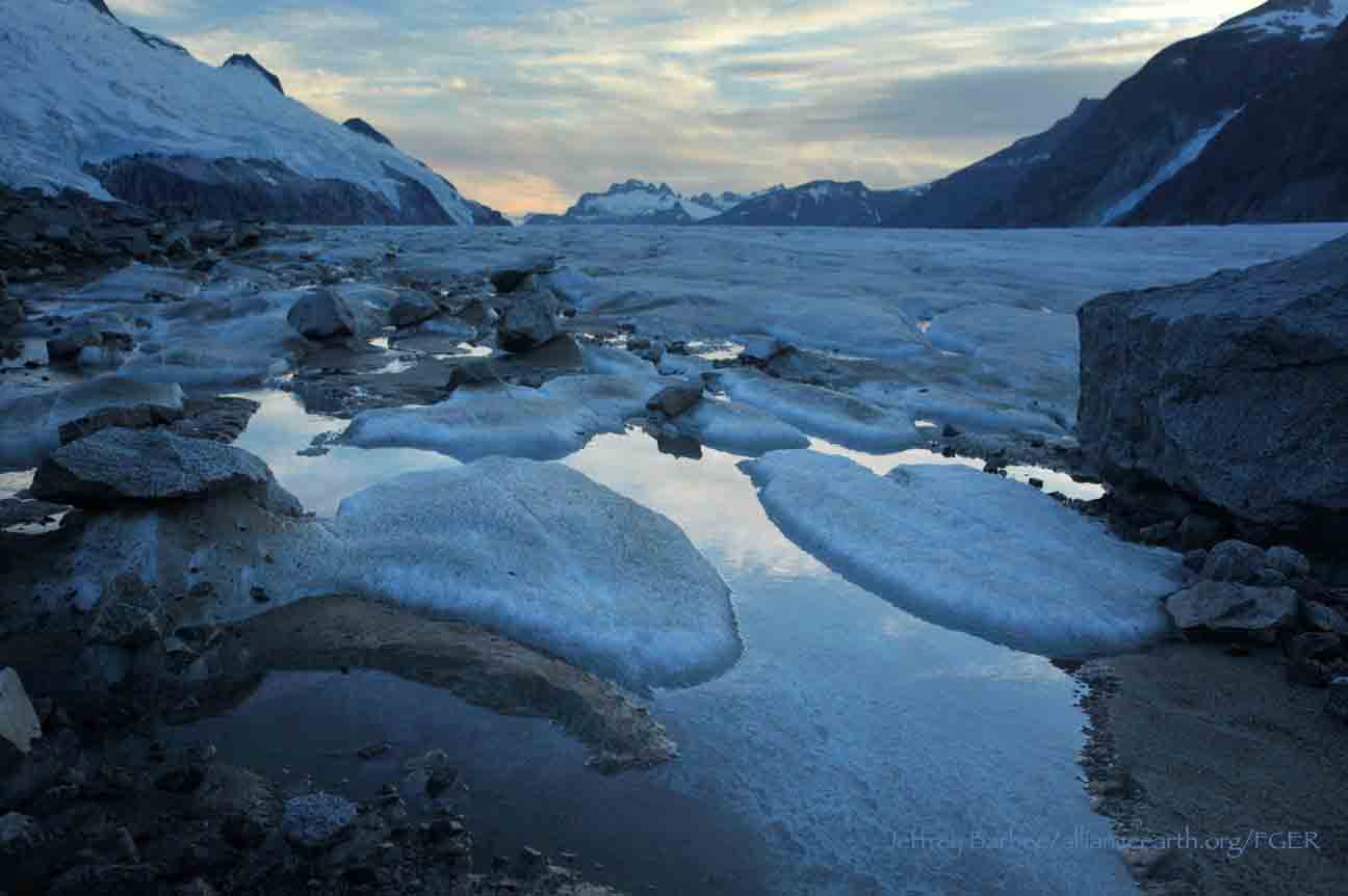
Introducing the Summer 2014 Surveyors

Scott McGee

Hi, I’m Scott McGee from Anchorage, Alaska. I’ve been here since before there were glaciers. Every summer, a crowd of students and faculty come to the Icefield for a few weeks. As I’ve almost memorized the regional geography, I’m happy to help these scientists safely traverse from Juneau to Atlin. In addition, I like the survey work, which gives me an excuse to explore those rare niches of the Icefield that I still don’t know.


Martin Lang

My name is Martin Lang, and I’m from Munich, Bavaria (Germany). I got sucked into the world of JIRP and the gorgeous Icefield in 1989. I have not succeeded in escaping since (well, I really never tried to). In the real world, I work as a surveyor for a small but cutting edge company doing high-precision kinematic 3D surveys. This minor obstacle does not allow me to be on JIRP every summer, so I come back on a regular irregular basis. I’m looking forward to supporting the surveying this summer, and working with the fantastic student crew we have up here.

Martin Lang with faculty geologist Cathy Connor

Paul Winter

Hello, my name is Paul Winter. I just finished my first year as a Master’s student at Beuth Hochschule Berlin (Germany) studying geodata recording and visualization. I also love mountains, and on this program I found the perfect combination of connecting both worlds. The first two weeks in this incredible glacier world were just awesome. I’m excited to see more and broaden my mountaineering and glacier travelling skills.

Paul Winter with some GPS equipment.

Paul Winter with some GPS equipment.

Gilkey Trench Fieldwork Adventure

By The Gilkey Trench Crew (Jamie Bradshaw, William Jenkins, Jon Doty, and Justyna Dudek)

While many students already started the fieldwork for their projects at Camp 10 and even Camp 18, five students have been anxiously awaiting to begin their fieldwork in the Gilkey Trench. The Gilkey Trench is the magnificent view that you see from Camp 18 where the Gilkey, Vaughan-Lewis, the Unnamed and many other glaciers connect and flow down through the steep, glacially carved, 2,000 foot deep valley. The Trench is filled with beautiful curving medial moraines and jaw dropping ogives created by ice falls. Getting to such a beautiful place is not easy and well worth a full day’s effort.

Descending "The Cleaver" - approaching the start of the series of fixed ropes - with the Gilkey Trench in the background.  Photo by Adam Toolanen

On Wednesday, July 31st, these students and four safety staff members departed Camp 18 for our camp on the bare glacier ice in the sunshine. The trick to getting to the glacier is descending what is affectionately called “The Cleaver.” The Cleaver is the 2,000 feet of bedrock that sits between Camp 18 and the glaciers below.  The descent was led by senior staffer Scott McGee, who has done the route many, many times. The first half of the route was going down steep snow slopes until we got to a vegetated area called “The Heather Camp.” This is where the fixed ropes began.

Waiting in a safe location - protected from rockfall from above - for their turn to descend the next section of fixed ropes.  Photo by Adam Toolanen. 

Here, the students and staff put on helmets and harnesses and tied into the fixed ropes with a knot called a prussik. This rope system served as a back up in case there was a slip on the steep, unstable terrain.  Fixed ropes were used for the last half of the descent because the route became steeper and more exposed. Because the glacier is melting, new bedrock and rock debris is left behind. This makes finding new routes difficult and challenging in the unstable footing. After 11 very long hours, the students and staff safely and happily arrived at our camp in the Gilkey Trench during a magnificent sunset.

Scott McGee scouts the lowest section of the descent made of freshly exposed bedrock, and precariously deposited boulders left by the rapidly thinning Gilkey Glacier.  Photo by Jeffrey Barbee. 

The next two days were spent collecting data from the field. A brief explanation of the students’ projects in the Gilkey Trench are below:

Jamie Bradshaw - Surface Ablation of the Gilkey Glacier

For my project, I looked at the ablation, or melt rates, of the Gilkey Glacier. In May 2013, wires were steam drilled into the ice for Dr. Anthony Arendt at the University of Alaska Fairbanks (also a visiting JIRP Faculty member earlier in the summer). My task was to find these wires and measure how much wire was exposed. Luckily the sites came with known GPS coordinates and had a wire tetrahedron with bright orange flagging attached to it, so it was fairly easy to find in the rolling, mildly crevassed terrain of the Gilkey Glacier. By knowing the length of the wire exposed at the time of installation (which I will find out upon returning to civilization) and measuring the length of wire exposed in August, the ablation can be determined. This becomes important because once the area of the glacier is known, the total amount of melt water runoff from the glacier to the ocean can be calculated.

Jamie Bradshaw photo documents one of the ablation-measurement sites on Gilkely Glacier.  As the glacier surface melts, more wire (at Jamie's feet) is exposed.  Photo by Jeffrey Kavanaugh. 

William Jenkins - Ogive Survey

My research in the Gilkey Trench was focused on the ogives, also called Forbes Bands, which form at the base of the Vaughan Lewis Icefall, adjacent to Camp 18. These interesting features in the ice are annual formations that only appear beneath fast flowing icefalls. It is commonly accepted that their light and dark banding represents the variations between summer and winter ice that has made its way through the icefall in one year. Summer ice, which is subjected to wind blown particulates and increased melt, constitutes the dark bands of the ogives and forms the trough of their frozen wave-like appearance. The white winter ice is composed of that year’s snowfall, and forms the crests of the wave bulges. 

William Jenkins surveys one of the Gilkey Glacier ogives with GPS.  "The Cleaver" is the ridge of rock in the background, with the Vaughan Lewis Icefall on the right.  Photo by Jamie Bradshaw. 

The purpose of my study was to determine how fast this area of the Gilkey Glacier was thinning in comparison to previous years. In order to determine this rate, I conducted a longitudinal GPS survey, with the help of Scott McGee, that had previously been carried out from the years 2001-2007. As a result of the glacier’s rapid thinning rate, I’ll be able to calculate its subsidence by the changes in the elevation of the survey over time. I will also compare the data I observe with the Vaughan Lewis mass-balance data that JIRP has collected over the years. This comparison will allow me to correlate the changes in annual precipitation with the transformations in the ogives wavelength and amplitude over time. The relationship between mass balance and ogive structure will shed light on the future transformations of the ogives and Vaughan-Lewis Glacier as a whole.    

Panorama of one of the ogives near the base of the Vaughan Lewis Icefall (in the background).  Photo by William Jenkins. 

Justyna Dudek - Photogrammetry

The main objective of my project was to create an up to date digital terrain model (DTM) of the Vaughan Lewis Icefall flowing down from Camp 18 into the Gilkey Trench. A digital terrain model describes the 3-dimentional position of surface points and objects, and can be used to retrieve information about geometrical properties of glaciers. In order to create the model, I decided to explore the procedures and tools available within the field of digital photogrammetry, a practical method which allows carrying out non-contact measurements of inaccessible terrain (very useful for areas such as icefalls, which for the sake of avalanches and falling seracs, might be too dangerous for exploration or measurements on their actual surface). The baseline dataset for creating the DTM of Vaughan Lewis Icefall  were recorded on the first, sunny and cloudless day of our stay in the Trench. With the guidance from Paul Illsley (present via radio from Camp 18) and help from my colleagues Jeff Barbee and Jon Doty (present on the Gilkey Trench), I set up the three profiles along which we collected the data in the form of terrestrial photogrammetric stereo pairs and ground control points (GCP). The database created by our team will be subsequently processed in order create a DTM which can constitute a reliable, starting point for further research in this area in the future.


Paul Illsley overlooks the Vaughan Lewis Icefall from a terrestrial photogrammetry station near Camp 18.  Photo by Mira Dutschke. 

Jon Doty - Nunatak Biology

My path into the trench followed a slightly different approach than the other students who reached the Gilkey Trench via the Cleaver descent.  Ben Partan – Senior Staff member in charge of camp maintenance – and I were brought down to the Gilkey via helicopter from Camp 18 to Camp 19, with a load of material to fix up the camp, which sees infrequent use. After two days repairing the roof, and siding, as well as swamping the camp interior, we descended into the trench. During our descent we made four stops at progressively lower elevations, conducting a botanical survey. At each site I recorded all plant species present, the compass orientation of the plot, elevation, and tried to keep an eye out for faunal interaction, and any other interesting features of the site. 

Ben Partan repairs the C 19 roof.  The upper Gilkey Glacier is in the background.  Photo by Jon Doty. 

As we dropped down closer to the surface of Gilkey Glacier - biodiversity plummeted. My final site featured only a single species of plant, as opposed to nearly twenty at the highest point of my survey. This loss of biodiversity can be tied to the recession of the Gilkey exposing new substrates, and the time required for mosses and lichens to reach the area and for soil to develop. Using a rough dating technique called lichenometry, we can gain insight as to the amount of time each site has been exposed by the recession of the glacier. The lichen species Rhizocarpon geographicum grows about 1 cm for every 100 years and is very common. Its absence at the lowest two sites is therefore noticeable, and signals that these sites were only recently revealed.

My survey is paired with another conducted by Molly Blakowski on the southerly oriented C 18 nunatak. These two slopes face each other with the Gilkey separating them. We plan on comparing the results of our surveys to determine what affects the differences of aspect have on the vegetation.   It was an absolute pleasure to join back up with the group and explore the Trench, and true fun to climb up the Cleaver and reunite with the rest of the JIRPers at C 18. 

The 2013 Gilkey Trench Crew (left to right): Jeff Kavanaugh, Jeff Barbee, Justyna Dudek, Jamie Bradshaw, Adam Toolanen, Adam Taylor, Jon Doty and William Jenkins. Photo by Jeffrey Kavanaugh

In closing, on August 3rd, the Gilkey Trench Crew packed up camp and headed towards the Cleaver to ascend back to life at Camp 18. Again, we tied into fixed ropes, had a remarkably beautiful day and had a safe climb up the Cleaver. The Gilkey Trench Fieldwork Adventure had been a success and possibly, the icing on the cake for all crew members.

Additional photos from the Gilkey Trench Fieldwork Adventure.  Click on any of the images below to open a slideshow with all photos and captions:     

A Reconnaissance Mission with GPS Receivers

By Brooke Stamper

With safety training and ski practice behind us at Camp-17, we have begun to “hit it hard” as M. M. Miller would put it. Our daily routines have transitioned from gearing up to be outside and gathering our “glacier legs”, to spending time inside working on our research  projects.  The opportunities for place-based education are endless on the icefield and many students are taking advantage of the resources provided. I recently took advantage of an opportunity to set up GPS satellite receivers with Jason Amundson, Assistant Professor of Geophysics at the University of Alaska Southeast.

Jason and I rode on a snow machine and towed “the coffin”, a storage container with the bulky equipment in it. We traveled seven miles down glacier to a predetermined transect and placed our first of four satellite receivers just below the equilibrium line altitude, where the annual average snow accumulation and ablation are equal. We placed an additional three receivers at equal distances upglacier until we were at the convergence of the Matthes Glacier and Taku Glacier.  The GPS receivers will continuously track the velocity of the glacier over a one-week period to determine what portions of the glacier respond most strongly to meltwater input, and to what degree.  The project is simply exploratory at this stage.  Our hypothesis is that the daily variation in glacier velocity will be higher in the ablation area rather than on the “high ice” in the accumulation area.

The historical and current GPS data collection has been at specific points on the icefield to gather long-term annual data on surface elevation and velocity.  Most notably, Scott McGee and Ben Slavin set up stakes at set locations along a line that runs across the Taku Glacier from JIRP’s Cook Shack to Shoehorn Peak as well as a second set of stakes directly parallel to those stakes but starting from our favorite outhouse, curiously named “Dream Land”. On these stakes are placed black trash bags to allow us to better see the daily flow of Taku Glacier.  Eventually, the stakes will begin to arc and there will be noticeable change in location of the stakes. This will give us a fantastic example of strain on the icefield and an explanation as to why there are more crevasses on the edges of glaciers as compared to the center. Because the margins of the glacier are influenced by friction, the differences in flow rates are greater; therefore, there are more crevasses we must mind when downhill skiing from the Nunatak that Camp-10 sits on.

Although all of the students have begun to work independently on our projects, we are all aware that our efforts, in total, are for the betterment of the knowledge and understanding of the Juneau Icefield. Together as classmates and expedition-mates we are all here for the furthering of science on glacial dynamics and how this specific environment fits into the greater Earth system.

Links

The Crevasse Zone:  GPS Glacier Surveying on the Juneau Icefield, Alaska - Scott McGee's great website devoted to JIRP surveying efforts.


Surveying the Taku Glacier

By Stephanie Streich

This week, I had the opportunity to take part in two different glacial surveys to better understand the nature and changing characteristics of the Taku Glacier, located in the backyard of Camp-10.

The first surveying activity was the monitoring of the surface elevation of Taku Glacier, to track its pattern of growth and deflation. The monitoring of this part of the icefield has been one of JIRP’s long-running projects, and has contributed to a thorough record of this section of the ice.  On this occasion, German surveyor Christian Hein and I traveled by snow machine across Taku Glacier to the same locations that are measured every year with a global positioning system (GPS). Upon reaching the approximate location of each waypoint, while carrying the GPS receiver, antenna and data logger, I walked around the snow machine to find the exact coordinates of the waypoints. Once the points were found, an elevation could be determined by holding the GPS antenna a fixed distance above the ground. This continued throughout the day until all the data for the waypoints were collected (approximately 40). Not only did I learn about the techniques used in the surveying, I was able to appreciate the tedious process of maintaining a record of the health of a glacier. On another note, I was surrounded by a gorgeous landscape that I do not have the privilege of seeing in my every day life, at the University of Alberta.

On my second day of surveying, I went out on the icefield with my former University of Alberta professor, Jeff Kavanaugh, and University of Alaska Southeast professor Jason Amundson to undertake the fieldwork required to monitor the movement of an area of glacial ice on the Taku. During this time, we set up a grid of predetermined GPS coordinates with nine wooden stakes that were jammed into the snow. Once the grid was established, a GPS  antenna was placed on each of the stakes for a half hour to procure their exact locations. The height of the poles were also measured to monitor the rates of snow ablation, or melt.  Jeff intends to revisit these sites two more times before we leave Camp 10 to obtain their GPS coordinates to eventually calculate the surface velocities of the moving ice.

Stephanie Streich by a GPS antenna, mounted to one of the strain gauge stakes. Photo by Jeff Kavanaugh.

As a student that had not done much field work in the past, participating in JIRP has made me appreciate working in the field in a way that I did not value in school. In a university setting, I learned about field work through the presentations from my professors and in my labs. However, learning about fieldwork and actually applying it in real life are two different things. For example, the presentations that Jeff delivered in class did not come near to actually experiencing what he does as a professional.  In class, field work felt like a strict, rigid, process, which  can be attributed to the stressful environment of university academia. Instead, I was pleasantly surprised to find out  through experience that the work I was doing with Jeff was fun, insightful, relaxed and made me want to know the results of our tests. This is a message that I want to stress: that without participating in JIRP, I may never have known that science does not have to be a rigorous, structured activity in a stressful academic environment. I had lots of fun during my two field trips and hope to do more as the program continues into August.