Windows of JIRP

By Crystal Yong, Yale-NUS College

Camp 17 is infamous for its cold, wet, rainy weather. After the treacherous traverse there from Juneau, we got one rest day before jumping right into safety training, slogging it out in the rain for five days in a row to become proficient in the skills required to cross the glaciers. I was beginning to feel a little down because of the non-stop routine and horrible weather, so when I was assigned cook duty on the sixth day, I was overjoyed at the thought of being able to stay indoors all day.

It was just my luck that this happened to be the first day the rain stopped and the sun came out. It didn’t make me feel any better to see everyone wash their hair and do their laundry under the sunny weather, while I had to cook, wash dishes and crush cans in the cook shack.

Yearning for a glimpse of the outside, I found a window above the stove and was immediately captivated by the view. It wasn’t solely the scenery that intrigued me, but the combination of the odd-shaped opening, the way the frame caught the sunlight, and the mix of items carelessly placed on the sill.

Window above stove of cook shack, Camp 17. Photo credit: Crystal Yong

Window above stove of cook shack, Camp 17. Photo credit: Crystal Yong

This combination of objects captured the glow and warmth of the outside even better than the scenery itself. It felt like JIRP’s presence on the Juneau Icefield was reflected here, where people lived side-by-side with big nature, coexisting at a comfortable distance for both the people and the wilderness. This was when I began to develop a fondness for the windows around JIRP’s camps.

Back window of The Institute, Camp 10 Photo credit: Crystal Yong

Back window of The Institute, Camp 10 Photo credit: Crystal Yong

The fact that there are so many windows makes it impossible to escape being with the outdoors, even if you’re in. At Camp 10, where there are many more sunny days, the light flooding through the many windows around camp reminds me of Dr. Maynard Miller’s famous words, “Nature is screaming at you”.

While every angle of the Icefield is beautiful, I somehow got the sense that each window was intentionally built to frame a certain scenic view. This intentionality really gives the sense that these JIRP camps are lived spaces. They aren’t just shacks for people to take a pit stop, or caches to store gear. They are places for explorers to live and be with nature.

Photographing these windows, I found that every one has its own unique character, with its special mix of objects placed around it. Just like the individuals in camp, they each have their own history and personality, and all carry beauty within them.

Quietly, these windows invite you to look up and out. And I think this sense of intrigue captures the spirit of many of the JIRPers I’ve met – they are all constantly looking, seeking for different ways to view the world, with eyes filled with fascination and hearts filled with both admiration and curiosity for the beauty around them.

Double Wide outhouse window, Camp 17. Photo credit: Crystal Yong

Double Wide outhouse window, Camp 17. Photo credit: Crystal Yong

I have yet to see camps 18 and 26, but I’m excited to see what windows I’ll find there - I’m sure they won’t disappoint.


Gilkey Trench Fieldwork Adventure

By The Gilkey Trench Crew (Jamie Bradshaw, William Jenkins, Jon Doty, and Justyna Dudek)

While many students already started the fieldwork for their projects at Camp 10 and even Camp 18, five students have been anxiously awaiting to begin their fieldwork in the Gilkey Trench. The Gilkey Trench is the magnificent view that you see from Camp 18 where the Gilkey, Vaughan-Lewis, the Unnamed and many other glaciers connect and flow down through the steep, glacially carved, 2,000 foot deep valley. The Trench is filled with beautiful curving medial moraines and jaw dropping ogives created by ice falls. Getting to such a beautiful place is not easy and well worth a full day’s effort.

Descending "The Cleaver" - approaching the start of the series of fixed ropes - with the Gilkey Trench in the background.  Photo by Adam Toolanen

On Wednesday, July 31st, these students and four safety staff members departed Camp 18 for our camp on the bare glacier ice in the sunshine. The trick to getting to the glacier is descending what is affectionately called “The Cleaver.” The Cleaver is the 2,000 feet of bedrock that sits between Camp 18 and the glaciers below.  The descent was led by senior staffer Scott McGee, who has done the route many, many times. The first half of the route was going down steep snow slopes until we got to a vegetated area called “The Heather Camp.” This is where the fixed ropes began.

Waiting in a safe location - protected from rockfall from above - for their turn to descend the next section of fixed ropes.  Photo by Adam Toolanen. 

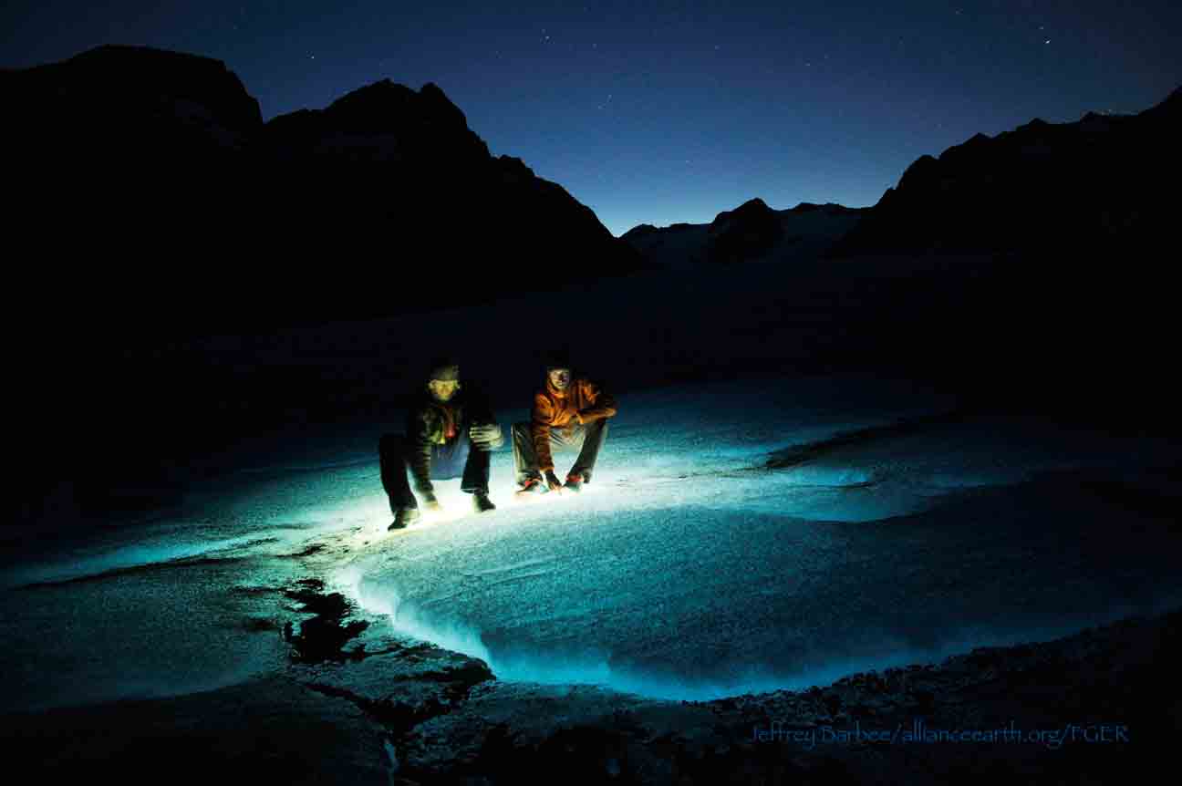
Here, the students and staff put on helmets and harnesses and tied into the fixed ropes with a knot called a prussik. This rope system served as a back up in case there was a slip on the steep, unstable terrain.  Fixed ropes were used for the last half of the descent because the route became steeper and more exposed. Because the glacier is melting, new bedrock and rock debris is left behind. This makes finding new routes difficult and challenging in the unstable footing. After 11 very long hours, the students and staff safely and happily arrived at our camp in the Gilkey Trench during a magnificent sunset.

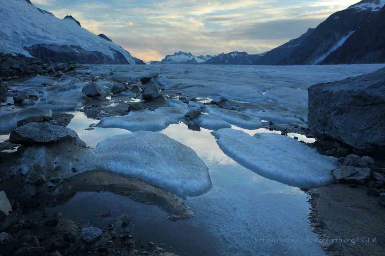
Scott McGee scouts the lowest section of the descent made of freshly exposed bedrock, and precariously deposited boulders left by the rapidly thinning Gilkey Glacier.  Photo by Jeffrey Barbee. 

The next two days were spent collecting data from the field. A brief explanation of the students’ projects in the Gilkey Trench are below:

Jamie Bradshaw - Surface Ablation of the Gilkey Glacier

For my project, I looked at the ablation, or melt rates, of the Gilkey Glacier. In May 2013, wires were steam drilled into the ice for Dr. Anthony Arendt at the University of Alaska Fairbanks (also a visiting JIRP Faculty member earlier in the summer). My task was to find these wires and measure how much wire was exposed. Luckily the sites came with known GPS coordinates and had a wire tetrahedron with bright orange flagging attached to it, so it was fairly easy to find in the rolling, mildly crevassed terrain of the Gilkey Glacier. By knowing the length of the wire exposed at the time of installation (which I will find out upon returning to civilization) and measuring the length of wire exposed in August, the ablation can be determined. This becomes important because once the area of the glacier is known, the total amount of melt water runoff from the glacier to the ocean can be calculated.

Jamie Bradshaw photo documents one of the ablation-measurement sites on Gilkely Glacier.  As the glacier surface melts, more wire (at Jamie's feet) is exposed.  Photo by Jeffrey Kavanaugh. 

William Jenkins - Ogive Survey

My research in the Gilkey Trench was focused on the ogives, also called Forbes Bands, which form at the base of the Vaughan Lewis Icefall, adjacent to Camp 18. These interesting features in the ice are annual formations that only appear beneath fast flowing icefalls. It is commonly accepted that their light and dark banding represents the variations between summer and winter ice that has made its way through the icefall in one year. Summer ice, which is subjected to wind blown particulates and increased melt, constitutes the dark bands of the ogives and forms the trough of their frozen wave-like appearance. The white winter ice is composed of that year’s snowfall, and forms the crests of the wave bulges. 

William Jenkins surveys one of the Gilkey Glacier ogives with GPS.  "The Cleaver" is the ridge of rock in the background, with the Vaughan Lewis Icefall on the right.  Photo by Jamie Bradshaw. 

The purpose of my study was to determine how fast this area of the Gilkey Glacier was thinning in comparison to previous years. In order to determine this rate, I conducted a longitudinal GPS survey, with the help of Scott McGee, that had previously been carried out from the years 2001-2007. As a result of the glacier’s rapid thinning rate, I’ll be able to calculate its subsidence by the changes in the elevation of the survey over time. I will also compare the data I observe with the Vaughan Lewis mass-balance data that JIRP has collected over the years. This comparison will allow me to correlate the changes in annual precipitation with the transformations in the ogives wavelength and amplitude over time. The relationship between mass balance and ogive structure will shed light on the future transformations of the ogives and Vaughan-Lewis Glacier as a whole.    

Panorama of one of the ogives near the base of the Vaughan Lewis Icefall (in the background).  Photo by William Jenkins. 

Justyna Dudek - Photogrammetry

The main objective of my project was to create an up to date digital terrain model (DTM) of the Vaughan Lewis Icefall flowing down from Camp 18 into the Gilkey Trench. A digital terrain model describes the 3-dimentional position of surface points and objects, and can be used to retrieve information about geometrical properties of glaciers. In order to create the model, I decided to explore the procedures and tools available within the field of digital photogrammetry, a practical method which allows carrying out non-contact measurements of inaccessible terrain (very useful for areas such as icefalls, which for the sake of avalanches and falling seracs, might be too dangerous for exploration or measurements on their actual surface). The baseline dataset for creating the DTM of Vaughan Lewis Icefall  were recorded on the first, sunny and cloudless day of our stay in the Trench. With the guidance from Paul Illsley (present via radio from Camp 18) and help from my colleagues Jeff Barbee and Jon Doty (present on the Gilkey Trench), I set up the three profiles along which we collected the data in the form of terrestrial photogrammetric stereo pairs and ground control points (GCP). The database created by our team will be subsequently processed in order create a DTM which can constitute a reliable, starting point for further research in this area in the future.


Paul Illsley overlooks the Vaughan Lewis Icefall from a terrestrial photogrammetry station near Camp 18.  Photo by Mira Dutschke. 

Jon Doty - Nunatak Biology

My path into the trench followed a slightly different approach than the other students who reached the Gilkey Trench via the Cleaver descent.  Ben Partan – Senior Staff member in charge of camp maintenance – and I were brought down to the Gilkey via helicopter from Camp 18 to Camp 19, with a load of material to fix up the camp, which sees infrequent use. After two days repairing the roof, and siding, as well as swamping the camp interior, we descended into the trench. During our descent we made four stops at progressively lower elevations, conducting a botanical survey. At each site I recorded all plant species present, the compass orientation of the plot, elevation, and tried to keep an eye out for faunal interaction, and any other interesting features of the site. 

Ben Partan repairs the C 19 roof.  The upper Gilkey Glacier is in the background.  Photo by Jon Doty. 

As we dropped down closer to the surface of Gilkey Glacier - biodiversity plummeted. My final site featured only a single species of plant, as opposed to nearly twenty at the highest point of my survey. This loss of biodiversity can be tied to the recession of the Gilkey exposing new substrates, and the time required for mosses and lichens to reach the area and for soil to develop. Using a rough dating technique called lichenometry, we can gain insight as to the amount of time each site has been exposed by the recession of the glacier. The lichen species Rhizocarpon geographicum grows about 1 cm for every 100 years and is very common. Its absence at the lowest two sites is therefore noticeable, and signals that these sites were only recently revealed.

My survey is paired with another conducted by Molly Blakowski on the southerly oriented C 18 nunatak. These two slopes face each other with the Gilkey separating them. We plan on comparing the results of our surveys to determine what affects the differences of aspect have on the vegetation.   It was an absolute pleasure to join back up with the group and explore the Trench, and true fun to climb up the Cleaver and reunite with the rest of the JIRPers at C 18. 

The 2013 Gilkey Trench Crew (left to right): Jeff Kavanaugh, Jeff Barbee, Justyna Dudek, Jamie Bradshaw, Adam Toolanen, Adam Taylor, Jon Doty and William Jenkins. Photo by Jeffrey Kavanaugh

In closing, on August 3rd, the Gilkey Trench Crew packed up camp and headed towards the Cleaver to ascend back to life at Camp 18. Again, we tied into fixed ropes, had a remarkably beautiful day and had a safe climb up the Cleaver. The Gilkey Trench Fieldwork Adventure had been a success and possibly, the icing on the cake for all crew members.

Additional photos from the Gilkey Trench Fieldwork Adventure.  Click on any of the images below to open a slideshow with all photos and captions:     

Connections

By Adam Taylor

Jon and Christy reflecting on the mountains as they make memories that will last a lifetime.  Photo:  Adam Taylor

Day 12 of the JIRP experience and the weather has changed quite drastically. The past few days students and staff have seen higher winds and rain which apparently is "more like Camp 17 weather".  But even with the change in weather, morale is still soaring with the eagles and yesterday we were able to dig our first snow pit.  Snow pits are a way for us to study how much mass the glacier is gaining or losing. We have also been skiing, setting up z-pulleys, and learning to safely navigate the icefield. Alongside our safety skills we've also been developing relationships.  JIRP students and staff are forming bonds not only with each other but with former and future JIRP members as well.

Adam Toolanen, Jamie Bradshaw, and Jai Beeman tying knots and friendships that if dressed properly, can last a lifetime. Photo:  Adam Taylor

JIRP students and staff will make friendships and memories that will last a lifetime. Everywhere you look at Camp 17, JIRP members are laughing and enjoying each other's company. And although most of the individuals have only known each other for a short time, they are beginning to form a family. We feel safe and comfortable with each other, which is important when traveling across the icefield. Trust will be needed during our traverse, since the time will come when your life will be put in another's hands.  

I relate the JIRP experience with my time spent in the military. Both experiences are difficult to relate to others if they haven't been participants themselves. The time spent in Camps and on different glaciers will only be shared among the few members on the icefield. When leaving, this connection stays between the students and staff. Stories will be told and memories shared with others outside, but the bonds formed will remain within the family members of JIRP.

Not only are current JIRP members creating memories with each other but they are forming bonds with former and future JIRP members as well. When blogs are posted, the experiences will be read by all; however, only fully understood by those who have experienced it before. I would hope that readers wanting the same connections would view the blogs as a motivator to attend JIRP in the future. These connections do not stop at the blog, they carry over in all aspects of life. When JIRP 2013 is written on a resume, anyone who reads it and has attended JIRP will more easily relate to the experience than those who have not been through the program. 

The memories created and time spent during the Juneau Icefield Research Program will last a lifetime. In addition to the science being done, we are gathering memories alongside data points. My feeling is that five, ten or fifteen years from now the data collected may become a bit clouded but names like Annie Cantrell, Grayson Carlile, and Brooke Stamper will hold strong. Since 1946 JIRP has been creating friendships and will continue to form them into the unforeseeable future. As Scott McGee says, "once a JIRPer, always a JIRPer". This in itself, says it all.

A JIRP trail party settles in for the night at Camp 17A over tuna-macaroni and cheese. Photo:  Adam Taylor

The Hike to C17

By Grayson Carlile, Photos by Jeff Barbee and Mira Dutschke

After almost two weeks of hot weather in the Juneau area we had an extremely rare experience for Southeast Alaska, on the long trek up to Camp 17, the trail wasn't a stream!  Our hike up to Lemon Creek Glacier was truly unique.  Most amazing was the  sunlight that filtered through the high forest canopy as we wound our way up, up, up the valley.

The trail wasn't a stream, but we still had a number of stream crossings to challenge us.  Photo:  M. Dutschke

Hiking through the dense understory of Lemon Creek Valley.  Photo:  M. Dutschke

Ascending the "vertical swamp".  Photo:  J. Barbee

The alleged "vertical swamp" that took us up past tree line, was pleasantly un swamp-like and after a muddy mosquito filled trip through southeast Alaska's temperate rain forest we were finally greeted with a refreshing drizzle of rain in the high alpine valleys. Skirting a glacial "tarn" lake, a flash of lightning and a peal of thunder caught us exposed near a ridge.  We found safe lower ground and waited out the worst of the danger before heading up towards Camp 17 once again.

Hiking in the alpine after ascending from Lemon Creek Valley.  Photo:  J. Barbee

Ascending to the low pass that leads into Ptarmigan Valley.  Photo:  J. Barbee

Descending into Ptarmigan Valley.  Photo:  J. Barbee

Climbing the upper Ptarmigan Glacier near camp, the most amazing thing of all were the cloud-free views of Juneau's Auke Bay, the fjords of the inside passage, and the jagged ridge lines that mark the far western edge of the Juneau Icefield.  While it was a tiring 14 hour day, we could not have asked for a more amazing introduction to our first research camp.

Beginning the climb up Ptarmigan Glacier to camp.  Photo:  J. Barbee

The fantastic view from Camp 17 across the upper Lemon Creek Glacier.  Observation Peak is on the right.  Photo:  J. Barbee