"Snake Linda": The Field Science of Drone Photogrammetry

Kenzie McAdams

Purdue University

A new morning was upon us, and the familiar misty cloud that lives over Camp 17 greeted us and the new day. After a delicious breakfast of spacon (spam bacon) and oatmeal, we learned of our upcoming “Plan of the Day”. With safety training winding down and afternoons starting to become free for academics and field science, we were all given the choice of a variety of different opportunities to take part in for the day.

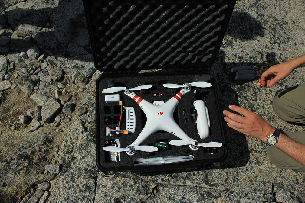
We started our day in the library, with a lecture by academic director Matt Beedle that introduced us to photogrammetry. Photogrammetry. The term was familiar, but I really had no firm grasp on what it meant. Matt described photogrammetry as “the science or art of making reliable measurements using photography”. During lecture, we explored the two types of photogrammetry: terrestrial (on land) and aerial (from the air). The focus of this lecture was on exploring and using Structure-from-Motion (SfM) Photogrammetry. SfM is a low-cost and effective tool that we utilized to obtain high-resolution datasets. The SfM method relies on multiple overlapping images that photogrammetric software uses to match points taken from the same feature in each image. With that in mind, Matt prompted us to think of some difficulties we may have with using this method on the icefield. One of the primary issues we would face in our attempts to image the icefield would be the lack of these identifiable features on the surface, due to it being a vast white expanse. Nearby Lake Linda, on the other hand, would pose as the perfect target for our experiment. The lake is a meltwater feature that drains subglacially down the Lemon Creek Glacier into the Lemon Creek valley. Due to its identifiable ridgelines and rock surfaces, it includes many reference points for the SfM software to do its analysis. Moreover, it is an ideal location to use aerial photogrammetry to model the elevation of the lake basin because it is not an easy task to obtain these measurements terrestrially.

Team Drone in front of Lake Linda on the Lemon Creek Glacier. From left to right: Uwe Hoffman, Chris Miele, Matt Beedle, Deirdre Collins, Kenzie McAdams, Cézy Semnacher, Louise Borthwick, Alex Burkhardt, Lucas Beem. (Photo credit: Matt Beedle)

Team Drone in front of Lake Linda on the Lemon Creek Glacier. From left to right: Uwe Hoffman, Chris Miele, Matt Beedle, Deirdre Collins, Kenzie McAdams, Cézy Semnacher, Louise Borthwick, Alex Burkhardt, Lucas Beem. (Photo credit: Matt Beedle)

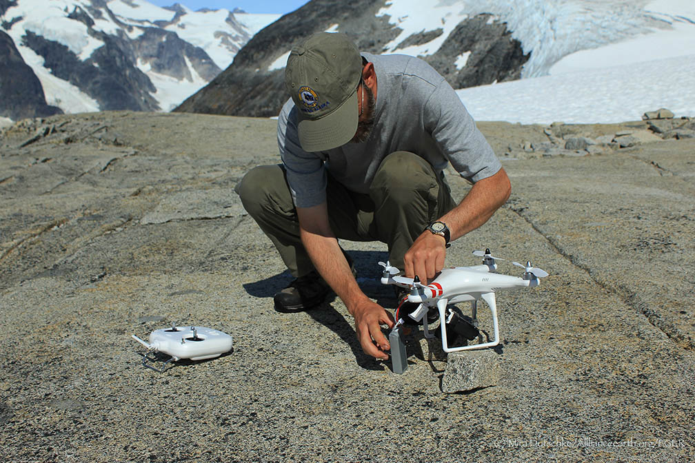
After a discussion on the pros and cons of drone flight path design, our initial task was to create two flight paths. During this discussion we chatted of techniques related to camera angle, area coverage, and possible difficulties with the surrounding topography. We students collaborated to design two paths: one that flew in a spiral pattern radially outward, with the camera facing at a 45-degree angle, and the other in a snake-like pattern with the camera facing straight downward. We had to think carefully about our camera angle choices, because if the angle of the camera were at the same angle as the slope of a feature, the image would not capture it. Student Alex Burkhart explains that by creating the spiral pattern, the 45-degree camera angle would continuously capture the rim of the lake as well as always capturing a portion of the concave basin. I helped to design the snake pattern, with the intention that by having the flight zig-zag over the surface with the angle facing straight downward, we would cover the most area and have the smallest chance at missing any features.  After we had our paths set, we journeyed out on our skis towards Lake Linda.

A screenshot of the 3D image of Lake Linda with the “Snake Linda” flight path photo positions marked as blue squares. (Photo credit: Matt Beedle)

A screenshot of the 3D image of Lake Linda with the “Snake Linda” flight path photo positions marked as blue squares. (Photo credit: Matt Beedle)

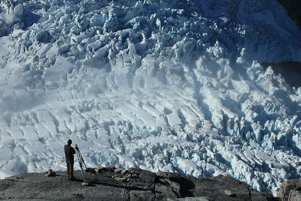
Once in the field, our first priority was placing Ground Control Points (GCPs) around the rim of the lake. These GCPs served as exact locations for JIRP faculty surveyor, Uwe Hoffman, to collect GPS coordinates. With these GCPs geo-referenced, we can later locate our whole model in space. We wanted to space the GCPs consistently around the rim of the lake, so we decided to make the hike up and around the large moraine on the back side. The hike consisted of a side-hill ski up to a small ledge where we removed our skis from our feet and continued to bootpack up the ridge. In order to test the different methods of photogrammetry, students Auri Clark and Cézy Semnacher took photos terrestrially along the hike using their iphones.

Kenzie McAdams preparing to position a GCP. (Photo credit: Cezy Semnacher)

Kenzie McAdams preparing to position a GCP. (Photo credit: Cezy Semnacher)

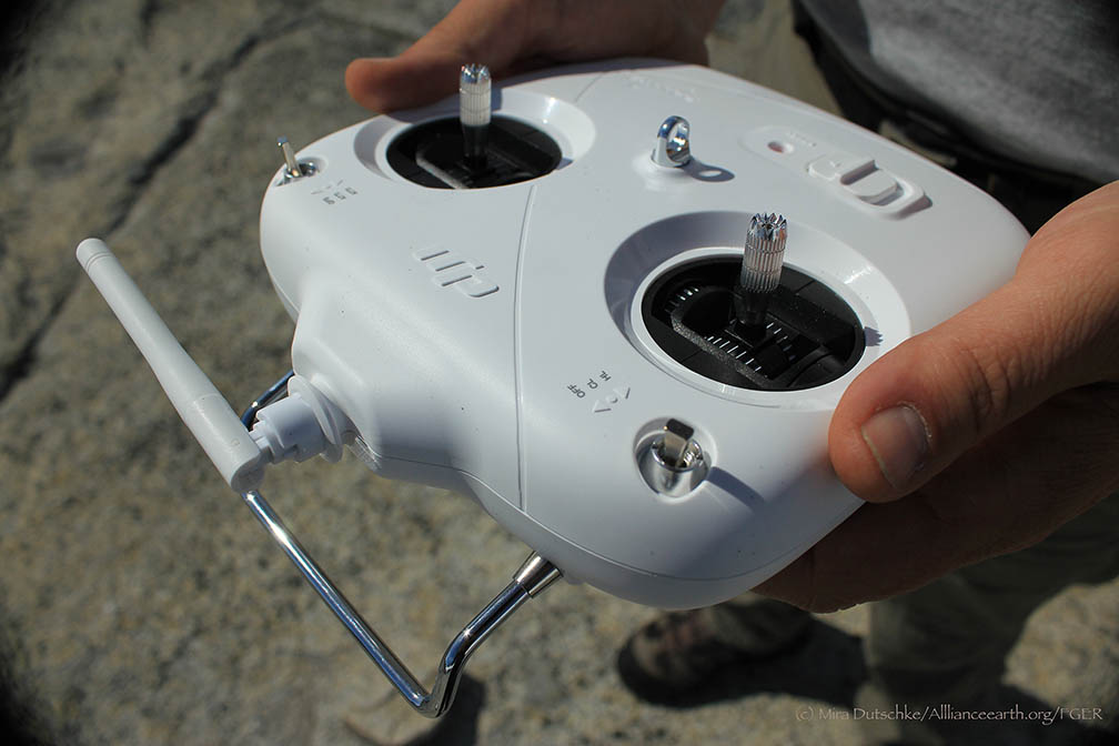
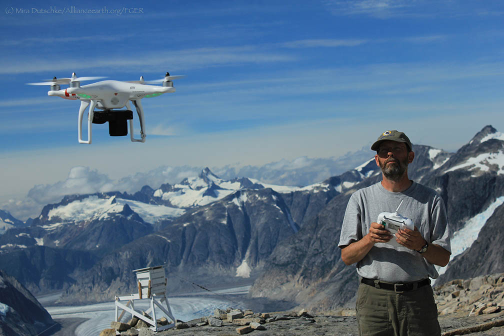
After placing all of our GCPs, we started our drone flights. During Spiral Linda, everything was going as planned until we noticed the drone getting pretty close to the rocks. As it flew closer, we could start to hear the concern in Matt's voice: “Is the drone going to hit the cliff? Is it worth continuing the flight?” After some speculation, Matt made the final decision to abort the mission. For our second flight, “Snake Linda”, we changed the flight elevation of each point to ~40m higher than previously done. We started our flight, everything going as planned, until we noticed an unexpected visitor: above the ridge we could see an eagle flying curiously around Lake Linda. Now we were not only on patrol to make sure the drone didn’t crash into the rocks, but also to keep an eye out for an airborne eagle attack. We suddenly noticed the drone once again flying precariously close to the rocks: How could this be? We had just updated all of the settings to make sure our flight ran smoothly. We re-checked the flight path, and then realized our mistake: we had neglected to adjust one point by 40 m. To prevent disaster, Matt took over manual control of the drone. All in all, after a few close calls with the rocks and one pesky eagle, we had collected our field data.

Once back at Camp-17, Matt uploaded our data into a program called Photoscan.  Photoscan generates a point cloud, which creates a 3-D surface that produces a model from all of the aerial photos taken in the field. We can use this 3-D model of Lake Linda to visualize and obtain surface elevation measurements. Unfortunately, the images from Spiral Linda weren’t recorded by the drone, so we only created a model using the Snake Linda flight. If we were to do this field experiment again, we would try to recreate the Spiral Linda flight so we could compare it to our current model. We can continue to use this technique in the future to observe the surface elevation changes over time of our favorite meltwater lake, Lake Linda.

A screenshot of the final 3D image of Lake Linda in Photoscan. (Photo credit: Matt Beedle)

A screenshot of the final 3D image of Lake Linda in Photoscan. (Photo credit: Matt Beedle)

Juneau Ice Field - 1965: The Science Experience to Last a Lifetime

By Thomas A. Herbert, Ph.D., P.G.

The Story:

This is a field science story of learning to work with a small team of individuals on projects that have merit and impact. This story is told looking back through the telescope after 49 years of other professional experiences with the intent of stressing the value of that first summer in 1965.

Background:

I am a geologist and was destined to be a geologist. My father, grandfather, and great grandfather were mining engineers so my post natal education began with discussions on rocks, oil fields, ores, and coal mines from my first recollections. I was born and grew up in Rock Island, Illinois, living on the Rock River so in retrospect I could have picked a geology career track in any subcategory from petrology to geomorphology.

I was fortunate to be offered a full scholarship for track at Michigan State University (MSU) in 1962 and went off to throw the discus and shot. We won several Big Ten championships when I was an undergraduate. The coaches all wanted me to take the jock courses to keep my grades up to give me time to train. My first quarter in 1962 had me in a really dumb jock course so I started to look for courses that would be interesting. I landed in Physical Geology 201 in the winter quarter of 1963 and did well. Spring quarter of 1964 had me in Geomorphology 303 with Dr. Maynard M. Miller. I was hooked on the science and on Dr. Miller’s engaging academic style and stories of doing science on Mount Everest. I declared a major in geology and began assembling knowledge in an organized fashion.

In March 1964 the Good Friday Earthquake hit Alaska and Dr. Miller packed his several Nikon F cameras, his red Eddie Bauer parka, Lowa boots and headed to the action for an expedition to evaluate damage and changes to the coastal glaciers. By fall quarter he was back in East Lansing with many slide trays depicting coastal glaciers laden with land slide debris and discussing incipient kinematic waves. I was enrolled in his Glacial Geology 412 class and it was all action science with new information from Alaska.

My big day was when Dr. Miller asked if I wanted to go for the 1965 field season on the Juneau Ice Field as a National Science Foundation undergraduate research participant. There was no question that I wanted to go and my father jumped in with his checkbook to cover all the purchases from Eddie Bauer and REI. An interesting side note is that my REI number in 1965 was only five digits long meaning I was buying gear from the beginning of that greatly successful recreational equipment company.

Field camp is required for geology students between junior and senior year in most programs. I petitioned the MSU Geology Department to accept the Summer JIRP work for my field camp requirement and was approved with the caveat that I would need to write several papers as directed independent study (DIS) for the 12 credits I would take. I was encouraged by the department chairman to engage in as many diverse tasks as possible to give me a broad field experience (Duh, how could that not happen on the Ice Field?). In retrospect it was sort of like a “self-directed” field camp. Dad got me up to Alaska early in June by plane and I stayed late that summer since MSU didn’t start fall quarter until the third week of September. Several of the MSU JIRP team drove the Alaska Highway in the 1963 VW bus that was early JIRP transportation. I got to Juneau early, stayed late, and was able to do some extra tasks.

Before the science adventure started the MSU Track Team won the Big Ten championship on May 26 and I did well in the discus setting the MSU record. I learned later from Barry Prather that Dr. Miller really wanted me for my lifting and toting abilities to schlep equipment. Barry had worked in a toting role for Dr. Miller on both the Everest (1963) and Mount Kennedy (1965) Expeditions and I think the muscular athlete roll worked well for Dr. Miller’s plans. Barry was a Dartmouth footballer who later was my office mate in grad school at MSU. I was awed by his record of climbing to 28,000’+ on Everest staging gear for the ascent team.

The Gear:

I admit to being a gear nut. My family and colleagues know that I stand ready to give a full discourse on the merits of field equipment. This character flaw has its root in the preparation for JIRP in 1965. There have been many improvements in clothing, foot gear, packs and rainwear. But the most important and symbolic gear item is the hat (Figure 1).

Figure 1: Gurka hat in place ready for the adventure to start

Figure 1: Gurka hat in place ready for the adventure to start

Hat selection – I picked a Gurka bush hat with wide brim to keep off the sun at altitude and the occasional rain. In my professional geology career the bush hat has been retired to the field gear box and replaced by several Tilley hats. My pick for the Alaska summer season would be a narrow brim Tilley.

Camera – I went off with a 35 mm Minolta rangefinder and about 30 rolls of film and mailers to send the exposed rolls off for processing. I bought additional rolls and shot about 1600 slides of which about 600 have been scanned at this writing. As a side note more than 500 nearly identical photos of the Taku Towers have been tossed.

At Dr. Miller’s suggestion and later in 1966, I purchased a Nikon F and a couple lenses. That camera is still in the case along with a Nikon F3, 8008, underwater Nikon and presently about five Nikon digital cameras. My pick for a summer field season would be a small pocket digital with 20 megapixels and a cheaper backup camera with batteries. Small is good for field cameras and backups are handy. Digital video is a good backup too. Also, you can record field observations on the audio track of the video… just in case you forget your field notebook. As Dr. Miller told me early on, a durable and high end camera is your best choice for field work. I definitely concur. All these cameras have been used for my work recording tens of thousands of frames. What we do as geologists is observe and record and explain what we have seen to others.

Foot gear – I had two pairs of Danner leather boots that I coated in layers of Snow Seal. Bad choice on boots, because after I stepped off the Hiller 12E at Camp 10 on June 21 into deep, wet snow I had wet feet for the rest of the summer. See Figure 1 for un-soaked boots.  I screwed up on socks too with cotton. Every night was a process of socks drying in the foot of the Bauer bag. Every boot company now has sealed and water proof boots and wicking socks of wonderful fibers so that won’t be a problem for future JIPRers.

Pack – I got the biggest oversized Kelty frame, frame extension and bag that was made then. I had six extra side pockets and two big back pockets sewn on. That pack worked for soft good and loose gear and the frame took a Blazo box of two 5 gallon gas tins for many trips up to Camp 10. We lugged full-sized wet cell car batteries around on the frame for the photogrammetry work too. Other than having battery acid eat up my pants, I never had a problem with the pack frame or bag. There are many designs today and most will work but big volume is better. After I finished my Ph.D. in 1973 at MSU I gave Dr. Miller the Kelty for his gear and I know he used it for years.

Parka – I had the Everest down Eddie Bauer Karakorum in red, the standard field jacket of the day. That type of down jacket is great if you are standing around watching drilling rigs in the winter at -5 which I did later in northern Michigan. For the Icefield, however, layers of Polartec or equivalent would be better since the temperature range is wide and in the summer 35 degrees is about as low as it went. You can regulate heat/cold better with Polartec type materials and it performs when wet. Dr. Miller was the recipient of the parka and in size XL he had plenty of room for layers.

Sleeping gear – I had the extra-long extra-large Karakorum bag that worked great particularly at Camp 8. I had a closed cell foam, three quarter length pad and a rubber sheet. We were sleeping on snow for the 10 days at the Ice Fall and the pad worked great until I rolled off. Dr. Miller also got the mummy bag when I moved to Florida in 1973. Joan chided me on that gifting because the bag had never been cleaned from 1965-1973 so it still had some Icefield grunge on it.

Ice axe – Bought from REI and gifted to Bill Isherwood for his trip to the South Pole in 1966. I have a picture of the ice axe (living vicariously through an ice axe!!!!) at the pole.

Crampons – 12 point deluxe models from REI and also went to the South Pole with Isherwood.

Binoculars – I bought a 7x35 pair just in case I might need them. They were bulky and took up pack space but they were invaluable in the surveying work picking up control stations and flagging across the ice. Dr. Adam Chrzanowski took over the binoculars for his survey spotting. They now reside in my gear bag for the shooting range.

Dr. Adam Chrzanowski at Mendenhall control point … note my binocular case around his neck.

Dr. Adam Chrzanowski at Mendenhall control point … note my binocular case around his neck.

Knife – I had a Swiss Army knife with a bunch of blades, tooth pick and tweezers. The knife is still in my field kit but the can opener is worn out. Swiss knives are always a good choice.

Pants – I had cotton rip stop military surplus cargo pants in 1965. Now I wear Tactical 911 rip stop synthetic fabric cargo pants and they are the best choice. I would wear them in AK.

Shirts – I wore MSU cotton athletic tees until they were totally grubby. I recommend Under Armor of several weights to layer up if needed. The fabric wicks and packs small.

GPS – No such luck in 1965 but today one is handy with extra batteries. The cheap ones seem to be as accurate for field work as the expensive survey quality gear. Don’t leave home without one.

Summer Activities Schedule 1965:

Scoping the Project Area:

I arrived in Juneau on June 12, 1965, and soon met up with Chris Egan (then a MSU doctoral student with two ice field summers under his belt) and we began limited exploring of Juneau and the Mendenhall terminus on foot. We used the UAK Marine Lab as a base and temporary bunk room. We chartered a Cessna from Kenny Loken at Channel Flying Service (Dad came through with some extra cash for the flight) and did a flying recon of the entire area in a Cessna 185 float plane before we went in the field. This flight was a great synoptic view of the project area. Now we have Google Earth and other imagery to give us scientists the big picture but then it was topo maps and 9x9 B&W aerials. We flew south over Taku Lodge and up the Taku Glacier to C10 and C8 and over towards Atlin and then back over the Vaughn Lewis Icefall, down the Gilkey following the medial moraines down glacier back to tidewater and back to Juneau. I shot about 10 of my 30 rolls of film on that flight.

Chris Egan exploring Mendenhall terminus June 16, 1965

Chris Egan exploring Mendenhall terminus June 16, 1965

Preparing Camp 10:

We reported to Livingston Helicopters early on June 21 and loaded our gear on the floats of a Hiller 12E (Figure 1). Nancy Livingston was the pilot for this my first helicopter flight. Nancy was about 45 years old then, tall and really strong. Her flight experience made me feel very safe. Not only did she have thousands of hours in helicopters but Nancy had been a ferry pilot in WWII flying P-47s and P51s and about 50 other aircraft around England.

Dick Shaw, Chris Egan and I flew into Camp 10 to find about 8-10 feet of wet snow covering the rocks with the cook shack, generator shack and the teaching building pretty much buried. We had to dig down to get into the doors. There was a snowmobile garage that had been built late in 1964 that was unfinished and not structurally sound for snow loads. We had to dig out the snow machines from a collapsed structure then get everything running.

Arriving Camp 10 June 22, 1965

Arriving Camp 10 June 22, 1965

 The weather for the next 12 days was sunshine and hot and the snow was melting at a rate of feet per day. By the time the full team arrived on July 3 the nunatak was snow free around the camp. We began recording met data beginning on the 20th and recorded some glorious days.

Chris Egan at the met shelter, 10 PM, June 26, 1965

Chris Egan at the met shelter, 10 PM, June 26, 1965

On July 3, the Alaska Air Guard C-123J landed a mile or so out on the Taku snow pack on ski wheels. Personnel and gear was off loaded. I was the lone passenger for the flight back to Juneau that day and it was an “interesting flight.” The C-123J was about four miles above the neve line and General William Elmore, USAF (pilot and commanding general of the AK Air Guard) decided to take off down glacier (and downwind with katabatic tail wind at about 10-15 mph). The wet snow landing and taxiing had packed the ski wheels with extra weight. The two radial engines were run up as we started down glacier; the two jet engines on the wing tips were started for extra power. We ran for several miles and could not get takeoff speed to lift off, all the time we were bumping and slewing over the sun cupped surface. I was belting in next to the crew chief in the cargo bay. After a couple minutes when I’m sure General Elmore and his copilot Col. McKee, USAF, could see the crevasses in the distance he alerted the crew chief to the next move. The chief, T/Sgt. Wm. Christy USAF, yelled at me over the din something like … “son, tighten up you seat belt and hang on for a ride”. General Elmore engaged the JATO unit that rocket launched us up to several hundred feet above the snow. Now we were in the air in an empty plane with plenty of power to fly. The next problem was that the ski wheels would not retract since the three miles of takeoff run had packed the wheel wells with more snow. We flew to Juneau airport with the ski wheels down with the General cycling the gear to dislodge the snow. We circled Juneau for about an hour while the General continued to clear the ski wheels. He was able to get the wheels partially deployed but the huge skis (I estimate at 5’ by 18’ aluminum panels) would not fully retract so the skis and wheels were both down for the landing and everything was packed with snow. I bet this type of landing was not in the C-123J operating manual before this incident. Again the crew chief told me to hold on and we landed with some minor sounds of metal scraping. The loading ramp was dropped and I kissed the ground and marched off to a new task. We had landed with the crash trucks deployed; scraping the aluminum skis but all went well.

Alaska Air Guard C-123J on the Taku Plateau; July 3, 1965

Alaska Air Guard C-123J on the Taku Plateau; July 3, 1965

Loading for Juneau return: Left to Right: Dick Shaw, Barry Prather, Scott Hulse, Dennis Cowals and Bonito Colqui (orange hat)

Loading for Juneau return: Left to Right: Dick Shaw, Barry Prather, Scott Hulse, Dennis Cowals and Bonito Colqui (orange hat)

Terrestrial Photogrammetry:

My next adventure job was to be the chief gear schlepper and toter for three professors from the University of New Brunswick (UNB) Surveying Engineering Department. I had taken Dr. Miller’s photogrammetry and geology course and was very interested in that topic. I had about 14 days of intense and extremely “hands on” work with these fellows. I have used that knowledge nearly every day for the past 48 years of my geology career.

The UNB team included Dr. Godfried Konecny, Professor Gerhardt Gloss, and Dr. Adam Chrzanowski. Their project was to obtain terrestrial photo images for plotting of the ice surface near the terminus of the Mendenhall, Taku and Norris glaciers. To accomplish this we had to establish geospatial positions for known points on the peaks overlooking each terminus and ground control points. This was “back in the day” when we had distance and angles to establish control points and image stations.

The images were stereo pairs on glass photographic plates from a base line established on the mountain side. The base line was several hundred meters long with an image at each end. The plates were exposed and later taken back to UNB for stereo plotting of the contours. The scientific carry forward is that the 1965 JIRP ice volume studies were the starting point accurately tracking ice volume changes in the system as early documented data for climate studies.

The Mendenhall work started with a set up over the geodetic monument at the Juneau Airport which had a clear view direct line to the top of Mt. McGinnis. We set up a Tellurometer Micro Distancer M/RA1 (made in South Africa) which we used to measure distance. The instrument had been on the market for about two years so we were “cutting edge.” The instrument used phase shifts in the modulation of micro waves. This was a new science toy in 1965 that Dr. Konecny was eager to use. We measured the distance to a monument on Mt. McGinnis that I constructed with a clear view down to the ice. I drove a steel pin and later built a rock cairn over it.  We used a Wild T-2 to measure angles from the airport and swung to the other end of the stereo baseline. Then a Wild P-30 photo theodolite was set up on the mountain side at each end of the base centered over the control points to take the images. The logistics for this work was the 12E with Arlo Livingston flying. We also had a second vantage point from the cirque bowl (ski bowl) on the south side and established a second base line and took photos. All of the points were established with steel pins I drove in the rock and then built about 4-foot high cairns over them. We had great weather and this Mendenhall work took about five days.

Dr. Konecny and myself (in the hat) using the Tellurometer to tie back to the Juneau Airport geodetic monument

Dr. Konecny and myself (in the hat) using the Tellurometer to tie back to the Juneau Airport geodetic monument

The Taku and Norris work was conducted from a base camp at Taku Lodge where we stayed for several days. There was a geodetic monument near the lodge that we set up on with the Tellurometer and the T-2 and took control up to the peaks south of the channel and looking at both ice fronts. Arlo flew in to assist with some ground control work on the outwash in front of the ice where we had other monuments and good shots back to the peaks to the south. These were some long legs in the survey net where we had distance shots of 5-10 miles.

Dr. Konecny set up on peak above Taku Lodge to cover Taku/Norris terminus


Dr. Konecny set up on peak above Taku Lodge to cover Taku/Norris terminus

There were two notable experiences in Juneau for the few days we were billeting there for the photogrammetry work. First off was a note to me later in 1965 from Joan after the bills were paid for the summer. We had been eating at a restaurant around the corner from the Red Dog every morning and sometimes in the evening. Joan noted that I ate some expensive meals. I was just a growing boy on expense account!

The second experience came at a quiet little bar across the street from the Red Dog. I had turned 21 several months before so I went in for a beer one evening. I was nursing my one beer at the bar when two fellows in more formal dress than my field gear came in and sat down next to me and struck up a conversation. Being the naïve youngster I asked the gentlemen next to me “and what do you do?”  He replied, I’m the governor and this is my assistant and we come here for a drink after work. It was William Egan who was a friend of Dr. Miller who had requested Mal’s help on the damage assessments following the 1964 quake. Governor Egan later was a significant political player in national politics and was a key player in getting the Alaska North Slope oil resources developed.  

Seismographic Studies Below Camp 10:

I finished the work with the UNB team on July 16, 1965, and flew with Arlo in the 12E from Taku Lodge to Camp 10 just skimming the crevasses on the flight. The altitude change is about 5,000 feet over that distance and Arlo was climbing all the way. At one point he turned to me and asked how much I weighed because the Lycoming engine was starting to heat up. I told him about 260. He figured with all the supplies and my gear and weight we were probably a bit overloaded for the flight.

Upon arrival I was assigned to packing duties toting gas cans and lumber up the hill to the camp. I learned that toting heavy loads at even 5,500 feet can be hard. I came in a distant third to Scott Hulse and Richard Carlson. I was the bulky strong body type and they both were lean, mean and great climbers.

I was assigned to assist Dr. Tom Poulter, Director Emeritus of Stanford Research Institute, in conducting seismic traverses of the area of the Taku near Camp 10. We were using the Poulter Method of shooting that he had developed for reflection shooting in the Antarctic in the 1930s and 1940s. The energy sources were small portions of stick dynamite on a stainless steel pole detonated to create an air burst. Poulter would cut the sticks of dynamite with his pocket knife and affix with cap with early duct tape to the pole. The twelve or so recording geophones were placed in a line and detonated. Poulter lectured on explosives, safety, handling and the theory of seismic wave propagation. When we ran low on explosives Kenny Loken airdropped several cases of dynamite and another of detonating caps. This was an air drop where the packages were pushed to the door to free fall to the snow.

Dr. Tom Poulter (right) checking the seismic record on the Taku plateau; Barry Prather in sunglasses is also reading the printout; Poulter seismic shooting pole next to him

Dr. Tom Poulter (right) checking the seismic record on the Taku plateau; Barry Prather in sunglasses is also reading the printout; Poulter seismic shooting pole next to him

I had several life experiences with Dr. Poulter that I can relate. He was a large man at about 6’4” and 240 pounds and he was 68 at the time he was very fit. I use him as my model for fitness today since I am 71 now myself. One evening sitting at Camp 10 near the met station I had an hour one-on-one discussion with him in his mentoring role. I asked the naïve question of him … “what did you do during WWII?” He responded that his role had been classified work at Los Alamos and that he had designed the shape charges of conventional explosive to detonate the first atomic bomb. The task was to create the spherical charge to force the critical mass together. He explained that the timing through the electrical circuit was the secret to success. His solution was very practical … trial and error cutting the silver not copper wire with electrician’s pliers until it worked.  

I have assisted oil companies with seismic projects for the past 40 years. The Poulter Method is still used in various situations around the world where shot hole drilling is difficult. I even had an oil company geophysicist ask me if I knew anything about “Pouter Shooting” wherein I proudly reported that I had learned seismic prospecting from the man himself on the Ice Field.

Camp 8:

I finished seismic work in late July and one evening headed to Camp 8. We arrived after midnight and crossed the bergschrund on the snow bridge and on to the bedrock. The next morning our trail had collapsed into the “schrund.”

My Camp 8 stay was for about a week and I made some lasting friends. Dick Shaw from MSU was there and he later was an office mate in grad school. Dick spent decades with Exxon and now is a consultant in Denver. We crossed paths about a year ago in a professional capacity on oil field development. Bill Patzert was at Purdue and headed for University of Hawaii; he later became a guru on ocean dynamics at Scripps and is now with JPL. Bill Isherwood of Antarctic fame was there along with Dennis Cowles, Chris Egan and Scott Hulse. Ty Kittridge went back in the Army Special Forces in Vietnam where he was a true silver star hero.

My most notable feat at Camp 8 was eating a case of 24 chocolate Mountain bars in two days. Then we moved to the Ice Fall for several days.

Camp 8 July 25, 1965; the team lounging include Scott Hulse and Bill Patzert (sunbathing on the roof), Bill Isherwood (back to camera with pack), Chris Egan (red shirt seated behind solarimeter) Ty Kittridge (seated on rock with his Bull Mastiff “Si…

Camp 8 July 25, 1965; the team lounging include Scott Hulse and Bill Patzert (sunbathing on the roof), Bill Isherwood (back to camera with pack), Chris Egan (red shirt seated behind solarimeter) Ty Kittridge (seated on rock with his Bull Mastiff “Siggy”) and Dennis Cowels (red socks)

Vaughn Lewis Ice Fall:

We traveled to the Ice Fall late one evening and stayed in the army squad tent on the outcrop at the top of the Ice Fall. The group included Bill Isherwood, Bill Patzert, Ty Kittridge and his dog Siggy and myself. We climbed down the snow and rock and camped on one of the wave ogives. We spent three days conducting masters thesis research on movement rates for Ty. We did a lot of walking and climbing. Siggy the Bull Mastiff at 160 pounds was eating more canned stew and hash than the entire human group so we had to climb out to resupply.

Camping on the wave ogives on the Gilkey Glacier July 29, 1965; Bill Patzert checking the tent, Siggy looking for food, Bill Isherwood checking seismic geophones, and Ty Kittridge smoking his last Picayune cigarette.

Camping on the wave ogives on the Gilkey Glacier July 29, 1965; Bill Patzert checking the tent, Siggy looking for food, Bill Isherwood checking seismic geophones, and Ty Kittridge smoking his last Picayune cigarette.

Back to Civilization:

Once back to the ice plateau we motored back to Camp 10 where several of us had the task of securing the buildings for winter and heavy snow. We drained fuel from the snowmobiles and generator and picked up loose gear and trash. We burned the trash with the aid of some extra generator gas. As I recall, in 1965 the main body of the summer team marched down the Taku to tidewater and in later years I think the team marches down to Atlin. I had neither option since I had been on the cleanup crew. We flew out with Arlo Livingston back to Douglas Island and his aerodrome.

Back to school August 15, 1965

Back to school August 15, 1965

Then ‘til Now ... the Next 50 Years:

There is not a single day that I do not think about the Ice Field and the guys I was with that summer. There were no females back in the day. I finished BS in record time before my sports eligibility was completed so I was a scholar-athlete in 1966. I worked for five years drilling holes for the Michigan Highway Department and sorting/identifying rocks for concrete aggregate and went to school full time. The MS was finished in 1968 and I switched to the College of Agriculture and Natural Resources in 1969 for a PhD in Resource Development that was finished in 1973. The doctoral work focused on law, public policy and geologic processes. Dr. Miller was on my committee and greatly assisted in defense and editing in his usual giving manner. I moved to Florida and worked five years for the Florida Legislature on natural resource issues as a staff director and science adviser where I learned how scientists and politicians interact. During that time Dr. Miller moved to Idaho and was involved as the State Geologist in phosphate mining there. I had just helped pass comprehensive mine reclamation legislation in 1975,  for Florida’s phosphate industry and I was able to help Mal with background information.  Since 1978, my spouse, Dr. Linda Lampl, and I have been in the consulting business covering a host of topics in the sciences. See more at www.lampl-herbert.com. For more than 25 years I have helped the Florida State University geology program in an adjunct professor role. If anyone needs an interesting graduate program the newly assembled Department of Earth, Oceans and Atmospheric Sciences is a wonderful place to learn about the planet.

And, to the chagrin of my old friends and associates, most of my good stories start with the glaciers moving down the mountain.

Be safe!

 Editor's Note: Are you a former JIRPer with stories or photos to share? Please be in touch by email if you would like to help us tell the JIRP story: fger.jirp@gmail.com


Patterns of the Planet: A Conversation with Paul Illsley

An Interview by Jai Chowdhry Beeman

Paul Illsley is a cartographer at the Centre of Geographic Sciences in Nova Scotia, Canada. He joins  the JIRP 2013 program as a visiting faculty member for several weeks. In addition to delivering captivating  lectures on aerial surveying, he has been using a quadcopter to take aerial surveys for student projects.

Paul Illsley at the controls of his quadcopter at Camp 18.  Photo by Mira Dutschke. 

High-resolution aerial photography is essential to the geosciences. In particular, aerial photography allows for the creation of much higher-resolution surface images of glaciers than are available from satellites. I spoke with Paul Illsley on the Juneau Icefield above the Gilkey Trench about aerial surveying.

JCB: What sparked your interest in aerial photography?

PI: My background is in research photography—close-up work in the natural sciences. I also have a passion for flying. I realized that I could combine these two by taking aerial photographs. I moved to the Centre of Geographic Sciences (COGS) to study cartography , where I studied aerial imaging. After graduation I conducted numerous mapping projects, after which I moved back to COGS.

JCB: When did you begin working with the Juneau Icefield Research Program?

PI: I first came to JIRP in 2003. Maynard Miller, the former director of the Program, needed a faculty member to help students with mapping the Icefield. He had contacted my college, and I agreed to come. I’ve been coming back in the summers since then.

At JIRP, I have been able to learn from the work of my colleagues who serve as the other instructors from the program – and also from spending time with students and working on imagery for student projects.

I also work with satellite imagery to study changes in the positions of the termini of six glaciers on the Icefield. We have tracked the Llewellyn, Taku, Mendenhall, Hole-In-Wall, Norris and Herbert glaciers using images taken between 1985 and 2011. As is well known, the Taku Glacier and Hole in the Wall have continued to advance throughout this period, while the others are all clearly retreating.

JCB: What are some of the challenges of your work on the icefield?

PI: The remoteness. It is challenging and expensive to fly aircraft over the icefield. Every year, I have experimented with bringing different technology to the program to take photographs. For the first few years, I photographed with kites, and this year I began using a remote-control quad copter, which allows me to control the flight path much more easily.

Remoteness, though, comes with beauty. In 2004, for the first time, I rappelled into a crevasse close to Camp 10 on the TakuGlacier. The ice in the crevasse was deep, blue and spectacular.

JCB: Tell me about the importance of combining aerial photographic surveys and satellite imagery.

PI: Aerial photographic surveys come into play when higher-resolution images are needed. At present, the best-resolution satellite imagery is about half a meter. With aerial photographs, we can produce resolution up to 10 centimeters, allowing for much finer detail and a more accurate picture of landscape change.

Aerial surveys can also be performed on a low budget, especially using smaller-scale technology—the quad copter I am using on this trip, for example, cost around US $1200, and still provides excellent high-resolution imagery of the areas we are surveying.

JCB: What are some projects you have worked on off the icefield?

PI: During the year, I serve as a resource for students working on cartographic projects at the COGS. I’ve recently done a few other mapping projects—one in the Caribbean, on the Dutch Island of Saba, where I created a new map of the island’s hiking trails using GPS. Another project I recently worked on was a map of Sable Island National Park off the coast of Nova Scotia.

I approach each project differently, depending on the resources available and the landscape at hand. I recently worked on a project sponsored by NASA and National Geographic on the glaciers that supplied water to communities in the Peruvian Cordillera Blanca. A consortium of scientists from various disciplines—chemists, glaciologists, hydrologists and cartographers—investigated the sustainability of the community’s water resources, which rely mainly on glacial water. The water chemists, for example, took samples to investigate whether water sources would still be potable without the addition of glacial water.

I performed a photogrammetric study of the glaciers using both the visual and infrared spectra. The photographs we usually take are in the visible spectrum—that is, they record the reflections of visible light off the surfaces we see in the photograph. But by modifying the filters inside a camera, we can allow it to record the reflections of infrared waves—which creates images that are much more sensitive to the moisture content of the surface. On glaciers, this gives us a much clearer picture of the boundaries between snow, firn and ice surfaces, which can appear similar in visual spectrum photography, but are distinct in infrared images.
I photographed the same locations on the glaciers in the area from five different camera positions. Using these photos and airborne LiDAR, which provides high vertical resolution, we were able to create 3-dimensional models of the glacial surfaces. We compared this model to another we made using photographs taken in the same locations by a Peruvian Aerial Survey in the 1950’s, to get a rough idea of the rate of retreat of these glaciers. At the rate we estimated, the glacial water source in the area will only last about 30 more years.

The Peru project presented much different challenges than working on the Juneau Icefield. At JIRP, technology and replacement parts can be sent to camps on a 20-minute helicopter ride from Juneau. The nearest town to the research site was a day-long bus ride away from Lima, and the research site in the mountains was another day-long hike away from the community. The research site was at 15,000 feet above sea level, and extra equipment could only be packed in by mule. Instruments had to be lightweight and very carefully packed, and sometimes replacement parts could not be found in Peru. The altitude was also a challenge—work goes slowly and becomes taxing much more quickly at such high elevations.

JCB: What kinds of work are you engaged in at JIRP this year?

PI: I am helping JIRP  students with projects that use Geographic Information Systems (GIS) and satellite imagery, and supplying aerial imagery for geographic mapping projects at two camps. Christiane McCabe, for example, is using satellite imagery and digital elevation models to map changes in the equilibrium line altitude (ELA) of the glaciers on the Icefield over time. The equilibrium line marks the boundary between the accumulation zone of a glacier, where snow and firn dominate, and ablation (melt) zone, where ice dominates. Infrared images easily pick up on the different water content in snow, firn and ice, and I’m assisting Christiane in integrating these images with digital elevation models to find the ELA locations for multiple years.

JCB: Why cartography?

PI: I definitely have a passion for the outdoors—I really enjoy hiking and kayaking. I’m not as good of a skier—Nova Scotia is pretty flat.

An aerial photographer looks at patterns in the landscape. I was captivated by patterns of color and physical surface features— for example, I surveyed the ogives on the Gilkey Glacier,  in 2003, which are repeating arcs of ice that go downglacier, and are so out of character with the evenness you see on other parts of the Icefield. In the og  ives, you can see wave-flow, whereas above the icefall that produces them the pattern is continuous flow.

I am taking a time lapse series of the Vaughan Lewis Icefall—a tributary of the Gilkey Glacier—over seven days while I’m here. I take a photograph every five minutes, and will compile them into a movie of the downward motion of the icefall. I’ve been lucky enough to have seven days of perfect weather (Interviewer’s note: as I type this interview, it has finally started to rain.) And people who have never experienced seeing an icefall move will be able to see the patterns of the crevasses and seracs—towers of ice—flowing and crashing down the slope.

I am also captivated by the patterns formed by farmlands—the way humans use the colors of vegetation—and by the intricacies of hard-rock coastlines and beaches. But glaciers are something different entirely—large and expansive, exactly like rivers of ice.
Those who want to pursue cartography as a career path should have an interest in accuracy and precision, a desire to create information that others can understand, using color, symbols and careful thought.

Cartographers work with the psychology of maps—we use color and pattern theories to develop representations of landscapes with the user in mind. For the general public, we can use certain thicknesses of lines, text and colors…but in other contexts, we have to completely redesign maps. Some of our students have created maps for the sight-impaired, the elderly, and the blind. For the last project, they used a textured cloth to create a detailed map of a college campus. I have also been working on time-light maps, as well as maps using multiple datasets and new technologies like Google Earth. These kinds of projects are challenging and unique.

JCB: What is the future of cartography?

PI: One interesting new direction in the mapping world is public sourcing. Individuals can upload GPS data to online databases, and the entire globe is populated with people who can contribute data to make enormous datasets at an incredibly quick rate. Google Earth, for example, is an important source for advancing public interest in cartography. But cartographers have to keep in mind data integrity—where surveys by trained cartographers follow high standards of accuracy, public-sourced survey data may not maintain these high standards. Public sourcing is at a starting point—and has a lot of potential—but is still not ready to be used as a source of authoritative maps.

JCB: Any closing comments?

PI:  You never know what might happen when working on a mapping project. Sable Island, where I worked several years ago, is home to a protected herd of nearly 300 wild horses. When I arrived, I was setting up aerial photo targets on the island. The horses, of course, were curious about the new targets, and cautiously came up right beside us to see what we were doing.

I was on my hands and knees placing a target, and when I leaned back to get up, I was inches away from a huge pair of curious, gentle, brown eyes watching my actions. I remember fondly these kinds of moments.

I have been really fortunate to belong to the JIRP community—to be able to learn and help others learn in a landscape so spectacular and so wild that it never leaves you. Sometimes, in the middle of winter, the view at Camp 18 comes back to me—the incredible sight of the Vaughn Lewis Icefall and the Gilkey Trench far below. 

Gilkey Trench Fieldwork Adventure

By The Gilkey Trench Crew (Jamie Bradshaw, William Jenkins, Jon Doty, and Justyna Dudek)

While many students already started the fieldwork for their projects at Camp 10 and even Camp 18, five students have been anxiously awaiting to begin their fieldwork in the Gilkey Trench. The Gilkey Trench is the magnificent view that you see from Camp 18 where the Gilkey, Vaughan-Lewis, the Unnamed and many other glaciers connect and flow down through the steep, glacially carved, 2,000 foot deep valley. The Trench is filled with beautiful curving medial moraines and jaw dropping ogives created by ice falls. Getting to such a beautiful place is not easy and well worth a full day’s effort.

Descending "The Cleaver" - approaching the start of the series of fixed ropes - with the Gilkey Trench in the background.  Photo by Adam Toolanen

On Wednesday, July 31st, these students and four safety staff members departed Camp 18 for our camp on the bare glacier ice in the sunshine. The trick to getting to the glacier is descending what is affectionately called “The Cleaver.” The Cleaver is the 2,000 feet of bedrock that sits between Camp 18 and the glaciers below.  The descent was led by senior staffer Scott McGee, who has done the route many, many times. The first half of the route was going down steep snow slopes until we got to a vegetated area called “The Heather Camp.” This is where the fixed ropes began.

Waiting in a safe location - protected from rockfall from above - for their turn to descend the next section of fixed ropes.  Photo by Adam Toolanen. 

Here, the students and staff put on helmets and harnesses and tied into the fixed ropes with a knot called a prussik. This rope system served as a back up in case there was a slip on the steep, unstable terrain.  Fixed ropes were used for the last half of the descent because the route became steeper and more exposed. Because the glacier is melting, new bedrock and rock debris is left behind. This makes finding new routes difficult and challenging in the unstable footing. After 11 very long hours, the students and staff safely and happily arrived at our camp in the Gilkey Trench during a magnificent sunset.

Scott McGee scouts the lowest section of the descent made of freshly exposed bedrock, and precariously deposited boulders left by the rapidly thinning Gilkey Glacier.  Photo by Jeffrey Barbee. 

The next two days were spent collecting data from the field. A brief explanation of the students’ projects in the Gilkey Trench are below:

Jamie Bradshaw - Surface Ablation of the Gilkey Glacier

For my project, I looked at the ablation, or melt rates, of the Gilkey Glacier. In May 2013, wires were steam drilled into the ice for Dr. Anthony Arendt at the University of Alaska Fairbanks (also a visiting JIRP Faculty member earlier in the summer). My task was to find these wires and measure how much wire was exposed. Luckily the sites came with known GPS coordinates and had a wire tetrahedron with bright orange flagging attached to it, so it was fairly easy to find in the rolling, mildly crevassed terrain of the Gilkey Glacier. By knowing the length of the wire exposed at the time of installation (which I will find out upon returning to civilization) and measuring the length of wire exposed in August, the ablation can be determined. This becomes important because once the area of the glacier is known, the total amount of melt water runoff from the glacier to the ocean can be calculated.

Jamie Bradshaw photo documents one of the ablation-measurement sites on Gilkely Glacier.  As the glacier surface melts, more wire (at Jamie's feet) is exposed.  Photo by Jeffrey Kavanaugh. 

William Jenkins - Ogive Survey

My research in the Gilkey Trench was focused on the ogives, also called Forbes Bands, which form at the base of the Vaughan Lewis Icefall, adjacent to Camp 18. These interesting features in the ice are annual formations that only appear beneath fast flowing icefalls. It is commonly accepted that their light and dark banding represents the variations between summer and winter ice that has made its way through the icefall in one year. Summer ice, which is subjected to wind blown particulates and increased melt, constitutes the dark bands of the ogives and forms the trough of their frozen wave-like appearance. The white winter ice is composed of that year’s snowfall, and forms the crests of the wave bulges. 

William Jenkins surveys one of the Gilkey Glacier ogives with GPS.  "The Cleaver" is the ridge of rock in the background, with the Vaughan Lewis Icefall on the right.  Photo by Jamie Bradshaw. 

The purpose of my study was to determine how fast this area of the Gilkey Glacier was thinning in comparison to previous years. In order to determine this rate, I conducted a longitudinal GPS survey, with the help of Scott McGee, that had previously been carried out from the years 2001-2007. As a result of the glacier’s rapid thinning rate, I’ll be able to calculate its subsidence by the changes in the elevation of the survey over time. I will also compare the data I observe with the Vaughan Lewis mass-balance data that JIRP has collected over the years. This comparison will allow me to correlate the changes in annual precipitation with the transformations in the ogives wavelength and amplitude over time. The relationship between mass balance and ogive structure will shed light on the future transformations of the ogives and Vaughan-Lewis Glacier as a whole.    

Panorama of one of the ogives near the base of the Vaughan Lewis Icefall (in the background).  Photo by William Jenkins. 

Justyna Dudek - Photogrammetry

The main objective of my project was to create an up to date digital terrain model (DTM) of the Vaughan Lewis Icefall flowing down from Camp 18 into the Gilkey Trench. A digital terrain model describes the 3-dimentional position of surface points and objects, and can be used to retrieve information about geometrical properties of glaciers. In order to create the model, I decided to explore the procedures and tools available within the field of digital photogrammetry, a practical method which allows carrying out non-contact measurements of inaccessible terrain (very useful for areas such as icefalls, which for the sake of avalanches and falling seracs, might be too dangerous for exploration or measurements on their actual surface). The baseline dataset for creating the DTM of Vaughan Lewis Icefall  were recorded on the first, sunny and cloudless day of our stay in the Trench. With the guidance from Paul Illsley (present via radio from Camp 18) and help from my colleagues Jeff Barbee and Jon Doty (present on the Gilkey Trench), I set up the three profiles along which we collected the data in the form of terrestrial photogrammetric stereo pairs and ground control points (GCP). The database created by our team will be subsequently processed in order create a DTM which can constitute a reliable, starting point for further research in this area in the future.


Paul Illsley overlooks the Vaughan Lewis Icefall from a terrestrial photogrammetry station near Camp 18.  Photo by Mira Dutschke. 

Jon Doty - Nunatak Biology

My path into the trench followed a slightly different approach than the other students who reached the Gilkey Trench via the Cleaver descent.  Ben Partan – Senior Staff member in charge of camp maintenance – and I were brought down to the Gilkey via helicopter from Camp 18 to Camp 19, with a load of material to fix up the camp, which sees infrequent use. After two days repairing the roof, and siding, as well as swamping the camp interior, we descended into the trench. During our descent we made four stops at progressively lower elevations, conducting a botanical survey. At each site I recorded all plant species present, the compass orientation of the plot, elevation, and tried to keep an eye out for faunal interaction, and any other interesting features of the site. 

Ben Partan repairs the C 19 roof.  The upper Gilkey Glacier is in the background.  Photo by Jon Doty. 

As we dropped down closer to the surface of Gilkey Glacier - biodiversity plummeted. My final site featured only a single species of plant, as opposed to nearly twenty at the highest point of my survey. This loss of biodiversity can be tied to the recession of the Gilkey exposing new substrates, and the time required for mosses and lichens to reach the area and for soil to develop. Using a rough dating technique called lichenometry, we can gain insight as to the amount of time each site has been exposed by the recession of the glacier. The lichen species Rhizocarpon geographicum grows about 1 cm for every 100 years and is very common. Its absence at the lowest two sites is therefore noticeable, and signals that these sites were only recently revealed.

My survey is paired with another conducted by Molly Blakowski on the southerly oriented C 18 nunatak. These two slopes face each other with the Gilkey separating them. We plan on comparing the results of our surveys to determine what affects the differences of aspect have on the vegetation.   It was an absolute pleasure to join back up with the group and explore the Trench, and true fun to climb up the Cleaver and reunite with the rest of the JIRPers at C 18. 

The 2013 Gilkey Trench Crew (left to right): Jeff Kavanaugh, Jeff Barbee, Justyna Dudek, Jamie Bradshaw, Adam Toolanen, Adam Taylor, Jon Doty and William Jenkins. Photo by Jeffrey Kavanaugh

In closing, on August 3rd, the Gilkey Trench Crew packed up camp and headed towards the Cleaver to ascend back to life at Camp 18. Again, we tied into fixed ropes, had a remarkably beautiful day and had a safe climb up the Cleaver. The Gilkey Trench Fieldwork Adventure had been a success and possibly, the icing on the cake for all crew members.

Additional photos from the Gilkey Trench Fieldwork Adventure.  Click on any of the images below to open a slideshow with all photos and captions: