The Juneau Icefield: Sub-Surface Exploration

Kit Cunningham, Montana State University
Annie Zaccarin, University of California, San Diego

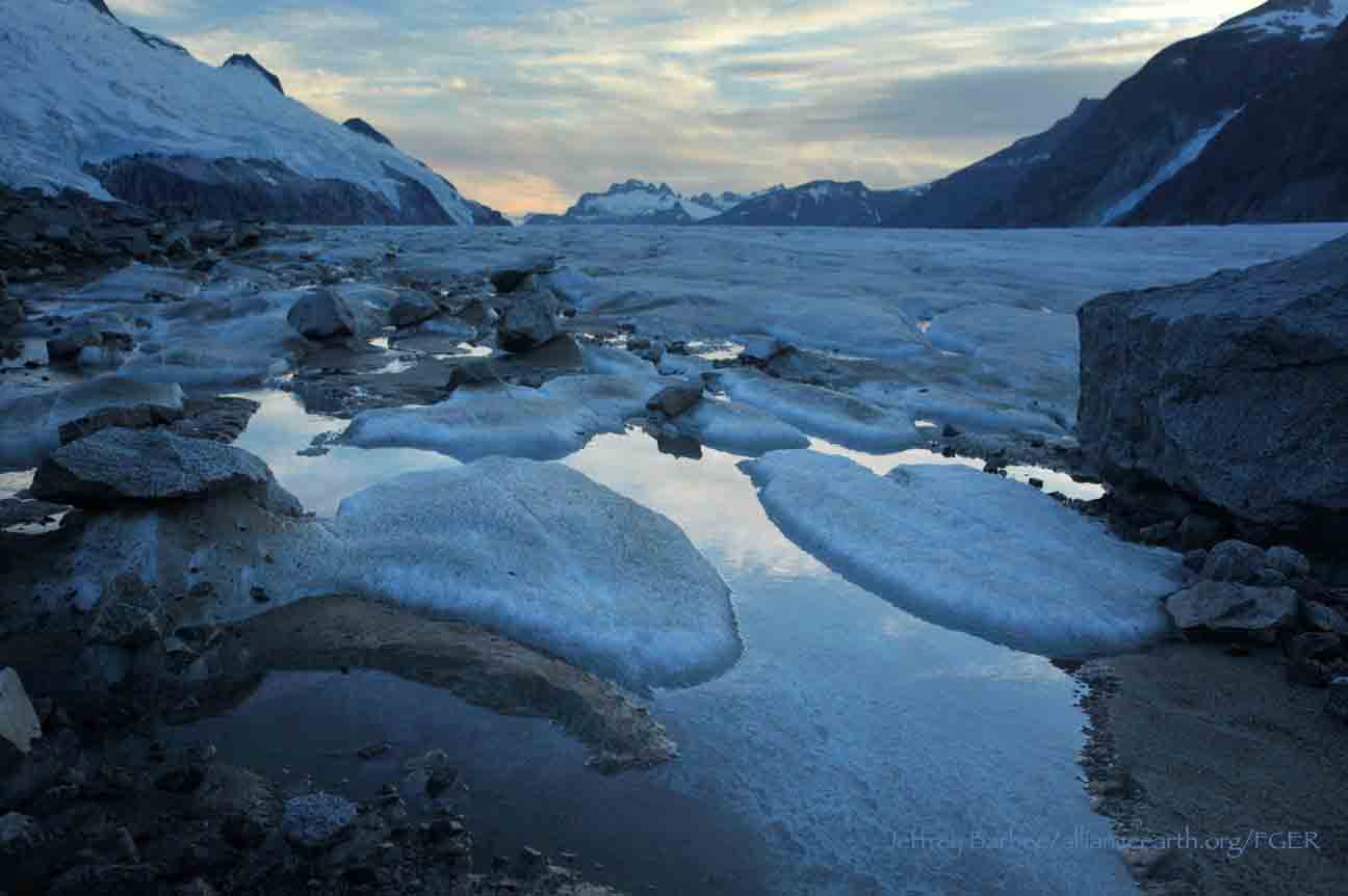
As the sun warmed the rocks and the clouds drifted away from Camp 18, the biogeochemistry research group skied up and away from camp. The weather was pleasant. A glacial breeze cooled us as we gleefully kicked and glided our way across the icefield towards the Matthes-Llewellyn divide. The divide is a topographic high between the two glaciers, from which point the ice flows downhill and away in both directions. Our research group aimed to gather snow samples from the past years’ snowpack on the Llewellyn Glacier to analyze in a lab.

We arrived at our location, roughly halfway between the two sides of the Llewellyn Glacier, on a relatively flat area downhill of the divide. Enthusiastic to start working, we kicked off our skis and set up our work area amid the ever glorious snow and mountain peaks surrounding us. The first step was to dig a trench roughly 1.5 m by 3 m, and 1 m deep. We used the excavated snow to build a shade wall on the south side of the work area, protecting sensitive samples from the sun. This trench and wall created our main workstation, a sort of subterranean workbench where we could comfortably stand and use the top of the snowpack as a waist-high counter top. After this our team prepared to gather snow samples by pulling up snow cores from the depths of the snow beneath our feet, just to the side of the trench. We all picked a job to start at on our snow core assembly line and enthusiastically got ready for a day of collecting samples.

The snow core assembly starts with gathering the snow core itself. This consisted of 3 main parts: the snow corer, the flights, and the handle. The snow corer is a tube about 1.5 m long, with plastic threads down the outside connecting to sharp teeth, and metal latches in the inside, also known as ‘dogs’ (Fig. 1). The snow corer acts like a hollow screw, with the plastic threads on the side helping to guide it straight downward as the sharp teeth cut into the snow. The metal latches are at the inside bottom of the tube, which prevent the snow core from sliding out when the snow core is brought to the surface.
 

Figure 1. Image of the bottom of a snow corer. Photo Credit: Kovacs Enterprise; Ice Drilling and Core Equipment

Figure 1. Image of the bottom of a snow corer. Photo Credit: Kovacs Enterprise; Ice Drilling and Core Equipment

A flight, the second section of the set up, is a meter-long attachment to the handle. It is meant to increase the depth of the coring hole. Basically, once the snow corer is deeper than its own height (1.5 m), we need additional attachments in able to retrieve it. A flight is one meter long, so if the snow core hole is 10 m deep, we need to attach 10 flights to the handle to drill and recover the core. The last piece of the snow corer set up is the handle. This is where all the power comes from, with our own arm strength. We operate the drill by turning the T-shaped handle, slowly spinning the whole apparatus and drilling the corer deep into the snow.

Caption: Kit Cunningham and Chris Miele adding flights to the drill (partly lowered in the hole). Photo credit: Sarah Fortner

Caption: Kit Cunningham and Chris Miele adding flights to the drill (partly lowered in the hole). Photo credit: Sarah Fortner

Once the snow corer is set up, we began the core extraction. I started out at the beginning of the assembly line, pulling the snow core out of the hole; which in my opinion is the most fun job. Using the snow core assembly, I pulled out our first segment of snow and slid it out of the snow corer and onto our workbench. Since extra snow shavings, or filings, from the threads of the snow corer can gather on top of the snow core sample itself, we measured both the depth of the hole and the length of the snow core and compared the measurements. If the snow core sample was longer than the depth of the hole, we removed the excess snow (filings from the side and top of the hole). As the snow core assembly went deeper, more filings got into the core, and this discrepancy increased. After we matched our snow core sample to the depth of the hole, the next two people in the assembly line, the snow core sawer, cut the snow core into 10 cm segments. We treated each of these 10 cm segments as individual samples. We measured the top and bottom diameters and the mass of each segment using a field scale, so that we could calculate the density of the sample later. The next person in the assembly line, the master note keeper, carefully recorded all these measurements. The master note keeper also kept track of any ice lenses, layers of ice within the snow core, in each sample. The master note keeper handed off the baggie holding the snow core segment to yet another member of the assembly line, the snow core pulverizer. The snow core pulverizer had perhaps the most entertaining job, breaking the snow core up into tiny little pieces. Accomplished via fist pounding and sometimes the use of a hammer, the goal is to break up and mix all of the snow core segment particles together, to make them as uniform in size as possible. Because we did not have enough sample bottles, or helicopter space, to carry out the entire snow core, we filled two sample bottles with the pulverized snow from each 10 cm segment. Pulverizing the segment helps ensure that the snow core pieces bottled are representative of the entire 10cm segment and not just the top or bottom part. Last, but not least of our tasks, the bottle labeler was responsible for marking all the sample bottles with the core segment label, so that back at the lab everyone knows which bottle goes with which part of the snow core.

Caption: Field staffer Matt Pickart and faculty member Natalie Kehrwald measure the snow core section, camouflaged on the snow workbench. Biogeochemistry students Molly Peek, Annie Holt, and faculty member Sarah Fortner bottle and label samples in t…

Caption: Field staffer Matt Pickart and faculty member Natalie Kehrwald measure the snow core section, camouflaged on the snow workbench. Biogeochemistry students Molly Peek, Annie Holt, and faculty member Sarah Fortner bottle and label samples in the background.
Photo credit: Annie Zaccarin.

These snow cores will travel, from our backpacks, hundreds of miles via helicopter, car, and airplane to get to a laboratory to be tested for inclusions. These inclusions will function as proxies for different characteristics and changes occurring on the Icefield. The inclusions we will be testing for are isotopes, major ion content, snow density, levoglucosan (which is a chemical produced through burning plant biomass), and dust particles. Through these five things, we will be able to understand changing precipitation and wind patterns, temperature fluxes, types of rock surrounding the glaciers, and the quantity of forest fires in the area and if they are affecting the Icefield melt. Independently, each test is a little clue about the Icefield health and together it can make a more encompassing picture.

The Juneau Icefield is the fifth largest Icefield in the western hemisphere and determining whether changes are occurring, such as increased precipitation or ash deposits, are important factors in hypothesizing its present and future melt patterns. Since these cores can go back approximately 3-5 years depending on depth, we can compare this year’s annual melt, precipitation, and wind data to previous year’s data as a way to put current changes into perspective. Through these little microscopic changes in the snow, we can gain huge amounts of information on the Icefield's present and future health. And this whole process starts with a group of excited students enjoying the day and stuffing snow inside small bottles.

This brings us back to our makeshift conveyor belt of snow chunks, and what marked the end of the day’s sample collection. Our snow core reached an impressive 9.2 meters depth, which contains snow dating back 3-4 years. We packed the hundreds of sample bottles away into our bags, ready to be carry them back to camp. After taking off a layer and grabbing a quick snack, we all put on our skis and started the long trek back to camp for supper. We gazed at the tall, mountainous beauty of the Storm Range, hypothesized about what might be cooking for supper, and reflected on how lucky we are to learn science in a place as wonderful as the Juneau Icefield.

To learn more about the potential links between snow cores and forest fires, take a listen to this podcast by Elizabeth Jenkins about our group’s snow coring on the icefield.

The JIRP 2017 Biogeochemistry team at Camp 18. From left to right: Kiana Ziola, Dr. Sarah Fortner, Auri Clark, Molly Peek, Annie Zaccarin, Kit Cunningham, Annie Holt, Chris Miele and Dr. Natalie Kehrwald.

The JIRP 2017 Biogeochemistry team at Camp 18. From left to right: Kiana Ziola, Dr. Sarah Fortner, Auri Clark, Molly Peek, Annie Zaccarin, Kit Cunningham, Annie Holt, Chris Miele and Dr. Natalie Kehrwald.


Earth's Heat Budget: How Lakes and Glaciers Are Connected

Kellie Schaefer,

Michigan Technological University

When I initially signed up for JIRP, I had no idea how I would be able to find a connection between my field of study and glaciers. The only correlation between the two that I could think of was the fact that about 2 billion people worldwide rely on annual snow pack and glaciers for drinking water (Griggs, 2015). On that note, it is relevant to mention the fact that approximately 90% of the city of Anchorage, AK relies on the Eklutna Glacier for drinking water, and about 15% of its electricity comes from a hydropower plant that utilizes meltwater from the glacier (Sinnott, 2013). While this idea was fascinating to me, I wanted to find other connections between Environmental Engineering and glaciers.

Now that I am back in school, I am finding that what I learned on the icefield can be found everywhere in the classes that I am currently taking. My Senior Design project involves calculating a mass balance model to find various concentrations of copper in a mining basin. Soil Science has showed me just how important glaciers are when forming landscapes and depositing till in certain areas (not to mention the fact that we get to dig pits, although digging a dirt pit is a much slower process than digging a snow pit). In Geohydrology, we discussed how the global groundwater flux, or movement of groundwater over a specific area, is almost equivalent to global glacial meltwater flux. Surface Water Engineering brought up the fact that inland freshwater lakes are being affected by a change in Earth’s climate due to an imbalance in our heat budget.

Meltwater from the Thomas and Lemon Creek glaciers pours into small lakes (green with glacier silt), and continue on to Lemon Creek and the Pacific Ocean. Photo by M. Beedle.

Meltwater from the Thomas and Lemon Creek glaciers pours into small lakes (green with glacier silt), and continue on to Lemon Creek and the Pacific Ocean. Photo by M. Beedle.

This “heat budget” concept really struck a chord with me. The sun emits shortwave radiation, which enters our atmosphere. This shortwave radiation can be reflected back into space (clouds), absorbed by Earth’s surface, or absorbed by chemical compounds in the atmosphere and re-emitted as longwave radiation back to Earth’s surface. Typically, the Earth would have a balanced heat budget, with incoming radiation equivalent to outgoing radiation. The atmospheric chemistry of the Earth has been anthropogenically altered, and now the heat budget of the Earth is imbalanced. Greenhouse gases absorb reflected shortwave radiation from the Earth’s surface, and re-emit it as longwave radiation. 

What does this imbalance in Earth’s heat budget mean? In terms of surface water, lakes are absorbing more shortwave radiation and increasing in temperature. This is especially true for Lake Superior, which has had an increase in mean lake temperature by 2.5°C since 1976. Additionally, winter ice cover has been reduced by 23% - 12% over the last 100 years (Austin and Colman, 2007). This decrease in the ice cover results in a lower albedo for the lake. More shortwave radiation is absorbed during the winter months, increasing the temperature of the lake. This positive feedback has gradually resulted in reduced ice cover and increased lake temperatures. Freshwater fish require specific temperatures in order to survive, and this increase in lake temperature results in a reduction in the ideal environment for some fish species. Similarly, glaciers provide specific temperatures required for salmon spawning. Streams fed by glacier meltwater become cooler, allowing salmon to spawn in streams that would otherwise be too warm. The decreasing mass in glaciers can sometimes lead to a reduction in the glaciers surface area. This results in a lower albedo for that particular area, since the glacier is no longer reflecting the incoming solar radiation. 

On a global scale, the reduction in glacier surface cover and the shortened ice cover period of inland lakes is resulting in an overall lower albedo. The Earth’s heat budget continues to become more and more imbalanced, with more heat being retained in Earth’s atmosphere than is being emitted back into space. Positive feedback cases such as a reduction in ice cover, both with glaciers and lakes, is resulting in more retained heat. We cannot afford to allow Earth to reach a point where it is impossible to return to a balanced heat budget.

References

Austin, J. A., and S. M. Colman (2007), Lake Superior summer water temperatures are increasing more rapidly than regional air temperatures: A positive ice-albedo feedback, Geophys. Res. Lett., 34, L06604, doi:10.1029/2006GL029021.

Griggs, M. B.. (2015), Two Billion People Rely On Snow For Drinking Water, And Supplies Are Melting." Popular Science. Environmental Research Letters, 12 Nov. 2015. Web. 27 Sept. 2016.

Sinnott, Rick (2013), As Eklutna Glacier Shrinks, Anchorage's Water and Power Will Become More Expensive. Alaska Dispatch News. N.p., 15 Dec. 2013. Web. 27 Sept. 2016.

Gilkey Trench Fieldwork Adventure

By The Gilkey Trench Crew (Jamie Bradshaw, William Jenkins, Jon Doty, and Justyna Dudek)

While many students already started the fieldwork for their projects at Camp 10 and even Camp 18, five students have been anxiously awaiting to begin their fieldwork in the Gilkey Trench. The Gilkey Trench is the magnificent view that you see from Camp 18 where the Gilkey, Vaughan-Lewis, the Unnamed and many other glaciers connect and flow down through the steep, glacially carved, 2,000 foot deep valley. The Trench is filled with beautiful curving medial moraines and jaw dropping ogives created by ice falls. Getting to such a beautiful place is not easy and well worth a full day’s effort.

Descending "The Cleaver" - approaching the start of the series of fixed ropes - with the Gilkey Trench in the background.  Photo by Adam Toolanen

On Wednesday, July 31st, these students and four safety staff members departed Camp 18 for our camp on the bare glacier ice in the sunshine. The trick to getting to the glacier is descending what is affectionately called “The Cleaver.” The Cleaver is the 2,000 feet of bedrock that sits between Camp 18 and the glaciers below.  The descent was led by senior staffer Scott McGee, who has done the route many, many times. The first half of the route was going down steep snow slopes until we got to a vegetated area called “The Heather Camp.” This is where the fixed ropes began.

Waiting in a safe location - protected from rockfall from above - for their turn to descend the next section of fixed ropes.  Photo by Adam Toolanen. 

Here, the students and staff put on helmets and harnesses and tied into the fixed ropes with a knot called a prussik. This rope system served as a back up in case there was a slip on the steep, unstable terrain.  Fixed ropes were used for the last half of the descent because the route became steeper and more exposed. Because the glacier is melting, new bedrock and rock debris is left behind. This makes finding new routes difficult and challenging in the unstable footing. After 11 very long hours, the students and staff safely and happily arrived at our camp in the Gilkey Trench during a magnificent sunset.

Scott McGee scouts the lowest section of the descent made of freshly exposed bedrock, and precariously deposited boulders left by the rapidly thinning Gilkey Glacier.  Photo by Jeffrey Barbee. 

The next two days were spent collecting data from the field. A brief explanation of the students’ projects in the Gilkey Trench are below:

Jamie Bradshaw - Surface Ablation of the Gilkey Glacier

For my project, I looked at the ablation, or melt rates, of the Gilkey Glacier. In May 2013, wires were steam drilled into the ice for Dr. Anthony Arendt at the University of Alaska Fairbanks (also a visiting JIRP Faculty member earlier in the summer). My task was to find these wires and measure how much wire was exposed. Luckily the sites came with known GPS coordinates and had a wire tetrahedron with bright orange flagging attached to it, so it was fairly easy to find in the rolling, mildly crevassed terrain of the Gilkey Glacier. By knowing the length of the wire exposed at the time of installation (which I will find out upon returning to civilization) and measuring the length of wire exposed in August, the ablation can be determined. This becomes important because once the area of the glacier is known, the total amount of melt water runoff from the glacier to the ocean can be calculated.

Jamie Bradshaw photo documents one of the ablation-measurement sites on Gilkely Glacier.  As the glacier surface melts, more wire (at Jamie's feet) is exposed.  Photo by Jeffrey Kavanaugh. 

William Jenkins - Ogive Survey

My research in the Gilkey Trench was focused on the ogives, also called Forbes Bands, which form at the base of the Vaughan Lewis Icefall, adjacent to Camp 18. These interesting features in the ice are annual formations that only appear beneath fast flowing icefalls. It is commonly accepted that their light and dark banding represents the variations between summer and winter ice that has made its way through the icefall in one year. Summer ice, which is subjected to wind blown particulates and increased melt, constitutes the dark bands of the ogives and forms the trough of their frozen wave-like appearance. The white winter ice is composed of that year’s snowfall, and forms the crests of the wave bulges. 

William Jenkins surveys one of the Gilkey Glacier ogives with GPS.  "The Cleaver" is the ridge of rock in the background, with the Vaughan Lewis Icefall on the right.  Photo by Jamie Bradshaw. 

The purpose of my study was to determine how fast this area of the Gilkey Glacier was thinning in comparison to previous years. In order to determine this rate, I conducted a longitudinal GPS survey, with the help of Scott McGee, that had previously been carried out from the years 2001-2007. As a result of the glacier’s rapid thinning rate, I’ll be able to calculate its subsidence by the changes in the elevation of the survey over time. I will also compare the data I observe with the Vaughan Lewis mass-balance data that JIRP has collected over the years. This comparison will allow me to correlate the changes in annual precipitation with the transformations in the ogives wavelength and amplitude over time. The relationship between mass balance and ogive structure will shed light on the future transformations of the ogives and Vaughan-Lewis Glacier as a whole.    

Panorama of one of the ogives near the base of the Vaughan Lewis Icefall (in the background).  Photo by William Jenkins. 

Justyna Dudek - Photogrammetry

The main objective of my project was to create an up to date digital terrain model (DTM) of the Vaughan Lewis Icefall flowing down from Camp 18 into the Gilkey Trench. A digital terrain model describes the 3-dimentional position of surface points and objects, and can be used to retrieve information about geometrical properties of glaciers. In order to create the model, I decided to explore the procedures and tools available within the field of digital photogrammetry, a practical method which allows carrying out non-contact measurements of inaccessible terrain (very useful for areas such as icefalls, which for the sake of avalanches and falling seracs, might be too dangerous for exploration or measurements on their actual surface). The baseline dataset for creating the DTM of Vaughan Lewis Icefall  were recorded on the first, sunny and cloudless day of our stay in the Trench. With the guidance from Paul Illsley (present via radio from Camp 18) and help from my colleagues Jeff Barbee and Jon Doty (present on the Gilkey Trench), I set up the three profiles along which we collected the data in the form of terrestrial photogrammetric stereo pairs and ground control points (GCP). The database created by our team will be subsequently processed in order create a DTM which can constitute a reliable, starting point for further research in this area in the future.


Paul Illsley overlooks the Vaughan Lewis Icefall from a terrestrial photogrammetry station near Camp 18.  Photo by Mira Dutschke. 

Jon Doty - Nunatak Biology

My path into the trench followed a slightly different approach than the other students who reached the Gilkey Trench via the Cleaver descent.  Ben Partan – Senior Staff member in charge of camp maintenance – and I were brought down to the Gilkey via helicopter from Camp 18 to Camp 19, with a load of material to fix up the camp, which sees infrequent use. After two days repairing the roof, and siding, as well as swamping the camp interior, we descended into the trench. During our descent we made four stops at progressively lower elevations, conducting a botanical survey. At each site I recorded all plant species present, the compass orientation of the plot, elevation, and tried to keep an eye out for faunal interaction, and any other interesting features of the site. 

Ben Partan repairs the C 19 roof.  The upper Gilkey Glacier is in the background.  Photo by Jon Doty. 

As we dropped down closer to the surface of Gilkey Glacier - biodiversity plummeted. My final site featured only a single species of plant, as opposed to nearly twenty at the highest point of my survey. This loss of biodiversity can be tied to the recession of the Gilkey exposing new substrates, and the time required for mosses and lichens to reach the area and for soil to develop. Using a rough dating technique called lichenometry, we can gain insight as to the amount of time each site has been exposed by the recession of the glacier. The lichen species Rhizocarpon geographicum grows about 1 cm for every 100 years and is very common. Its absence at the lowest two sites is therefore noticeable, and signals that these sites were only recently revealed.

My survey is paired with another conducted by Molly Blakowski on the southerly oriented C 18 nunatak. These two slopes face each other with the Gilkey separating them. We plan on comparing the results of our surveys to determine what affects the differences of aspect have on the vegetation.   It was an absolute pleasure to join back up with the group and explore the Trench, and true fun to climb up the Cleaver and reunite with the rest of the JIRPers at C 18. 

The 2013 Gilkey Trench Crew (left to right): Jeff Kavanaugh, Jeff Barbee, Justyna Dudek, Jamie Bradshaw, Adam Toolanen, Adam Taylor, Jon Doty and William Jenkins. Photo by Jeffrey Kavanaugh

In closing, on August 3rd, the Gilkey Trench Crew packed up camp and headed towards the Cleaver to ascend back to life at Camp 18. Again, we tied into fixed ropes, had a remarkably beautiful day and had a safe climb up the Cleaver. The Gilkey Trench Fieldwork Adventure had been a success and possibly, the icing on the cake for all crew members.

Additional photos from the Gilkey Trench Fieldwork Adventure.  Click on any of the images below to open a slideshow with all photos and captions: