Link TV: Juneau Icefield Expedition

By Matt Beedle

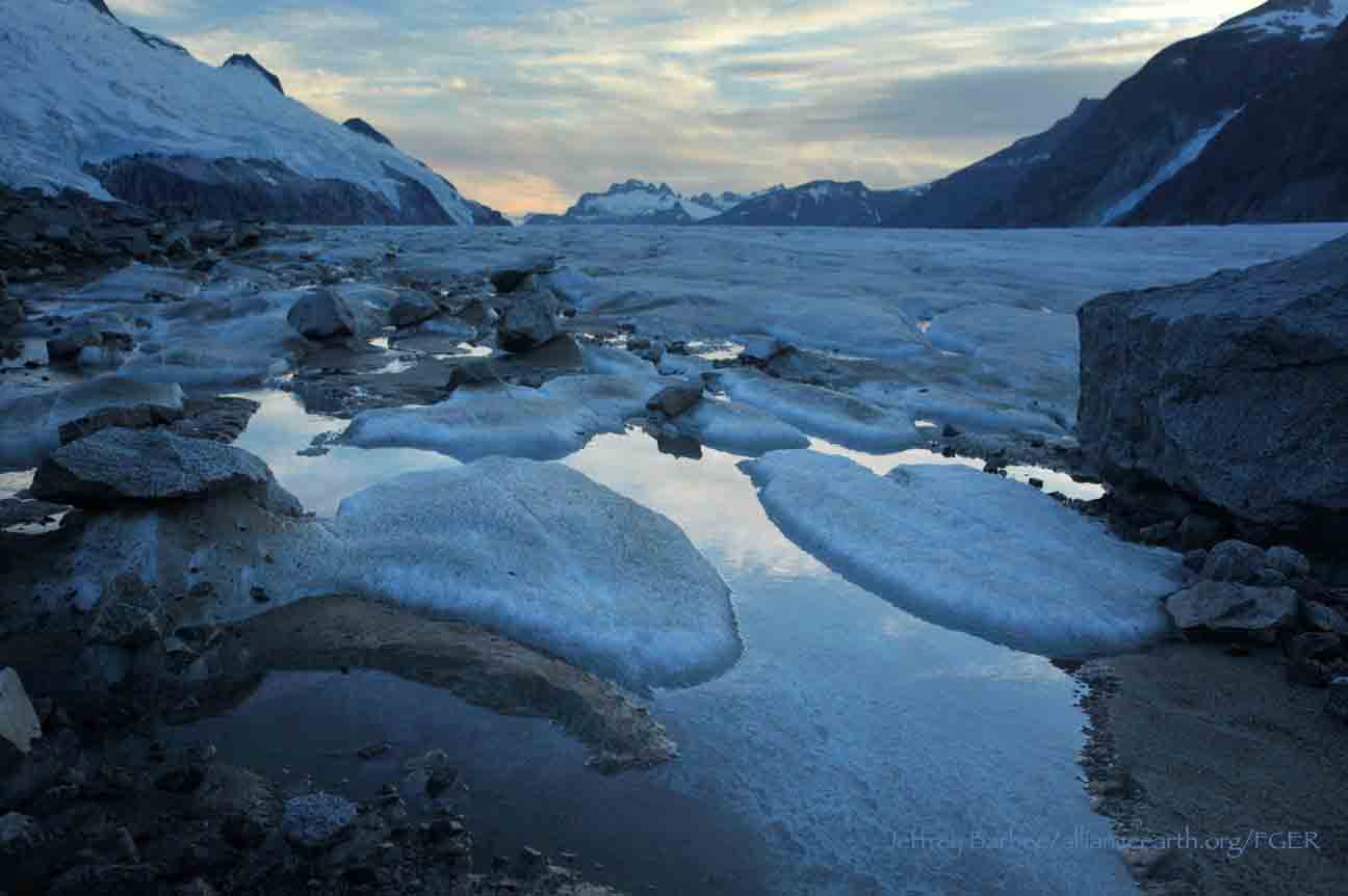
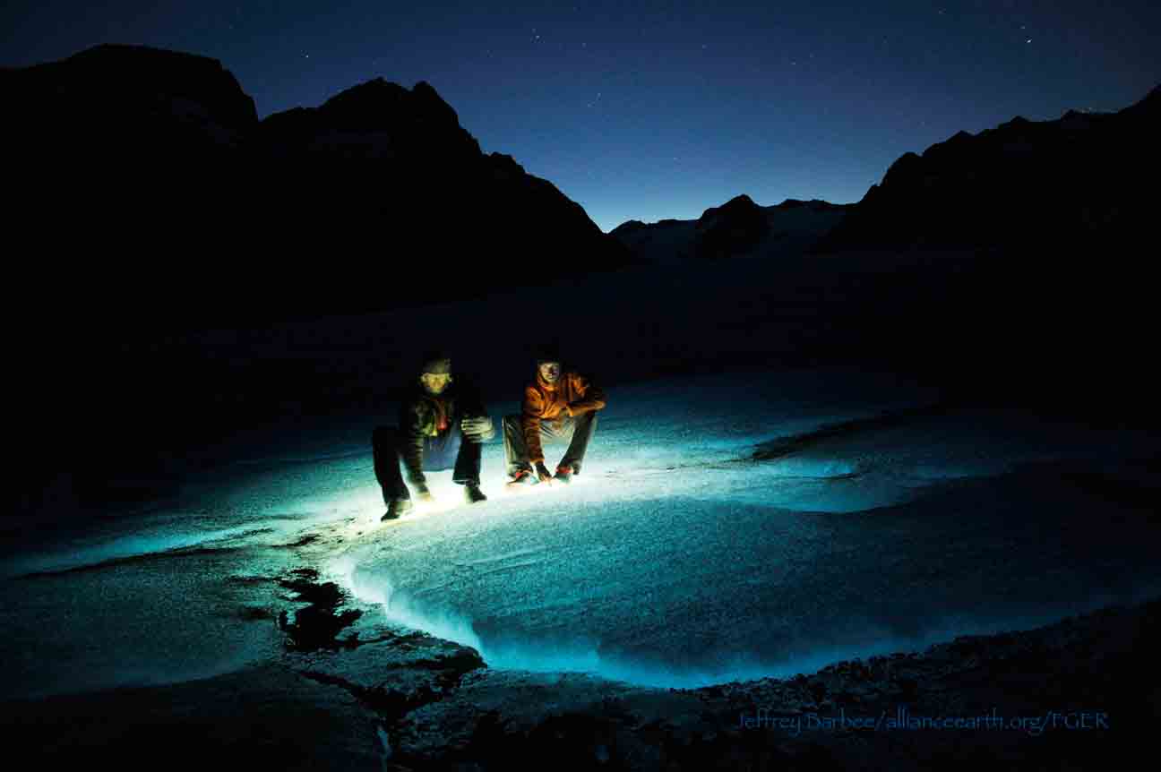
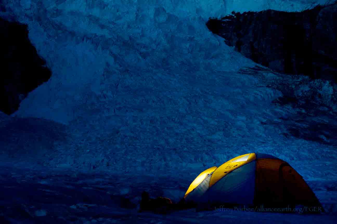
In 2013 JIRP was fortunate to have photographers and documentary film makers Jeffrey Barbee and Mira Dutschke as members of a great crew of staff and faculty.  In addition to their efforts to help JIRP run smoothly and safely Jeff and Mira produced two fantastic video episodes on the 'Juneau Icefield Expedition' for Link TV.  Enjoy!

Thank you, Jeff and Mira! 

Aurora Hunters

By Sarah Bouckoms

For the first seven nights at Camp 18 I did not sleep under a roof. We were blessed with fabulous weather that left most of us retreating inside a building only for an hour or two during our daily lectures.  As the sun set, we all wandered around the rocks, looking for the best sleeping site we could find. Armed with bed rolls or sleeping pads, we knew we could tolerate a few bumps and rolls of rocks but the flatter the spot, the better. This of course could all be compromised for the view or proximity to the icefalls. Yes, we were lulled to sleep by the sounds of the calving Vaughan Lewis Icefall under the clear night skies of Alaska. It sounds so wild and remote that sometimes I feel as if I am dreaming before I have even fallen asleep. 

Armed with a book for a pillow the Vaughan-Lewis Icefall can lull anyone to sleep. Photo by Sarah Bouckoms.

We do our best to avoid sleeping and spend time finding constellations and hunting for aurora. I am familiar with the constellations of the Northern Hemisphere so it is a joy to see some old friends that have gone missing with the extended daylight hours this close to the Arctic Circle. An even greater joy comes when I am able to point out the constellations to the students. I have to explain the first fundamental rule to be an astronomer -  having an overactive imagination. That, yes, this square over here is completely different from that square over there. Clearly one is Hercules, the brave warrior, the other is Pegasus, proudly soaring through the sky. The Summer Triangle also greets us shinning forth from the stars Vega, Altair and Deneb. Not to be forgotten is the slightly dimmer star Polaris which is near the North Celestial Pole, the special point that marks the axis around which the stars appear to rotate.  It can easily be found by extending the distance between the last two stars in the Big Dipper. Surely every good Alaskan must know this group of stars since it is represented on the state flag. But did you know that it is not actually a constellation? Yes it is true. As Pluto is not a planet, nor is the Big Dipper a constellation. Have no fear though, for the group of stars that we know well as the Big Dipper resides in another constellation, Ursa Major. The Latin name translates to Big Bear.  Another key ingredient to being a good astronomer is imagination. For the handle of the Big Dipper is actually the elongated tail of a bear and the four stars of the cup are the rear end and back of the bear. Further stars contribute to the face along with stars in groups of three to make up the paws. It is much easier to see the constellations when there is less light pollution, such as we are lucky to avoid on the Juneau Icefield. It seems a shame that the light from the stars should travel light years through outer space only to be dimmed out by the man-made light in the lower parts of the atmosphere just before it reaches our eyes. Thus is life in a world where we are no longer ruled by the solar cycle but a 9 – 5 workday. If you can manage to escape out to the country or turn the lights off in your house, you will be amazed at the glory of the stars and the white band that is the Milky Way.

A group sleeping outside wakes to morning views of the Gilkey Trench. Photo by Sarah Bouckoms.

While stars are pretty, that is not what we outside slumberers dream to see. What we really want to see are the solar particles colliding above Earth’s atmosphere attracted by the magnetic field. This fantastic display of collisions is responsible for the light that we call the Aurora Borealis in the Northern Hemisphere and the Aurora Australis in the Southern Hemisphere.  The different colors are dependent on the type of particles interacting and the altitude. The sun emits electrons which interact with either Nitrogen or Oxygen. The collisions (and hence the aurora) are most prominent closer to the poles as this is where the magnetic fields converge, creating the greatest pull for the electrically charged particles emitted from the Sun.

So if you are a good aurora hunter, what do you have to look for? The probability of the collisions happening in the winter is no greater than in the summer. The largest difference is that during the winter you have 12 + hours of darkness, which gives you a greater chance of observing the light show. We are only just creeping into true darkness as we enter August, so the Sun, which is ironically the source of the particles, is also producing light which is brighter than the light of the aurora.  The Sun has decided to help us out though! The Sun is climbing out of its 11 year cycle from a solar minimum – or minimum amount of solar activity. As the Sun becomes more active, it will send more particles into the Solar System, increasing the chance of an interaction in Earth’s atmosphere. So if the stars alight for us and we get a clear night, with high solar activity, we may be lucky enough to see this dazzling display of lights. Keep your fingers crossed readers and you two will get to vicariously live through the wonder of the aurora in another blog post full of aurora pictures or videos.

While I have watched with enthusiasm as the faces of my students light up when I show them YouTube videos of aurora, I hope that I may be lucky enough to record my own video or describe the lights personally back in the classroom. I love teaching physics, as I find that knowing the science behind the phenomena of the natural world only makes it more beautiful.

Taken straight from the sleeping bag. The beautiful sunrise over Atlin Lake welcomes us to the day when we return to civilization. Photo by Sarah Bouckoms.

While the Sun wakes me up earlier than I would like at times, watching it lighting up the glaciers as they drip off the jagged mountain peeks from the comfort of my toasty sleeping bag, I have a quiet moment in the morning to myself thinking I must have done something right to wake up to this view. Then the hustle and bustle of the day on the Juneau Icefield begins and we wait for nightfall when the aurora hunters emerge again.

Gilkey Trench Fieldwork Adventure

By The Gilkey Trench Crew (Jamie Bradshaw, William Jenkins, Jon Doty, and Justyna Dudek)

While many students already started the fieldwork for their projects at Camp 10 and even Camp 18, five students have been anxiously awaiting to begin their fieldwork in the Gilkey Trench. The Gilkey Trench is the magnificent view that you see from Camp 18 where the Gilkey, Vaughan-Lewis, the Unnamed and many other glaciers connect and flow down through the steep, glacially carved, 2,000 foot deep valley. The Trench is filled with beautiful curving medial moraines and jaw dropping ogives created by ice falls. Getting to such a beautiful place is not easy and well worth a full day’s effort.

Descending "The Cleaver" - approaching the start of the series of fixed ropes - with the Gilkey Trench in the background.  Photo by Adam Toolanen

On Wednesday, July 31st, these students and four safety staff members departed Camp 18 for our camp on the bare glacier ice in the sunshine. The trick to getting to the glacier is descending what is affectionately called “The Cleaver.” The Cleaver is the 2,000 feet of bedrock that sits between Camp 18 and the glaciers below.  The descent was led by senior staffer Scott McGee, who has done the route many, many times. The first half of the route was going down steep snow slopes until we got to a vegetated area called “The Heather Camp.” This is where the fixed ropes began.

Waiting in a safe location - protected from rockfall from above - for their turn to descend the next section of fixed ropes.  Photo by Adam Toolanen. 

Here, the students and staff put on helmets and harnesses and tied into the fixed ropes with a knot called a prussik. This rope system served as a back up in case there was a slip on the steep, unstable terrain.  Fixed ropes were used for the last half of the descent because the route became steeper and more exposed. Because the glacier is melting, new bedrock and rock debris is left behind. This makes finding new routes difficult and challenging in the unstable footing. After 11 very long hours, the students and staff safely and happily arrived at our camp in the Gilkey Trench during a magnificent sunset.

Scott McGee scouts the lowest section of the descent made of freshly exposed bedrock, and precariously deposited boulders left by the rapidly thinning Gilkey Glacier.  Photo by Jeffrey Barbee. 

The next two days were spent collecting data from the field. A brief explanation of the students’ projects in the Gilkey Trench are below:

Jamie Bradshaw - Surface Ablation of the Gilkey Glacier

For my project, I looked at the ablation, or melt rates, of the Gilkey Glacier. In May 2013, wires were steam drilled into the ice for Dr. Anthony Arendt at the University of Alaska Fairbanks (also a visiting JIRP Faculty member earlier in the summer). My task was to find these wires and measure how much wire was exposed. Luckily the sites came with known GPS coordinates and had a wire tetrahedron with bright orange flagging attached to it, so it was fairly easy to find in the rolling, mildly crevassed terrain of the Gilkey Glacier. By knowing the length of the wire exposed at the time of installation (which I will find out upon returning to civilization) and measuring the length of wire exposed in August, the ablation can be determined. This becomes important because once the area of the glacier is known, the total amount of melt water runoff from the glacier to the ocean can be calculated.

Jamie Bradshaw photo documents one of the ablation-measurement sites on Gilkely Glacier.  As the glacier surface melts, more wire (at Jamie's feet) is exposed.  Photo by Jeffrey Kavanaugh. 

William Jenkins - Ogive Survey

My research in the Gilkey Trench was focused on the ogives, also called Forbes Bands, which form at the base of the Vaughan Lewis Icefall, adjacent to Camp 18. These interesting features in the ice are annual formations that only appear beneath fast flowing icefalls. It is commonly accepted that their light and dark banding represents the variations between summer and winter ice that has made its way through the icefall in one year. Summer ice, which is subjected to wind blown particulates and increased melt, constitutes the dark bands of the ogives and forms the trough of their frozen wave-like appearance. The white winter ice is composed of that year’s snowfall, and forms the crests of the wave bulges. 

William Jenkins surveys one of the Gilkey Glacier ogives with GPS.  "The Cleaver" is the ridge of rock in the background, with the Vaughan Lewis Icefall on the right.  Photo by Jamie Bradshaw. 

The purpose of my study was to determine how fast this area of the Gilkey Glacier was thinning in comparison to previous years. In order to determine this rate, I conducted a longitudinal GPS survey, with the help of Scott McGee, that had previously been carried out from the years 2001-2007. As a result of the glacier’s rapid thinning rate, I’ll be able to calculate its subsidence by the changes in the elevation of the survey over time. I will also compare the data I observe with the Vaughan Lewis mass-balance data that JIRP has collected over the years. This comparison will allow me to correlate the changes in annual precipitation with the transformations in the ogives wavelength and amplitude over time. The relationship between mass balance and ogive structure will shed light on the future transformations of the ogives and Vaughan-Lewis Glacier as a whole.    

Panorama of one of the ogives near the base of the Vaughan Lewis Icefall (in the background).  Photo by William Jenkins. 

Justyna Dudek - Photogrammetry

The main objective of my project was to create an up to date digital terrain model (DTM) of the Vaughan Lewis Icefall flowing down from Camp 18 into the Gilkey Trench. A digital terrain model describes the 3-dimentional position of surface points and objects, and can be used to retrieve information about geometrical properties of glaciers. In order to create the model, I decided to explore the procedures and tools available within the field of digital photogrammetry, a practical method which allows carrying out non-contact measurements of inaccessible terrain (very useful for areas such as icefalls, which for the sake of avalanches and falling seracs, might be too dangerous for exploration or measurements on their actual surface). The baseline dataset for creating the DTM of Vaughan Lewis Icefall  were recorded on the first, sunny and cloudless day of our stay in the Trench. With the guidance from Paul Illsley (present via radio from Camp 18) and help from my colleagues Jeff Barbee and Jon Doty (present on the Gilkey Trench), I set up the three profiles along which we collected the data in the form of terrestrial photogrammetric stereo pairs and ground control points (GCP). The database created by our team will be subsequently processed in order create a DTM which can constitute a reliable, starting point for further research in this area in the future.


Paul Illsley overlooks the Vaughan Lewis Icefall from a terrestrial photogrammetry station near Camp 18.  Photo by Mira Dutschke. 

Jon Doty - Nunatak Biology

My path into the trench followed a slightly different approach than the other students who reached the Gilkey Trench via the Cleaver descent.  Ben Partan – Senior Staff member in charge of camp maintenance – and I were brought down to the Gilkey via helicopter from Camp 18 to Camp 19, with a load of material to fix up the camp, which sees infrequent use. After two days repairing the roof, and siding, as well as swamping the camp interior, we descended into the trench. During our descent we made four stops at progressively lower elevations, conducting a botanical survey. At each site I recorded all plant species present, the compass orientation of the plot, elevation, and tried to keep an eye out for faunal interaction, and any other interesting features of the site. 

Ben Partan repairs the C 19 roof.  The upper Gilkey Glacier is in the background.  Photo by Jon Doty. 

As we dropped down closer to the surface of Gilkey Glacier - biodiversity plummeted. My final site featured only a single species of plant, as opposed to nearly twenty at the highest point of my survey. This loss of biodiversity can be tied to the recession of the Gilkey exposing new substrates, and the time required for mosses and lichens to reach the area and for soil to develop. Using a rough dating technique called lichenometry, we can gain insight as to the amount of time each site has been exposed by the recession of the glacier. The lichen species Rhizocarpon geographicum grows about 1 cm for every 100 years and is very common. Its absence at the lowest two sites is therefore noticeable, and signals that these sites were only recently revealed.

My survey is paired with another conducted by Molly Blakowski on the southerly oriented C 18 nunatak. These two slopes face each other with the Gilkey separating them. We plan on comparing the results of our surveys to determine what affects the differences of aspect have on the vegetation.   It was an absolute pleasure to join back up with the group and explore the Trench, and true fun to climb up the Cleaver and reunite with the rest of the JIRPers at C 18. 

The 2013 Gilkey Trench Crew (left to right): Jeff Kavanaugh, Jeff Barbee, Justyna Dudek, Jamie Bradshaw, Adam Toolanen, Adam Taylor, Jon Doty and William Jenkins. Photo by Jeffrey Kavanaugh

In closing, on August 3rd, the Gilkey Trench Crew packed up camp and headed towards the Cleaver to ascend back to life at Camp 18. Again, we tied into fixed ropes, had a remarkably beautiful day and had a safe climb up the Cleaver. The Gilkey Trench Fieldwork Adventure had been a success and possibly, the icing on the cake for all crew members.

Additional photos from the Gilkey Trench Fieldwork Adventure.  Click on any of the images below to open a slideshow with all photos and captions:     

The Traverse to Camp 18

By Adam Toolanen

The summer’s third big traverse is the ski from Camp 10 to Camp 18. As a former JIRPer returning as staff member, I have knowledge of the magnificence of Camp 18, which is what kept me going during the 18 mile ski from Camp 10, whereas the students only had my description of the splendor of Camp 18 to ponder as we skied. The excitement of seeing the vast icy expanse on a gorgeous summer day made the journey as rewarding as the destination.

Uwe Hofmann skiing down the hill at Camp 10 for an early morning departure. Photo by Sarah Bouckoms

In the days leading up to the traverse, it was unfortunate that we could not see the Taku Towers - the iconic landmarks of Camp 10. Luckily, the weather cleared on the day that our group left for Camp 18. The first few hundred feet of the 18 mile day consisted of a steep downhill pitch covered in suncups, which always takes awhile to navigate.  Just as we thought we would have a smooth start to the day a ski binding broke on that first, steep slope. Not wanting to have everyone wait at the bottom of the hill, I sent the group on their way and headed back to Camp 10 with Will Jenkins and his broken binding. Luckily, the binding was fixed quickly and we skied back down the hill. I remember being a student on JIRP and never wanting to be behind the group. No different than I, Will cruised ahead of me and soon we caught up with the others.

The trail party takes a snack break, changes some layers and rests for a minute before hitting the trail again. Photo by Sarah Bouckoms

As we traveled up the Taku Glacier towards the Matthes Glacier, we took many breaks to adjust our gear. It is not always obvious how to dress for travel on the glacier. The effect of the sun heating your body is amplified by the solar radiation that reflects off the glacier. Naturally, skiing with a big backpack keeps you toasty as well. On the other hand, there is the massive body of snow under your feet and the cold katabatic winds that cool you off as you ski. Katabatic winds are created by cold air flowing from high to low elevations on the glacier, and can really chill you on a hot summer’s day. Depending on the combination and prevalence of these factors, people have to change clothes constantly. The other challenges are hotspots and blisters. As potentially day-ruining afflictions, these need to be addressed immediately. During the breaks to bandage foot sores and adjust outfits, we also snack to keep our energy levels up and joke together as we rest our feet for a little while.

Author Adam Toolanen on a sunny day on the Icefield. Photo by Jeff Kavanaugh

When I was a student I skied the traverse in a whiteout, so I couldn’t see anything other than the ski tracks from the person in front of me. The staff member leading my group told us about the views of Devil's Paw and the Storm Range, but we could only imagine them. Coming up the trail to Camp 18 this year we were all captivated by the stunning ridgelines and mountain glaciers set against the backdrop of the blue, blue sky and did not have to rely on our imaginations.

The group slowly rising over the final crest of the Matthes Glacier headed towards Camp 18. Photo by Sarah Bouckoms.

As with many things in Alaska, the size and scale of icefield features is deceiving. Setting small personal goals is both rewarding and challenging on such a long ski trip. Promising yourself that you will eat that chocolate bar once you crest the next hill can mean waiting an hour instead of the 20 minutes you were planning on. However, when you finally stand on that hill enjoying your chocolate bar and take in the views offered by the massive slope you just conquered, you can be all the more content with reaching your goal. Some of the students started inquiring about the location of Camp 18 and although I can point out the peaks surrounding the camp, it really takes the whole day for the scale of the journey to really dawn on them.

A group of four carries on in good spirits on Matthes Glacier. Mt. Moore - with Camp 8 on the ridge of rock pointing down towards the first skier - is in the background.  Photo by Sarah Bouckoms

As the group crested the last hill of the Matthes Glacier, we could finally see down into the basin alongside the daunting ridge of the Storm Range. Huge black rock faces towered above us as we pushed through the remaining two miles to camp. The sun was setting behind this ridge and the soft snow froze over, creating a fast and slick surface for our skis. As we neared our destination, the Camp 18 buildings glimmered in the last sunlight, perched high on the nunatak. The final push to Camp 18 offered a view of the mighty Vaughan Lewis Icefall. The top of the icefall billows down a ridge where it breaks up into large crevasses. These crevasses stretch, become bigger, deform and transform into even larger crevasses. When these start to collapse due to the steep slope they are passing over, the icefall really shows that it is in slow, albeit chaotic motion. As my group crested the hill and we started the final downhill glide into Camp 18, the grandiose Gilkey Trench opened up before us. Only as we skied the final quarter-mile to camp did we really see the backdrop which is the surroundings of Camp 18. After 11 hours skiing uphill on the glaciers leading to Camp 18, the group made it just in time for a sunset over the Gilkey Trench. Being back at this magnificent Camp after a long day of skiing is just the reward I was hoping for.

The scale of the Icefield is shown with two skiers dwarfed by their surroundings as they ski up Matthes Glacier. Photo by Sarah Bouckoms

The real treat for me as a staff member was to be able to lead first-time JIRPers on this trip, to one of the most beautiful spots I have ever been to. The students were excited and positive all day, but what they saw upon arrival exceeded all of their expectations. Even I who knew what was in store was in wonder at the realization that this place is still here, that it is real, not just some past dream. I felt like the mediator or the guide who took the students to this place and when we arrived I could just sit back and smile as I watched them explore their new home, giddy with excitement.

After a long day of skiing from Camp 10 to Camp 18, the sun sets on the glaciers and peaks of the Gilkey Trench.  Photo by Sarah Bouckoms.