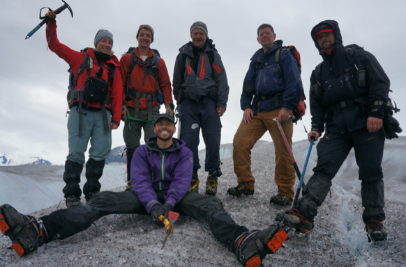
The Matthes-Llewellyn Divide

Kate Bartell

Wittenberg University

Science itself is an interesting focus. It is not just a thing, or an idea, or even a sole research topic. You cannot box it into a category with one title or one author. It is not defined to a single glacier system or a solitary winding stream. It can be studied in any part of the world, with any questions in mind. The science that I am working on now happens to be on the Juneau Icefield in Alaska. My science involves snow-machines, base-stations, and of course: Global-Positioning-System (GPS).

A beautiful sunset at Camp 8. Photo by Kate Bartell.

A beautiful sunset at Camp 8. Photo by Kate Bartell.

I am spending the majority of my summer traversing and researching the Juneau Icefield. As part of the GPS team here at the Juneau Icefield Research Program (JIRP), it is our job to help collect elevation, longitude, and latitude data points as we traverse along the icefield. This variety of information will be used to calculate velocity in the numerous areas of the Icefield and relate it with past GPS data and JIRP’s other research area’s data, for instance, Mass Balance.

One specific area of science and research that the GPS group is focusing in on is the Matthes-Llewellyn Divide. The Matthes-Llewellyn Divide is a glacier divide that connects and separates Matthes Glacier from Llewellyn Glacier. As part of our project, we are constructing a grid of GPS points that we will lay out onto the divide with bamboo wands. When we lay the wands out, we will survey their exact longitude and latitude coordinates. As the ice flows, the set points will flow along with the two different glaciers, moving in opposite directions. We then will return back to the bamboo wands and re-measure the new locations of the wands. The distance and direction the wands have travelled will allow us to calculate the ice flow velocities and where, exactly, the two glaciers separate. We are constructing this grid by looking at the divide data from 2013 and beyond, and interpreting where the Divide may have migrated in the intervening years.  By determining where exactly the flow divide is, how it has changed, and how it compares to previous years, we gain critical information about where one glacier ends and the other begins.

The research that the GPS team is working on over the course of summer 2016, and has worked on in many previous summers, provides important information about the condition of the Icefield. For example, that the Divide is shifting over time; this change can alter how much precipitation is being distributed to the Matthes and Llewellyn Glaciers. So, by using our GPS data along with data from other research teams, we can track long-term changes in the mass balance of the two glaciers. This, in turn, gives us a deeper understanding of the health of the whole glacial system.

One of JIRP’s trusty snow-machines that are used to collect points across the Juneau Icefield. Photo by Kristen Lyda Rees.

One of JIRP’s trusty snow-machines that are used to collect points across the Juneau Icefield. Photo by Kristen Lyda Rees.

GPS Surveying

By: Kurt Powell

730am. Wake up call. I roll over to go back to sleep in an attempt to restore as much energy as possible before another day on the icefield begins.

745am. Someone’s alarm screams beside my ear. I roll over again in hope to regain my necessary slumbers.

755am. My alarm calls to me. I rise gleefully, knowing that by the time I arrive at the Cookshack, the breakfast line will be near empty, so I won’t have to wait for food. It’s a great start to a rainy day at C-17.

Promptly after smooshing into a packed table and eating a couple of spoonfuls of hot peanut butter oatmeal, Annie, the camp manager, calls out “Goood Mooorning”. We respond with a weary good morning as we have only finished a quarter of our coffees. Daily shout outs to the cook with resounding applause are heard from outside of the camp, today’s agenda and work details are quickly stated – today we are doing science. This is exciting as safety training has been successfully completed as of yesterday, and we are all ready for this new adventure of doing science. Probing, mass balance pit digging and GPS surveying are available to everyone’s excitement; we all become a little more eager despite the fact that our coffees are now only half drank. Annie announces all the assistant GPS surveyors have already been selected as the JIRPers whose first names start with the letter K; Kim, Kelly and Kurt. My name starts with a K! Thrilled, finally science is about to occur, science that mysterious thing that we have travelled so far for, I am about to do this thing called science and GPS surveying.

Shortly after finishing my meal, everyone is about to start their second coffee and the morning conversation picks-up, the buzz of excitement from today’s agenda flows into the conversation, people slowly begin to file out as time moves on. I make my way to my sleeping quarters to gather my daily materials.

1025am. We all meet in the staff shack as Scott and the German surveyors, Martin and Paul, pull out the equipment that the team will be carrying for the rest of the day- a tarnished yellow bag with black alloy structure supporting the antenna, a controller, and a circular GPS unit node on a tall metal rod. They briefly explain the logistics of the system–find the spot, press buttons, move on, done. We divide into two teams to discuss how and what points of the Lemon Creek Glacier we will survey. We will be traveling by skis along lines of latitude measuring pre-arranged points every fifty meters or so.  This is done in order to find the glacier’s snow depths. Kelly and I throw on our personal packs with the teams’ lunches packed inside, and Kim throws on the GPS backpack. Raining more heavily now than early today, I feel that today will be amazing and we make our way down to the glacier.

1045am. With our skis strapped on, both teams head south making their way to the first locations. Martin begins to explain to Kim and I how to use the controller, a few swift button pushes and we arrive at the home screen. We select the point in which we want to measure, travel to it, locate the measuring point within a 50cm radius, press measure to send a signal to the satellites to ratify our measurement, alter a setting to show that we have measured this specific point and move on to the next point. Shortly after Kim nails her first point within a few centimeters, we move on and ski into the rain.

Paul teaches Kim how to use the survey equipment

Paul teaches Kim how to use the survey equipment


In a short matter of time Kim is hitting every surveying point within a few very short minutes with wicked accuracy. As we cross beside Lake Linda and begin to ascend its mountain side, she hits her points and we travel north along the farthest reach of the glacier.

While Kim surveys, Martin and I ski behind chatting about the EU and the status of Germany post-2008, the cost of the equipment, his part-ownership in his surveying company and how he has been a part of JIRP for the past nine years.

Skiing along the mountain-side, the group begins to separate with the oncoming white out and intensifying rain storm. Feeling the distance grow between us, the gradient of the mountain side amplifies and I begin to realize that I am not as confident in my skiing ability as I once thought. Stopping and looking down, I stare at potentially steep fall downward, a blanket of white covers all that I see below, gusts of wind cause me to teeter side to side, the rain begins to seep into my jacket with its cold jaws clamping around side. One moment passes into another, and dazed, I think to myself that I could seriously get hurt here…  pausing yet again, I take a deep breath.  I stride forward attempting to catch-up to my team as I have fallen even further behind, the cold following closely behind me.

Kelly taking measurements on the Lemon Creek glacier

Kelly taking measurements on the Lemon Creek glacier


Quick elongated strides allow me to close the gap, the cold fades away, and we reconnect at the end of the mountainside.  Relieved, we ski down a less steep hill side to group together to enjoy lunch – JIRPs famous peanut butter and strawberry jelly sandwiches.

Swapping packs with Kim, I begin to orientate myself with the cardinal directions and punch the first settings into the controller. Hopefully I will be as quick as Kim.  Beep…Beep, the controller received its coordinates from the responding satellites, I step forward, Martin and Kim follow closely behind me. Striding forward I am within two meters of the point of measurement, I stop and inch my way forward still, the screen on the controller flashes to show a display of my location as an X and my point within 50 cm as a large zero. I fiddle with the tall rod trying to place it correctly, one step this way, no the other way, no back again, damn – my frustration begins to build, all while Martin and Kim patiently wait for me to work it out.

Some five minutes later I feel satisfied with my work, I send off the coordinates, and I am finished my first point. My second point is quicker, third more efficient. My confidence grows, perhaps I’m not as fast as Kim, but I am capable.

The hours fade away just as the cold wind blows past us, and the afternoon slips away without hesitation until I arrive at my last few points. I notify the group that I am feeling relieved, and even victorious as we have finished this quest to acquire snow depth of Lemon Creek glacier! Martin looks at me with a kind smile and we turn to ski towards camp.

Survey crew Paul, Kim, and Kelly pose in the middle of a cloudy Camp 17

Survey crew Paul, Kim, and Kelly pose in the middle of a cloudy Camp 17

??? pm. Cold, wet, sweaty, tired, hungry, I have lost track of time, it been a full day. From the bottom of camp I look up at the cook shack with icy, wet, dripping skies on my shoulder and I can only hope that there will be some food left for me, I don’t care if there is a line anymore.

Special thanks to the GPS crew, JIRP coordinators, fellow students, my family and especially my editor in Windsor for making all of this happen – its been a life changing ride.

Surveying the Taku Glacier

By Stephanie Streich

This week, I had the opportunity to take part in two different glacial surveys to better understand the nature and changing characteristics of the Taku Glacier, located in the backyard of Camp-10.

The first surveying activity was the monitoring of the surface elevation of Taku Glacier, to track its pattern of growth and deflation. The monitoring of this part of the icefield has been one of JIRP’s long-running projects, and has contributed to a thorough record of this section of the ice.  On this occasion, German surveyor Christian Hein and I traveled by snow machine across Taku Glacier to the same locations that are measured every year with a global positioning system (GPS). Upon reaching the approximate location of each waypoint, while carrying the GPS receiver, antenna and data logger, I walked around the snow machine to find the exact coordinates of the waypoints. Once the points were found, an elevation could be determined by holding the GPS antenna a fixed distance above the ground. This continued throughout the day until all the data for the waypoints were collected (approximately 40). Not only did I learn about the techniques used in the surveying, I was able to appreciate the tedious process of maintaining a record of the health of a glacier. On another note, I was surrounded by a gorgeous landscape that I do not have the privilege of seeing in my every day life, at the University of Alberta.

On my second day of surveying, I went out on the icefield with my former University of Alberta professor, Jeff Kavanaugh, and University of Alaska Southeast professor Jason Amundson to undertake the fieldwork required to monitor the movement of an area of glacial ice on the Taku. During this time, we set up a grid of predetermined GPS coordinates with nine wooden stakes that were jammed into the snow. Once the grid was established, a GPS  antenna was placed on each of the stakes for a half hour to procure their exact locations. The height of the poles were also measured to monitor the rates of snow ablation, or melt.  Jeff intends to revisit these sites two more times before we leave Camp 10 to obtain their GPS coordinates to eventually calculate the surface velocities of the moving ice.

Stephanie Streich by a GPS antenna, mounted to one of the strain gauge stakes. Photo by Jeff Kavanaugh.

As a student that had not done much field work in the past, participating in JIRP has made me appreciate working in the field in a way that I did not value in school. In a university setting, I learned about field work through the presentations from my professors and in my labs. However, learning about fieldwork and actually applying it in real life are two different things. For example, the presentations that Jeff delivered in class did not come near to actually experiencing what he does as a professional.  In class, field work felt like a strict, rigid, process, which  can be attributed to the stressful environment of university academia. Instead, I was pleasantly surprised to find out  through experience that the work I was doing with Jeff was fun, insightful, relaxed and made me want to know the results of our tests. This is a message that I want to stress: that without participating in JIRP, I may never have known that science does not have to be a rigorous, structured activity in a stressful academic environment. I had lots of fun during my two field trips and hope to do more as the program continues into August.

Taku Terminus Survey

By Sarah Mellies, Brooke Stamper, and Salvatore G. Candela

Six members of the Juneau Icefield Research Program set out to take the annual GPS (global positioning system) measurements of one of the few glaciers advancing in the Northern Hemisphere.  

Group shot, left to right: Salvatore G. Candela, Brooke Stamper, Scott McGee, Sarah Mellies, Patrick Englehardt, and Uwe Hofmann, ready to board the plane and excited to leave. Photo credit: Brooke Stamper

The movement of Taku Glacier has gone through many changes in history. Currently, the Taku Glacier is acting as a land-terminating glacier because it is pushing into land known as Oozy Flats. About 120 years ago it was a tidewater glacier, since its tongue was flowing into the inlet as opposed to land. Since Oozy Flats is only a small patch of land, Taku Glacier could end up being a tidewater glacier again. The lower reaches of the glacier can be considered a “piedmont lobe”, resulting from the fact that it flows out of its constraining valley into a broader, less constricted area where it spreads out to fill the broad mudflat (much the way molasses would flow across a plate).

A panoramic view from our campsite of mountains with lupine in the foreground. Photo: Brooke Stamper

To track the movement of glaciers, scientists rely on data taken from satellites, airplanes, and people on the ground. What's the reason for three different data sets? To triple check! Six JIRPers participated in tracking the Taku Glacier on the ground this year. Our goal was to use survey-quality GPS to map the position of the glacier’s extent to see if the tongue is still moving forward into the land and, if so, at what speed.

Stranded ice in the tidal zone. Photo: Brooke Stamper

To speed up the survey work, the team divided into two groups. The first was lead by Scott McGee, JIRP’s field logistics manager, the second by Uwe Hofmann, a staff representative from Beuth University of Applied Sciences in Berlin. For several years, Beuth University has supported JIRP with surveying equipment and provided opportunities for German students to travel to Alaska – a great cultural exchange opportunity. Each leader took two students, to form the Taku West and the Taku East surveying teams. Scott, Brooke and Salvatore headed to the west, while Uwe, Pat and Sarah took the east path. Both groups walked along the terminus (the furthest extent of the glacier ice) taking GPS coordinates at regular intervals.

Scott McGee and Salvatore G. Candela surveying a point. Photo: Brooke Stamper

Brooke Stamper being a GPS hero. As usual. Photo: Brooke Stamper

With the approximate center of the glacier as our starting point, we headed out into the Martian-like landscape of the Taku Glacier terminus. Fighting knee deep mud, frigid glacier streams and bushwhacking that would make a grizzly bear cry, we worked our way around approximately 60% of the 9.2km total perimeter distance of the glacier's broad terminus. In previous years, wide meandering streams stopped teams from covering more ground, a problem we hoped to solve by bringing a small inflatable boat. When we reached the banks of the marginal rivers, our progress ground to a halt as we looked out across large, very fast turbid rivers – far too fast for our Gilligan-sized ship. So much for our dingy. To get around this obstacle, we had to improvise, as is often the case with field work. In order to bypass these inconveniently placed streams, we had to climb nearly 1000 feet up glacier, navigating several crevasse fields before descending back down to the glacier’s edge to continue our survey.

The west side of the Taku terminus as viewed from the flight. Photo: Salvatore G. Candela

Uwe Hofmann, route finding through crevasses. Photo: Brooke Stamper

The results of our survey are shown in the figure below, with 2012’s results also shown for comparison. In the figure, the terminus position (the furthest extent of visible ice) in 2012 is shown as black lines, and the 2013 extent as red lines. Right off the bat, we see that the glacier has advanced about ¼ kilometer (800 feet) since the aerial photographs of the base map were taken in 1998. Second, we can see that the glacier terminus has advanced a further 10 to 30 meters (35–100 feet) over most of its perimeter during the past year. This advance isn’t uniform, as is demonstrated by the seven insets in the figure, described in the figure caption.

Taku Glacier Map, with details shown as insets. In all images, North is upward. Over the central portion of the glacier terminus (Insets 2 – 6), the glacier advanced 10—30 meters (35—100 feet) between the 2012 and 2013 observations. Nearer the margins (Insets 1 and 7), the advance is less pronounced. At Inset 1 near the western edge, little to no advance was seen. In the location of Inset 7, the ice margin retreated approximately 20 meters (65 feet). A new meltwater stream established itself here between 2012 and 2013; this water flow seems to have contributed to greater ice erosion.  Figure by Scott McGee

Lupine with the Taku Glacier terminus. Photo: Salvatore G. Candela

The terminus shows no sign of stopping its advance, much to the dismay of the trees, shrubs and wildlife that call Oozy Flats home. It is likely that if this glacier continues to advance, it will someday again be a tidewater glacier as it continues to advance towards the Taku River.

Airplane docking at Taku Lodge with Hole-in-the-Wall Glacier in the background. Photo: Salvatore G. Candela