Adventures in Isotopes

By Jane Hamel, Middlebury College

This year, my research group is planning to take snow samples from the same snowpit multiple times. We want to study how the snow changes over time as we experience different weather patterns such as rain and sunshine.  We are hoping that this will help us answer our big picture question for the summer: what affects the ratios of water isotopes on the Juneau Icefield.  

Now to explain a bit about isotopes and how we can use them in our project this summer!  Not all water molecules are the same.  Most are the same weight, but there are some that can be heavier.  By comparing the ratio of heavier to lighter water molecules in the snow, we can learn about the snow and the conditions in which it formed and fell.  We will give a more thorough explanation of isotopes in a later blog post.

We were excited to start this project and kick off our summer research.  We planned the pit location to be adjacent to our ski hill for easy access, as we would be coming back multiple times to hopefully get new samples.  The process of probing and digging went well; we had an idea that the pit would end up being about 160 cm deep.  After some digging and snacking we were more than halfway through our pit, at about 100 cm when the snow started getting slushy.  Confused, we dug a bit deeper and wider to see if the slush layer continued throughout the snowpit.  Not only was the slush layer continuous, but it was 60 cm deep in some places, continuing all the way to the bottom of the pit. After shoveling out some of the slush, we saw that digging further would not be possible; the slush turned to water after a few centimeters, and even if we could somehow remove all of the water, it would just fill in again.  We were all surprised to find out that glaciers can have water layers in them, and we definitely could not have predicted it or known that our location had this.  

Alex Ihle floats on his therm-a-rest in the pool while recording data in the group field notebook.  JJ Graham takes a snow sample form the pit while Jane Hamel labels sample bottles and Chelly Johnson organizes the samples. Photo credit: Jay Ac…

Alex Ihle floats on his therm-a-rest in the pool while recording data in the group field notebook.  JJ Graham takes a snow sample form the pit while Jane Hamel labels sample bottles and Chelly Johnson organizes the samples. Photo credit: Jay Ach.

We decided to have some fun with our discovery, converting half of the pit into a pool by clearing out the rest of the snow and slush layer.  Some brave JIRPers went in for the inaugural dip, hot after shoveling in the sun.  On the other side of the pit we prepared the wall for sampling by making it smooth all the way down.  After collecting snow samples from the wall, we decided to also take one from the water in the bottom of the pit to add to our data of the pit.  

Even though the pit didn’t turn out how we had expected, it was still a really interesting discovery that we could learn from and use in our project. We were still able to collect data for our project, just with a bit of tweaking.  Since the construction of the pit, we’ve had two rain storms and after each one we’ve been able to go back and take new samples.  We don’t know yet how the water layer is affecting the pit and our data, but we’re excited to get our results at the end of the summer.  This project taught us that field work often doesn’t go as planned, but that you can make do with what you have and still get good data.


A Chain of Mentorship

Matt Beedle

Director of Academics and Research

Today is a special day on the JIRP calendar. As you read this, the 2017 JIRP staff team – with excitement for the new field season despite the weather – is hiking to Camp 17 for “Staff Week”. These 12 days of opening JIRP’s first main camp, wilderness first aid training, glacier travel/rescue training, and (let’s be honest) at least a few runs on the Ptarmigan Glacier to test skis and snow conditions, kicks off the field season. It establishes more than physical goals and hard skills, however. The culture, community and camaraderie of JIRP 2017 begin to form today. While each season is unique, there are threads of commonality that span the many generations of JIRP field seasons and individual JIRPers. One of the most powerful threads in each field season is that of mentorship.

We’ve done quite a number of short pieces on JIRP history in recent years (see some of them here, here and here), but a component of JIRP that hasn’t been communicated in particular is the long history of mentorship. Post-JIRP, students regularly comment on the value of having tremendous access to inspiring staff members and faculty. The often cheek-by-jowl conditions of a JIRP camp, skiing for hours in a driving rain, discussion of ideas, problems and dreams allow for JIRP students to get to know one another well. These moments, however, are also shared with faculty and staff, moments that have been shared on the Juneau Icefield for decades. The JIRP story begins in the 1940s, but a chain of mentorship can be traced back in time even further.

John Muir first ventured to Alaska in 1879 for the first of his fabled canoe journeys through southeast Alaska. He wasn’t the first to journey here, as western sailors had been poking into the bays and fjords of southeast Alaska since Chirikov’s voyage of 1741, and the Tlingit people had called this part of the world home for many thousands of years prior. Muir’s 1879 voyage, however, did initiate a western investigation of the glaciers of southeast Alaska, enabled by his Tlingit guides.

John Muir and Reid's team at the Muir cabin in Glacier bay, 1890. Source: National Park Service

John Muir and Reid's team at the Muir cabin in Glacier bay, 1890. Source: National Park Service

On a subsequent trip to southeast Alaska in 1890, Muir spent time in Glacier Bay with Harry Fielding Reid and a team of scientists investigating the dynamics of Muir Glacier.  Reid’s subsequent Variations of Glaciers work would be a foundational effort for the World Glacier Monitoring Service of today. One of the individuals that Reid mentored and inspired was William O. (Bill) Field, known as one of the founders of modern glaciological study in North America. For his 1941 expedition to southeast Alaska, Field inquired with Bradford and Barbara Washburn in looking for a capable field assistant.The Washburns pointed him to Maynard Miller, a Harvard undergraduate who had been on their expedition to Mount Bertha the previous year. Field and Miller’s shared field experiences in 1941 and subsequent years gave rise to this important new direction to explain glacier behavior:

It became fairly clear to us in 1941 that a full explanation was more likely to be found in the upper elevations rather than at the terminus.
— W. O. Field and M. M. Miller, Geographical Review, 1950
Maynard Miller (right) explores the remnants of the Muir cabin in Glacier Bay during the 1941 expedition led by Bill Field. Source: Field, William Osgood. 1941 No Glacier: From the Glacier Photograph Collection. Boulder, Colorado USA: National Snow …

Maynard Miller (right) explores the remnants of the Muir cabin in Glacier Bay during the 1941 expedition led by Bill Field. Source: Field, William Osgood. 1941 No Glacier: From the Glacier Photograph Collection. Boulder, Colorado USA: National Snow and Ice Data Center. Digital media.

After a few years of aerial reconnaissance and further investigation of the termini of glaciers of southeast Alaska, followed by a first exploration of the “high ice” of the Juneau Icefield in 1948, JIRP the annual field expedition began in 1949. It has continued ever since, and this chain of mentorship has been ongoing, from Field and Miller, to individuals such as Ed LaChapelle, Austin Post, Kurt Cuffey, Christina Hulbe, Steven Squyres, Kate Harris, Alison Criscitiello and many hundreds more. From this annual traverse of the Juneau Icefield, dreams, careers, adventures are launched.

It is challenging to keep track of the inspiring work that recent JIRP alumni are taking on, let alone the many hundreds who have come before them. A part of this inspiration has come from interactions with JIRP mentors: the long ski traverses filled with academic discussions, songs, and stories; the hardships and smiles shared in the field and back at camp; the guidance during the season and in the years that follow. With this view back at the long chain of mentorship through many decades of exploration of the icy corners of southeast Alaska, it is exciting to think of the JIRP staff of 2017. Slowly making their way to Camp 17 today, hiking in the literal and figurative footsteps of the many hundreds before, they are setting in motion the foundational community of JIRP 2017 - the community of staff, faculty and students that will continue this chain.

Note: Thanks to Bruce Molnia for being a JIRP mentor of mine and for pointing out the linkages back in time from Mal Miller, to Bill Field, to Harry Reid, and to John Muir.

A Basic Introduction to the Juneau Icefield Research Program

Annie Boucher

JIRP Senior Staff and Faculty Member

Welcome to the Juneau Icefield Research Program blog! We’re gearing up for the new season: students will soon be connecting with staff mentors to navigate expedition preparation, staff are making plans for staff training week in June, and faculty are sketching out plans for student research projects.

At this time of year, when our new students are preparing for the field season, we know there are a lot of people getting to know JIRP (pronounced “jerp”) for the first time. In the coming weeks, we will use this blog to give you a taste of who will be involved in the expedition this summer, what all goes into expedition prep, and some background on a few of the returning JIRPers who make everything happen. Over the course of the field season - June through August - we will use the blog to post daily updates from the field about what we’re up to. Students will post photos, essays, drawings, and video clips covering both the science research and the day-to-day mechanics of moving more than 50 people across the Icefield.

We have a lot to look forward to! To start, though, here’s a quick and dirty overview of what’s about to happen.

What is JIRP?
JIRP is an expedition-based field science education program. Over two months, we traverse the Juneau Icefield in southeast Alaska and northwest British Columbia, moving between permanent camps while we teach a variety of field research and glacier science topics. Because we are living right on the glacier, JIRP students are immersed in their studies. They don’t just learn about glacier ice flow from a textbook, they go out onto the glacier and explore the real-life markers of flow dynamics from the ice surface, from inside crevasses, from under the ice in sub-glacial caves, and from the bird’s eye view atop nearby mountains. JIRP students spend every waking minute soaking up their surroundings; this leads to a deeper understanding of the environment than any student could get inside the classroom.

Faculty member Billy Armstrong (right, red jacket) holds an evening lecture on ice flow dynamics above the Gilkey Glacier.

Faculty member Billy Armstrong (right, red jacket) holds an evening lecture on ice flow dynamics above the Gilkey Glacier.

Who makes up the JIRP team?
There are three groups of people at JIRP: students, staff, and faculty. At any given time, there are 50-60 people participating in the expedition. Our students are mostly undergraduates, although we often have high schoolers, graduate students, and in-between-schools students as well. Our students come from schools across the U.S. and around the world. Everything that happens at JIRP revolves around student education. This summer we expect to have 32 students, all of whom will be part of the program for the whole field season.

Students Matty Miller (blue jacket) and Tai Rovzar (green jacket) repel into a crevasse and observe their surroundings.

Students Matty Miller (blue jacket) and Tai Rovzar (green jacket) repel into a crevasse and observe their surroundings.

Our staff facilitate field safety and expedition logistics. The Icefield-based field staff spend the first two weeks of the program teaching the students and new faculty required glacier safety skills. For the rest of the season they manage our camps and accompany every group that goes out onto the ice to oversee technical mountaineering challenges and take care of any first aid needs. The Juneau-based staff organize personnel, equipment, and groceries for our helicopters, as well as maintaining daily radio communication with the expedition. This summer JIRP has 12 staff members on the Icefield and two in Juneau, all of whom will work for the whole season.

Field staffer Kirsten Arnell (center, blue jacket) discusses setting routes for rope team travel on the Norris Icefall. The field staff works closely with the students every step of the traverse, teaching them the skills to travel safely through the…

Field staffer Kirsten Arnell (center, blue jacket) discusses setting routes for rope team travel on the Norris Icefall. The field staff works closely with the students every step of the traverse, teaching them the skills to travel safely through the terrain. Photo credit: Ibai Rico.

Our faculty are researchers, professors, graduate students, journalists, medical doctors, and other professionals. While their backgrounds vary, they share a deep commitment to education and expertise in a field relevant to the Juneau Icefield. They are on the program primarily to teach and while they’re with the expedition all their work includes JIRP students. Faculty rotate throughout the summer; most weeks there are between 5 and 10 faculty members on the icefield.

Student Joel Gonzales-Santiago and faculty member Lindsey Nicholson download meteorological data from a weather station. Photo credit: Allen Pope.

When does JIRP happen?
JIRP is a summer program. Our team is in the field from mid-June through mid-August. The program has been running on this schedule every year since 1949. For more on the history of JIRP, check out our history page and stayed tuned for some JIRP legends to be posted to the blog this spring and throughout the summer.

On clear nights toward the end of the summer JIRPers often sleep outside. Everyone falls asleep around 11:00 pm when it’s getting dark, but it’s not uncommon to wake up three hours later to shouts of “Lights! Northern lights!” Photo credit: Brad Mar…

On clear nights toward the end of the summer JIRPers often sleep outside. Everyone falls asleep around 11:00 pm when it’s getting dark, but it’s not uncommon to wake up three hours later to shouts of “Lights! Northern lights!” Photo credit: Brad Markle.

Where are we working?
The Juneau Icefield is one of the largest icefields in North America at 3,700 square kilometers, covering an area a bit larger than the state of Rhode Island. An icefield is a collection of several contiguous glaciers that flow more or less outward from an area of high snow accumulation. The ice surface of an icefield is low enough that the glaciers flow around, not over, the highest mountains (distinguishing it from an ice cap). The Juneau Icefield straddles the border between southeast Alaska and northwest British Columbia. The western side of the Juneau Icefield abuts the city of Juneau, AK - our students begin their traverse hiking just beyond the Home Depot parking lot. In contrast to many icefields of a similar size, proximity to Juneau makes the logistics of JIRP relatively easy.

The hike down to camp for dinner. At the top of the rocky hilltop in the fore ground you can pick out the buildings of our largest camp. Beyond camp, Taku Glacier flows from right to left in front of the distant Taku Towers. Photo credit: Kenzie McA…

The hike down to camp for dinner. At the top of the rocky hilltop in the fore ground you can pick out the buildings of our largest camp. Beyond camp, Taku Glacier flows from right to left in front of the distant Taku Towers. Photo credit: Kenzie McAdams.

JIRP maintains several permanent camps across the Icefield; we are based out of these for most of the summer. Our large camps include bunk room housing for all 50-60 members of the expedition, cooking facilities, outhouses, generators, and lecture space. All permanent structures are built on the bare rocky hilltops above the flowing glaciers. The buildings are modest and space is sometimes tight, but it makes all the difference for us to be able to get out of the weather at the end of the day.

Our last large camp, near the divide between the U.S. and Canadian side of the icefield. Photo credit: Kenzie McAdams.

Our last large camp, near the divide between the U.S. and Canadian side of the icefield. Photo credit: Kenzie McAdams.

Why study the Juneau Icefield?
People study the Juneau Icefield for a host of reasons. Geologists seek information about the complicated tectonic and geologic history of Alaska. Biologists examine the flora and fauna of the rocky mountain islands isolated by the flowing ice. Physicists use seismic data to look into the ice itself to understand how the glaciers flow.

Students DJ Jarrin and Riley Wall set up the delicate gravimeter. The gravimeter measures tiny anomalies in the local gravity, which the students use to deduce information about the bedrock buried beneath almost a mile (1500 m) of ice. Photo credit:…

Students DJ Jarrin and Riley Wall set up the delicate gravimeter. The gravimeter measures tiny anomalies in the local gravity, which the students use to deduce information about the bedrock buried beneath almost a mile (1500 m) of ice. Photo credit: DJ Jarrin.

Glaciers are also a “hot topic” right now because of climate change. Glaciers form and flow in areas where annual snow accumulation is high enough that substantial snowpack survives the summer. Because they rely on the snowpack, glaciers are sensitive to two central pieces of climate: temperature and precipitation. Measuring and observing different aspects of glaciers can tell us about past and present trends in temperature and precipitation. Climate research is a central component of the JIRP curriculum, but it is far from the only topic we cover.

Students Kate Bollen, Kristen Lyda Rees, and Louise Borthwick measure the density of the snow accumulated over the past year. Even at the end of the summer the last year’s snow accumulation is often 4-6 m/13-20 ft. deep high on the icefield. Measure…

Students Kate Bollen, Kristen Lyda Rees, and Louise Borthwick measure the density of the snow accumulated over the past year. Even at the end of the summer the last year’s snow accumulation is often 4-6 m/13-20 ft. deep high on the icefield. Measurements of the each year’s snowfall are compared with a continuous dataset that stretches back to the 1940s. Photo credit: Victor Cabrera.

That’s all we’ve got for now. Blog posts will be published periodically this spring and almost daily during the summer on every aspect of working and living on the Juneau Icefield. In the meantime, we hope this gives new students, their friends and family a basic idea of what to expect in the coming months.


Communication and Toads

Riley Wall

Occidental College ’17

Blogging seems quite simple.  To blog one simply needs to communicate in an informal manner with one’s audience, but to be perfectly honest with you, blogging intimidates me.

When I write a blog I have a voice.  Not to say that I don’t usually have a voice; I mean writing a blog is like putting a megaphone in front of my mouth. My words can reach an audience far larger when written than when spoken.  I am intimidated. I am intimidated not because I find the process too difficult, but because I realize that if others are taking the time to read my words to better understand JIRP, that I have a responsibility to make those words representative of the experience and its impacts.  JIRP however, for me, has been so deeply impactful that I struggle with the question of how I could best attempt to communicate the myriad of ways that I have been changed by my experiences on the icefield and the myriad of landscapes that have contributed to those changes.  

I am reminded of a quote from one of my favorite authors, Yann Martell, “words are cold, muddy toads trying to understand sprites dancing in a field–but they’re all we have, ” and I know that I cannot communicate through my cold, muddy personal observations and senses what is most vital and important about JIRP.

I can describe the visual beauty of the enormous Gilkey Trench.  I can illustrate how it plunges 2,000 vertical feet down below JIRP’s Camp 18, how the curved ogives and enormous medial moraines create an unexpected symmetry in the ice until the canyon bends and carries them out of sight, how the glacier resembles a calm laminar flowing river several kilometers wide, and how the ice seems to light on fire as orange, pink, and purple clouds reflect down upon it at sunset.  I can effectively communicate what I see on the icefield, but I wonder if I can describe how the trench makes me small and insignificant before its grandeur, or how it can instill so much joy in me when I revel in its beauty one moment and so much sadness the next when I spot the engraved lines recording hundreds of feet of rapid glacial melting in the canyon walls, signaling that this mighty force before me is dying, and still I know that I cannot communicate how what I saw on the icefield changed me.  

The Gilkey Trench as seen from Camp 18. Photo by Riley Wall.

The Gilkey Trench as seen from Camp 18. Photo by Riley Wall.

I can describe the sounds that ice blocks larger than houses make when they tumble down the Vaughan Lewis Ice Fall.  I can convey how the noise that crumbling seracs make resembles the roar of distant thunder, how the crashes are often powerful enough to wake sleeping JIRPers, how the rumble that interjects forcefully into everyday life at random intervals never loses its novelty or ceases to cause excitement, and how one can’t help but hold his or her breath until each individual ice fall event terminates with an eerie thud.  I can effectively communicate what I hear on the icefield, but I wonder if I can communicate how these sounds indicate that despite the fact that the icefield seems static day to day, it is in a constant state of dynamic transformation, very much alive and susceptible to human actions, and still I know that I cannot communicate how what I heard on the icefield changed me.

The Vaughan Lewis Icefall. Photo by Allen Pope.

The Vaughan Lewis Icefall. Photo by Allen Pope.

I can describe the unexpected scents of the forget-me-not, heather, and fireweed blooms. I can express how tiny blue forget-me-nots conceal their fragrance during the day but unleash a powerful sweet aroma when the sun drops beneath the horizon, how the white, pink, and mountain heather release an earthy, herb-like smell that is reminiscent of the holiday season, and how expansive fields of deep purple fireweed draw passersby and bees alike with their citrus-honey like scent.  I can communicate what I smell on the icefield, but I wonder if I can communicate how these smells are more prevalent now than ever, how many of these plants are markers of change in the form of primary succession, how the hillsides now full of bright colors and smells used to be permanently white and scentless, how even though I enjoy the unexpected blooms, I can’t help but to feel a tinge of bitterness when encountering their aromas, and still I know that I cannot communicate how what I smelled on the icefield changed me.

Dwarf fireweed above Llewellyn Glacier. Photo by Riley Wall.

Dwarf fireweed above Llewellyn Glacier. Photo by Riley Wall.

I can describe the sensations caused by the ice of the Orphan Ice Caves.  I can explain how hands effortlessly slide across the walls as if they were greased with oil, how the ice’s surface is flawlessly smooth yet mere millimeters deeper within, billions of trapped bubbles resembling the cosmos crack and rearrange under the minimal pressure and heat of a fingertip, how the ridges of the inverted sun cups on the ceiling are as sharp as knife blades, and how the cave, warmed by the sun above, continually drips 0° C water, soaking clothing and causing moments of shock every time a drop touches exposed skin.  I can effectively communicate the feeling of what I touch on the icefield, but I wonder if I can communicate how lucky I feel to have walked through such an ephemeral feature of the landscape that morphs, stabilizes and destabilizes annually, ever-shrinking since changes in ice flow dynamics and rising temperatures permanently detached the caves from the larger glacier, bestowing on it the name Orphan, and still I know that I cannot communicate how what I felt on the icefield changed me.

Exploring the Orphan Ice Cave. Photo by Auri Clark.

Exploring the Orphan Ice Cave. Photo by Auri Clark.

I can describe even the flavor of the snow I ski across.  I can articulate how the finer snow is best for quenching one’s thirst because it melts most easily into refreshing water, how larger grained snow that has experienced melt and refreeze numerous times is best to provide a crunch in one’s PB&J sandwiches, and how concentrated Tang and Gatorade powder make the best snow-cone flavoring when carried out onto the icefield. I can even communicate what I taste on the icefield, but I wonder if I can communicate how I am constantly daydreaming about when the snow level was, on average, 8 meters (26 feet) above where I extract my cold treats now less than two decades ago, how I am terrified by the knowledge that many scientists estimate that the massive, seemingly unconquerable icefield I have been snacking on is already conquered and likely to completely disappear before 2200 (Ziemen et al., 2016), and still I know that I cannot communicate how even what I tasted on the icefield changed me.

Icefield trails. Photo by Riley Wall.

Icefield trails. Photo by Riley Wall.

The true value of JIRP comes from the realizations, revelations, and ideas that it inspires in its participants.  No amount of communication can describe the intangible elements of personal change that manifest from the first-hand icefield immersion of JIRP.  

Thus I am left with the conclusion that while one can gain an understanding of what JIRP and the icefield look like, sound like, smell like, feel like, and even taste like, the most important aspects, the impactful aspects, remain, for me, inexplicable…

Blogging perhaps intimidates me, therefore, not because I am incapable of communicating with readers, but because I am incapable of communicating what I feel needs to be communicated.  So my only remaining recourse is a plea to those truly interested in JIRP, glaciers, climate change, and the greater natural world: to embark on your own adventures, for you learn from your own personal experiences best, to foster any feelings of inspired motivation you find on those adventures, and to be a champion of the change you want to see. It is much easier to show people how you’ve changed than it is to describe it, trust me.   


Taku Glacier: Anomaly of the Juneau Icefield

Kate Bollen

On a map of the Juneau Icefield, Taku Glacier is a distinguished ribbon that winds out of the southeast corner of the icefield as an outlet glacier. It’s remarkably large, even by Alaskan standards. It encompasses 671 square kilometers (Pelto et al, 2013) and measures about 5 kilometers across where it passes in front of Camp 10. It’s fed by four tributary glaciers that line its upper margins, and its outline is similar to the shape of Thailand. Taku Glacier is quite special, not only because it sets a stunning scene for JIRPers to admire from the porch of the Camp 10 cook shack, but also because it’s one of only a hand-full of glaciers in Alaska (and around the world, for that matter), that has been advancing (Pelto et al, 2013).

Shawnee Reynoso and Louise Borthwick sleeping out on the porch of the Camp 10 cook shack overlooking Taku Glacier. Photo: Kate Bollen

Shawnee Reynoso and Louise Borthwick sleeping out on the porch of the Camp 10 cook shack overlooking Taku Glacier. Photo: Kate Bollen

Until recently, Taku Glacier has been growing in mass. Indeed, the Taku looks unlike its neighbors as it descends toward the floodplain of the Taku River. The ice juts out over the small trees that live in its path, as the adjacent Norris Glacier looks as if it’s withering away, cracked and shrunken. Since most Alaskan glaciers are surrounded by forests that are actively creeping out onto the new ground exposed by glacial retreat, the sight of the Taku mowing over trees and shrubs as it slides down its broad valley is quite victorious to the glacier enthusiast.

Positions of the end of Taku Glacier from 1948 to 2014. Adapted from a figure by Chris McNeil.

Positions of the end of Taku Glacier from 1948 to 2014. Adapted from a figure by Chris McNeil.

Boundaries of Taku Glacier on the Juneau Icefield. Adapted from a figure by Chris McNeil.

Boundaries of Taku Glacier on the Juneau Icefield. Adapted from a figure by Chris McNeil.

Students Molly Peek and Shawnee Reynoso and faculty member Chris McNeil ski through thinly exposed crevasses on Taku Glacier below Camp 10 on a sunny day. Photo: Kate Bollen

Students Molly Peek and Shawnee Reynoso and faculty member Chris McNeil ski through thinly exposed crevasses on Taku Glacier below Camp 10 on a sunny day. Photo: Kate Bollen

There are two main causes behind the anomalous case of the Taku. First, the glacier has a unique hypsometry, which refers to the distribution of the glacier’s surface area with respect to elevation. Most of the Taku lies above 1200 meters above sea level, so it has a huge accumulation zone (the area where annual snowfall doesn’t completely melt by the end of the melt season) compared to the total surface area of the glacier. As a result, the majority of Taku Glacier can gain mass from falling snow each year. Second, Taku Glacier is a tidewater glacier. This may strike an observer as peculiar since the Taku currently flows into a river rather than the ocean, but this classification stands based on the Taku’s behavior and bed topography.

Olivia Truax collects snow depth data on the Northwest branch of Taku Glacier. Photo: Kate Bollen

Olivia Truax collects snow depth data on the Northwest branch of Taku Glacier. Photo: Kate Bollen

To understand the dynamics of Taku Glacier, we have to know the story of the tidewater glacier cycle. Here is a summary derived from a lecture delivered to JIRP students by Martin Truffer earlier this summer at Camp 17. As the end of a tidewater glacier, known as the terminus, rests in a fjord, the elevation of the glacier’s bed is below sea level. As a result, the melt water beneath the terminus of the glacier becomes pressurized so that it can still flow into the ocean despite the weight of the seawater column. The terminus is quickly eroded as big chunks of ice peel away during calving events and as warm sea water circulates against the terminus. Consequently, the glacier is driven into a rapid retreat, and it recoils up its valley until it reaches a resting point above sea level. There, the glacier is able to stabilize and to eventually begin an advance by pushing its dirty, icy terminus forward on a terminal moraine (a pile of sediment collected by the glacier at its terminus as it grinds forward). By advancing a homemade mound of sediment ahead of itself, the glacier can rest above the deep water of the fjord and the subglacial hydraulics are less pressurized, so the glacier is protected from the intense melting and erosion that previously drove it back. As it continues to bulge onward, the glacier eventually reaches a state where its surface balance nears zero, which means that its accumulation and ablation (melting) are equal. At this point, the glacier can reenter a rapid retreat as the tidewater glacier cycle continues.

A steamship floats in front of the Taku terminus during an earlier advancement of the glacier.

A steamship floats in front of the Taku terminus during an earlier advancement of the glacier.

As for the Taku, its bed doesn’t rise above sea level until an estimated 20 kilometers up-valley of its terminus (oral comm. Beem 2016). Additionally, the Taku has been in the advancement stage of the tidewater glacier cycle since 1850, but its advance has halted in the last two years (oral comm. Truffer, 2016). It’s too early to determine if the Taku has reached the end of its advance or to say that a rapid retreat is imminent. However, the reactions of the Taku and other glaciers to climate will have wide-spread impacts and can tell us quite a bit about the changing climate. Mountain glaciers account for less than 1% of global glacial ice volume, but their rapid rate of mass loss is responsible for one-third of the current observed sea level rise (Larsen et al., 2015). Additionally, glaciers play a big role in downstream ecosystems as they deliver nutrients and sediment as well as well as manipulate water flow, turbidity, and temperature (O’Neel et al., 2015). Consequently, these glaciers can almost directly impact where and how people near and far are living. The Taku and other glaciers captivate us as scientists and inspire us as humans to understand the complex systems in which we live.

References

Beem, Lucas. Oral communication 2016.

Larsen, C. F., E. Burgess, A. A. Arendt, S. O’Neel, A. J. Johnson, and C. Kienholz (2015), Surface melt dominates Alaska glacier mass balance, Geophys. Res. Lett., 42, 5902–5908, doi:10.1002/2015GL064349.

O’Neel, S. et al. 2015. Icefield-to-Ocean Linkages across the Northern Pacific Coastal Temperate Rainforest Ecosystem, BioScience, 65, 5, 499-512.

Pelto, M., J. Kavanaugh, and C. McNeil , Juneau Icefield Mass Balance Program 1946-2011, Earth Syst. Sci. Data, 5, 319-330, doi:10.5194/essd-5-319-2013.

Truffer, Martin. Oral communication 2016.


Cooking and Teamwork

Olivia Truax

Amherst College

On an expedition filled with steep learning curves (you’ve never seen snow before? Try telemark skiing down a hill with a 30-pound pack! You’ve never slept outside before? How about camping on a glacier! You’ve never had a science class before? Let’s talk biogeochemical field methods!) the steepest, by necessity, is that of camp cook. When your name appears on the “plan of the day” as part of the three-student cook team it’s do or die. Well, I doubt that our camp of hungry JIRPers would kill a cook who, at the end of a long day of fieldwork, failed to produce an edible meal. However, cooks do run the risk of going down in JIRP history like “that idiot in such-and-such year who cooked the pasta into barely edible salt mush.”

Luckily, Brittany, Lyda and my first mistake was one of quantity not quality. Fifty JIRPers can eat a lot of oatmeal. They cannot, however, eat eighty servings of oatmeal. Having made it through breakfast without memorable slipups we faced our next task: lunch and what to do with 30 servings of rapidly congealing Quaker Oats (because all of our food on the icefield is delivered via wildly expensive, gas-guzzling, helicopters, food waste, always environmentally and financially irresponsible, is inexcusable). Word to the wise: 1. JIRPers love burritos 2. if you mix leftover oatmeal with brown sugar, flour, raisins, vegetable oil, and baking powder and stick it in the oven it won’t turn into an “oatmeal cake,” but it will turn into a delicious pudding-esque dish even if you forget about it and bake it at 400 degrees for an hour and a half.

For dinner we decided that it’d be a fun challenge to make a meal that used every dish in the kitchen. Well, our goal was to make enough roasted potato medley, chopped salad, and beef stew, for 51 people— no more, no less. The somewhat predictable result was four hours of chopping and roasting twenty-five pounds of potatoes, sweet potatoes, and carrots in a single oven, stewing canned beef in the largest cast iron skillet I have ever encountered (this behemoth requires two burners), and a brief stint as short-order cooks desperately trying to chop enough peppers, apples, and lettuce to keep the salad bowl full in the face of the seemingly inexhaustible appetite of a never ending line of JIRPers (it was our own fault, we told them to help themselves to “bottomless salad”).

The Mass-Balance Team - Evan Koncewicz, Victor Cabrera, Tai Rozvar, Olivia Truax, Alex Burkhart and Kate Bollen - present their research proposal on the deck at Camp 10. Photo by Matt Beedle.

The Mass-Balance Team - Evan Koncewicz, Victor Cabrera, Tai Rozvar, Olivia Truax, Alex Burkhart and Kate Bollen - present their research proposal on the deck at Camp 10. Photo by Matt Beedle.

When the line of salad-seeking JIRPers finally ended we had a moment to enjoy our meal staring out at the view of the Taku Towers from the porch of the cook shack before the mountain of dishes called us back inside. Sitting with Brittany and Lyda, enjoying the meat Brittany stewed, clutching a cup of coffee Lyda brewed, and savoring the last of the peppers we had frantically chopped I found myself reflecting that 1. Kirkland-brand canned meet and pre-ground coffee has never tasted so good and 2. my day cooking, a task that I’d dreaded as a chore for weeks, had been one of my favorite days so far on the icefield. Sometime in-between preparing almost twice the amount of oatmeal we needed and the final dash to finish the salad something about JIRP clicked for me. Far from the day I had anticipated away from the science and exploration I thought constituted the “real” business of JIRP, my time in the kitchen—surrounded as I was by the laughter I shared with Lyda and Brittany, the aroma of baking “oatmeal cake,” and the smiles of JIRPers with full bellies—took me to the heart of what it means to be part of an expedition family.

Here on the icefield we talk a lot about community and teamwork. The idea that we are stronger together than the sum of our parts is an organizing principle of our daily life, drawing us closer as we navigate the challenges of living and learning in this harsh environment. I began to feel the strength of this community on the long trek from Camp 17 to Camp 10 when the quiet encouragement of the person ahead of me on the rope team got me through the final slog up the crevasse field to our camp at the Norris Cache. It buoyed me when I took a hard fall running through Camp 17 to grab my ski boots for a sunset ski on the Ptarmigan Glacier and my fellow JIRPers patched up my bruised knees and low stoke level (word to the wise: DO NOT RUN IN CAMP). Co-authoring a research proposal and digging snow pits with the rest of the Mass Balance project group, I’d begun to feel an inkling of what’s possible when JIRPers devote themselves to a project as a team. But it was in the kitchen with Brittany and Lyda brainstorming an original menu from limited ingredients and dashing about to make enough salad that I first understood that phrase “stronger together than the sum of our parts” as not only an aspirational aphorism but an incontrovertible truth.

Completing the two-day traverse from Camp 17 to Camp 10. Photo by Catharine White.

Completing the two-day traverse from Camp 17 to Camp 10. Photo by Catharine White.

Our meal won’t go down in JIRP history. I’m sure the potatoes we agonized over have already begun to fade into the many delicious meals we’ve had here on the icefield in the minds of our fellow JIRPers, but my first day in the kitchen will stay with me. Working together wasn’t always easy: I stubbornly stuck to the idea that we should fry up two sausages to feed 51 people for dinner long after Brittany and Lyda, sensibly, pointed out that if we did that 40 JIRPers would go hungry. But, together, we produced three meals (none of which involved sausage) that kept our expedition, our community, happy and fed.

JIRP: Filling in the Blanks Since 1946

Dear Friends:

The 2013 Juneau Icefield Research Program has come to a close. The students have successfully and safely completed the traverse from Juneau to Atlin, and each has rightfully inscribed their name on the storied rafters of Camps 17, 10, 18, 26, and 30. I suspect that each is now excitedly recounting their own stories to family and friends, while also seeking quiet moments to reflect on their summer (as is necessary following such a long seclusion on the icefield). Many of these stories will share similarities with those told by past years’ JIRPers, while others will be shared just among the students of JIRP 2013. Odds are that these stories will be retold for many years.

JIRP 2013 participants at Camp 30 in Atlin, BC.  Photo by J.L. Kavanaugh.

Aldo Leopold wrote, “To those devoid of imagination a blank place on a map is a useless waste; to others, the most valuable part.” The Juneau Icefield can perhaps be considered the type locality for these blank places, appearing so even in many of today’s satellite images.  As has been the case every year since JIRP’s inception, each student spent their summer on the icefield working to fill in its vast blank space with learning, discoveries, memories, and friendships. In doing so, they created individual value and meaning for the place; furthermore, they added immeasurably to the value and meaning of JIRP.  As in the past, they performed the annual mass balance and glacier geometry surveys (including surveys both at the Taku Glacier terminus and in the Gilkey Trench) and completed individual projects, this year spanning topics in glaciology, snow science, hydrology, geology, atmospheric science, botany, and entomology.  While doing so, they also forged an extraordinary bond of friendship and mutual support that was truly incredible to witness.  I would like to thank each and every student for their outstanding contributions to the field expedition, to camp life, and to the academic and research lifeblood of the program.  It is because of students like you that I am certain that JIRP’s future is secure.

I would also like to thank the members of the teaching, research, and medical faculty, including first-time JIRPers Jason Amundson, Anthony Arendt, Gabrielle Gascon, Uwe Hofmann, Eran Hood, Lindsey Nicholson, Bill Peterson, and Stanley Pinchak, plus JIRP stalwarts Polly Bass, Cathy Connor, Jack Ellis, Christian Hein, Paul Illsley, Bill Isherwood, and Alf Pinchak.  The effort each of you put into developing and delivering the academic program and supervising student projects made JIRP 2013 the success that it was.  Special thanks go to Jay Fleisher, whose wisdom and insight continually surprise and inform, and to Jeff Barbee and Mira Dutschke, whose tireless efforts added immeasurably to the summer – and measurably, too, in the form of incredible photography and video footage that we will enjoy for years to come.

There is no way for me to sufficiently thank the logistics and safety team. Your efforts ensured that the season ran far more smoothly and safely than could be expected of any program involving 50+ people in a remote field setting.  This team included Field Logistics Manager Scott McGee, Juneau Logistics Manager Zach Miller, Carpenter/mechanic Ben Partan, and field safety staff members Kate Baustian (Camp 18 Manager), Annie Boucher (Camp 17 Manager), Sarah Bouckoms (Blog Coordinator and Camp 30 Manager), Matt Pickart (Camp 10 Manager), and Adam Toolanen (Safety Training Manager).  I also include in this list Matt Beedle, who ensured that our blog posts from the field were uploaded in a timely manner.

Finally, I would like to thank all of those who followed the blog this summer.  I hope that it provided a portal into the daily lives of the JIRP students, faculty, and staff – while showing that the icefield is both nowhere as blank as it seems and extremely valuable to those fortunate enough to traverse it.  May the students of JIRP 2013 continue to seek out blank spots on the map, and to fill them with value and meaning.

With best regards,

Dr. Jeffrey L. Kavanaugh
Director

Patterns of the Planet: A Conversation with Paul Illsley

An Interview by Jai Chowdhry Beeman

Paul Illsley is a cartographer at the Centre of Geographic Sciences in Nova Scotia, Canada. He joins  the JIRP 2013 program as a visiting faculty member for several weeks. In addition to delivering captivating  lectures on aerial surveying, he has been using a quadcopter to take aerial surveys for student projects.

Paul Illsley at the controls of his quadcopter at Camp 18.  Photo by Mira Dutschke. 

High-resolution aerial photography is essential to the geosciences. In particular, aerial photography allows for the creation of much higher-resolution surface images of glaciers than are available from satellites. I spoke with Paul Illsley on the Juneau Icefield above the Gilkey Trench about aerial surveying.

JCB: What sparked your interest in aerial photography?

PI: My background is in research photography—close-up work in the natural sciences. I also have a passion for flying. I realized that I could combine these two by taking aerial photographs. I moved to the Centre of Geographic Sciences (COGS) to study cartography , where I studied aerial imaging. After graduation I conducted numerous mapping projects, after which I moved back to COGS.

JCB: When did you begin working with the Juneau Icefield Research Program?

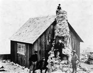
PI: I first came to JIRP in 2003. Maynard Miller, the former director of the Program, needed a faculty member to help students with mapping the Icefield. He had contacted my college, and I agreed to come. I’ve been coming back in the summers since then.

At JIRP, I have been able to learn from the work of my colleagues who serve as the other instructors from the program – and also from spending time with students and working on imagery for student projects.

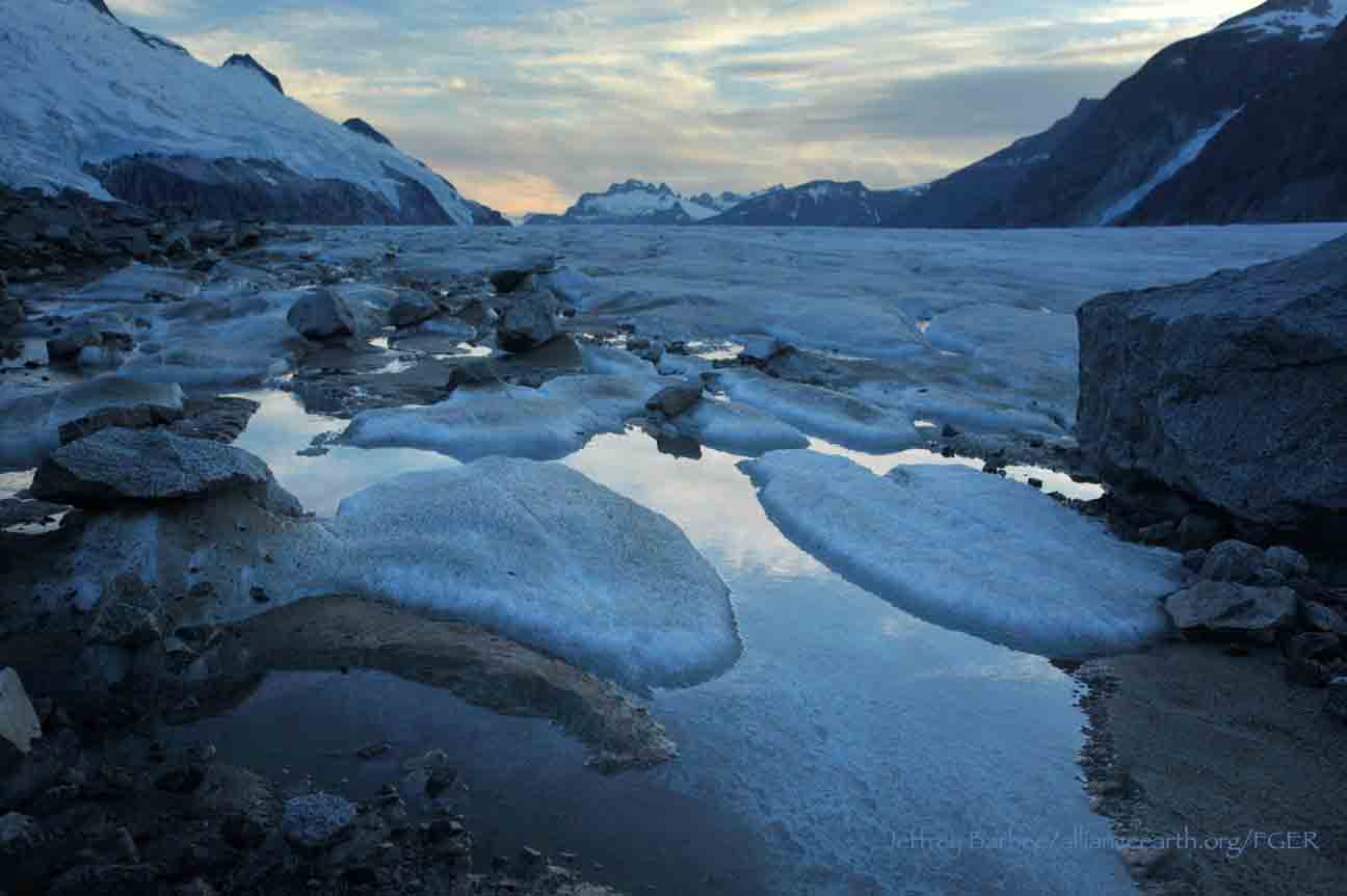
I also work with satellite imagery to study changes in the positions of the termini of six glaciers on the Icefield. We have tracked the Llewellyn, Taku, Mendenhall, Hole-In-Wall, Norris and Herbert glaciers using images taken between 1985 and 2011. As is well known, the Taku Glacier and Hole in the Wall have continued to advance throughout this period, while the others are all clearly retreating.

JCB: What are some of the challenges of your work on the icefield?

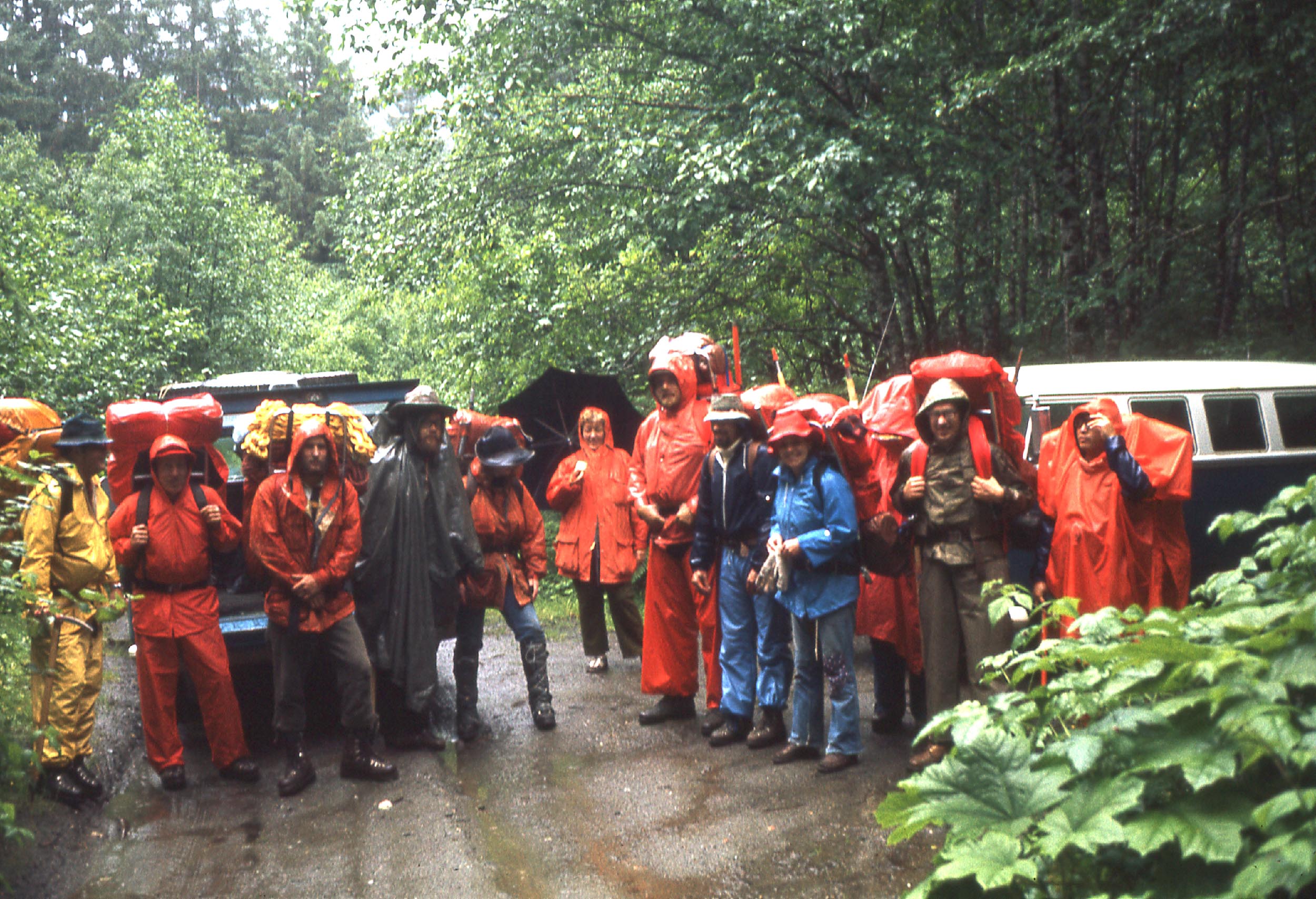
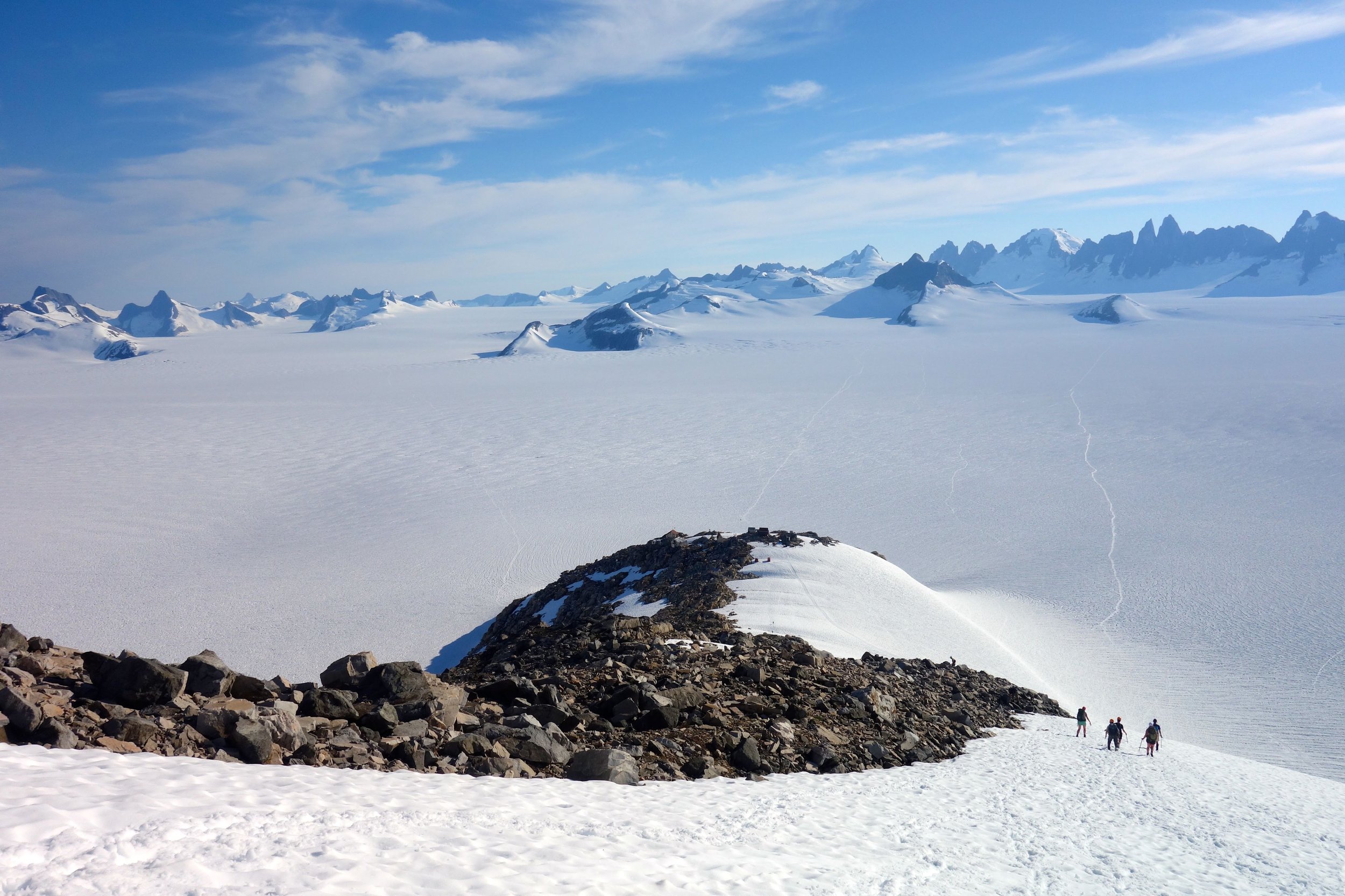
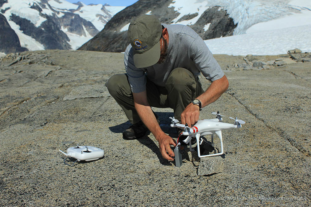
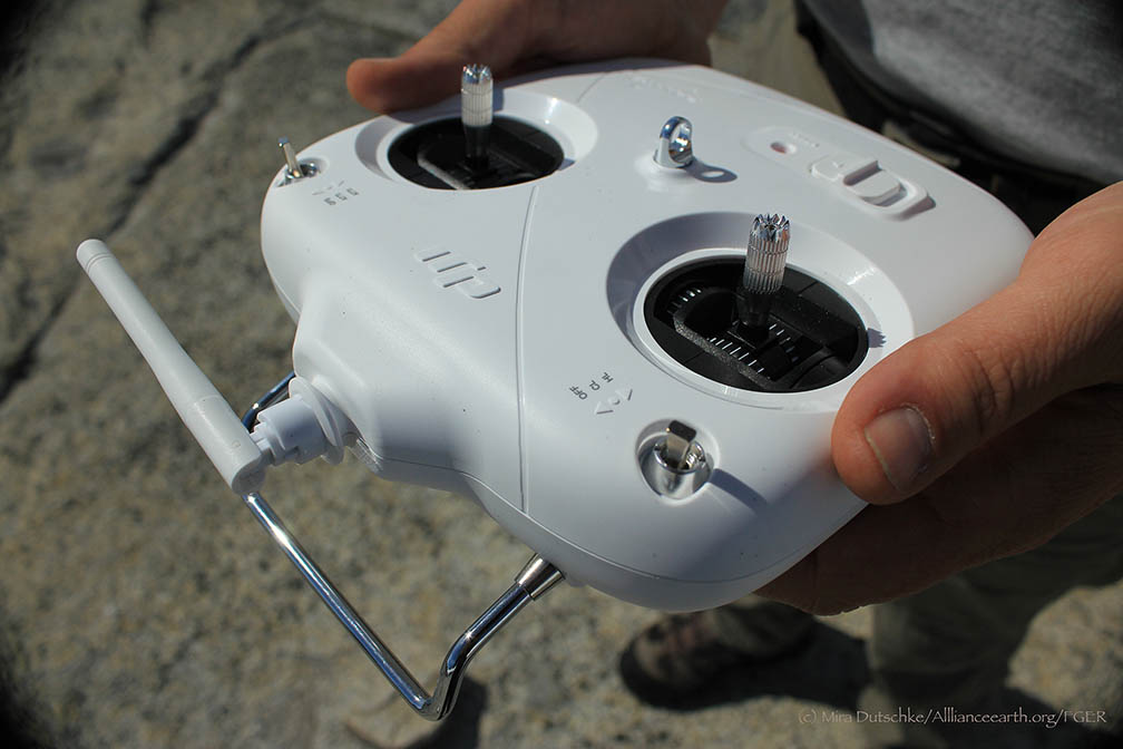
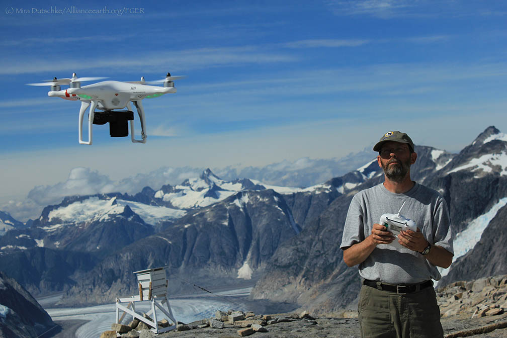
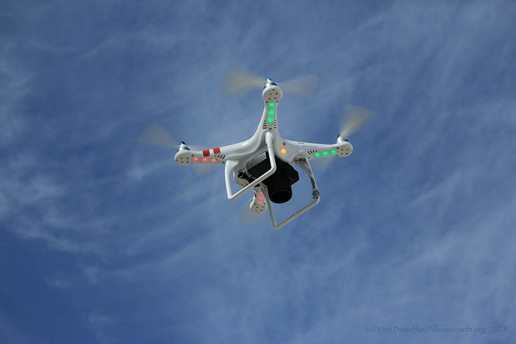
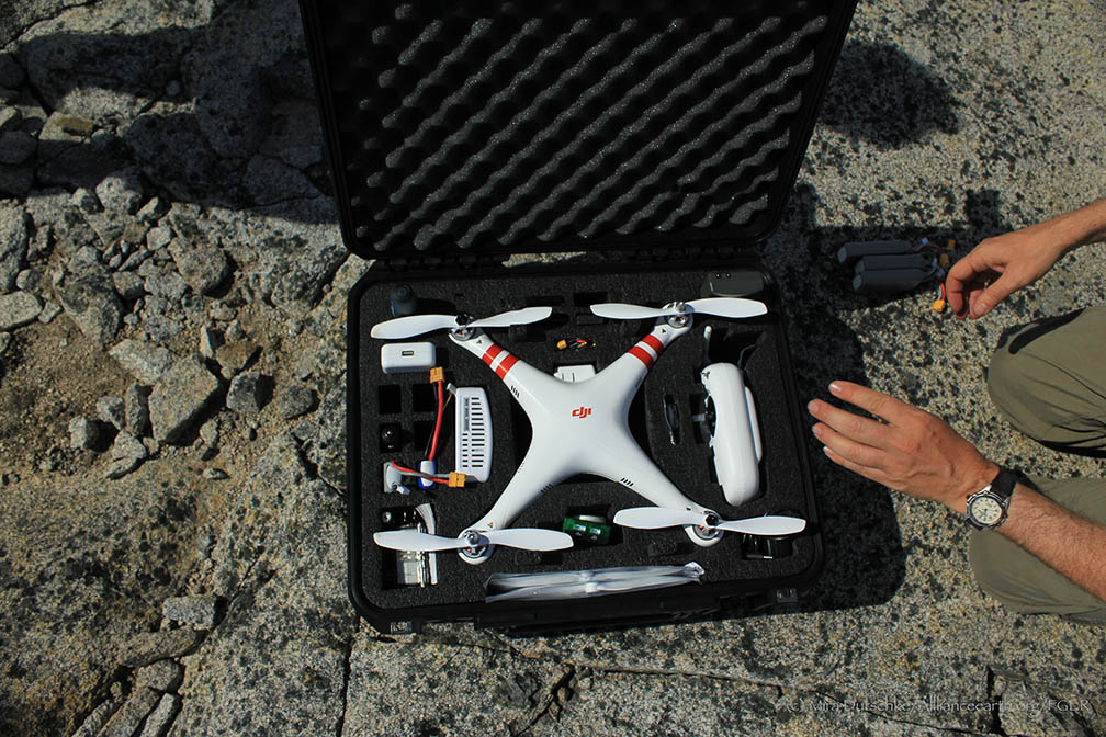
PI: The remoteness. It is challenging and expensive to fly aircraft over the icefield. Every year, I have experimented with bringing different technology to the program to take photographs. For the first few years, I photographed with kites, and this year I began using a remote-control quad copter, which allows me to control the flight path much more easily.

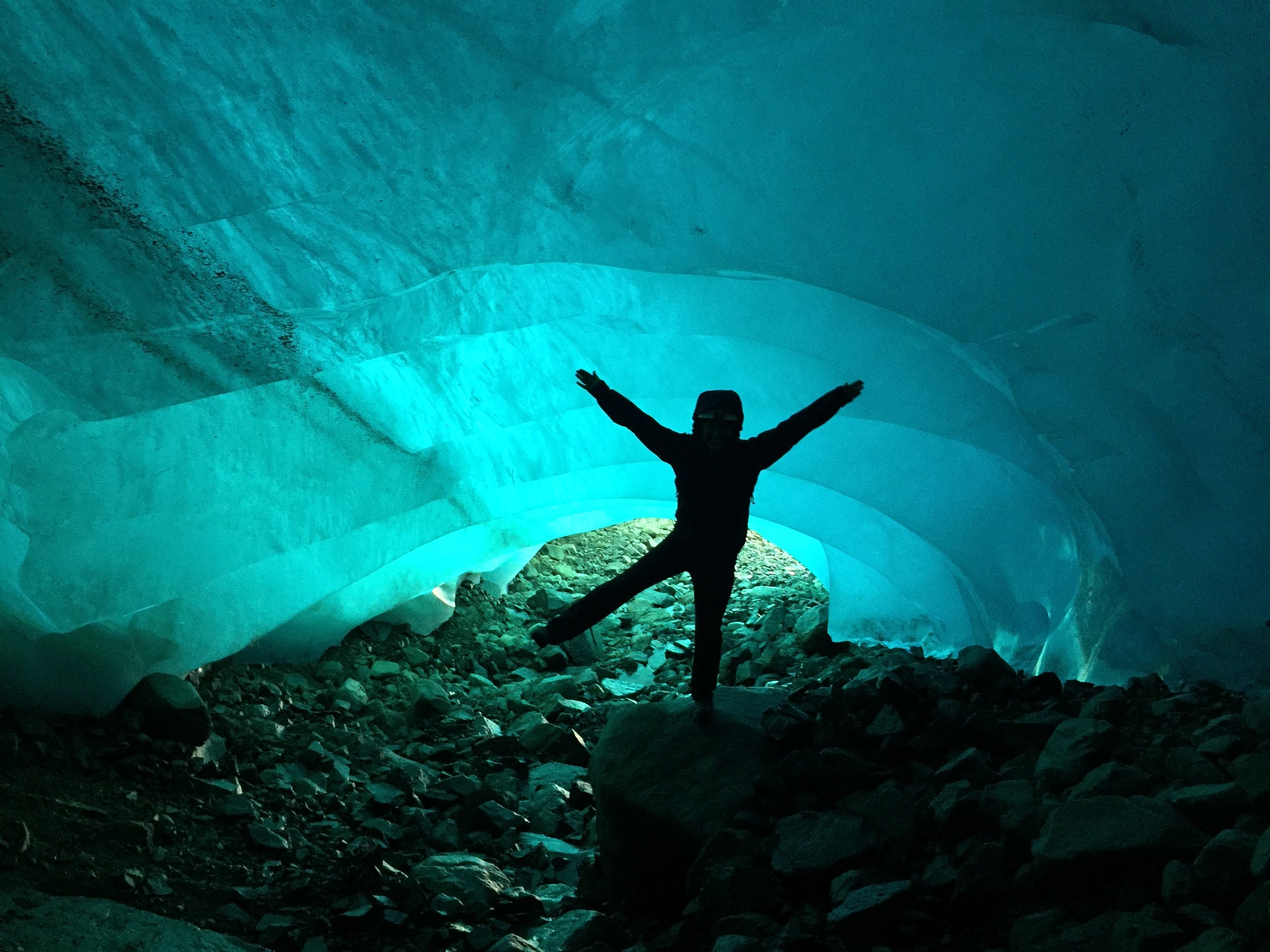
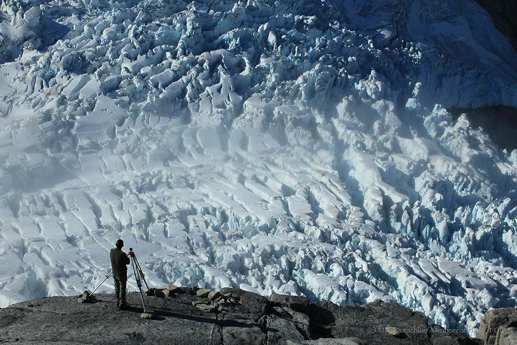
Remoteness, though, comes with beauty. In 2004, for the first time, I rappelled into a crevasse close to Camp 10 on the TakuGlacier. The ice in the crevasse was deep, blue and spectacular.

JCB: Tell me about the importance of combining aerial photographic surveys and satellite imagery.

PI: Aerial photographic surveys come into play when higher-resolution images are needed. At present, the best-resolution satellite imagery is about half a meter. With aerial photographs, we can produce resolution up to 10 centimeters, allowing for much finer detail and a more accurate picture of landscape change.

Aerial surveys can also be performed on a low budget, especially using smaller-scale technology—the quad copter I am using on this trip, for example, cost around US $1200, and still provides excellent high-resolution imagery of the areas we are surveying.

JCB: What are some projects you have worked on off the icefield?

PI: During the year, I serve as a resource for students working on cartographic projects at the COGS. I’ve recently done a few other mapping projects—one in the Caribbean, on the Dutch Island of Saba, where I created a new map of the island’s hiking trails using GPS. Another project I recently worked on was a map of Sable Island National Park off the coast of Nova Scotia.

I approach each project differently, depending on the resources available and the landscape at hand. I recently worked on a project sponsored by NASA and National Geographic on the glaciers that supplied water to communities in the Peruvian Cordillera Blanca. A consortium of scientists from various disciplines—chemists, glaciologists, hydrologists and cartographers—investigated the sustainability of the community’s water resources, which rely mainly on glacial water. The water chemists, for example, took samples to investigate whether water sources would still be potable without the addition of glacial water.

I performed a photogrammetric study of the glaciers using both the visual and infrared spectra. The photographs we usually take are in the visible spectrum—that is, they record the reflections of visible light off the surfaces we see in the photograph. But by modifying the filters inside a camera, we can allow it to record the reflections of infrared waves—which creates images that are much more sensitive to the moisture content of the surface. On glaciers, this gives us a much clearer picture of the boundaries between snow, firn and ice surfaces, which can appear similar in visual spectrum photography, but are distinct in infrared images.
I photographed the same locations on the glaciers in the area from five different camera positions. Using these photos and airborne LiDAR, which provides high vertical resolution, we were able to create 3-dimensional models of the glacial surfaces. We compared this model to another we made using photographs taken in the same locations by a Peruvian Aerial Survey in the 1950’s, to get a rough idea of the rate of retreat of these glaciers. At the rate we estimated, the glacial water source in the area will only last about 30 more years.

The Peru project presented much different challenges than working on the Juneau Icefield. At JIRP, technology and replacement parts can be sent to camps on a 20-minute helicopter ride from Juneau. The nearest town to the research site was a day-long bus ride away from Lima, and the research site in the mountains was another day-long hike away from the community. The research site was at 15,000 feet above sea level, and extra equipment could only be packed in by mule. Instruments had to be lightweight and very carefully packed, and sometimes replacement parts could not be found in Peru. The altitude was also a challenge—work goes slowly and becomes taxing much more quickly at such high elevations.

JCB: What kinds of work are you engaged in at JIRP this year?

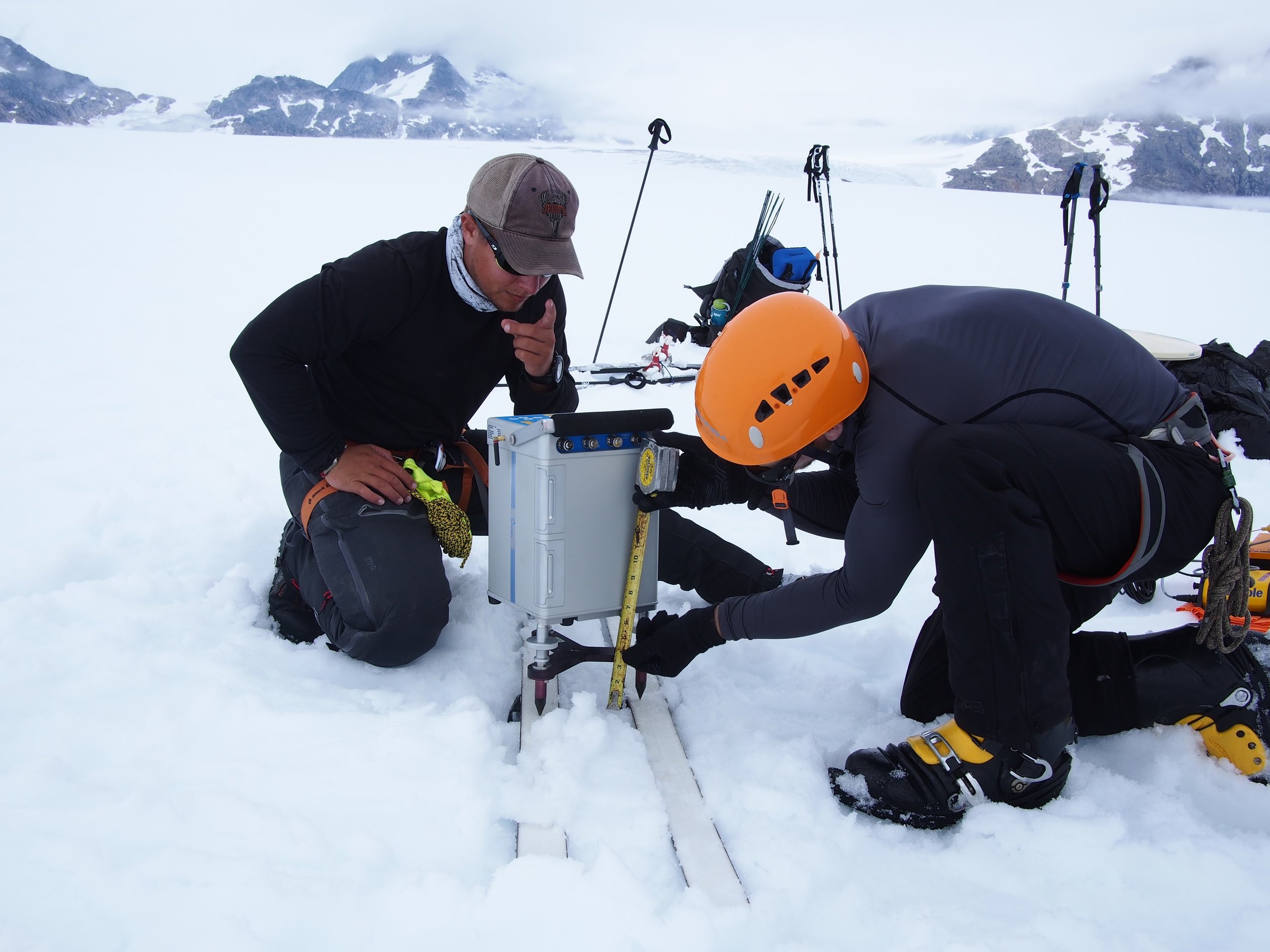
PI: I am helping JIRP  students with projects that use Geographic Information Systems (GIS) and satellite imagery, and supplying aerial imagery for geographic mapping projects at two camps. Christiane McCabe, for example, is using satellite imagery and digital elevation models to map changes in the equilibrium line altitude (ELA) of the glaciers on the Icefield over time. The equilibrium line marks the boundary between the accumulation zone of a glacier, where snow and firn dominate, and ablation (melt) zone, where ice dominates. Infrared images easily pick up on the different water content in snow, firn and ice, and I’m assisting Christiane in integrating these images with digital elevation models to find the ELA locations for multiple years.

JCB: Why cartography?

PI: I definitely have a passion for the outdoors—I really enjoy hiking and kayaking. I’m not as good of a skier—Nova Scotia is pretty flat.

An aerial photographer looks at patterns in the landscape. I was captivated by patterns of color and physical surface features— for example, I surveyed the ogives on the Gilkey Glacier,  in 2003, which are repeating arcs of ice that go downglacier, and are so out of character with the evenness you see on other parts of the Icefield. In the og  ives, you can see wave-flow, whereas above the icefall that produces them the pattern is continuous flow.

I am taking a time lapse series of the Vaughan Lewis Icefall—a tributary of the Gilkey Glacier—over seven days while I’m here. I take a photograph every five minutes, and will compile them into a movie of the downward motion of the icefall. I’ve been lucky enough to have seven days of perfect weather (Interviewer’s note: as I type this interview, it has finally started to rain.) And people who have never experienced seeing an icefall move will be able to see the patterns of the crevasses and seracs—towers of ice—flowing and crashing down the slope.

I am also captivated by the patterns formed by farmlands—the way humans use the colors of vegetation—and by the intricacies of hard-rock coastlines and beaches. But glaciers are something different entirely—large and expansive, exactly like rivers of ice.
Those who want to pursue cartography as a career path should have an interest in accuracy and precision, a desire to create information that others can understand, using color, symbols and careful thought.

Cartographers work with the psychology of maps—we use color and pattern theories to develop representations of landscapes with the user in mind. For the general public, we can use certain thicknesses of lines, text and colors…but in other contexts, we have to completely redesign maps. Some of our students have created maps for the sight-impaired, the elderly, and the blind. For the last project, they used a textured cloth to create a detailed map of a college campus. I have also been working on time-light maps, as well as maps using multiple datasets and new technologies like Google Earth. These kinds of projects are challenging and unique.

JCB: What is the future of cartography?

PI: One interesting new direction in the mapping world is public sourcing. Individuals can upload GPS data to online databases, and the entire globe is populated with people who can contribute data to make enormous datasets at an incredibly quick rate. Google Earth, for example, is an important source for advancing public interest in cartography. But cartographers have to keep in mind data integrity—where surveys by trained cartographers follow high standards of accuracy, public-sourced survey data may not maintain these high standards. Public sourcing is at a starting point—and has a lot of potential—but is still not ready to be used as a source of authoritative maps.

JCB: Any closing comments?

PI:  You never know what might happen when working on a mapping project. Sable Island, where I worked several years ago, is home to a protected herd of nearly 300 wild horses. When I arrived, I was setting up aerial photo targets on the island. The horses, of course, were curious about the new targets, and cautiously came up right beside us to see what we were doing.

I was on my hands and knees placing a target, and when I leaned back to get up, I was inches away from a huge pair of curious, gentle, brown eyes watching my actions. I remember fondly these kinds of moments.

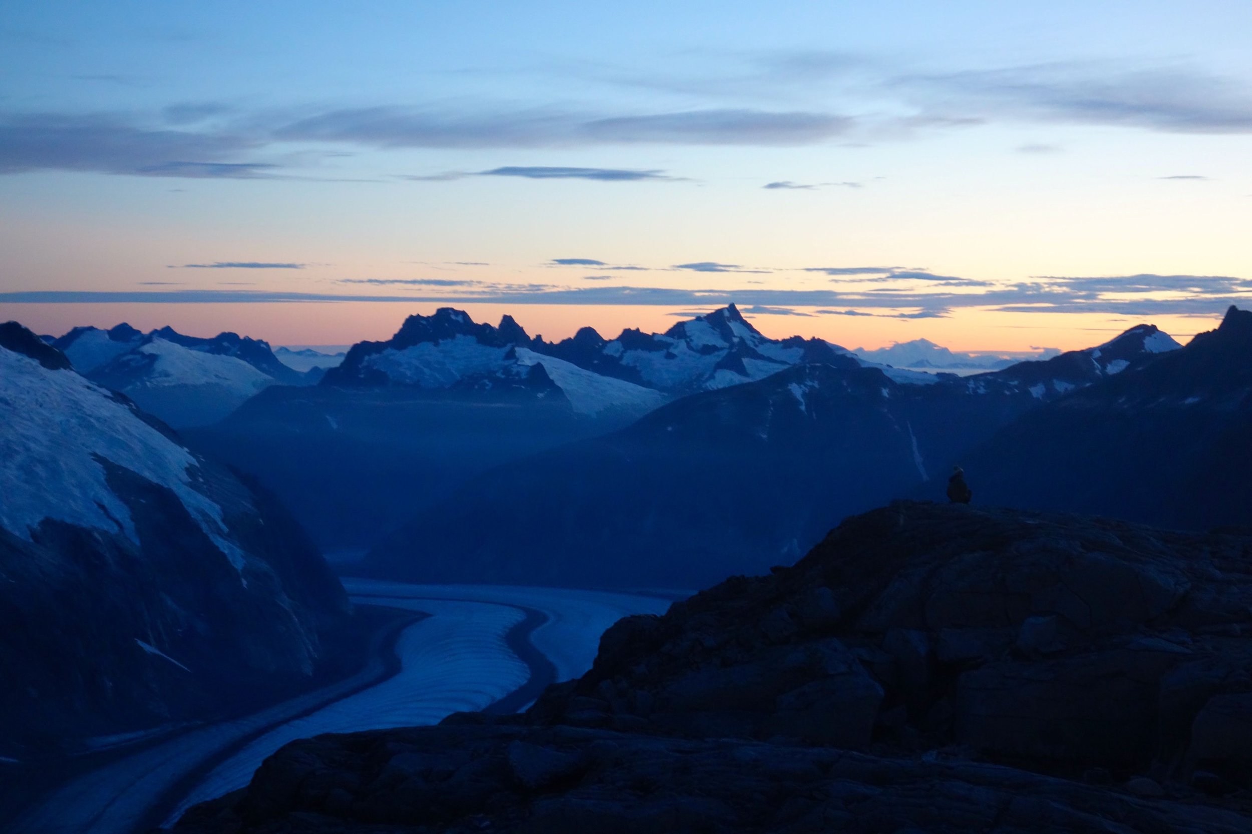
I have been really fortunate to belong to the JIRP community—to be able to learn and help others learn in a landscape so spectacular and so wild that it never leaves you. Sometimes, in the middle of winter, the view at Camp 18 comes back to me—the incredible sight of the Vaughn Lewis Icefall and the Gilkey Trench far below. 

Gilkey Trench Fieldwork Adventure

By The Gilkey Trench Crew (Jamie Bradshaw, William Jenkins, Jon Doty, and Justyna Dudek)

While many students already started the fieldwork for their projects at Camp 10 and even Camp 18, five students have been anxiously awaiting to begin their fieldwork in the Gilkey Trench. The Gilkey Trench is the magnificent view that you see from Camp 18 where the Gilkey, Vaughan-Lewis, the Unnamed and many other glaciers connect and flow down through the steep, glacially carved, 2,000 foot deep valley. The Trench is filled with beautiful curving medial moraines and jaw dropping ogives created by ice falls. Getting to such a beautiful place is not easy and well worth a full day’s effort.

Descending "The Cleaver" - approaching the start of the series of fixed ropes - with the Gilkey Trench in the background.  Photo by Adam Toolanen

On Wednesday, July 31st, these students and four safety staff members departed Camp 18 for our camp on the bare glacier ice in the sunshine. The trick to getting to the glacier is descending what is affectionately called “The Cleaver.” The Cleaver is the 2,000 feet of bedrock that sits between Camp 18 and the glaciers below.  The descent was led by senior staffer Scott McGee, who has done the route many, many times. The first half of the route was going down steep snow slopes until we got to a vegetated area called “The Heather Camp.” This is where the fixed ropes began.

Waiting in a safe location - protected from rockfall from above - for their turn to descend the next section of fixed ropes.  Photo by Adam Toolanen. 

Here, the students and staff put on helmets and harnesses and tied into the fixed ropes with a knot called a prussik. This rope system served as a back up in case there was a slip on the steep, unstable terrain.  Fixed ropes were used for the last half of the descent because the route became steeper and more exposed. Because the glacier is melting, new bedrock and rock debris is left behind. This makes finding new routes difficult and challenging in the unstable footing. After 11 very long hours, the students and staff safely and happily arrived at our camp in the Gilkey Trench during a magnificent sunset.

Scott McGee scouts the lowest section of the descent made of freshly exposed bedrock, and precariously deposited boulders left by the rapidly thinning Gilkey Glacier.  Photo by Jeffrey Barbee. 

The next two days were spent collecting data from the field. A brief explanation of the students’ projects in the Gilkey Trench are below:

Jamie Bradshaw - Surface Ablation of the Gilkey Glacier

For my project, I looked at the ablation, or melt rates, of the Gilkey Glacier. In May 2013, wires were steam drilled into the ice for Dr. Anthony Arendt at the University of Alaska Fairbanks (also a visiting JIRP Faculty member earlier in the summer). My task was to find these wires and measure how much wire was exposed. Luckily the sites came with known GPS coordinates and had a wire tetrahedron with bright orange flagging attached to it, so it was fairly easy to find in the rolling, mildly crevassed terrain of the Gilkey Glacier. By knowing the length of the wire exposed at the time of installation (which I will find out upon returning to civilization) and measuring the length of wire exposed in August, the ablation can be determined. This becomes important because once the area of the glacier is known, the total amount of melt water runoff from the glacier to the ocean can be calculated.

Jamie Bradshaw photo documents one of the ablation-measurement sites on Gilkely Glacier.  As the glacier surface melts, more wire (at Jamie's feet) is exposed.  Photo by Jeffrey Kavanaugh. 

William Jenkins - Ogive Survey

My research in the Gilkey Trench was focused on the ogives, also called Forbes Bands, which form at the base of the Vaughan Lewis Icefall, adjacent to Camp 18. These interesting features in the ice are annual formations that only appear beneath fast flowing icefalls. It is commonly accepted that their light and dark banding represents the variations between summer and winter ice that has made its way through the icefall in one year. Summer ice, which is subjected to wind blown particulates and increased melt, constitutes the dark bands of the ogives and forms the trough of their frozen wave-like appearance. The white winter ice is composed of that year’s snowfall, and forms the crests of the wave bulges. 

William Jenkins surveys one of the Gilkey Glacier ogives with GPS.  "The Cleaver" is the ridge of rock in the background, with the Vaughan Lewis Icefall on the right.  Photo by Jamie Bradshaw. 

The purpose of my study was to determine how fast this area of the Gilkey Glacier was thinning in comparison to previous years. In order to determine this rate, I conducted a longitudinal GPS survey, with the help of Scott McGee, that had previously been carried out from the years 2001-2007. As a result of the glacier’s rapid thinning rate, I’ll be able to calculate its subsidence by the changes in the elevation of the survey over time. I will also compare the data I observe with the Vaughan Lewis mass-balance data that JIRP has collected over the years. This comparison will allow me to correlate the changes in annual precipitation with the transformations in the ogives wavelength and amplitude over time. The relationship between mass balance and ogive structure will shed light on the future transformations of the ogives and Vaughan-Lewis Glacier as a whole.    

Panorama of one of the ogives near the base of the Vaughan Lewis Icefall (in the background).  Photo by William Jenkins. 

Justyna Dudek - Photogrammetry

The main objective of my project was to create an up to date digital terrain model (DTM) of the Vaughan Lewis Icefall flowing down from Camp 18 into the Gilkey Trench. A digital terrain model describes the 3-dimentional position of surface points and objects, and can be used to retrieve information about geometrical properties of glaciers. In order to create the model, I decided to explore the procedures and tools available within the field of digital photogrammetry, a practical method which allows carrying out non-contact measurements of inaccessible terrain (very useful for areas such as icefalls, which for the sake of avalanches and falling seracs, might be too dangerous for exploration or measurements on their actual surface). The baseline dataset for creating the DTM of Vaughan Lewis Icefall  were recorded on the first, sunny and cloudless day of our stay in the Trench. With the guidance from Paul Illsley (present via radio from Camp 18) and help from my colleagues Jeff Barbee and Jon Doty (present on the Gilkey Trench), I set up the three profiles along which we collected the data in the form of terrestrial photogrammetric stereo pairs and ground control points (GCP). The database created by our team will be subsequently processed in order create a DTM which can constitute a reliable, starting point for further research in this area in the future.


Paul Illsley overlooks the Vaughan Lewis Icefall from a terrestrial photogrammetry station near Camp 18.  Photo by Mira Dutschke. 

Jon Doty - Nunatak Biology

My path into the trench followed a slightly different approach than the other students who reached the Gilkey Trench via the Cleaver descent.  Ben Partan – Senior Staff member in charge of camp maintenance – and I were brought down to the Gilkey via helicopter from Camp 18 to Camp 19, with a load of material to fix up the camp, which sees infrequent use. After two days repairing the roof, and siding, as well as swamping the camp interior, we descended into the trench. During our descent we made four stops at progressively lower elevations, conducting a botanical survey. At each site I recorded all plant species present, the compass orientation of the plot, elevation, and tried to keep an eye out for faunal interaction, and any other interesting features of the site. 

Ben Partan repairs the C 19 roof.  The upper Gilkey Glacier is in the background.  Photo by Jon Doty. 

As we dropped down closer to the surface of Gilkey Glacier - biodiversity plummeted. My final site featured only a single species of plant, as opposed to nearly twenty at the highest point of my survey. This loss of biodiversity can be tied to the recession of the Gilkey exposing new substrates, and the time required for mosses and lichens to reach the area and for soil to develop. Using a rough dating technique called lichenometry, we can gain insight as to the amount of time each site has been exposed by the recession of the glacier. The lichen species Rhizocarpon geographicum grows about 1 cm for every 100 years and is very common. Its absence at the lowest two sites is therefore noticeable, and signals that these sites were only recently revealed.

My survey is paired with another conducted by Molly Blakowski on the southerly oriented C 18 nunatak. These two slopes face each other with the Gilkey separating them. We plan on comparing the results of our surveys to determine what affects the differences of aspect have on the vegetation.   It was an absolute pleasure to join back up with the group and explore the Trench, and true fun to climb up the Cleaver and reunite with the rest of the JIRPers at C 18. 

The 2013 Gilkey Trench Crew (left to right): Jeff Kavanaugh, Jeff Barbee, Justyna Dudek, Jamie Bradshaw, Adam Toolanen, Adam Taylor, Jon Doty and William Jenkins. Photo by Jeffrey Kavanaugh

In closing, on August 3rd, the Gilkey Trench Crew packed up camp and headed towards the Cleaver to ascend back to life at Camp 18. Again, we tied into fixed ropes, had a remarkably beautiful day and had a safe climb up the Cleaver. The Gilkey Trench Fieldwork Adventure had been a success and possibly, the icing on the cake for all crew members.

Additional photos from the Gilkey Trench Fieldwork Adventure.  Click on any of the images below to open a slideshow with all photos and captions:     

Maintaining a Balance

Written by Sarah Bouckoms, with contributions from Lindsey Nicholson and Gabrielle Gascon

For the past two years, JIRP has had more female students than male students. In addition, this year’s field staff and faculty include many powerhouse females. The notion that science is a male-dominated field may still be true in some areas, but not at JIRP.  JIRP’s focus is on science and outdoor learning, regardless of gender, race, religion, or sexual orientation/identification. In this blog, JIRP participants Lindsey Nicholson, Gabrielle Gascon and Sarah Bouckoms write on their experiences as women who have worked to attain advanced science degrees.

Lindsey Nicholson is a post doctoral researcher at the University of Innsbruck joining JIRP for four weeks as a visiting faculty member. Lindsey writes:

I'm happy to say that I have not felt discriminated against because of my gender in any way in my career so far. In fact, it seems more common at present to see job advertisements which state that preference will be given to suitably qualified women in order to achieve gender equality in the composition of faculty and staff. Similarly, my current research grant is specifically targeted to women in science, which gave me a better chance of winning the funding.  Clearly, although I would prefer to see a simple meritocracy determine the allocation of funding and appointments, I am not above taking advantage of these “positive” gender discrimination tactics that are currently in place. My perception is that current academic faculty in Earth sciences is still strongly dominated by men, but that the cohort of upcoming young scientists is increasingly equally made up of men and women, and in the future I expect that gender will not play any role in appointing scientists or allocating funding money.

That said, I am pleased to see so many young women participating in JIRP, particularly because the combination of group expedition and scientific endeavor encourages all participants to see themselves as equal parts of a whole. Each member has something different to bring to the group and all contribute to the group well-being and scientific success.

JIRP is a particularly powerful program as the expedition focus means that people have to take both individual and collective responsibility for their safety and that of the group. I am concerned that it is not uncommon to observe in science (and in wider society) that women do not take up leadership positions as readily as men, and while I do not wish to take away from instances of great leadership from men in science and society, I think this imbalance is a pity and a potential loss to the community. So, seeing both young men and women filling leadership roles at JIRP, and both male and female students working and cooperating on an equal footing in all the activities of JIRP is a great pleasure.

I hope that I can serve as a scientific role model here at JIRP and play a part in stimulating the participants to be interested in science and the environment, and believe that they can have important roles to play within these spheres of our society.

Gabrielle Gascon also joins us as a visiting faculty member for four weeks from Camp 10 to Camp 18. Gabrielle writes:

I am also happy to say that I have not felt discriminated by my gender so far. I’ve had equal opportunity to undertake field work in the Canadian Arctic, and have not felt disadvantaged when applying for scholarships. I think women should not believe that they are disadvantaged compared to men. Ambition, personality and hard work can take anybody far.

Although most faculties in Earth sciences are still male dominated, Undergraduate classes are becoming increasingly male/female balanced. During my Undergraduate studies in Atmospheric Sciences at McGill University, the program had an equal number of male and female students, and the 4th year Undergraduate course in atmospheric modeling I taught at the University of Alberta for the last two years was female dominated. Over the next few years, I believe that this wave of increasing female students will help balance faculty gender ratios.

Summer programs like JIRP provide equal opportunities to men and women, and teaches them to work together as a team. Everyone shares daily tasks,  goes out to dig (deep!) mass balance pits or cook for 40 people. Most importantly though, everyone feels equal, and I believe that this reflects of the  characteristics of the new generation of scientists to come.

Sarah Bouckoms is a JIRP field safety staff member this summer and a high school physics teacher during the school year. Sarah writes:

My mother pursued a career in a heavily male dominated field to become the first female dentist in Waterbury, Connecticut. Just as she followed after her father, I took example from my mother when choosing a profession. While I did not pursue dentistry, rather Physics, I followed her lead to enter a field usually left for the Y chromosomes.  

During my Undergraduate and Masters Degree in Physics, I would find myself tallying the head count of male vs. female. In a lecture of 30 or more students, only two or three would be female. At first this ratio made me nervous, but soon it became the normal and I thought nothing of it. From the study groups that formed, not only did I take away some great science lessons, but also both male and female friends.  I have had some great professors of both sexes but happened to have most of my supervisors as females.

Next year I am looking forward to teaching high school physics at an all-girls school.  I think it will be a great experience to see how the dynamics of a single sex classroom work. I hope that I can be an inspiration to my students motivating them to pursue a field in science. A generation later, Dentistry is now a field with an equal sex ratio, if not more women than men. I feel that transition is starting to take place across the sciences with the Juneau Icefield Research Program setting a great example.

While there is gender equality on the Icefield, this principle does not try to make everyone the same. In fact, each sex is allowed to express themselves however they feel. No one is made to feel uncomfortable by the way they dress, wear their hair or what they choose to shave. Both men and women have shown their excellent skills in the kitchen and in cleaning the lovely outhouses. The dress up parties for dinner are a special celebration enjoyed by all. So it is not at all that women are on the Icefield trying to fit into the mold of a man’s job, but that women are on the icefield doing a job. From pearl earrings to hairy armpits, there is a range of ways that the women on JIRP choose to express their feminine side and all levels are accepted.

In closing, the most important message to take away is that no matter what degree or profession is chosen, the anticipated challenges can be overcome. Anticipated gender inequality in the sciences is not an obstacle that should stand in anybody’s way of pursuing their dream career or following their passion for research in remote and harsh environments. Mental attitude has such a big part in overcoming any challenge regardless of gender. The determination and passion, not the roles traditionally assigned to the sexes, will have the biggest impact on the success of any career choice. Both Lindsey and Gabrielle have expressed their positive experiences as women in the sciences. They are great role models for all the students of JIRP and serve as an inspiration to any women wanting to pursue a career in science.